


Texas is a state known for many different things: cowboys, barbecue, booming cities, and an incredibly diverse range of landscapes and ecoregions within state borders. Each region of Texas is strikingly different, and most who haven’t visited the state would never know this without doing a bit of research.
In this guide, we'll be covering the massive state of Texas with the goal of breaking apart its landscape into seven distinct regions – each of which features a variety of unique features worth exploring.
A bit of backstory on Texas
As a state of extremes, exploring the different regions of the Lone Star State could also take quite a while – Texas is the second-largest US state, with Alaska being the largest. Stretching out over an area of around 268,596 square miles, Texas is home to a long list of cities, national parks, biomes, and ecoregions, many of which we’ll be discussing.
In terms of where all the humans are located, the state of Texas is home to over 30 million people as of 2023, with most of them living in cities like Houston, San Antonio, Dallas, Austin, and Fort Worth. While not quite as large as other cities within the US or other parts of the world, these five cities are home to millions of Texans, with more spread throughout the rest of the state.
What are the four regions of Texas?
Texas can be divided up into four main regions, including the:
-
Coastal Plains
-
North Central Plains
-
Great Plains
-
Mountains and Basins
The elevation of Texas changes drastically between these regions, giving the state a range of topographical landscapes for visitors and residents alike to enjoy.
If you’re interested in Texas topography or cartography, we have a guide dedicated to learning how to read topographical maps. We also stock a variety of topo maps, covering all kinds of areas of the United States including maps of Texas. Anyways, here’s the rundown on these four regions:
Coastal Plains
Featuring both beautiful beaches and flat plains, this region is home to a majority of Texans who live within cities like Houston and Dallas – this particular region makes up most of the state’s east and southern areas. The city of Austin, which also happens to be the capital of Texas, is located within the Coastal Plains.
While there are plenty of grasslands within this region, its close proximity to the Gulf of Mexico have allowed forests to sprout up as well, such as the Piney Woods ecoregion. Along the coastline you’ll find the seven Texas barrier islands, a series of islands along the Gulf Coast including the famous tourist destination of Padre Island.
North Central Plains
Stretching from the middle of Texas to its border with Oklahoma, this central area of north Texas is home to gently rolling plains – compared to the Great Plains region, this area has a much lower overall elevation of around 1000 feet and hot summers and cold winters are common here.
Some of the cities you’ll find here include Forth Worth, Waco, and Wichita Falls – in particular, the Fort Worth Stockyards is a popular destination for tourists looking for historical cattle ranching views. Similar to other regions of central Texas, the presence of rich soils in the North Central Plains have led to modern day agricultural booms in crops like corn, peanuts, and cotton.
Rainfall is common here and the region’s many creeks, rivers, and hills are part of why north Texas has such a unique hydrological landscape – if you’re interested in the hydrology of Texas make sure to check out our Texas hydrology map, and be sure to learn about hydrological mapping.
Great Plains
Home to the cities of Amarillo and Odessa, this region is where you’ll find some of the largest agricultural operations in central Texas, including massive cotton and soybean plantations as well as cattle ranches and other crops. When driving through this region, you’ll come across vast oil drilling fields – with too many pumping rigs to count in areas like the Panhandle.
Home to landmarks like the Edwards Plateau, this region is generally at a higher elevation than nearby areas. This is primarily thought to be due to unique geological properties that influence how the earth’s crust behaves below Texas.
Mountains and Basins
As the name implies, this region of west Texas is home to more mountainous areas, with fewer grasslands and savannas present. Home to the famous Guadalupe Mountains, this is the best place to find Texas mountain ranges when visiting, with other hotspots including the Davis, Chisos, and Chalk mountain ranges. While it is hot – like most regions of Texas – hiking and climbing among the many peaks present here is a common pastime, especially for lovers of cacti.
Big Bend National Park can also be found here: a park established in 1944 with the goal of preserving some of the Lone Star State’s most precious and rare flora and fauna – we’ll talk a bit more about Big Bend further down.
The seven subregions of Texas
Aside from the four main regions, Texas can be further broken down into seven subregions, including:
-
Big Bend Country
-
Gulf Coast
-
Hill County
-
Panhandle
-
Piney Woods
-
Prairies and Lakes
-
South Texas Plains
Big Bend Country
Location: West Texas
Major Features: Mountains, canyons, valleys, and rivers
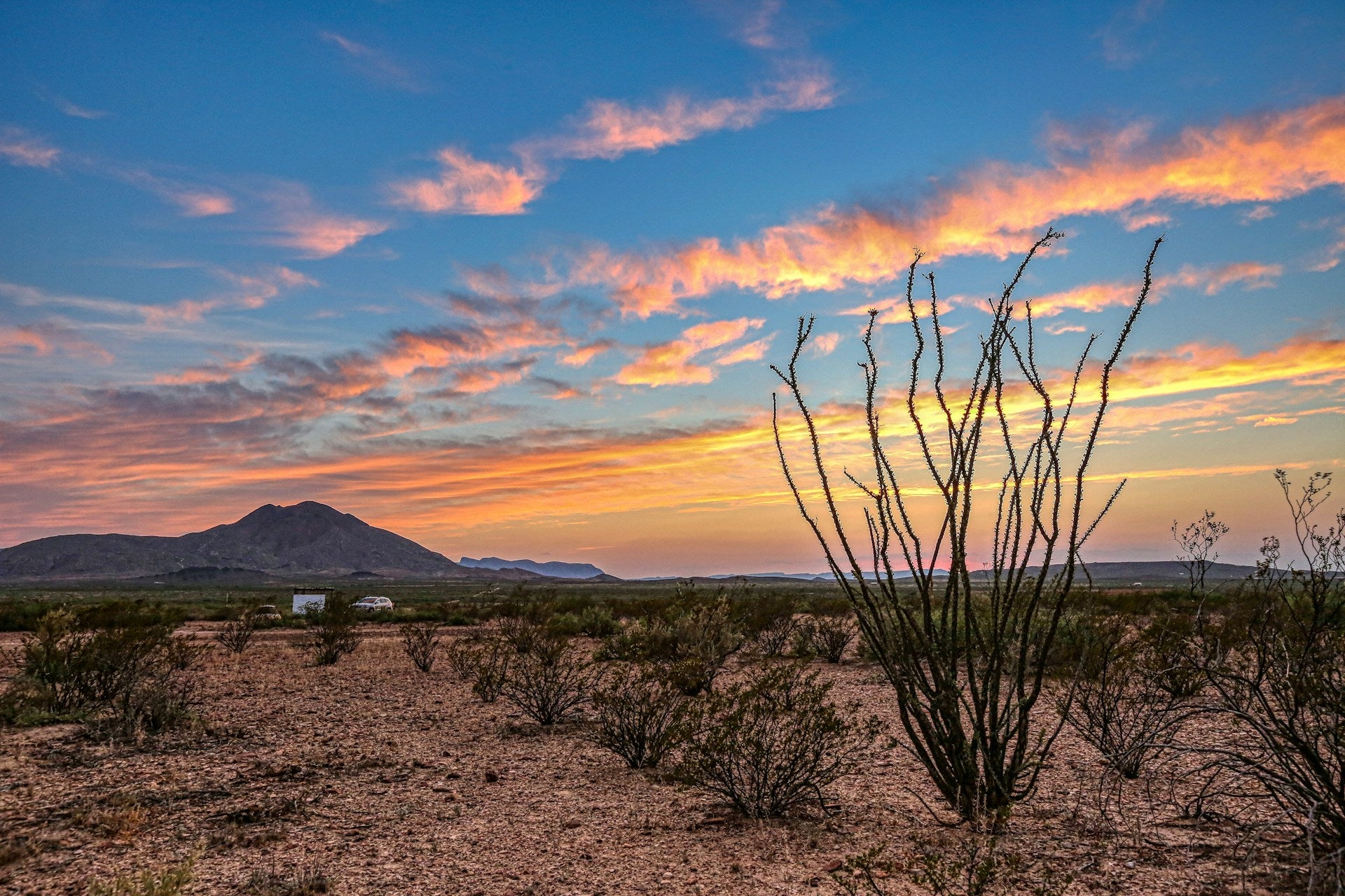
Located in the west Texas Mountains and Basins region, Big Bend is really the only place in the state that you can find large mountains in. It also includes desert biomes as part of the larger Chihuahuan Desert that stretches north from Mexico – these two aspects of the region have led to its rugged reputation.
Big Bend is a top destination for outdoor enthusiasts: fans of hiking, climbing, rafting, and more will find their niche here. Big Bend National Park, which we briefly covered earlier, is the main attraction of course.
A place of jagged, towering limestone peaks, winding rivers and valleys perfect for watersports, and dry canyons to hike, Big Bend is one of the largest and most diverse protected regions in far west Texas. While exploring the area, it’s common to stumble upon animal species like coyotes, pronghorn antelopes, and even wild tarantulas. In rarer cases you could even be lucky enough to spot a mountain lion or black bear.
Gulf Coast
Location: Southeast Texas
Major Features: Coast line, bays, rivers, marshes, and subtropical areas
The Gulf Coast is the wettest subregion of Texas; this is where you’ll find marshes, swamps, bays, and the state’s chain of barrier islands. Depending upon where you are in the Gulf Coast, you’ll likely find yourself close to some kind of natural water landscape, or even the Gulf Coastal Plains further inland.
In terms of the Gulf Coast’s topography, the area is largely defined by how individual rivers and creeks cut through the land, reaching their way across east Texas and spilling into the Gulf of Mexico. This system of river deltas is being tested by modern-day development, and significant amounts of money is spent securing the coast against hurricanes.
Due to all of this water, previous native inhabitants like the Atakapa or Atacapa people were able to grow crops like maize and winter squash and also find forage or hunt for fish, oysters, ducks, and other kinds of plants and animals – to this day, the area is popular with sport fishermen.
The wildlife of the Gulf Coast is distinct from other subregions, aquatic or semi-aquatic species like crabs, alligators, and even sea turtles and pelicans can be found here. In other regions of Texas, it’s too hot and dry for these animals to thrive.
Hill Country
Location: South Central Texas
Major Features: Valleys, hills, caves, natural springs
Like the name implies, this subregion is full of valleys, hills, caves, natural springs, and other interesting features not often found in central Texas. Surprisingly, this hilly area isn’t actually located in the Mountains and Basins region – you’ll have to travel east into Central Texas towards Edward’s Plateau.
Natural springs and underground lakes and caves are quite common in Hilly Country, with some of them like Hamilton Pool Preserve being open to the public for fans of hiking or swimming. These kinds of hidden water preserves and numerous streams have allowed this subregion to support populations of Guadalupe bass and other rare fish species, as well as other familiar Texan fauna like wild turkeys.
If you’re curious why there are so many caves and springs and underground lakes here – it’s due to a concept called karst topography, which basically just means lots of soluble rocks like limestone dissolved and left behind caverns, sinkholes, and other interesting formations.
Smaller towns can be found everywhere here, as well as Austin if you’re looking for a bigger city with a small town vibe while visiting.
Panhandle
Location: North Texas
Major Features: Plains, prairies, grasslands, sparse canyons
If you’ve ever driven through the north Texas Panhandle on Interstate 40 – you may be unimpressed by this region. Cattle ranches, oil rigs, and sweeping gray and yellow plains dominate the landscape, lulling even the most caffeinated driver to sleep.
Beyond major highways, however, the Panhandle holds other secrets. There’s no denying how flat this region is, but canyons filled with craggy peaks are scattered about. In fact, the major dividing line of the Panhandle from east-to-west is a series of canyons carved by ancient rivers within the Caprock Canyons State Park and other areas.
Before humans lived here, millions of Bison roamed freely among rolling Panhandle grasslands. Nowadays, not so much; however, you can still find songbirds, prairie dogs, white-tailed deer, rabbits, and even skunks and porcupines roaming about if you’re lucky.
Piney Woods
Location: East Texas
Major Features: Forests and swamplands
Considered by many to be the prettiest area in Texas, Piney Woods is primarily made up of pine forests – this is one of the only areas in Texas that really contains dense forest. Lots of species besides pine exist here, of course. Mulberry, cypress, cedar, oak and hickory, and even maple can be found depending on where you are in the overall forest.
South of the primary forest, swampland reigns supreme; this makes these woods one of the most biodiverse regions of Texas. Swamps are particularly rich in plant and animal life and it’s not uncommon to find animals like bullfrogs, river otters, flying squirrels, and other strange creatures here while adventuring.
Unfortunately, Texas ecoregions like these are threatened by the presence of logging industry titans – as most of the state’s timber is sourced from forests here. Some areas, like the previously mentioned Big Thicket National Preserve or simply “Big Thicket” (a swamp) are protected by federal law.
Prairies and Lakes
Location: East Texas
Major Features: Grasslands, small forests, plains, and lakes
Home to the Texan kangaroo rat, the Prairies and Lakes subregion is a mixture between the forests of Piney Woods and the grasslands and prairies of the Panhandle and the South Texas Plains. The rich and fertile soil of this region makes it a highly suitable area to grow crops in, and the slow rolling topographical landscape is dotted with all kinds of agricultural operations.
It’s not uncommon to see forests, or at least the scattered remains of a forest, mixed with monoculture farms growing hay, wheat, and pecan trees. The Blackland Prairie is one of the best examples of what kind of natural beauty existed in east Texas before settlers began filtering in – these huge swaths of tall grasses and wildflowers are shrinking each year, with only around 1% of original habitat remaining today.
As the transitional area between grassland prairies and the major forested areas of east Texas, you can also find a number of large and small lakes here – not all of these lakes are natural, but fans of fishing from all over travel here to try their luck. Compared to other areas in the US like the Great Lakes region, Texas may not have the biggest lakes, but there are a few hidden gems you may come across.
South Texas Plains
Location: Southwest Texas
Major Features: Plains, dry grassland, brush, and subtropical environments
The southern tip of Texas is home to the South Texas Plains, a huge region known for being quite dry and arid throughout most of the year. Historically home to many Spanish missions and forts, the area does manage to hold onto historical relevance for both the US and Mexico, even to this day.
Nowadays, once open grasslands and woodlands have mainly been converted into agricultural operations or left to their own devices – if you end up exploring the wilds of this area you'll likely come across tons of cacti and other hardy species like thorny acacia bushes.
Because of the relatively harsh landscape of this area, many of the common plant and animal species loved by Texas wildlife enthusiasts are more seasonal here; temporary lakes and marshes fill with water during the wet season and bring about nesting birds and other creatures. In fact, the World Birding Center's headquarters are actually located along the Rio Grande Valley, with birding addicts from around the world traveling here to enjoy their hobby.
What elements influence the regions and subregions of Texas?
All of the regions and subregions we’ve mentioned are influenced by existing industries, the underlying topography, and the history of the area itself. Each specific section of Texas – whether it’s the hidden caves and springs of Texas Hill Country or the grasslands of the Prairies and Lakes region – has arrived in its current form due to these factors.
Without soluble limestone caverns, we wouldn’t be able to appreciate the experience of swimming in an underground pool. If the state’s islands didn’t exist to protect towns and cities, the ever-popular tourist destination of the Gulf Coast wouldn’t have nearly the same level of appeal. There’s no doubt that the culture and landscape of the Texas countryside are both singular strands of an intricately woven web between humans and the natural world.
Final thoughts
Texas is a place filled with a truly astounding number of regions and subregions – most of which go unnoticed by those who haven't given the state a chance. Whether you want to do a bit of birding or explore some underground caverns, the Lone Star State could be your next dream destination. If you're interested in learning more, make sure to check out the rest of our content centering around the topography of other US states.


