Skip to content
Facebook
Instagram
Pinterest
National Park Week Sale –
Shop Sale
Country/Region
United States (USD $)
United States (USD $)
Search
Account
Search
Cart
Popular Collections
3D Raised Relief Maps
Vintage Shaded Relief Maps
Hydrological Maps
Apparel
Best Sellers
Shop by Location
USA Maps
State Maps
International Maps
National Park Maps
Shop by Type
Collections
3D Raised Relief
2D Vintage Shaded Relief
Hydrology Series
TOPO Series
National Park Series
2D Elevation Relief
2D Shaded Relief
Mountain Range
3D Raised Relief Maps
Shaded Relief Maps
Hydrological Maps
Historical Prints
Illustrations and Photographs
1884 Fish Drawings
1875 Zoology Drawings
1868 Yosemite Photos
1873 Yellowstone Photos
1874 Moon Photos
Historical Maps
Astronomy
Civil War Maps
Assorted Vintage
USGS Quadrant Maps
1876 State Maps
1876 Geologic/Topographic
1883 State Maps
1904 Yellowstone Maps
1906 Hawaii Maps
1884 Fish Drawings
Astronomy
Civil War Maps
Apparel
About Us
Our Story
Reviews
FAQs
Shipping and Returns
Contact Us
Historical Nautical Charts
Filter
Sort by
Alphabetically, A-Z
Best selling
Alphabetically, A-Z
Alphabetically, Z-A
Date, old to new
Date, new to old
Filters
US States
Alabama
1
Alaska
5
California
4
Connecticut
2
Delaware
1
Florida
2
Georgia
1
Guam
1
Hawaii
2
Illinois
2
Indiana
2
Louisiana
2
Maine
2
Maryland
2
Massachusetts
1
Michigan
6
Minnesota
3
Mississippi
1
New Hampshire
2
New York
6
North Carolina
1
Ohio
2
Oregon
2
Pennsylvania
3
Puerto Rico
1
Rhode Island
2
Texas
2
Virginia
2
Washington
3
Wisconsin
3
North America
Panama
1
Sort by
Best selling
Alphabetically, A-Z
Alphabetically, Z-A
Date, old to new
Date, new to old
Apply
10% off
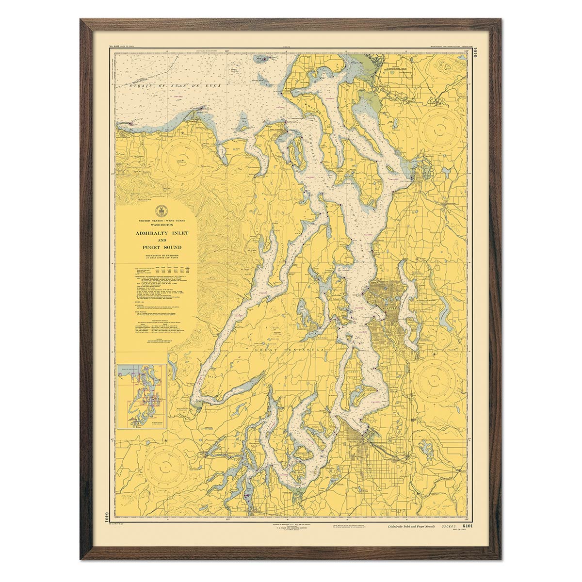
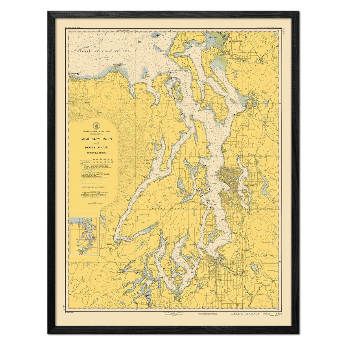
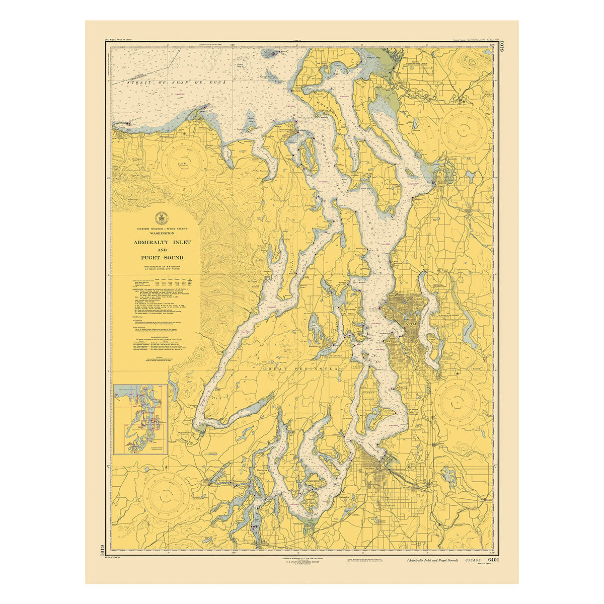
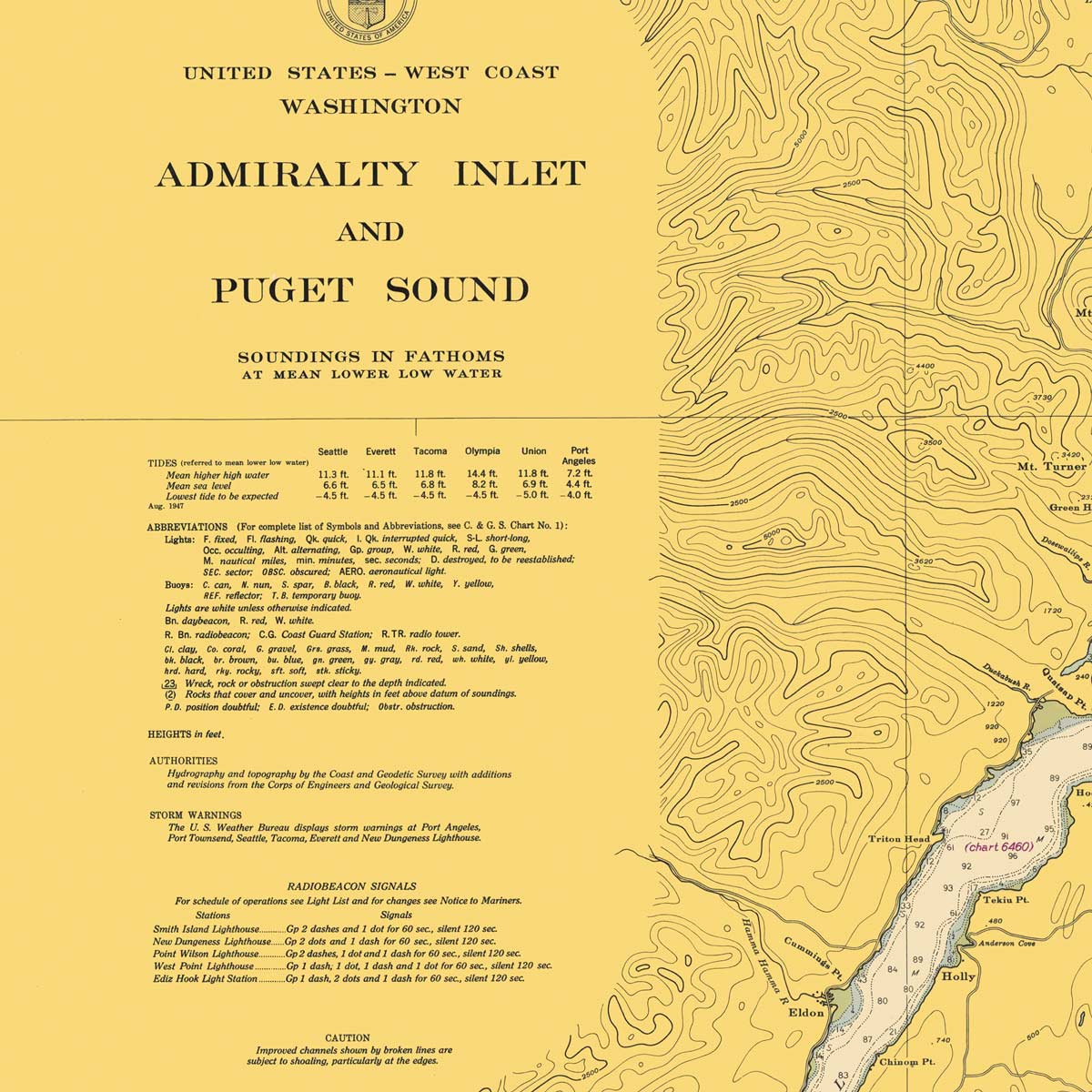
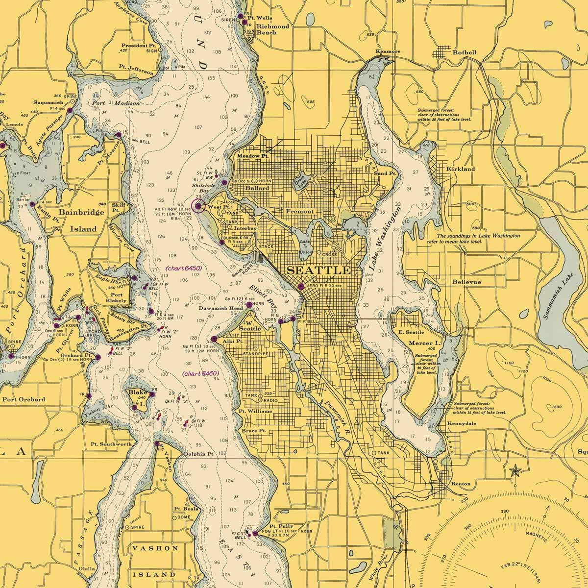
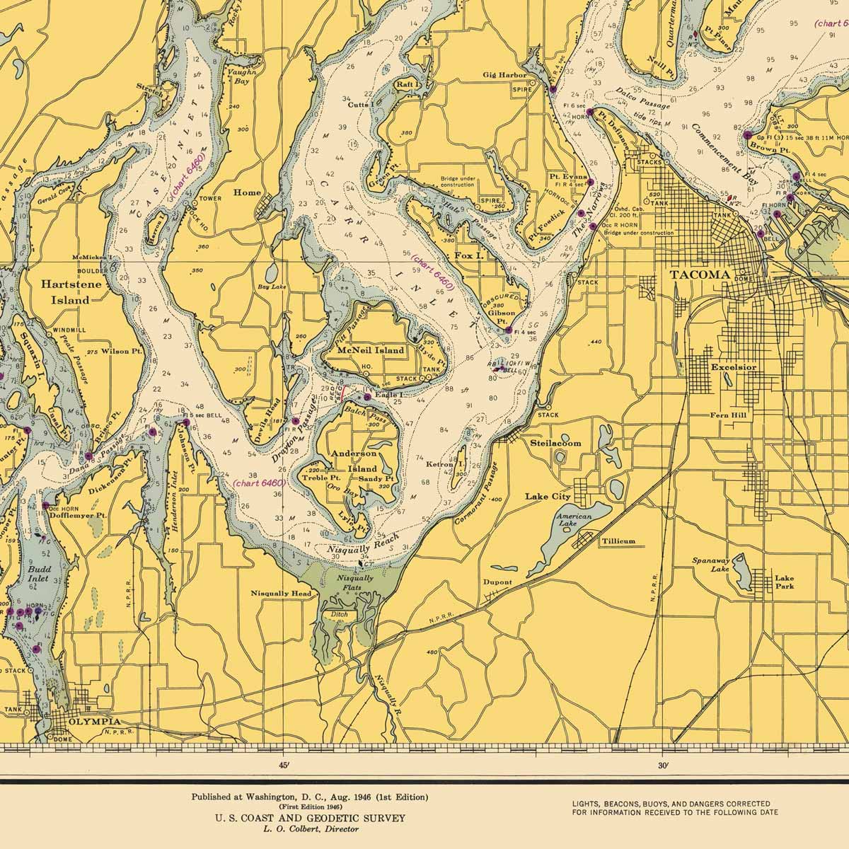
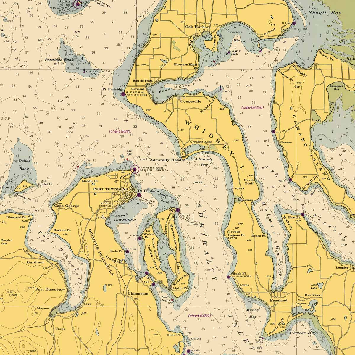
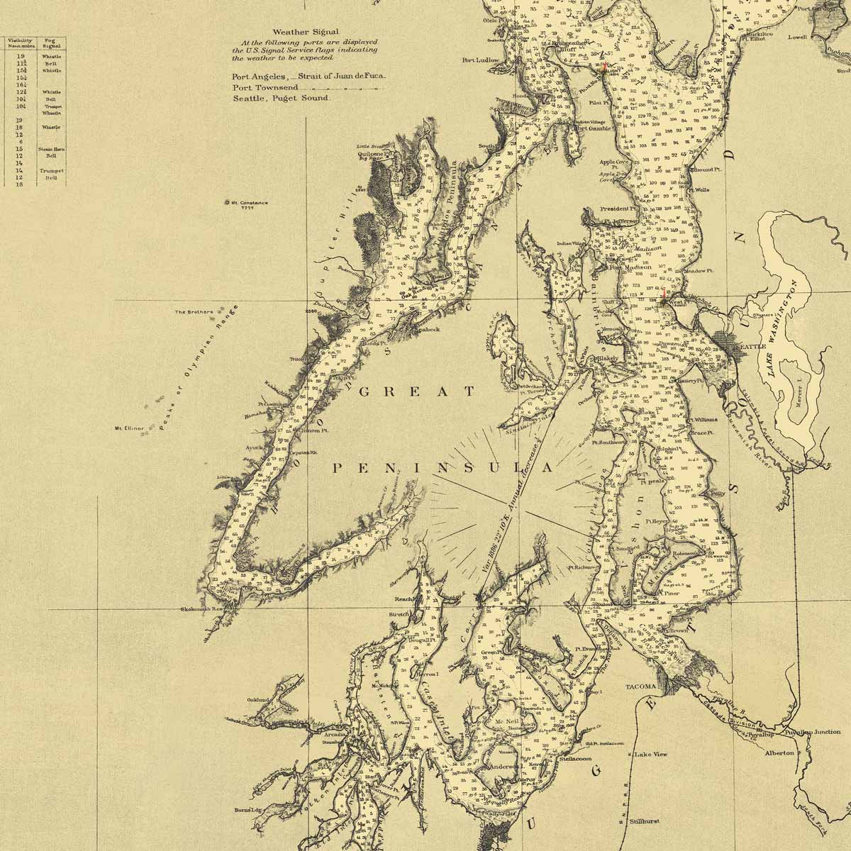
Admiralty Inlet and Puget Sound Nautical Chart 1948
From
$ 71.10 USD
$ 79.00 USD
Sale
10% off
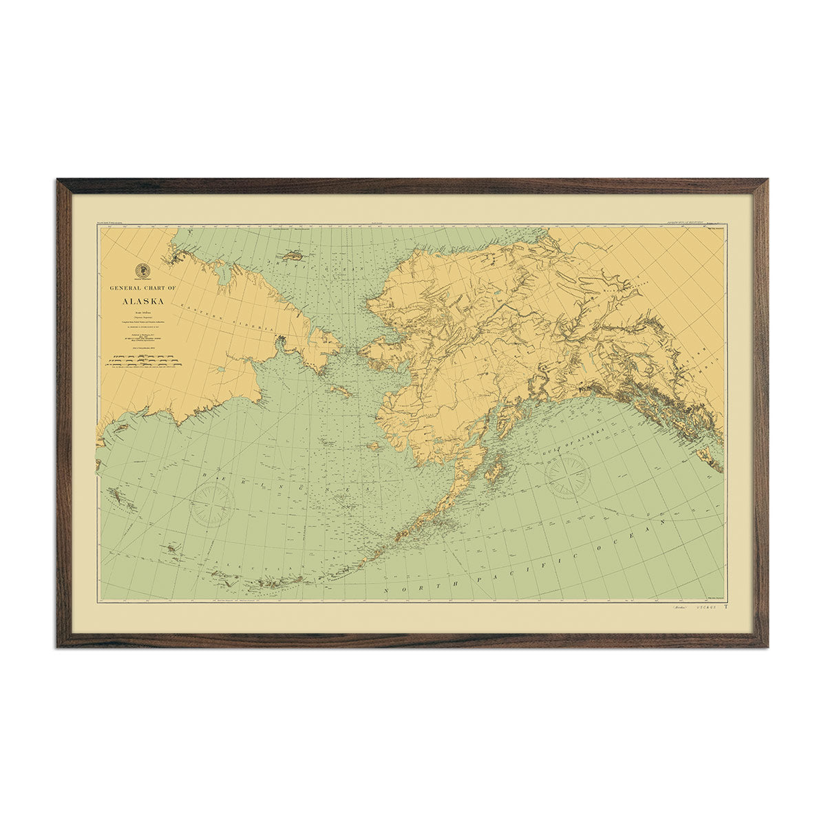
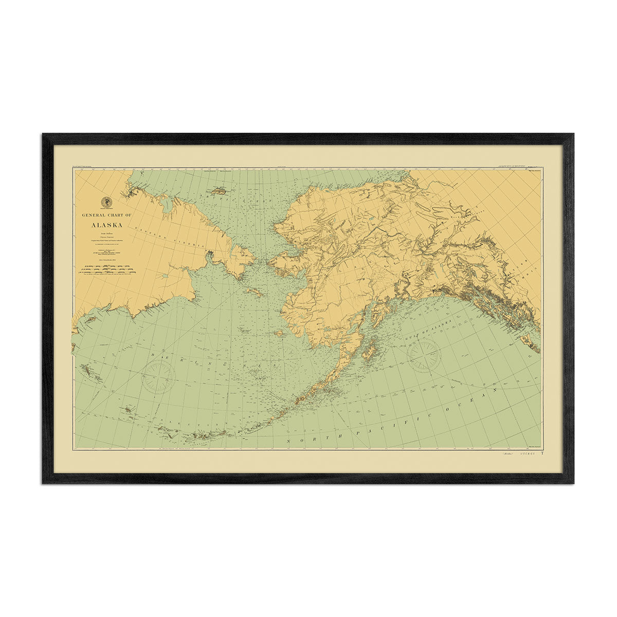
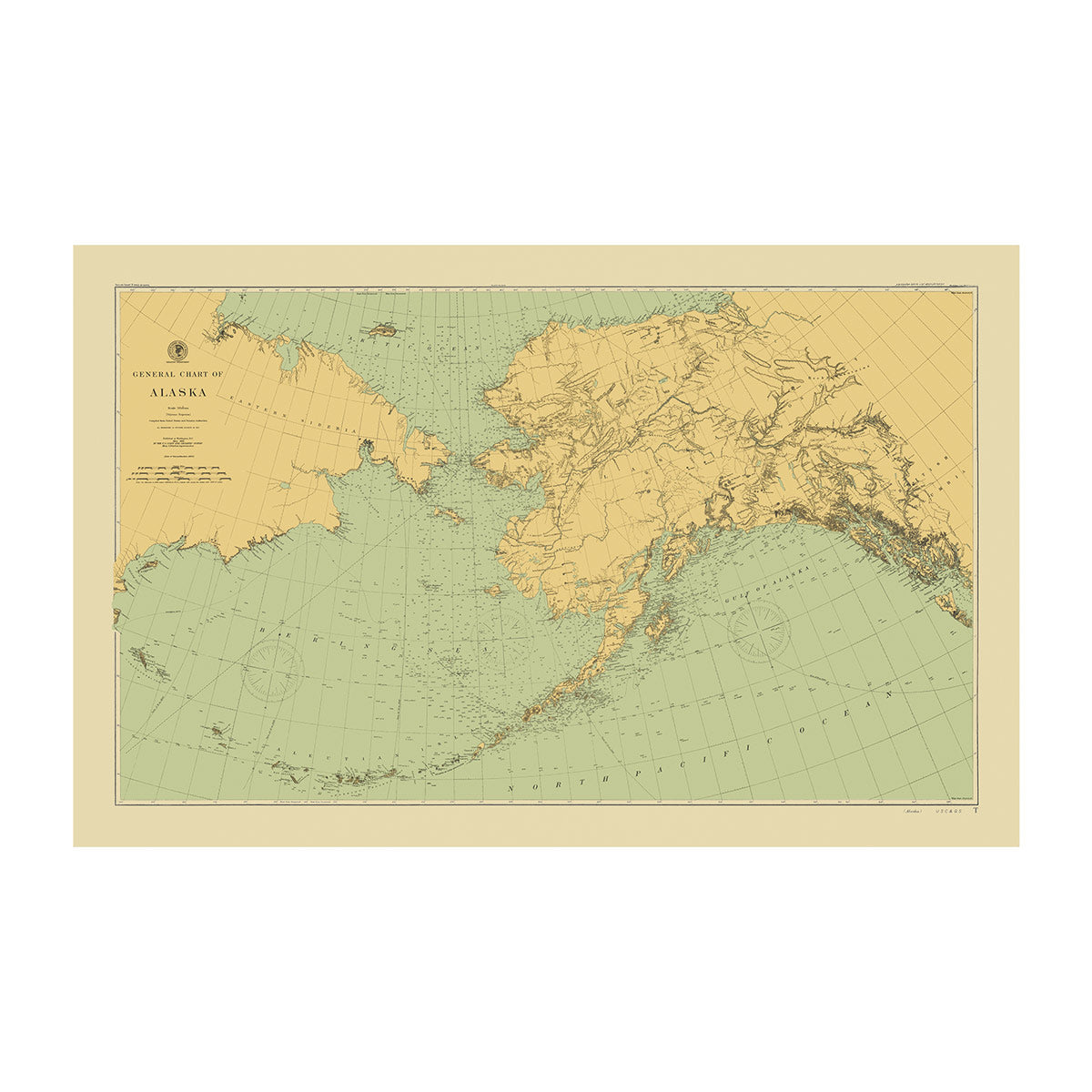
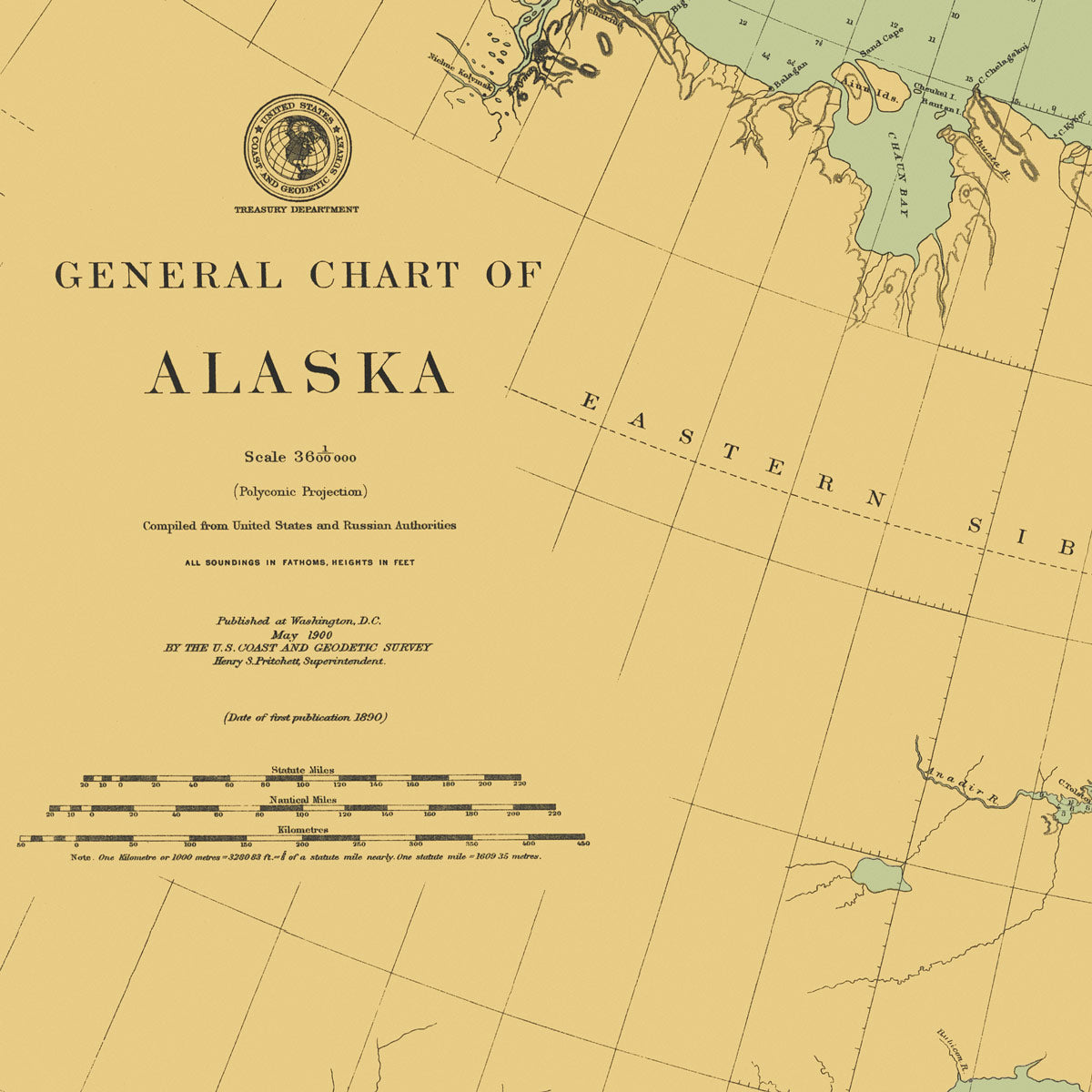
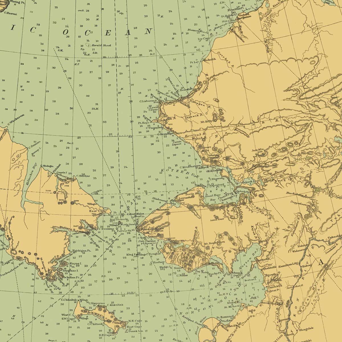
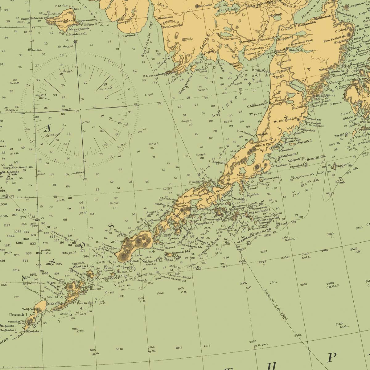
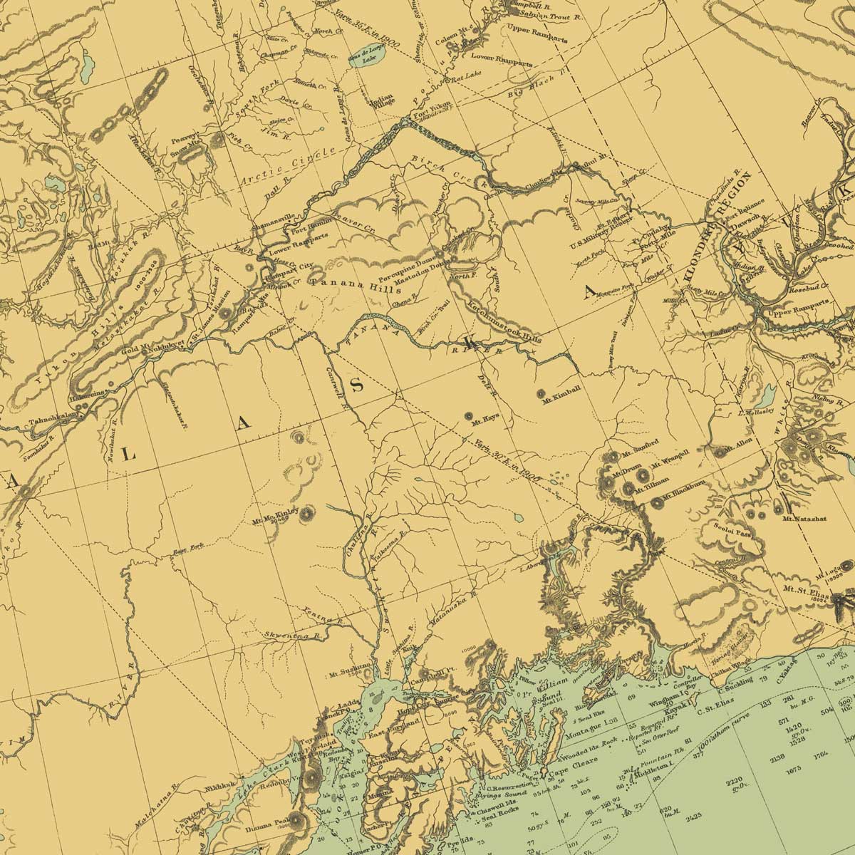
Alaska Nautical Chart 1900
From
$ 80.10 USD
$ 89.00 USD
Sale
10% off
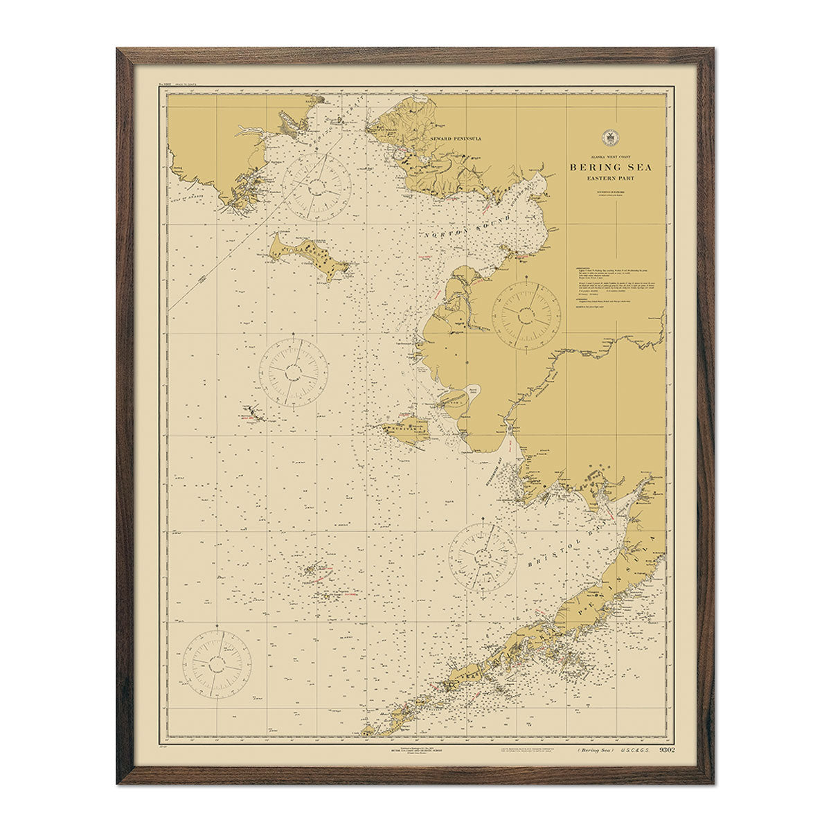
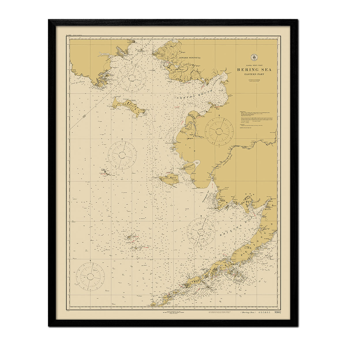
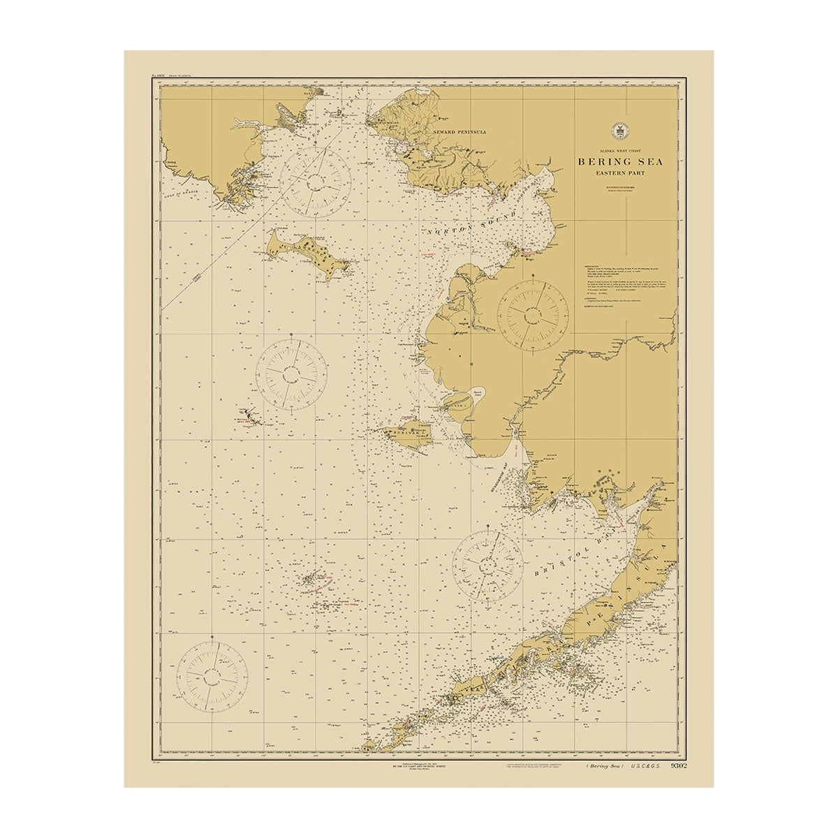
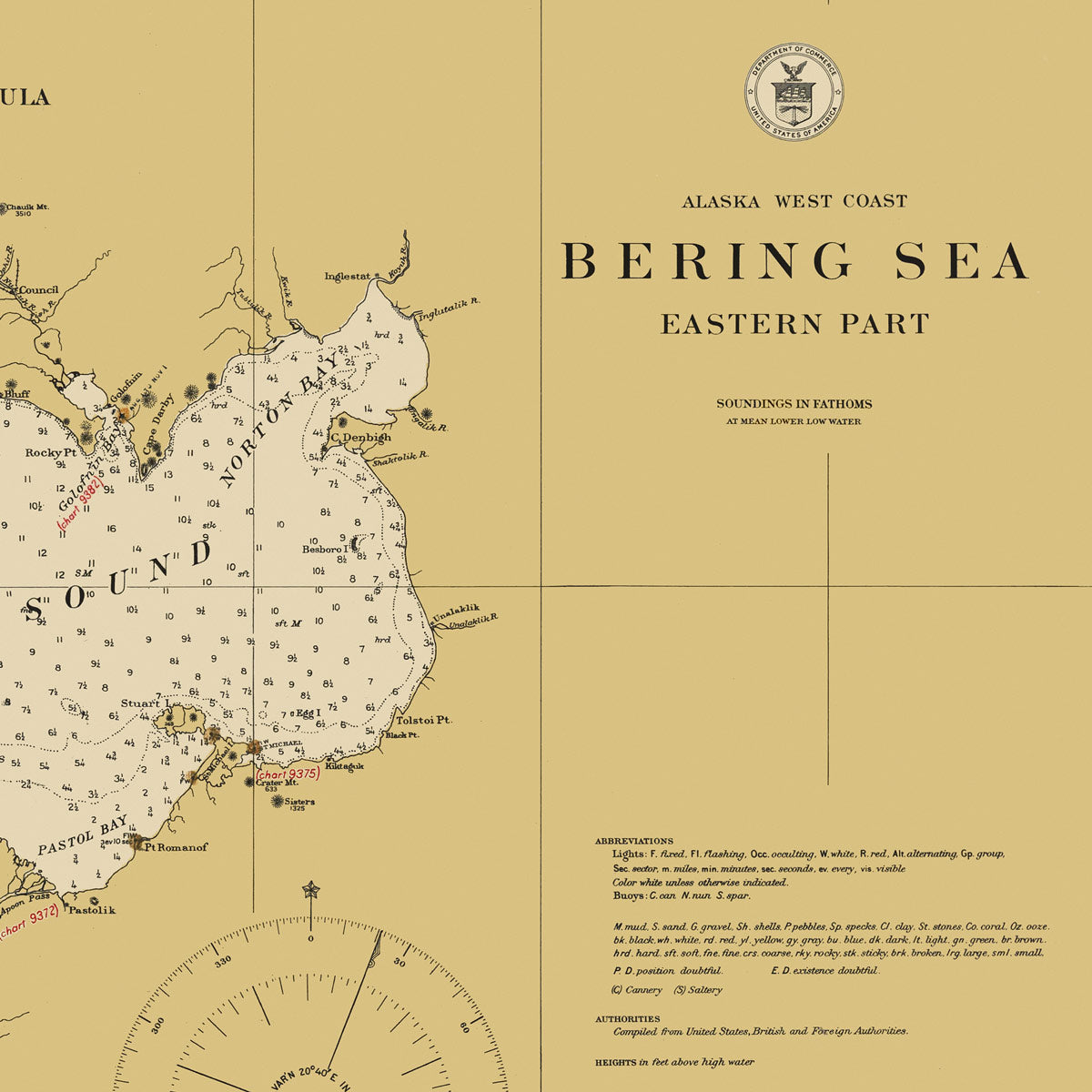
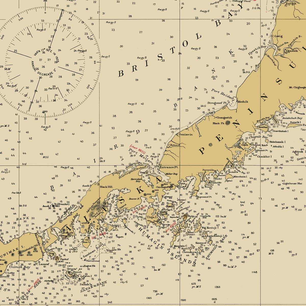
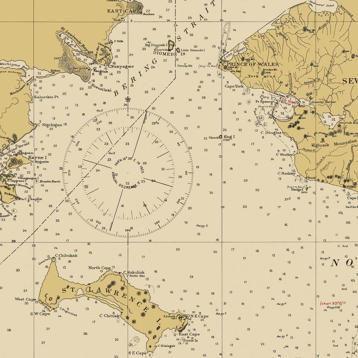
Bering Sea - Eastern Part Nautical Chart 1923
From
$ 57.60 USD
$ 64.00 USD
Sale
10% off
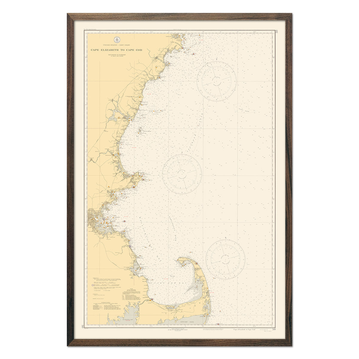
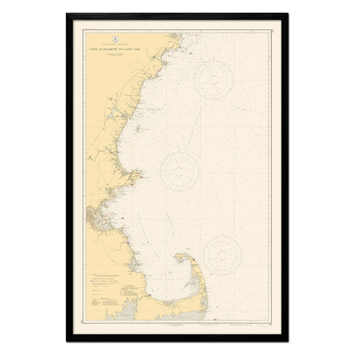
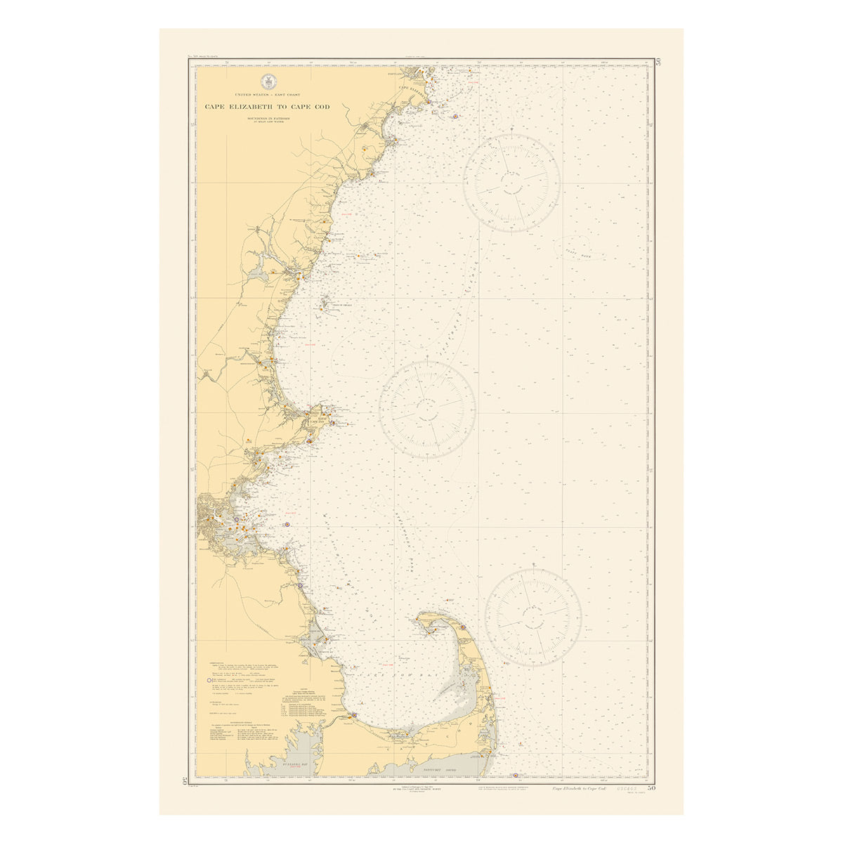
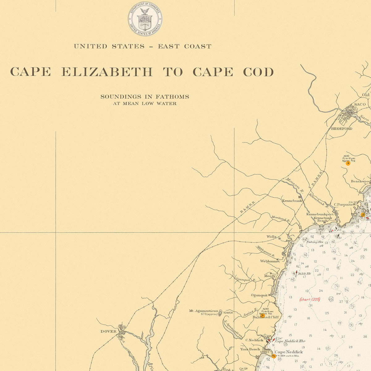
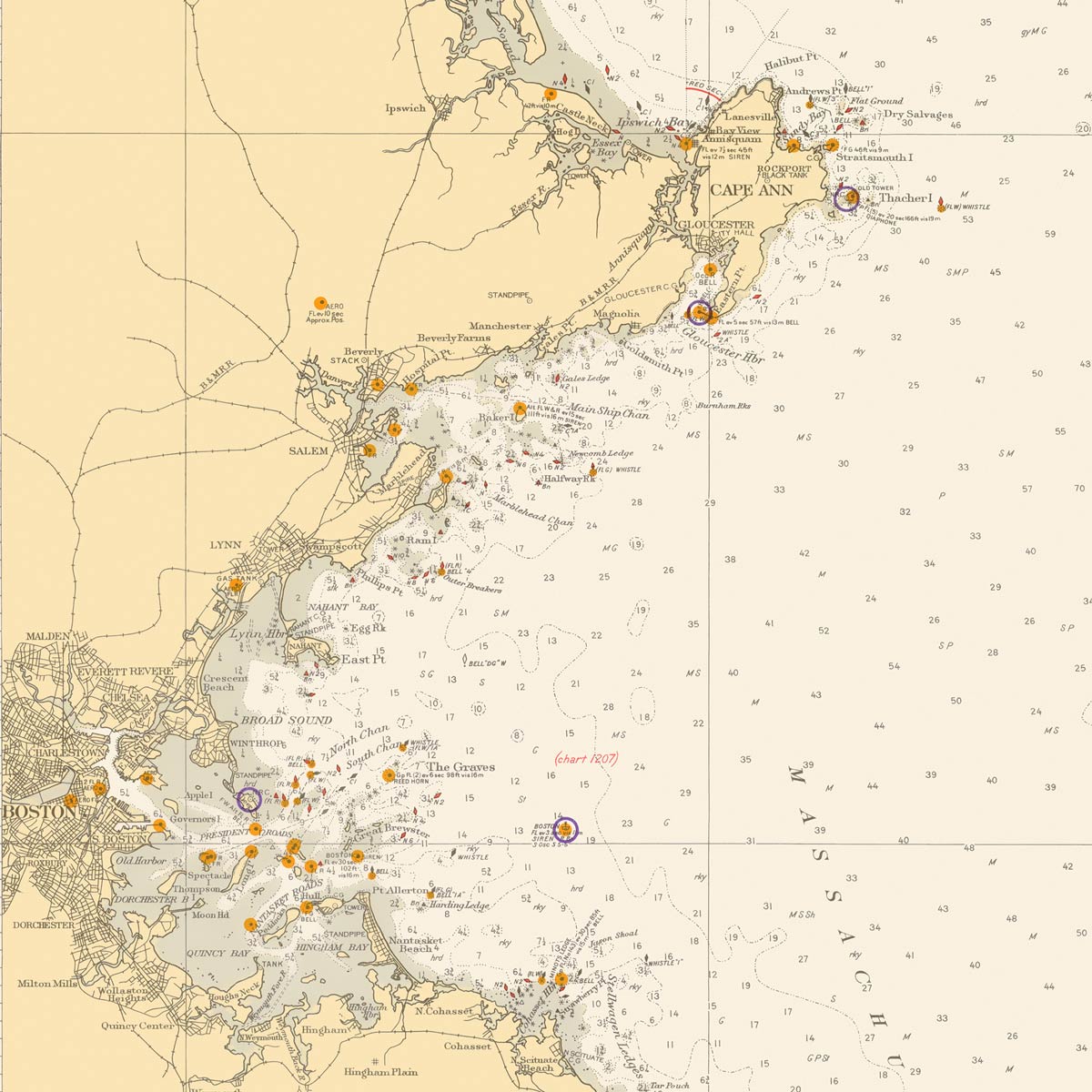
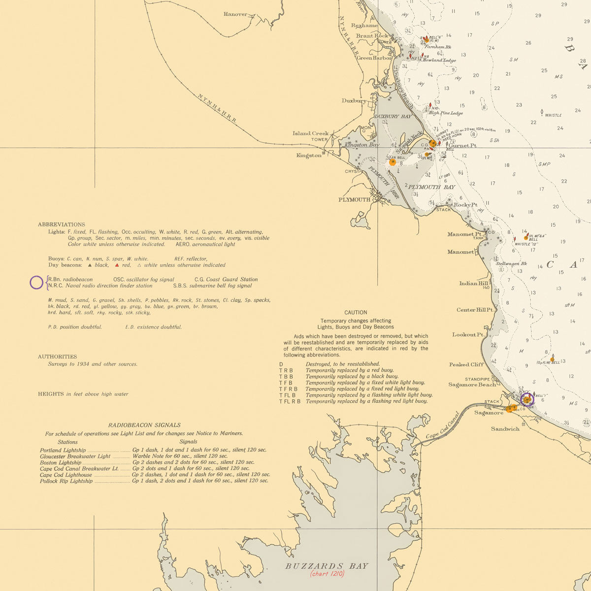
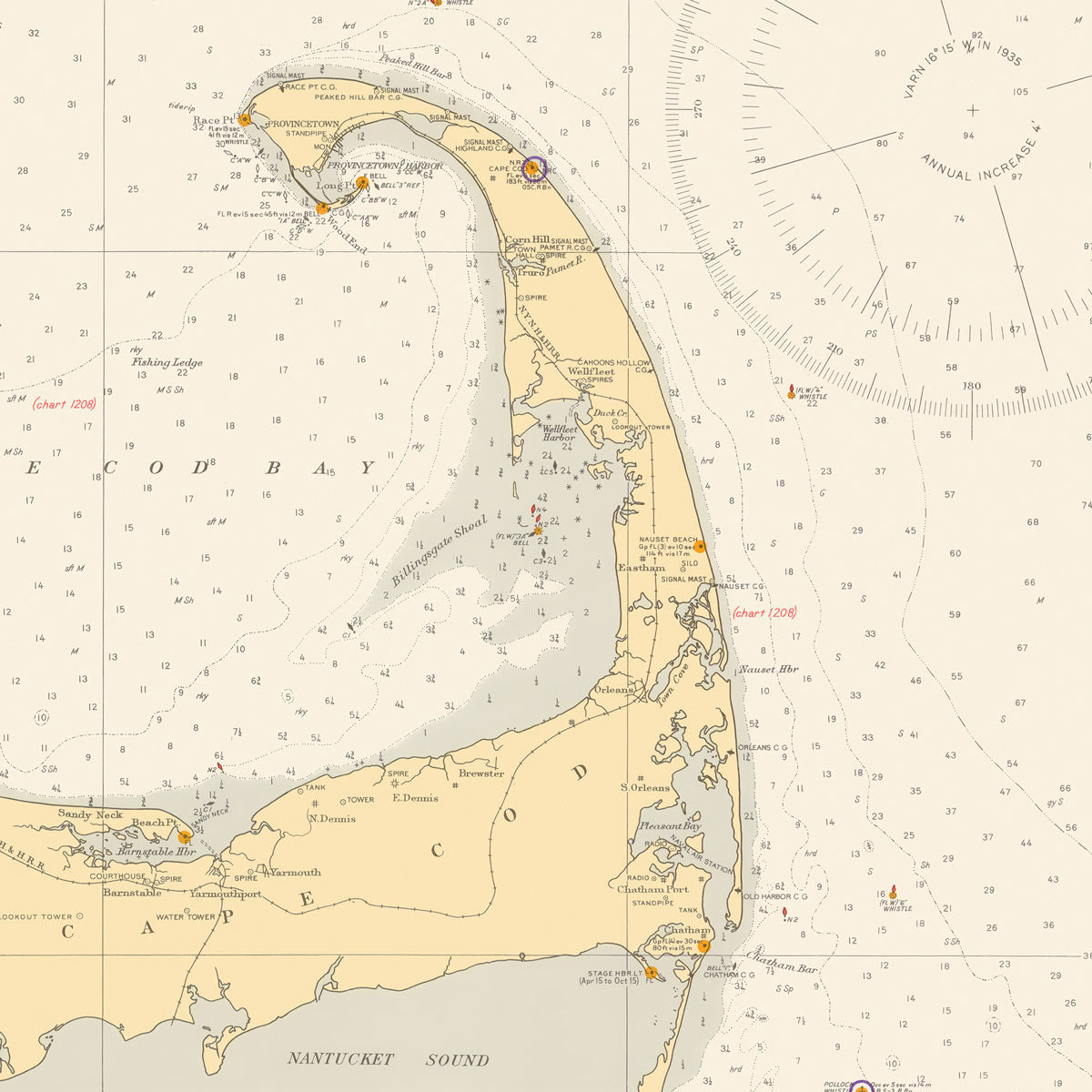
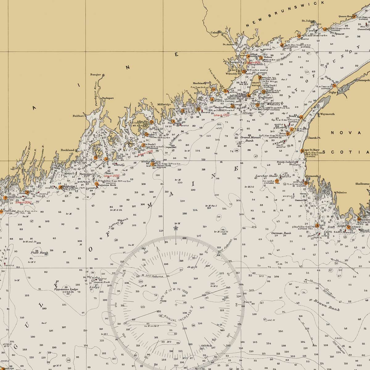
Cape Elizabeth to Cape Cod Nautical Chart 1935
From
$ 71.10 USD
$ 79.00 USD
Sale
10% off
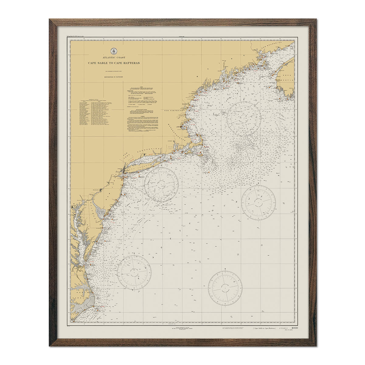
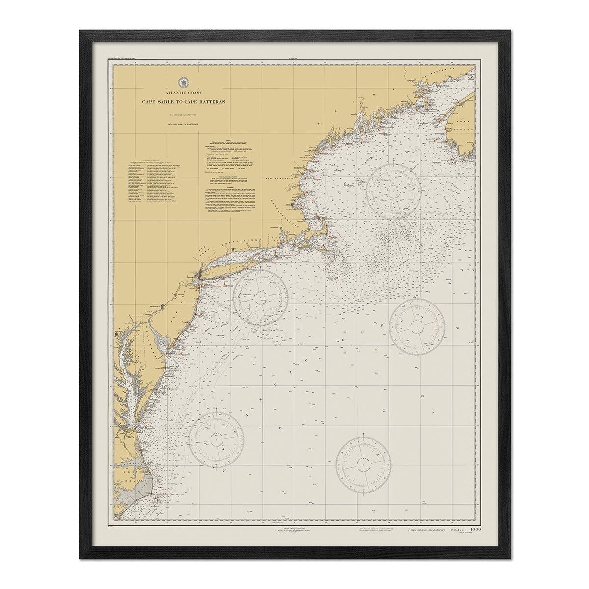
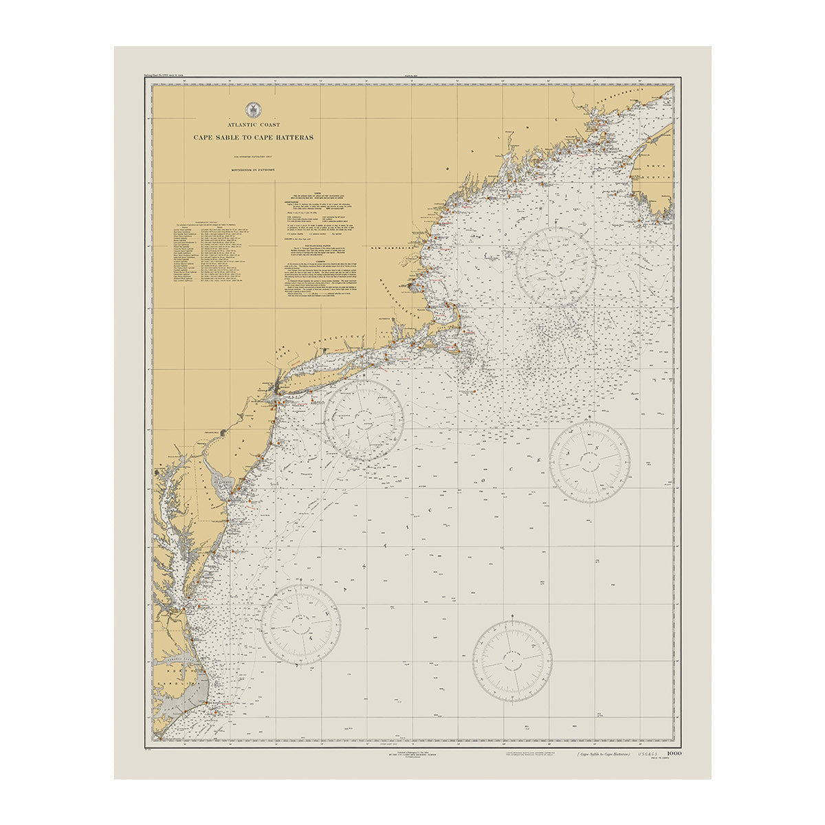
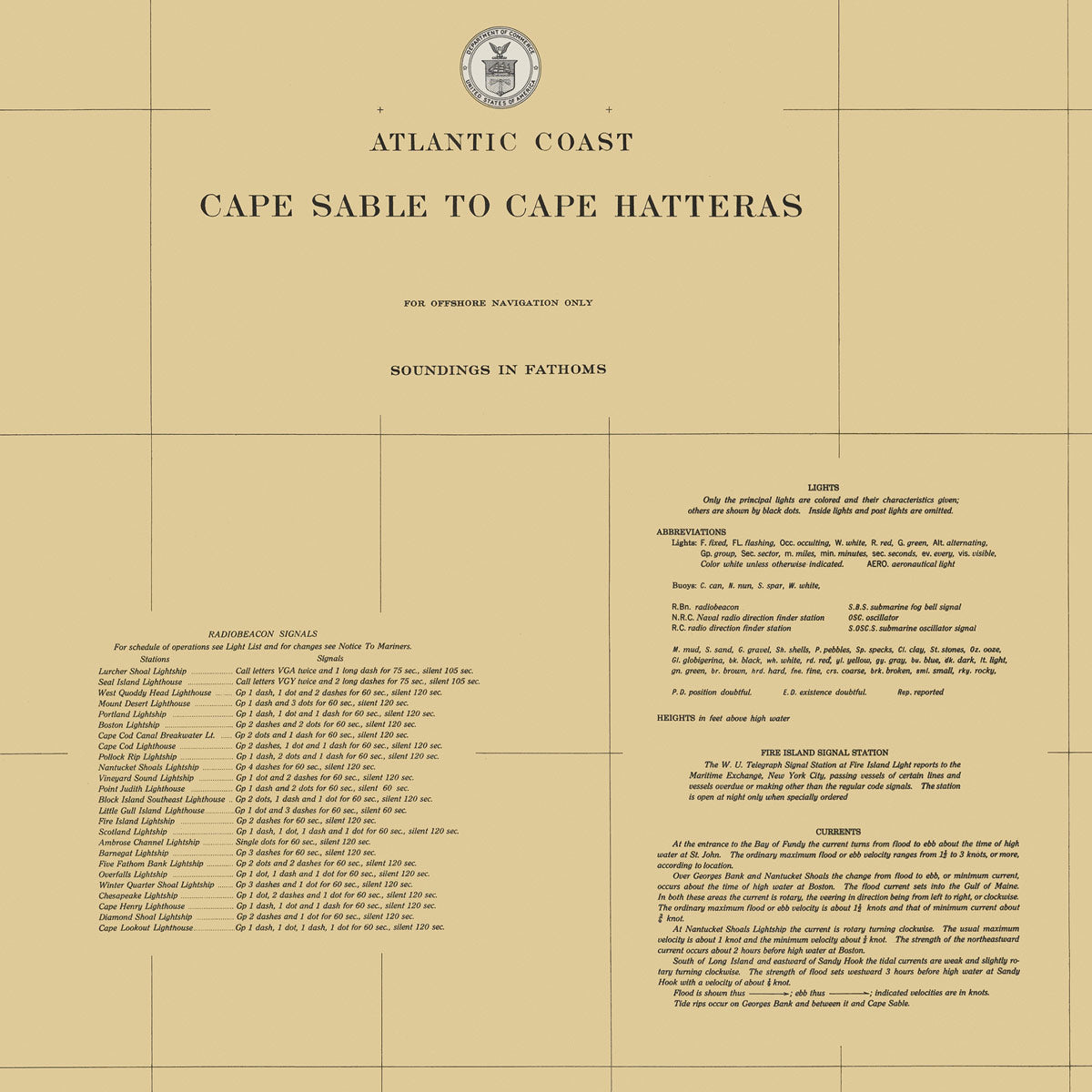
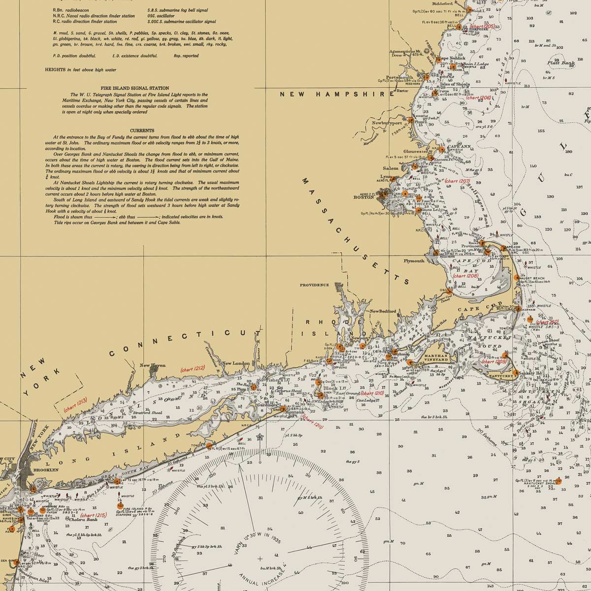
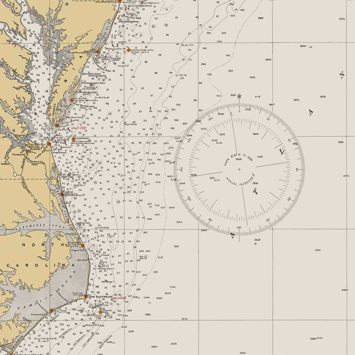
Cape Sable to Cape Hatteras Nautical Chart 1934
From
$ 57.60 USD
$ 64.00 USD
Sale
10% off
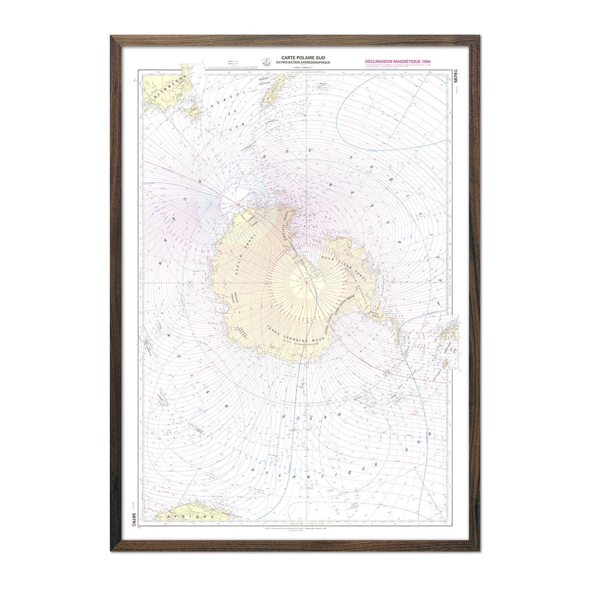
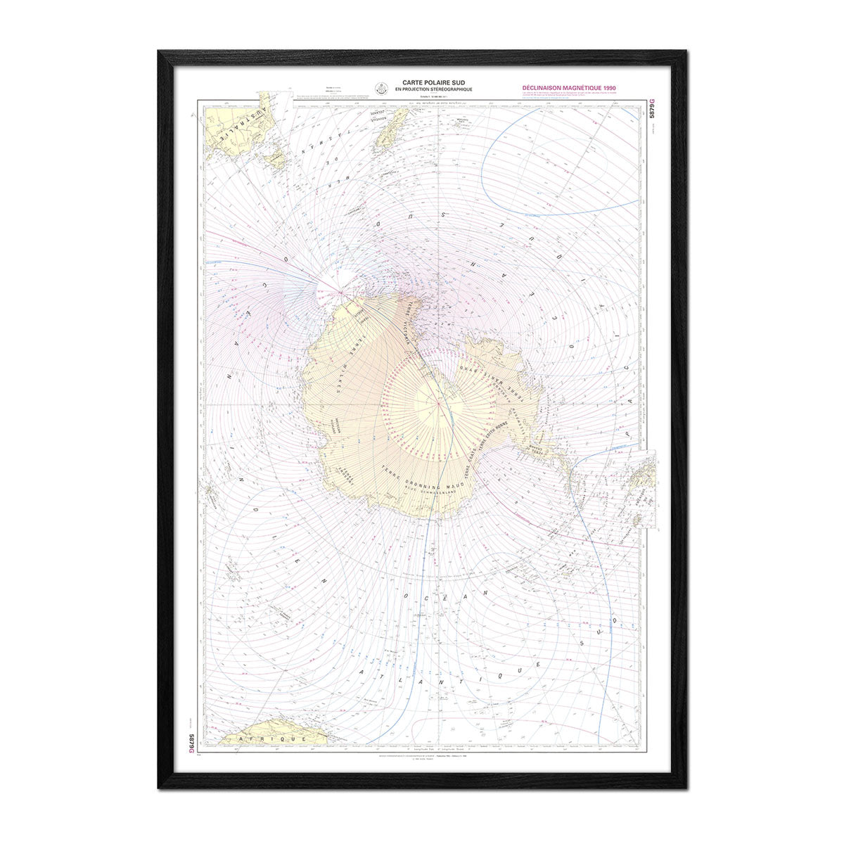
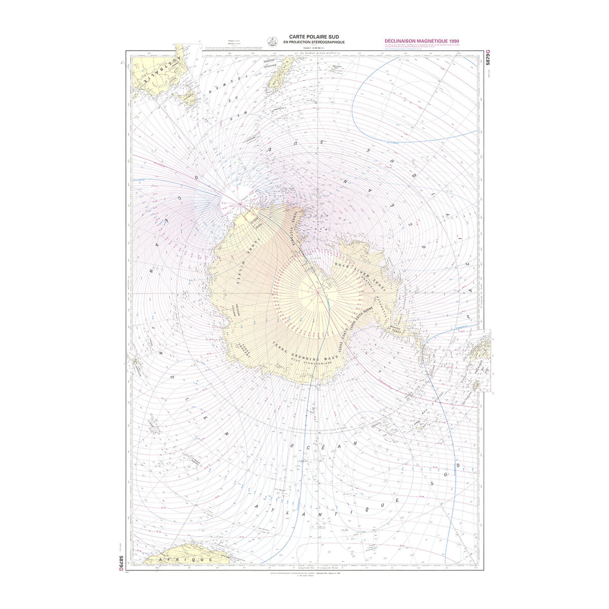
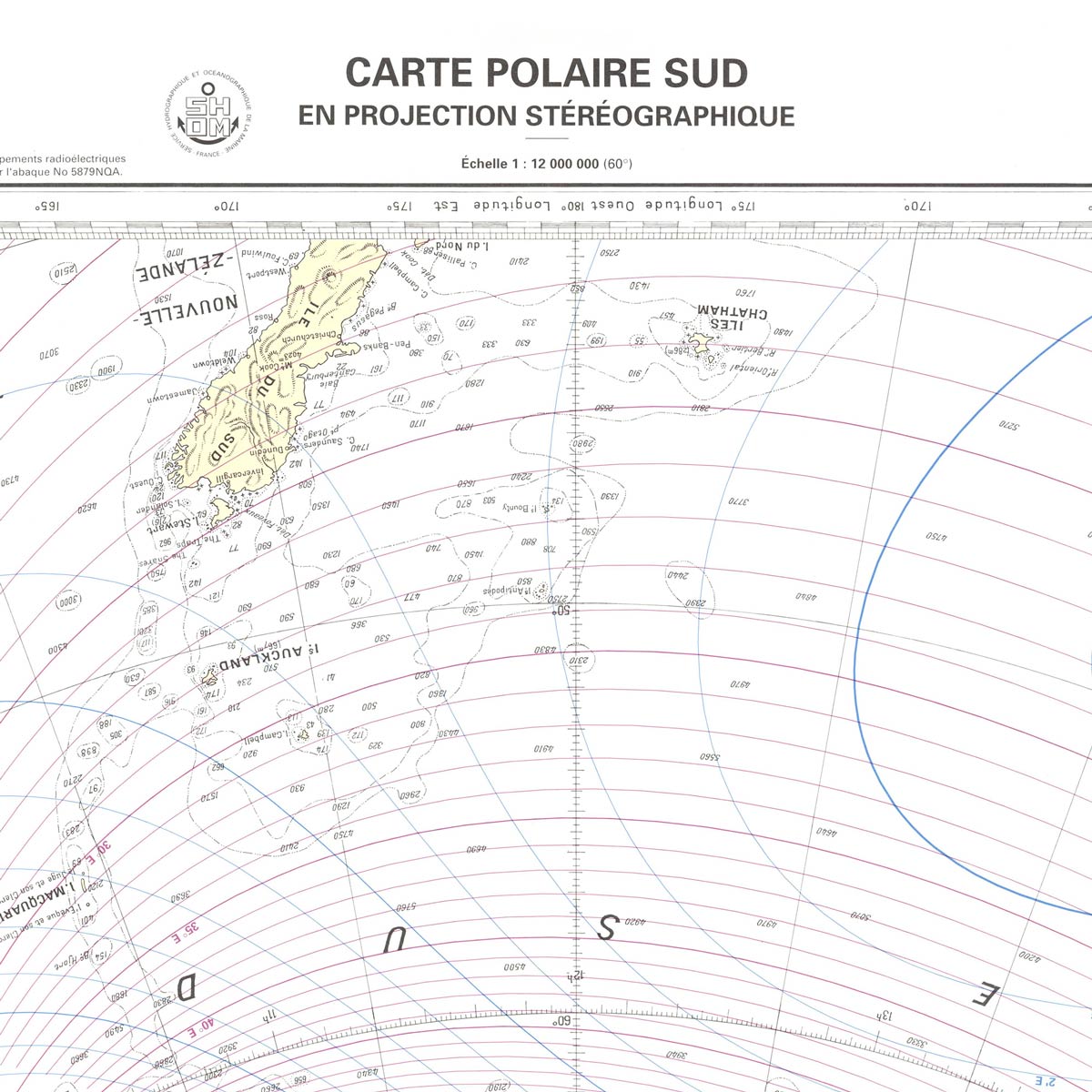
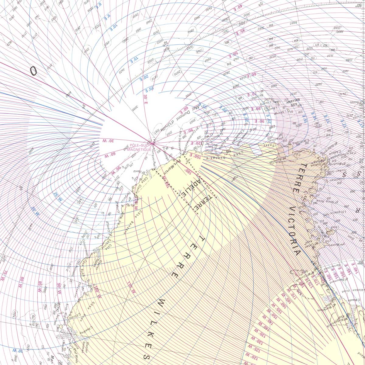
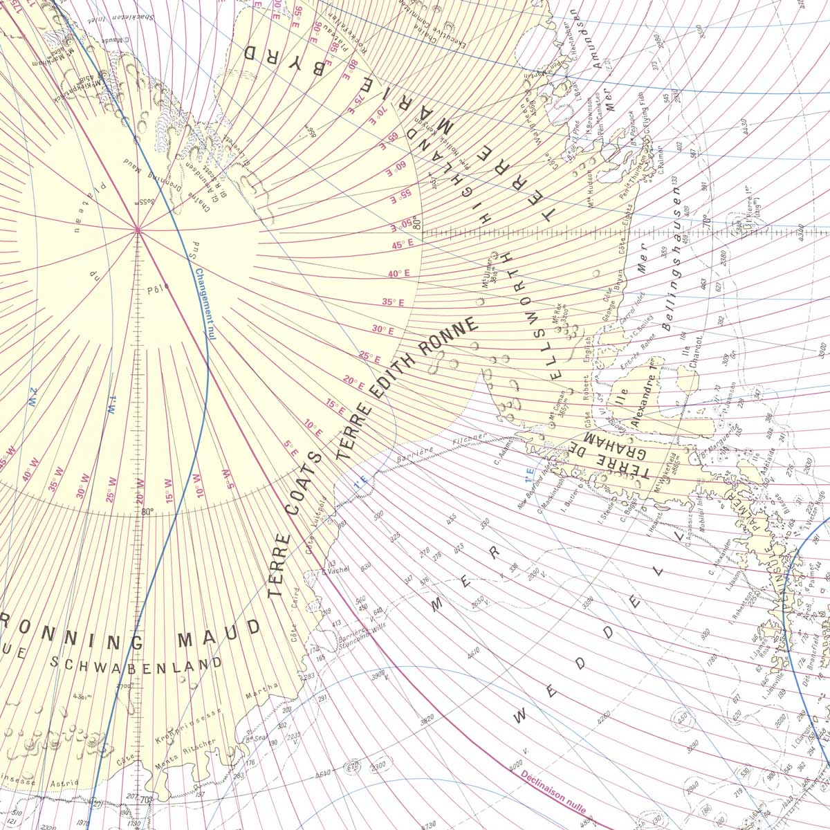
Carte Polaire Sud Nautical Chart 1992
From
$ 71.10 USD
$ 79.00 USD
Sale
10% off
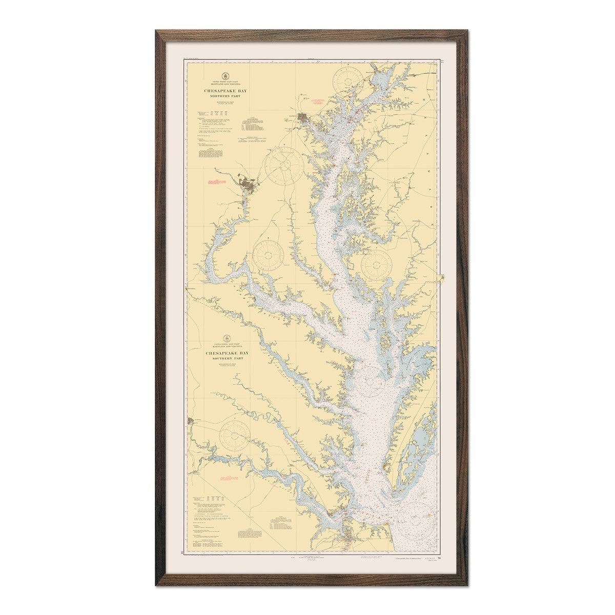
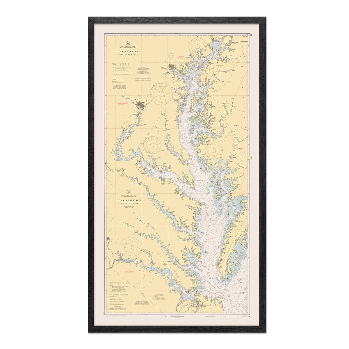
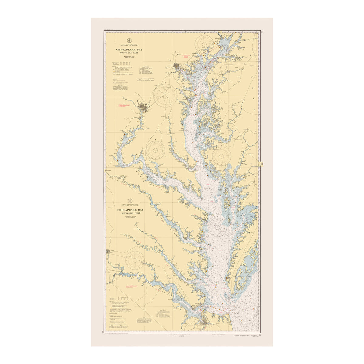
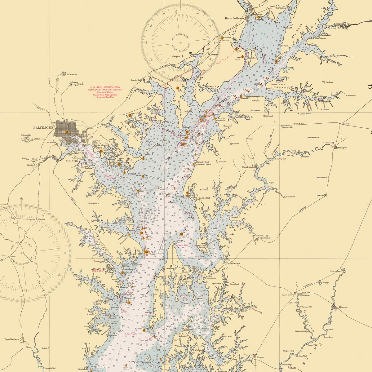
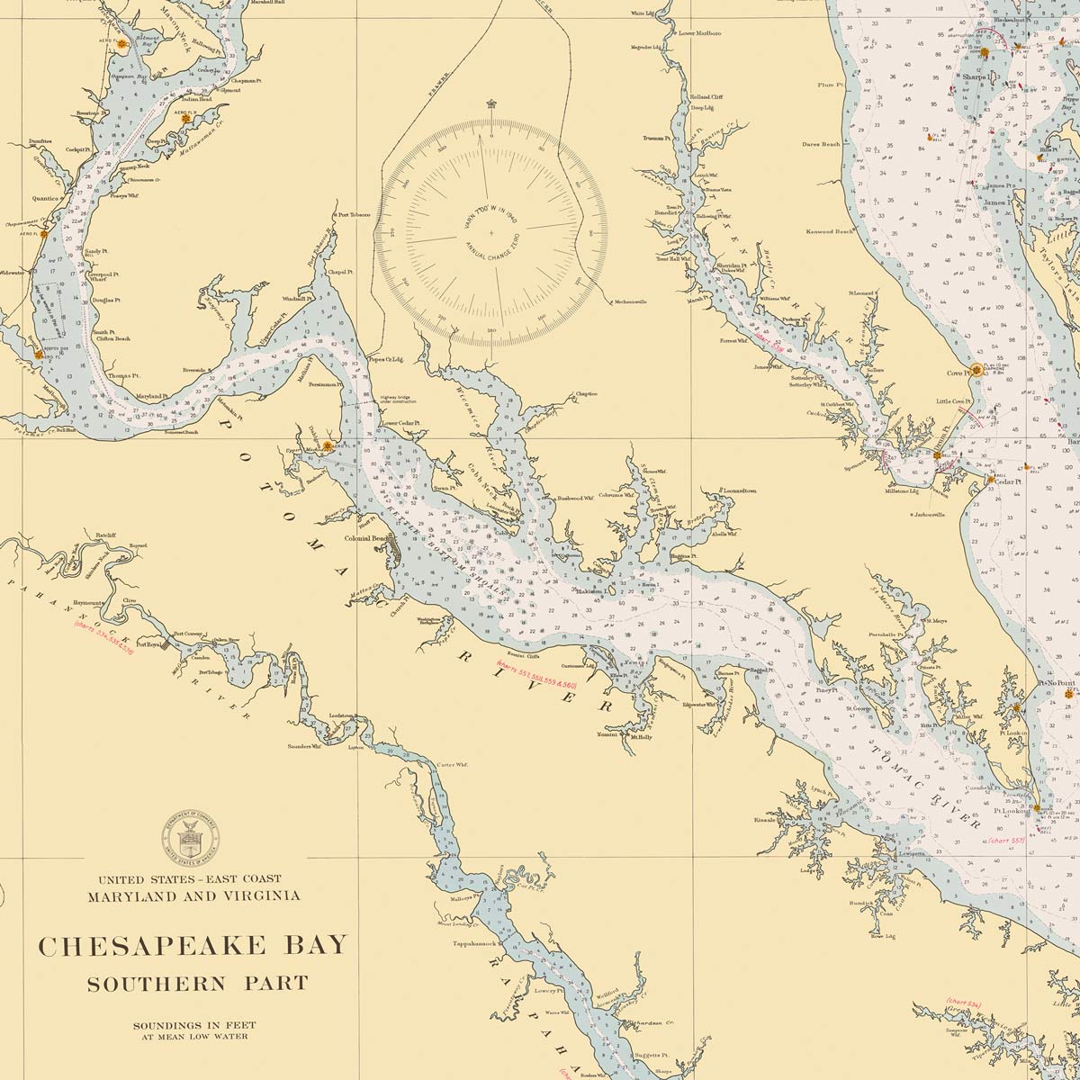
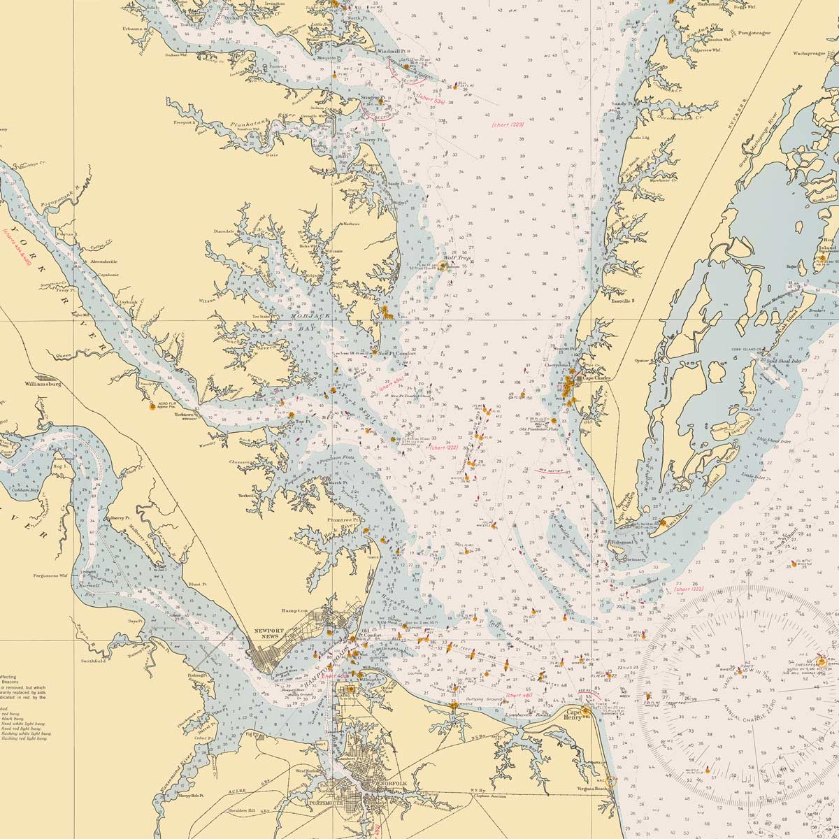
Chesapeake Bay Nautical Chart 1940
From
$ 89.10 USD
$ 99.00 USD
Sale
10% off
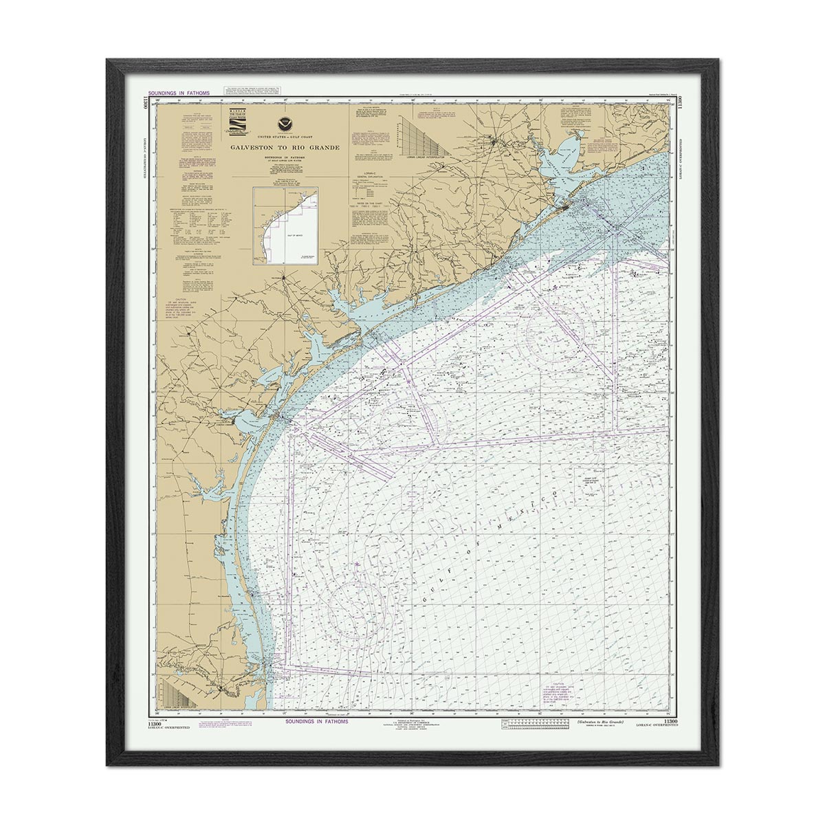
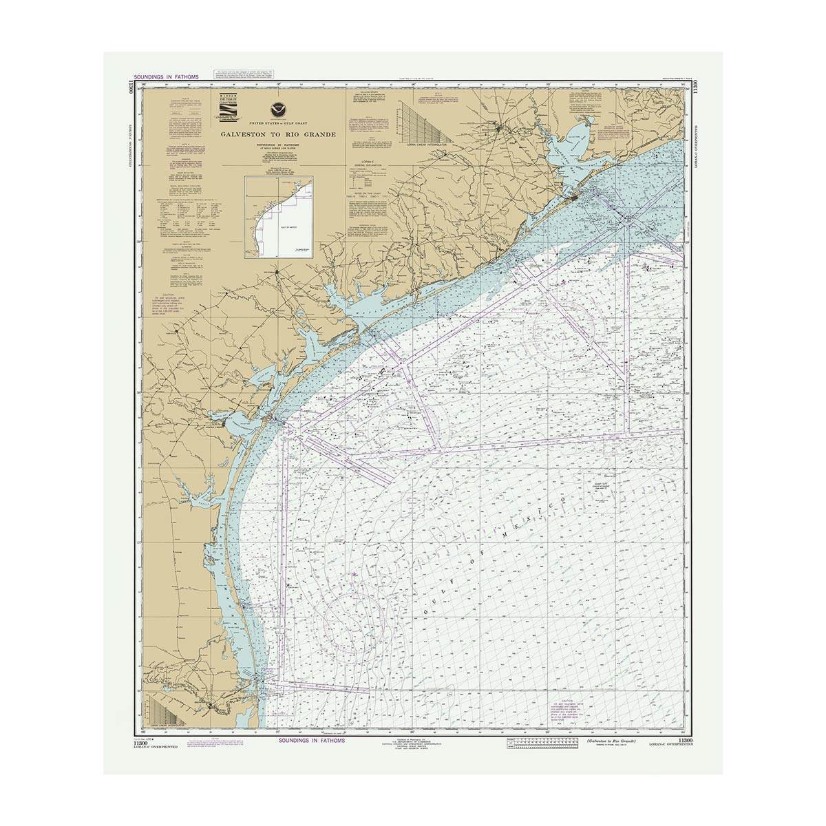
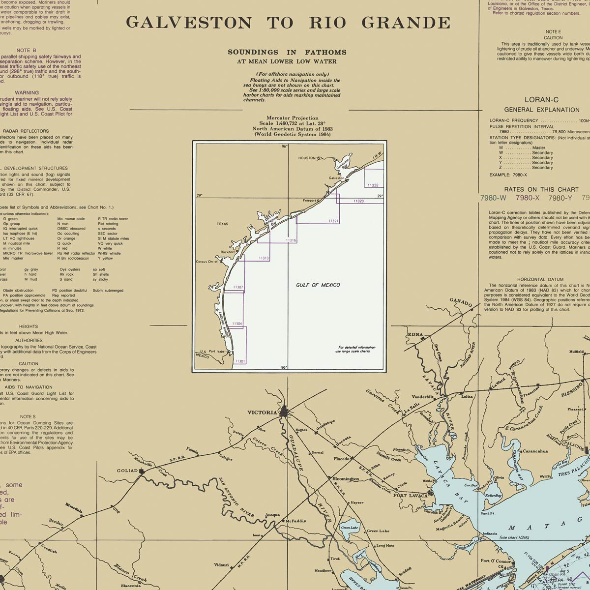
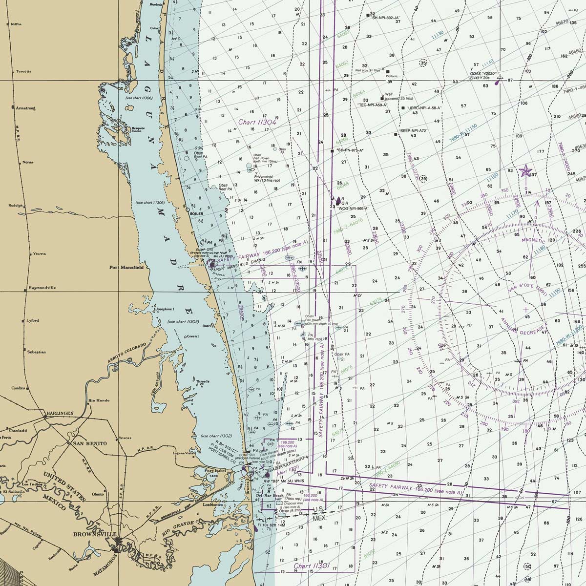
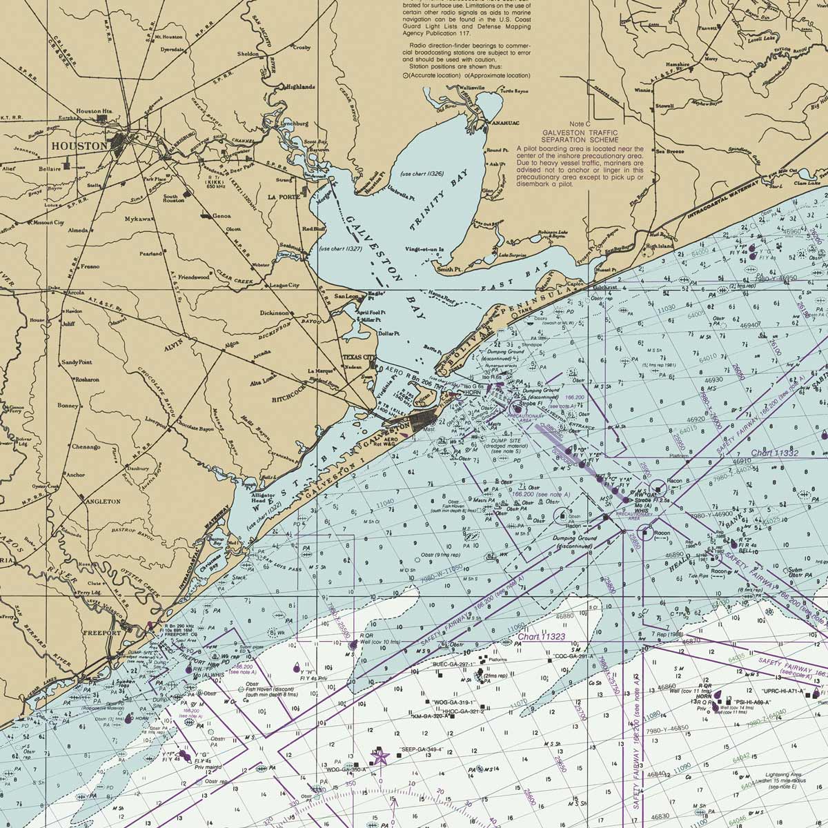
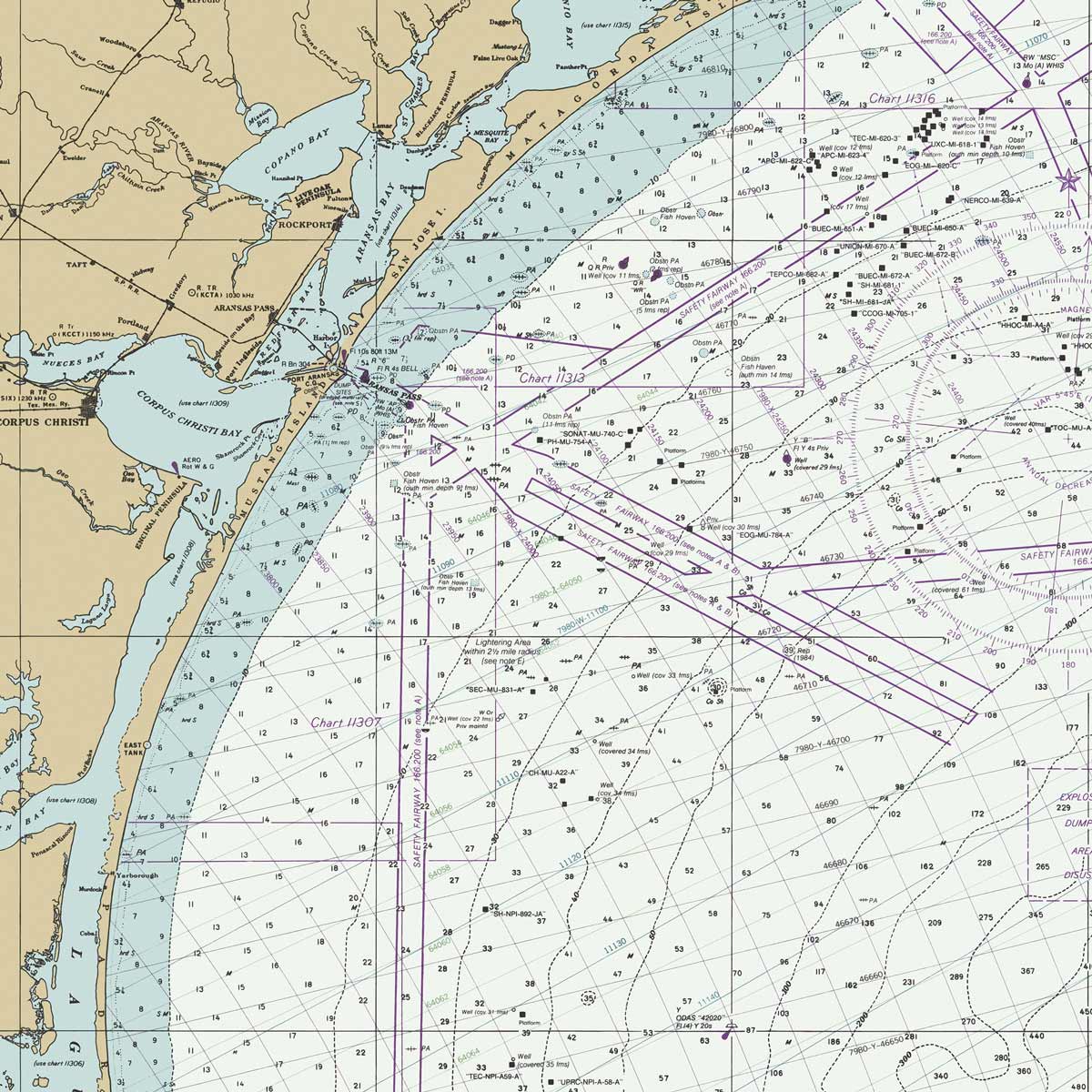
Galveston to Rio Grande Nautical Chart 1992
From
$ 57.60 USD
$ 64.00 USD
Sale
10% off
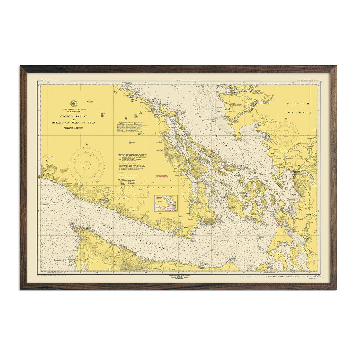
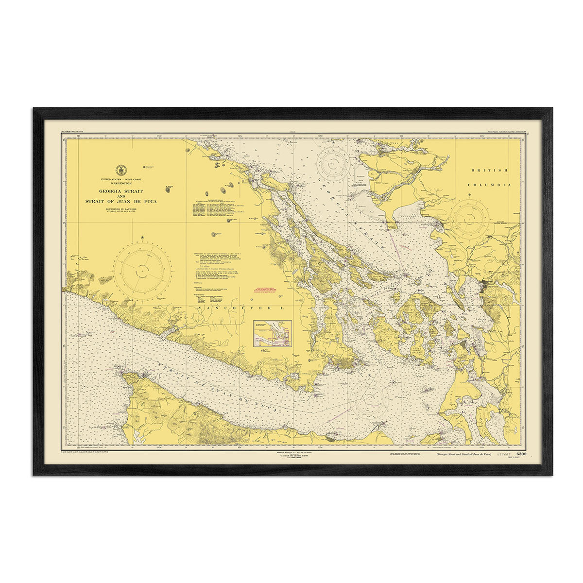
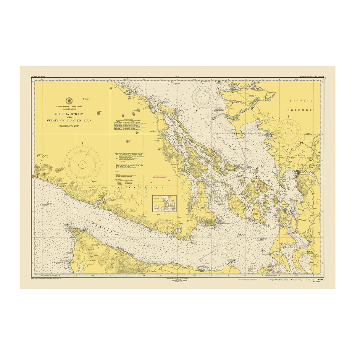
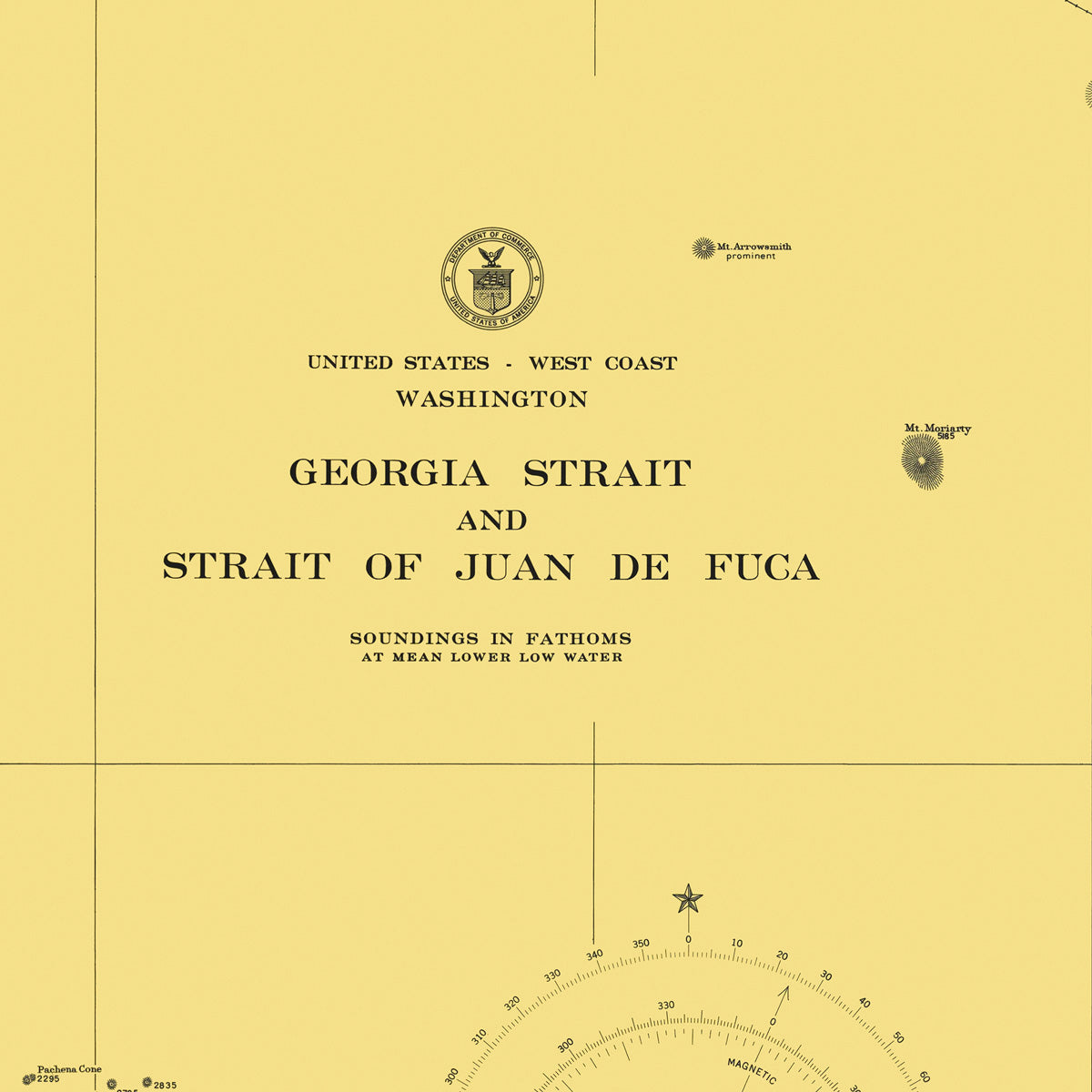
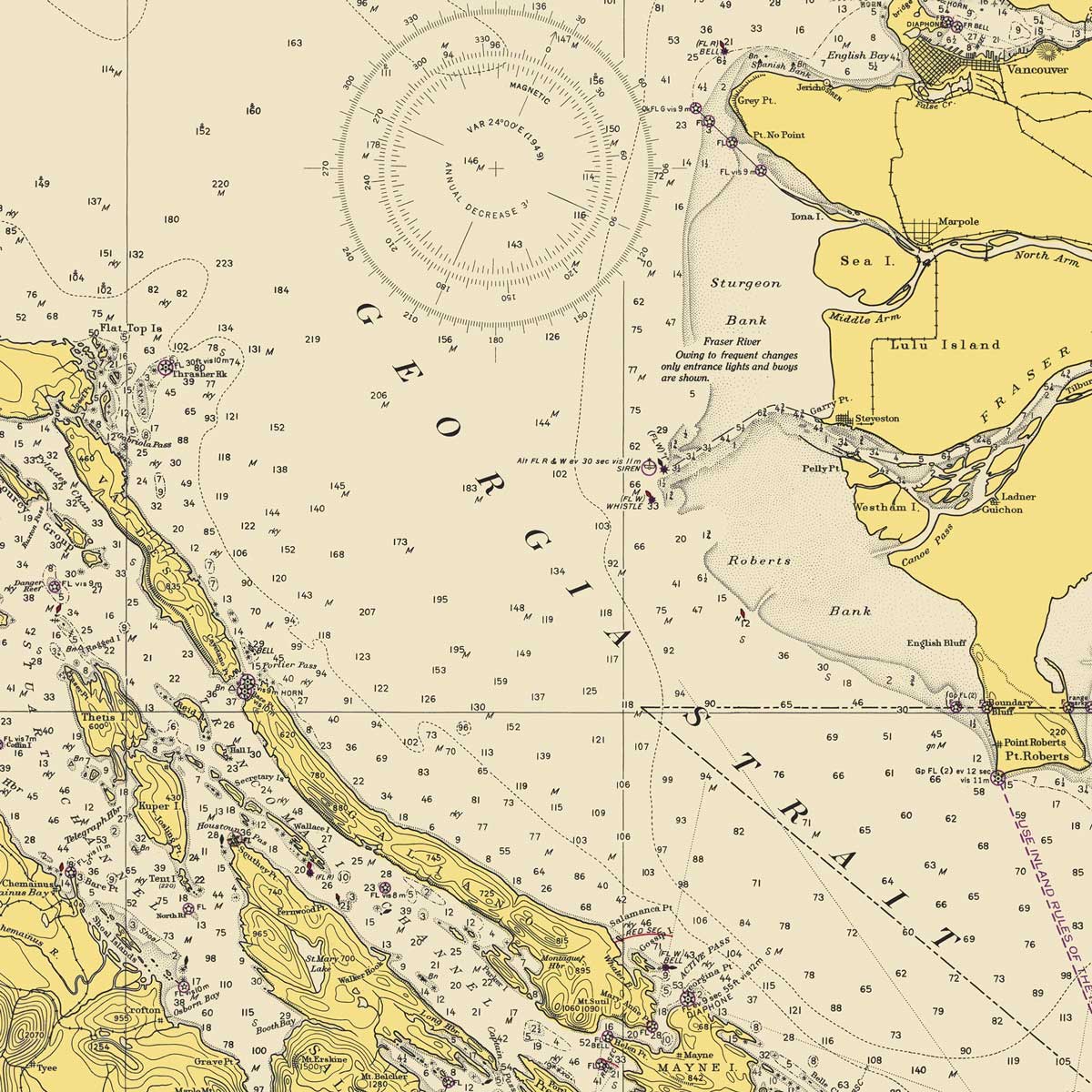
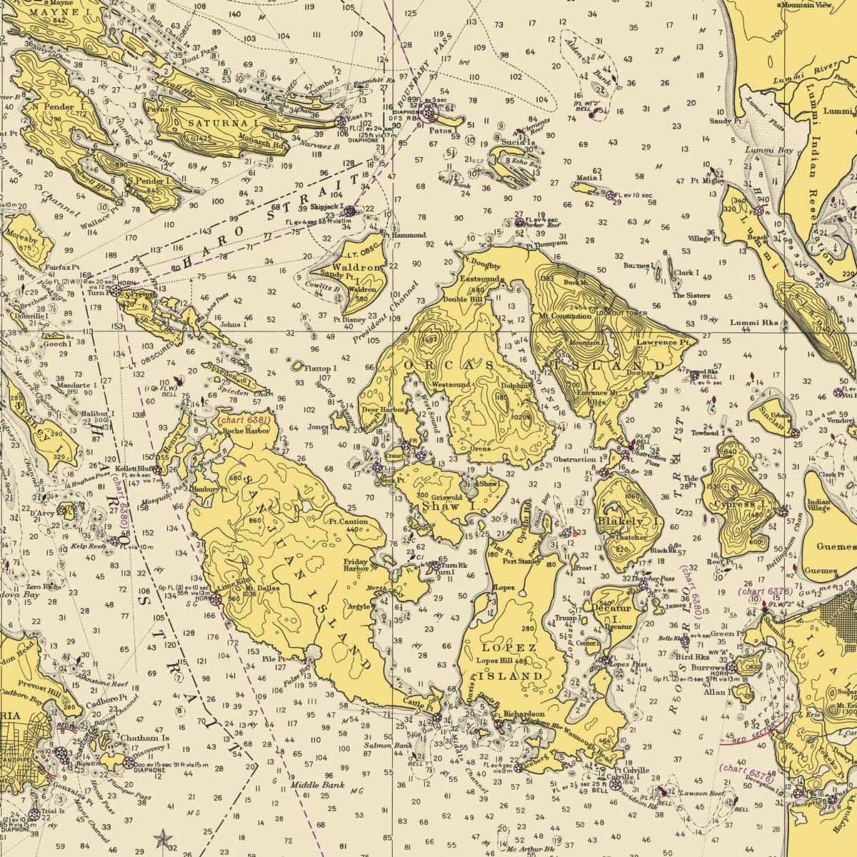
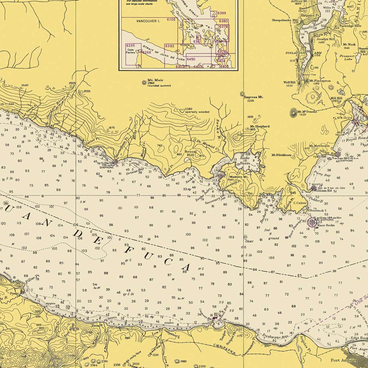
Georgia Strait & Strait of Juan de Fuca Nautical Chart 1948
From
$ 71.10 USD
$ 79.00 USD
Sale
10% off
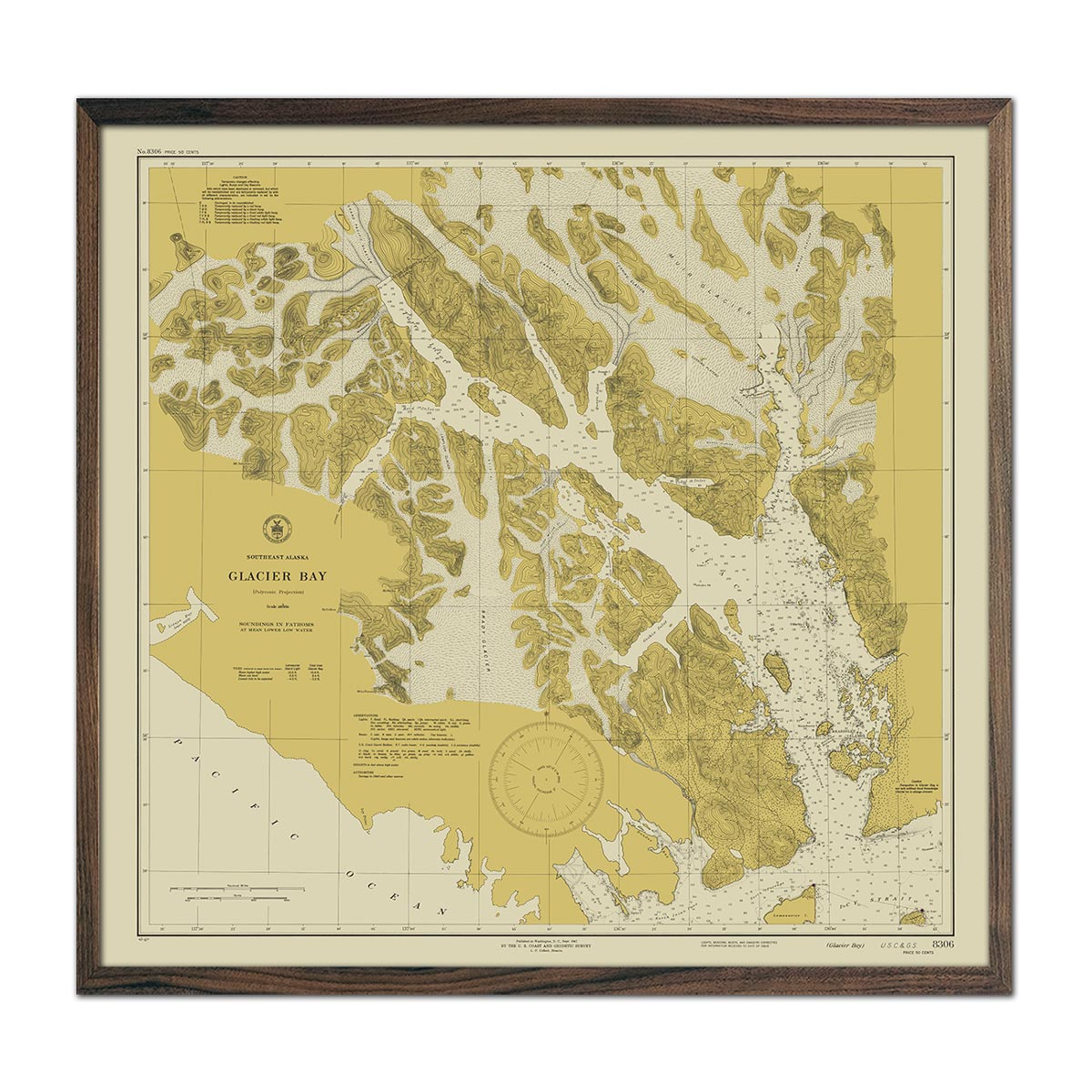
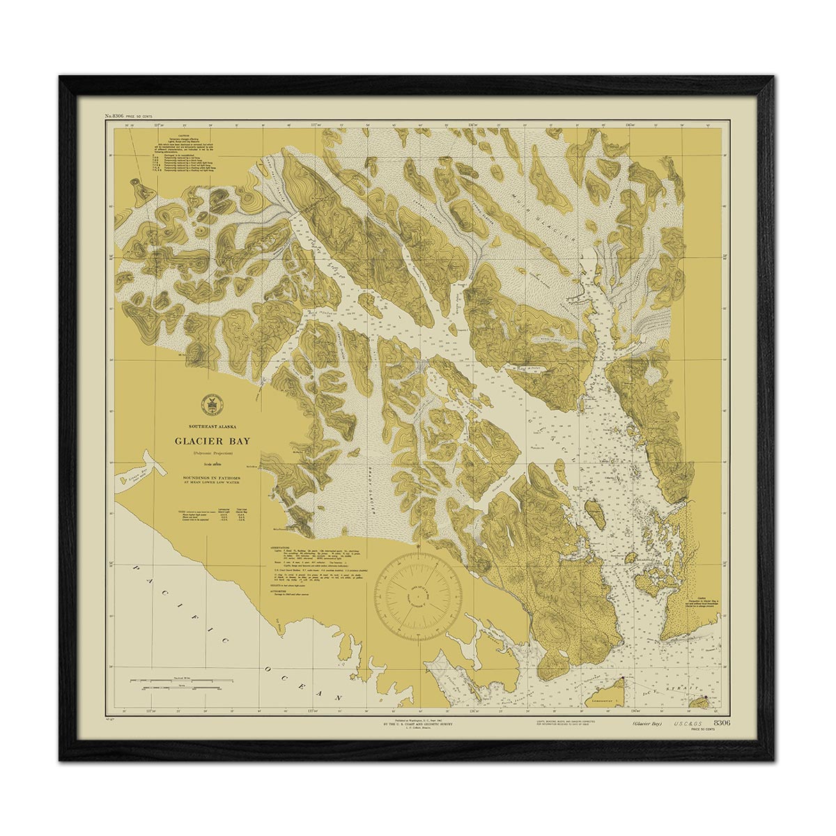
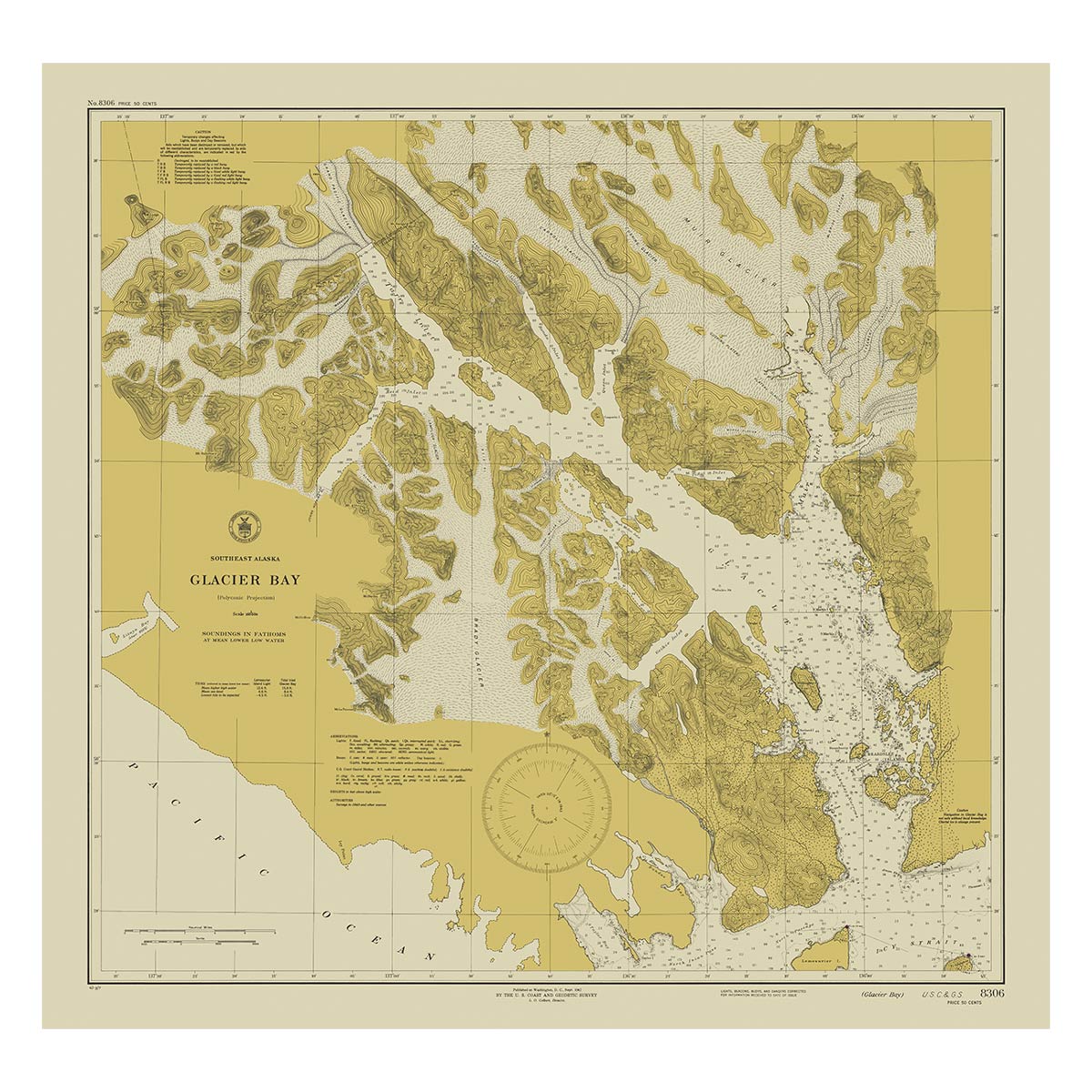
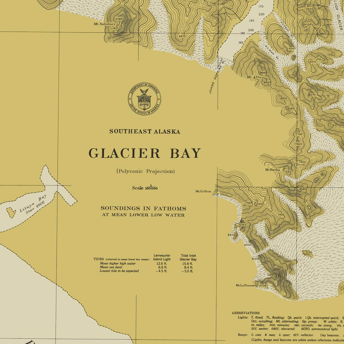
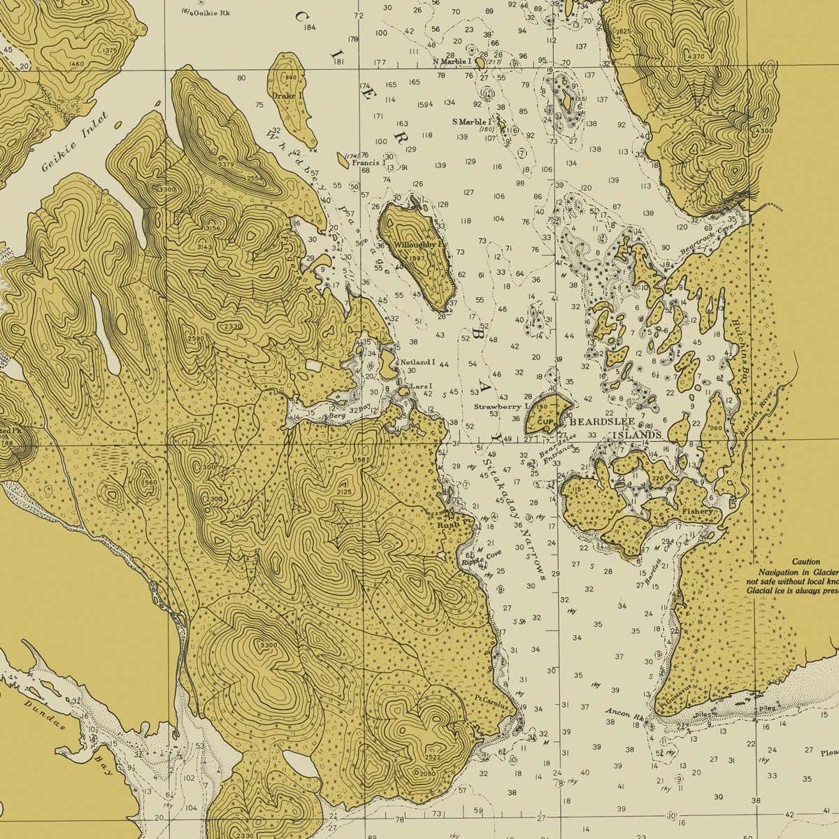
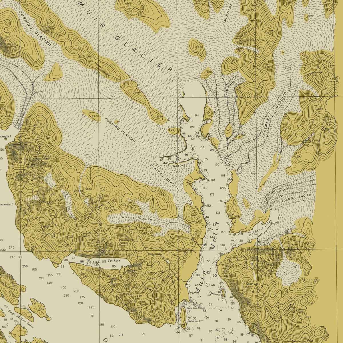
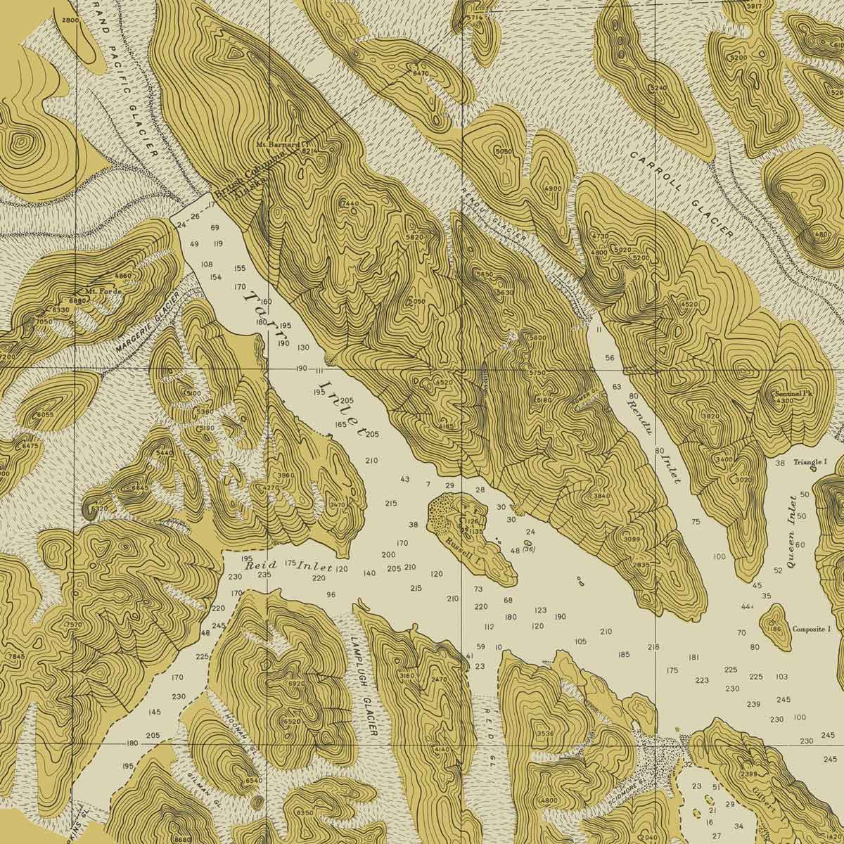
Glacier Bay, AK Nautical Chart 1942
From
$ 80.10 USD
$ 89.00 USD
Sale
10% off
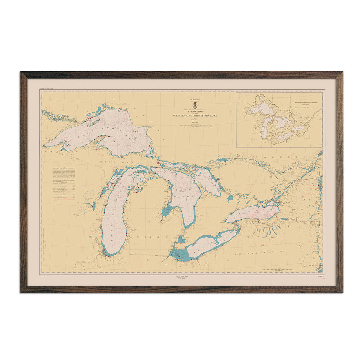
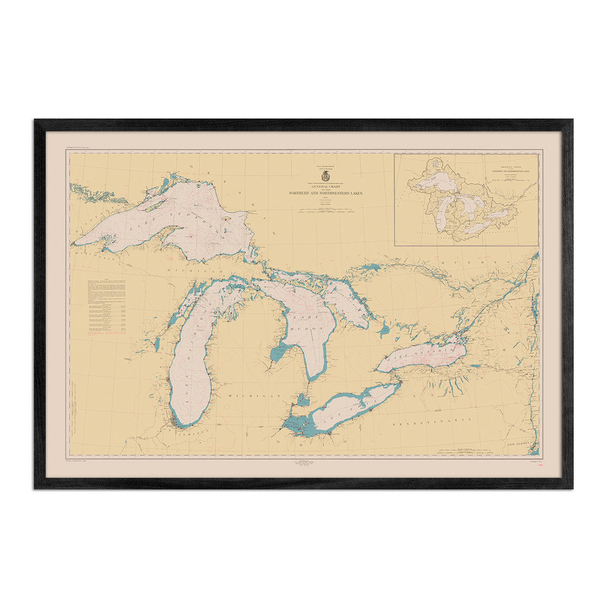
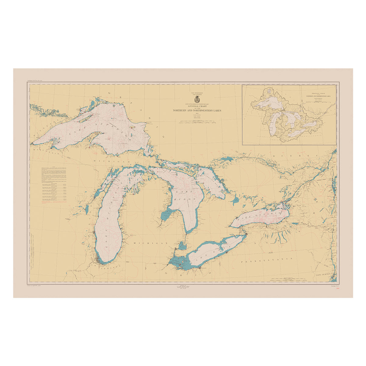
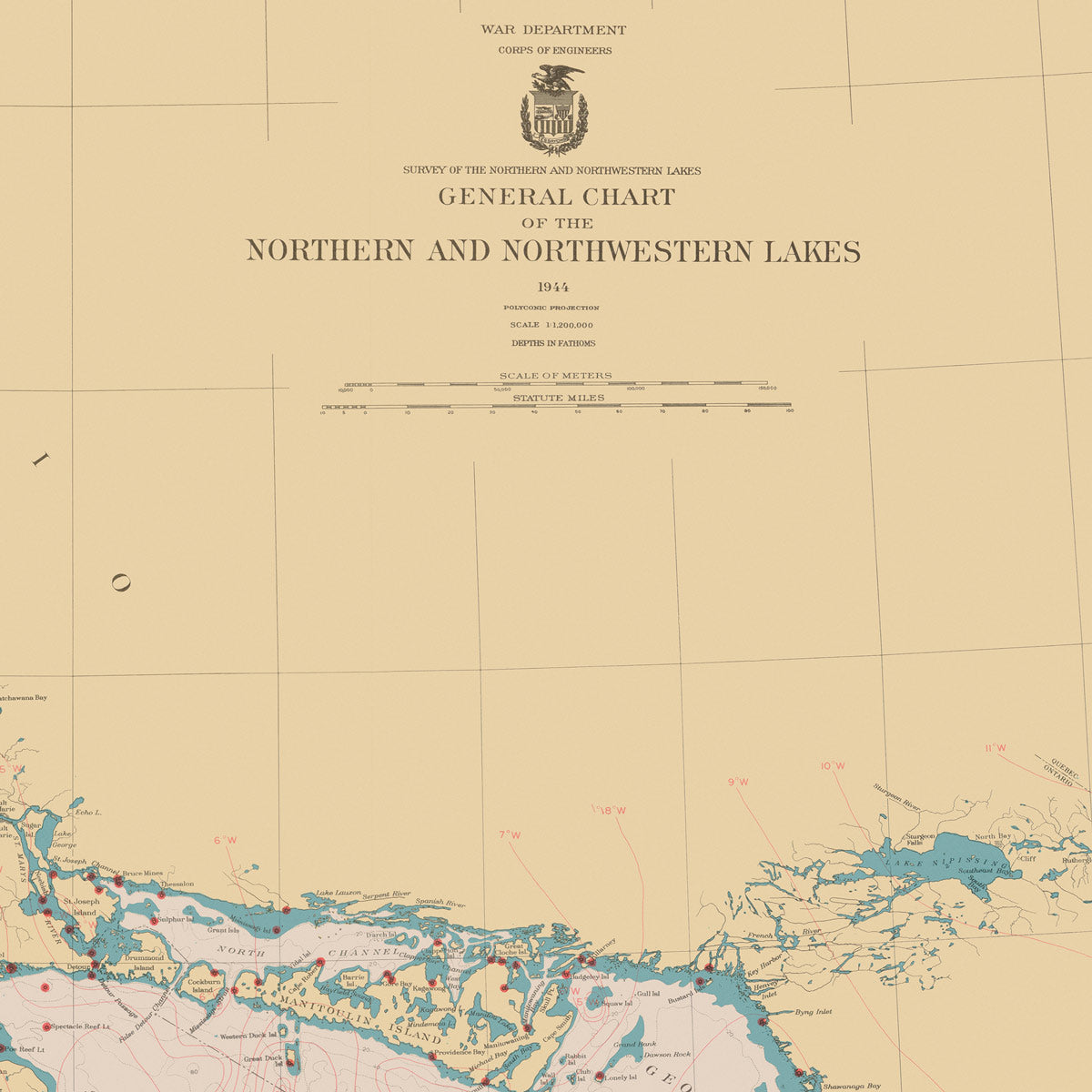
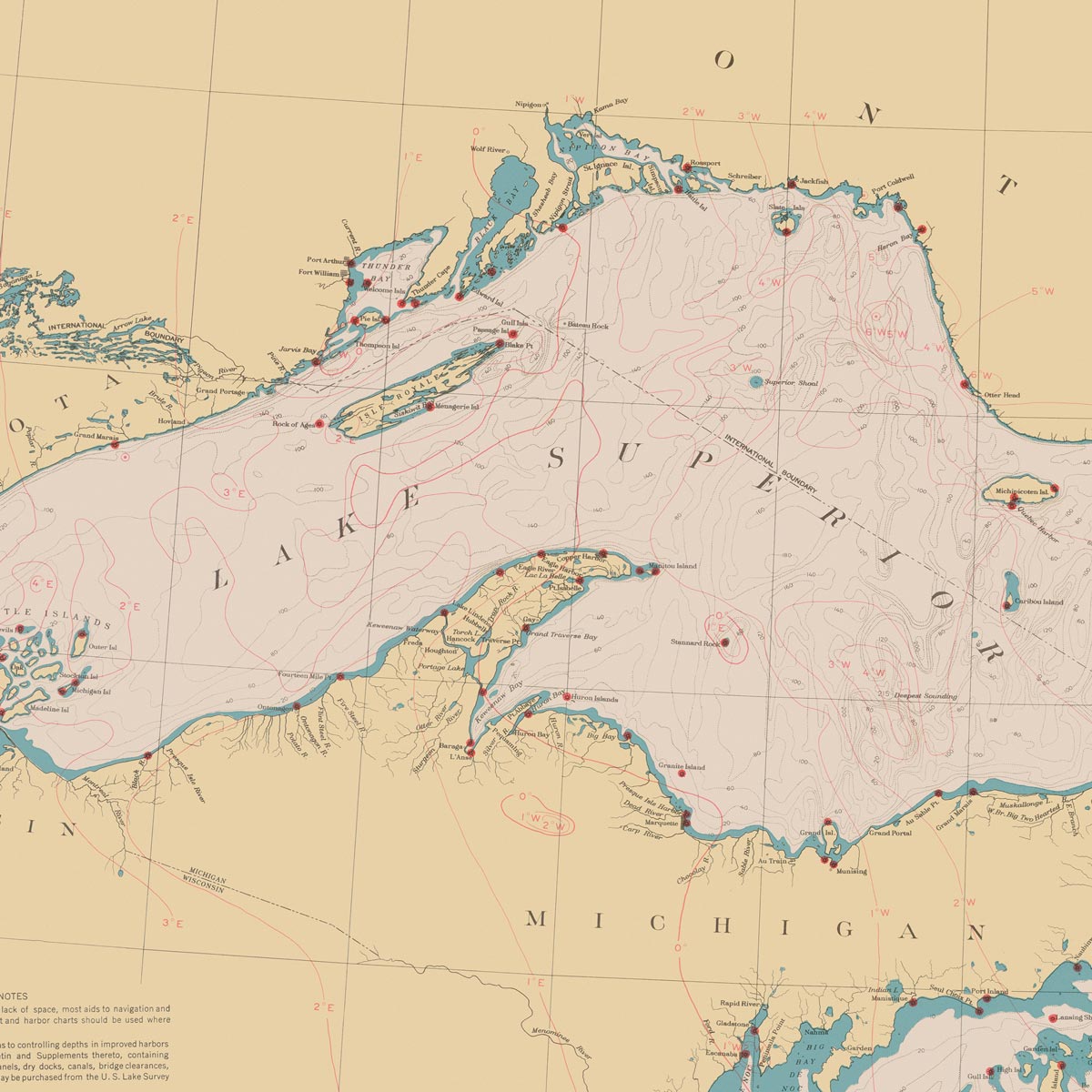
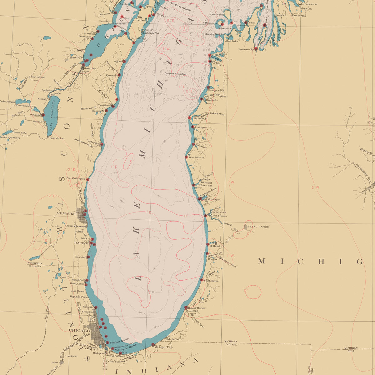
Great Lakes Nautical Chart 1944
From
$ 71.10 USD
$ 79.00 USD
Sale
10% off
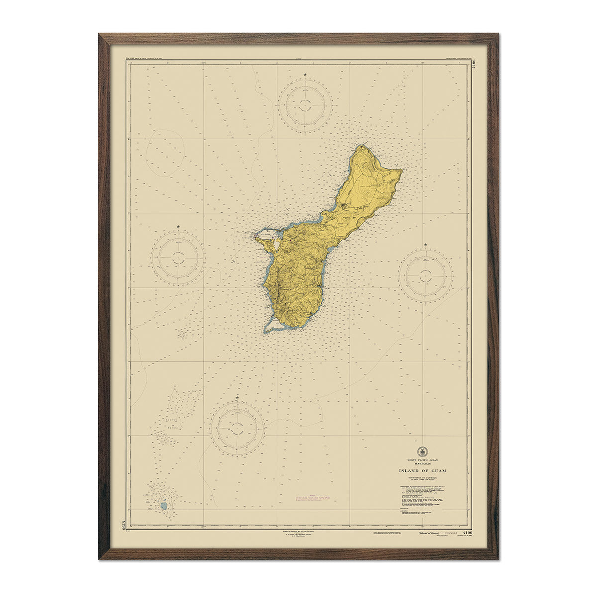
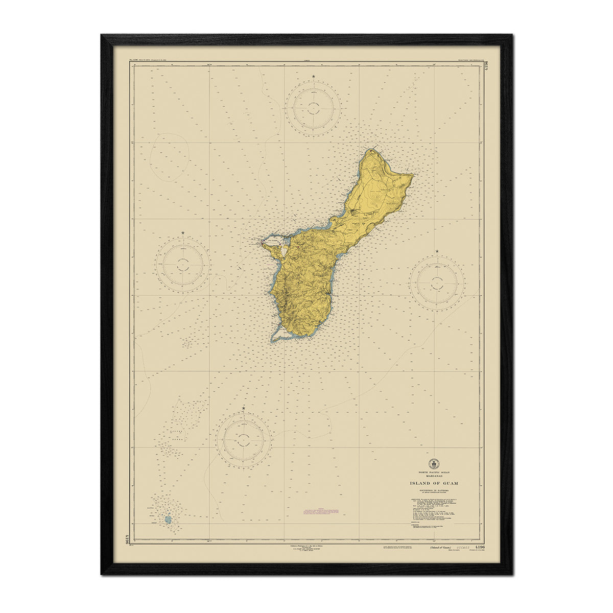
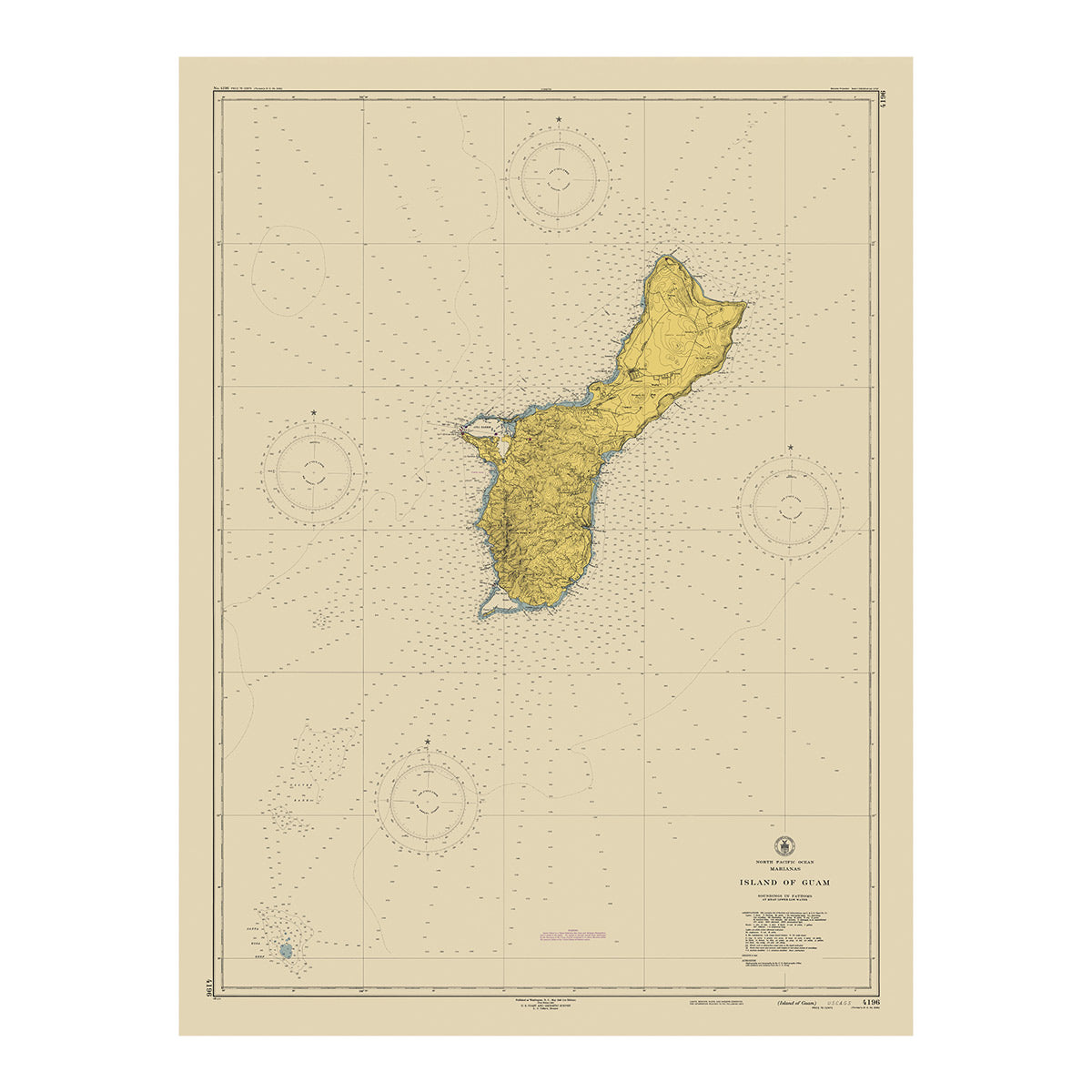
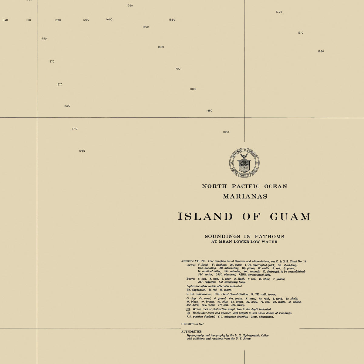
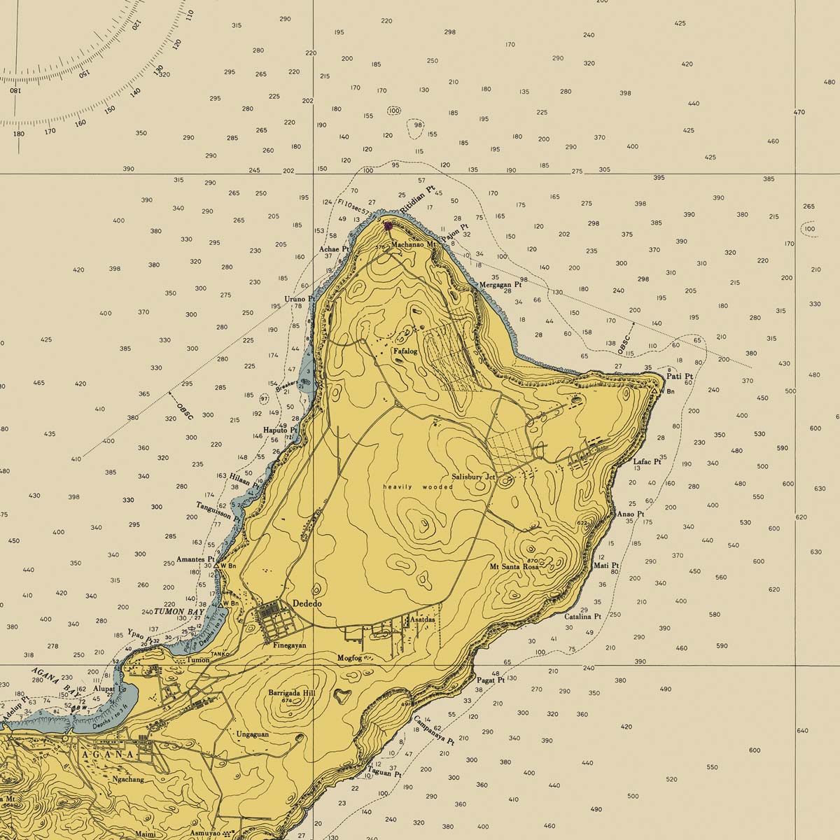
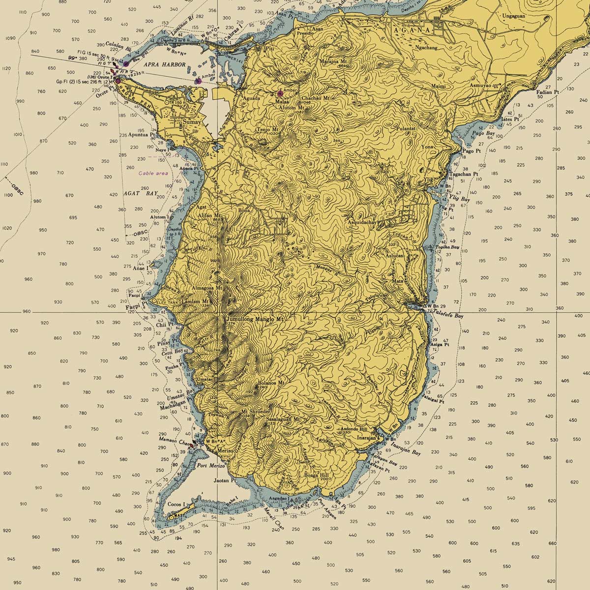
Guam Nautical Chart 1948
From
$ 71.10 USD
$ 79.00 USD
Sale
10% off
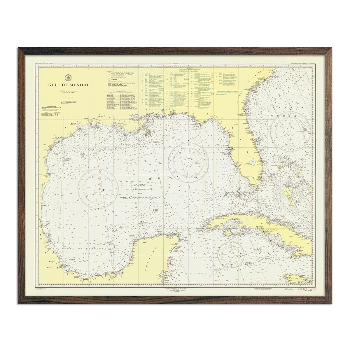
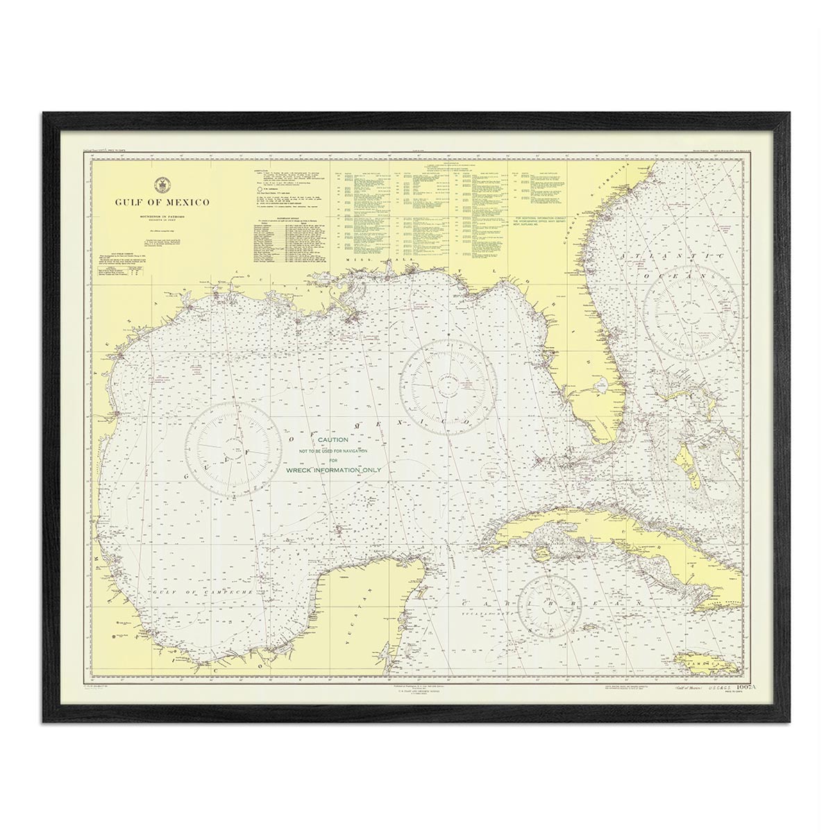
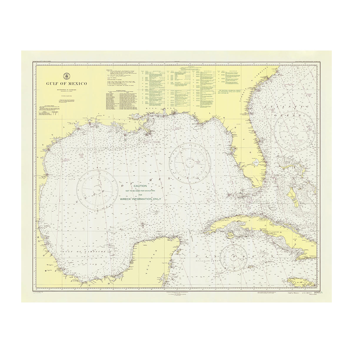
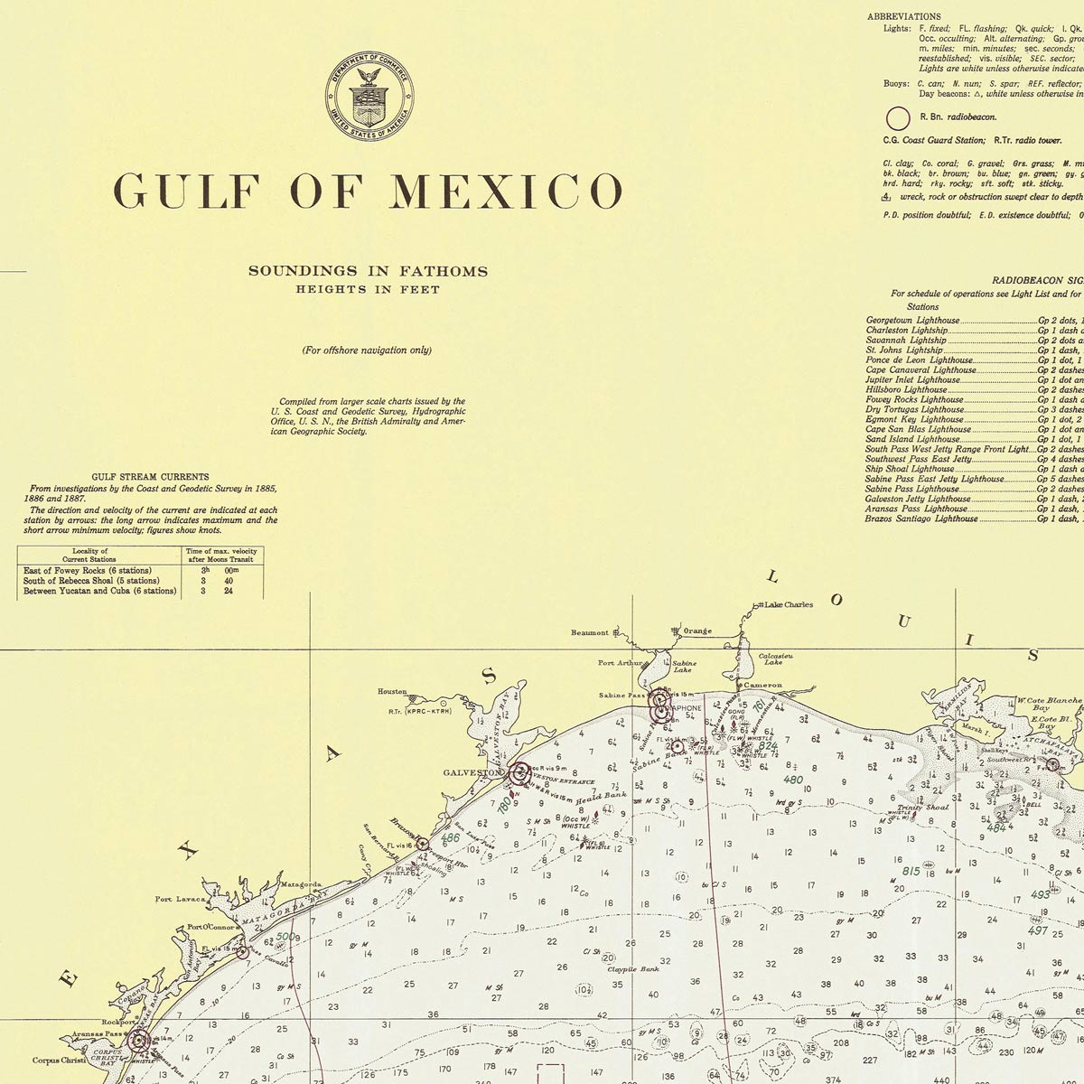
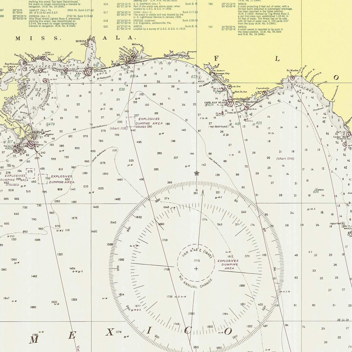
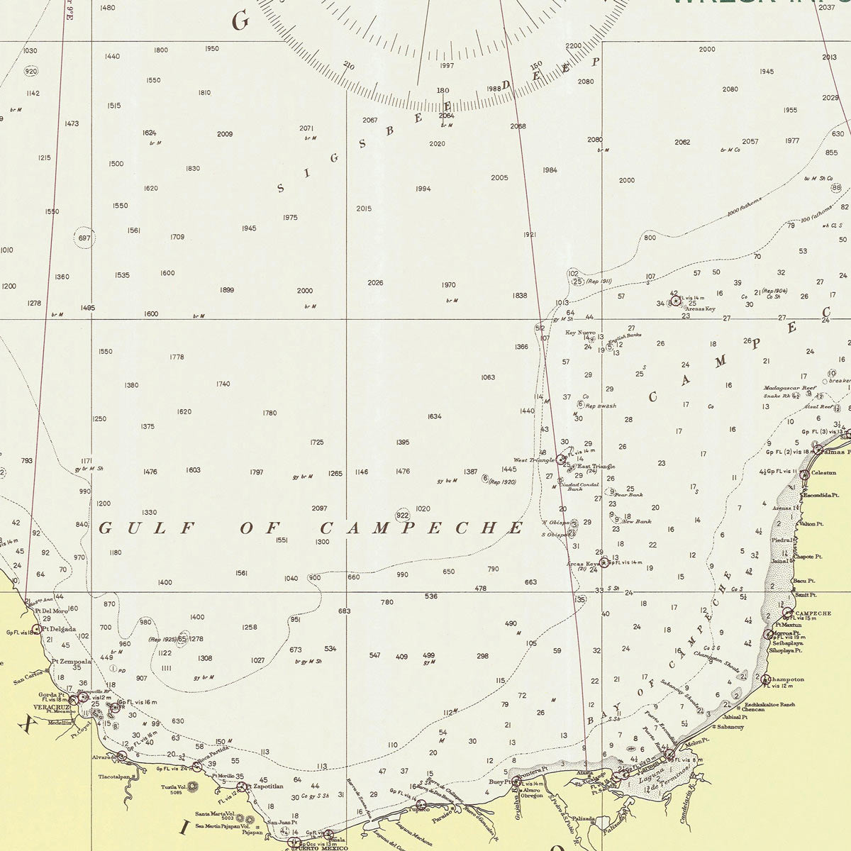
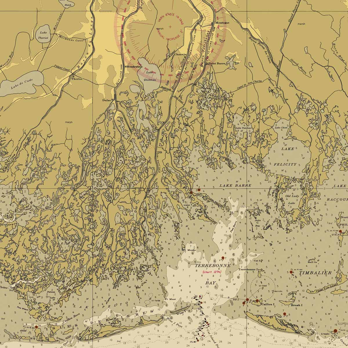
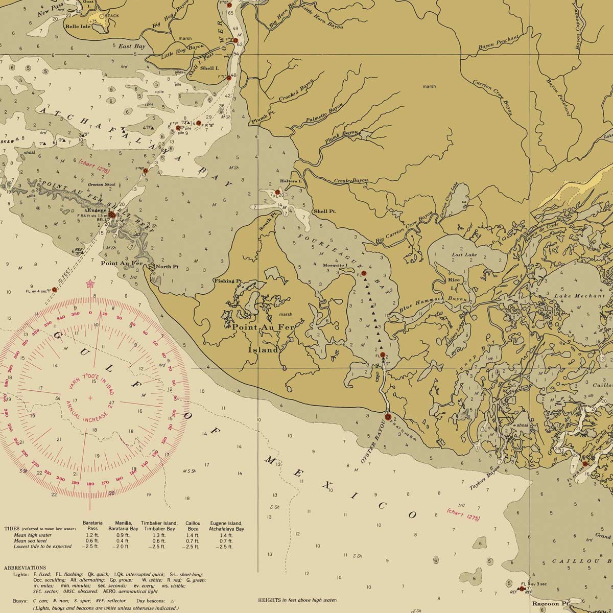
Gulf of Mexico Nautical Chart 1947
From
$ 57.60 USD
$ 64.00 USD
Sale
10% off
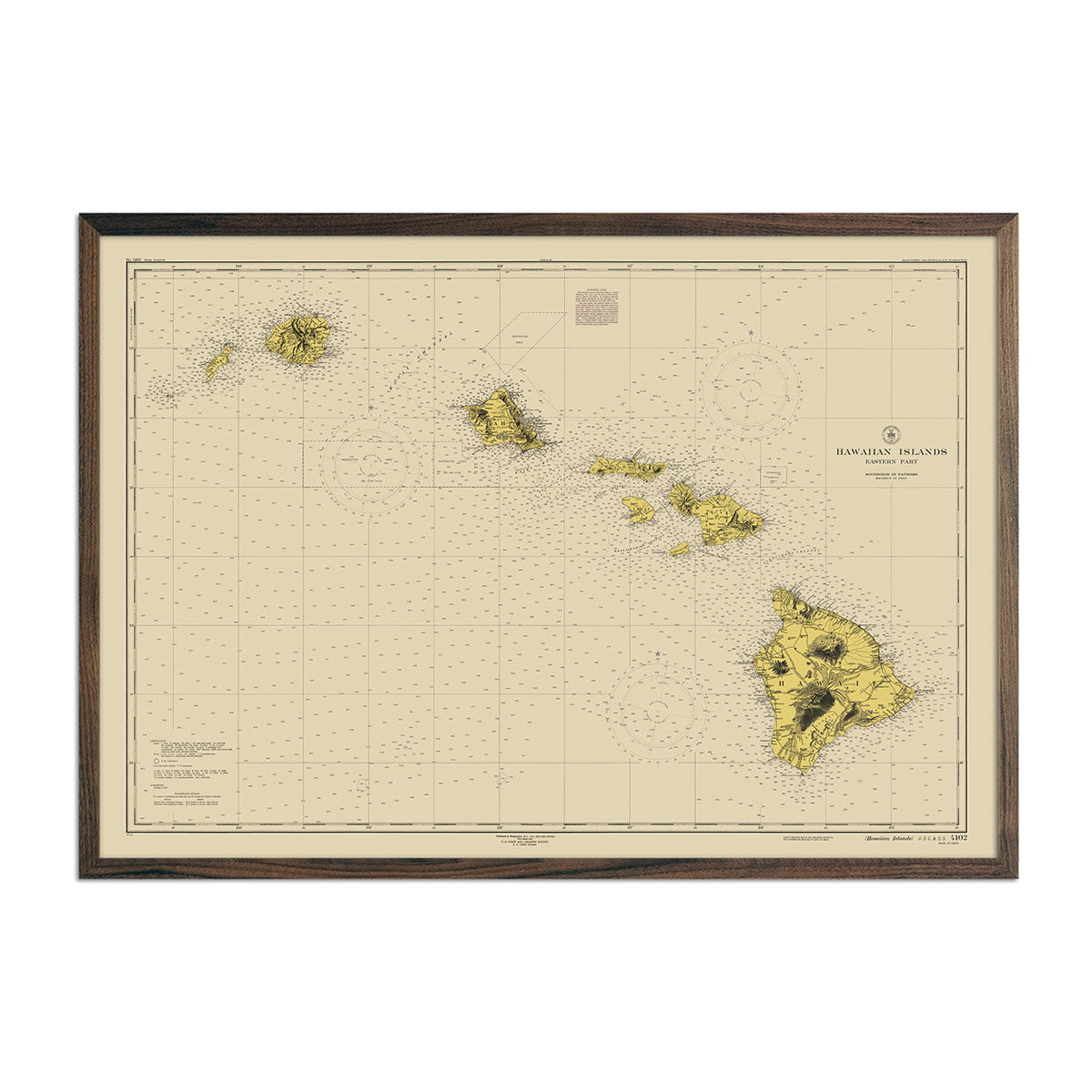
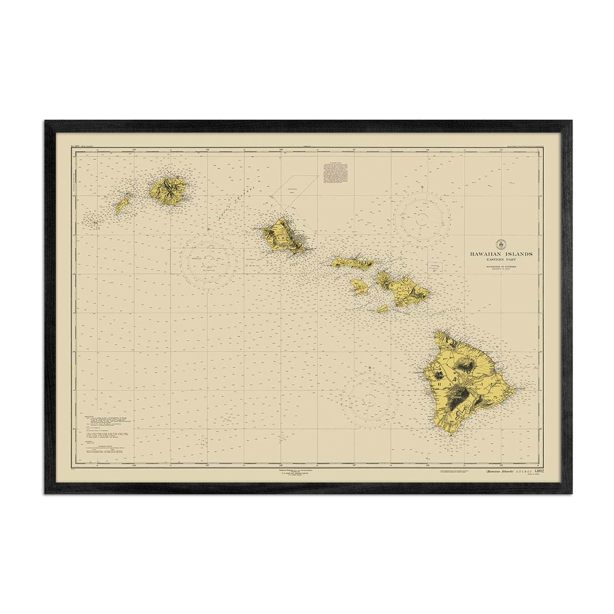
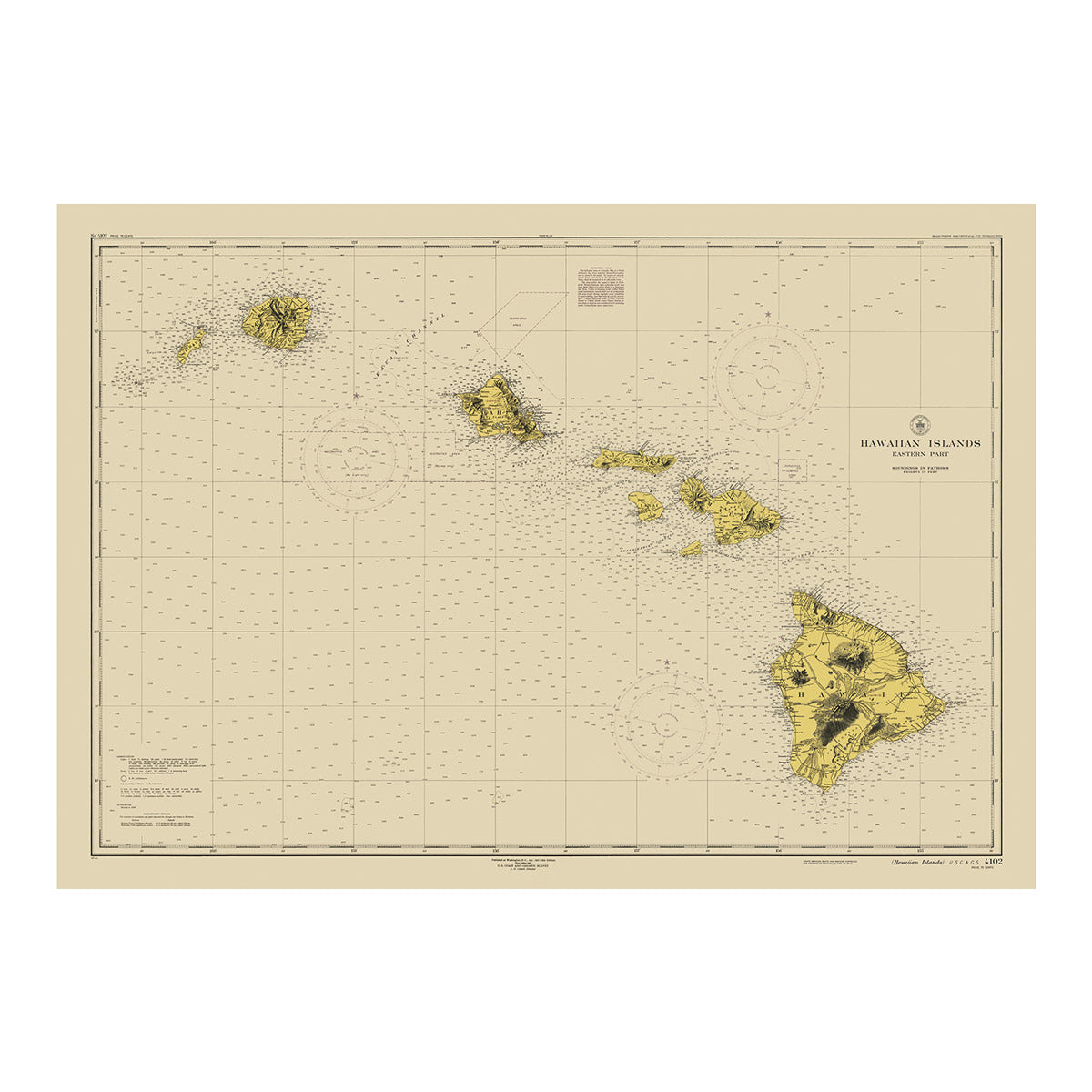
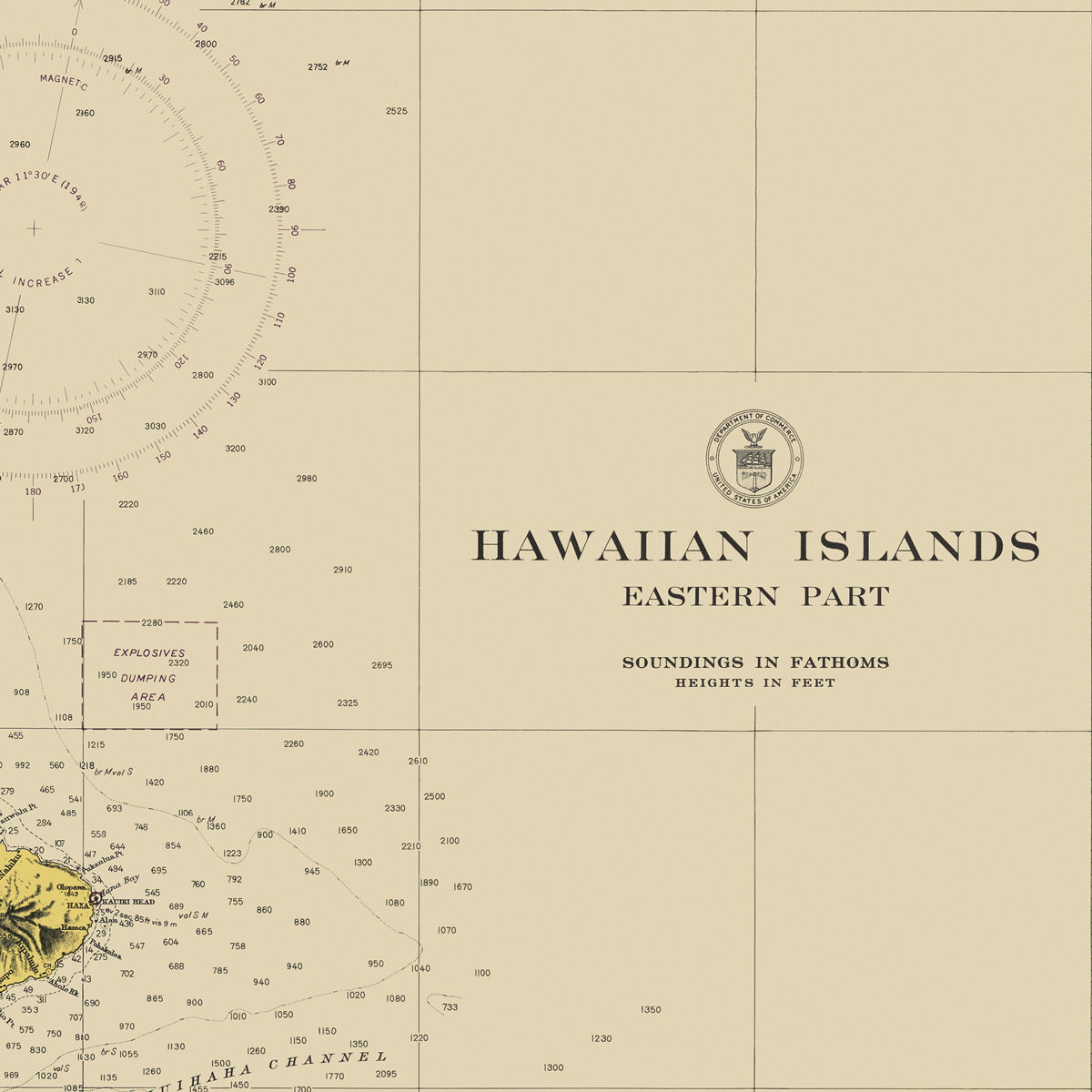
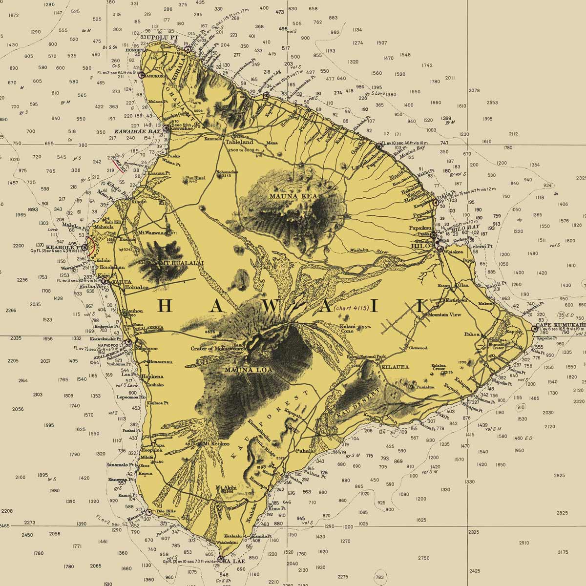
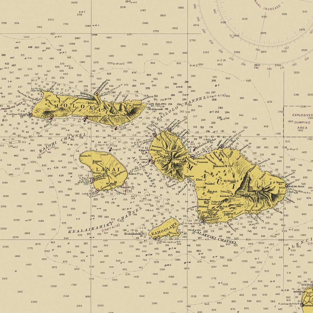
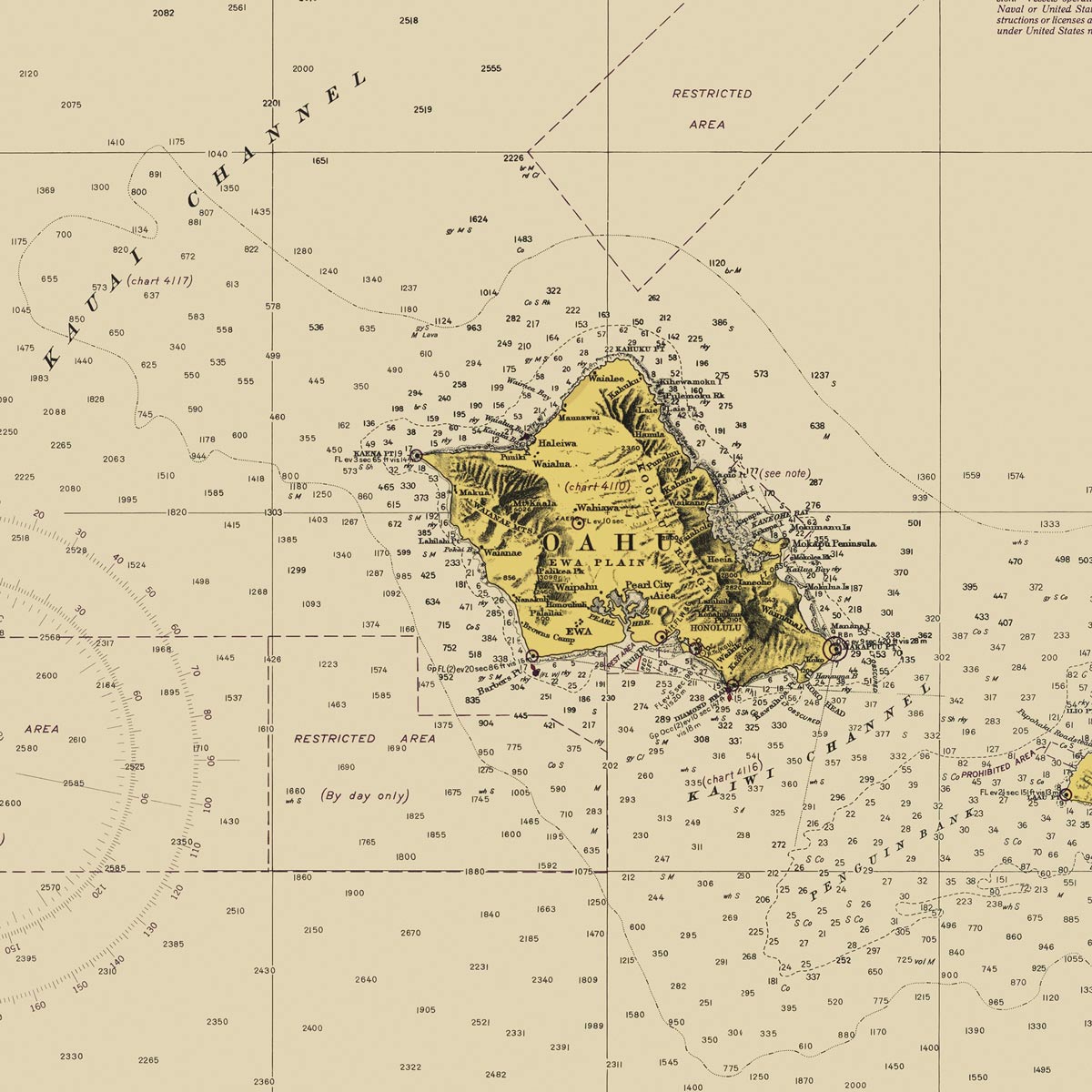
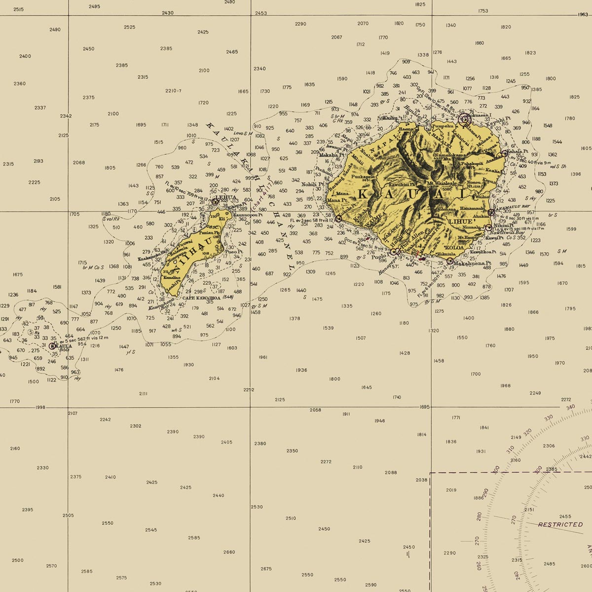
Hawaiian Islands Nautical Chart 1947
From
$ 71.10 USD
$ 79.00 USD
Sale
10% off
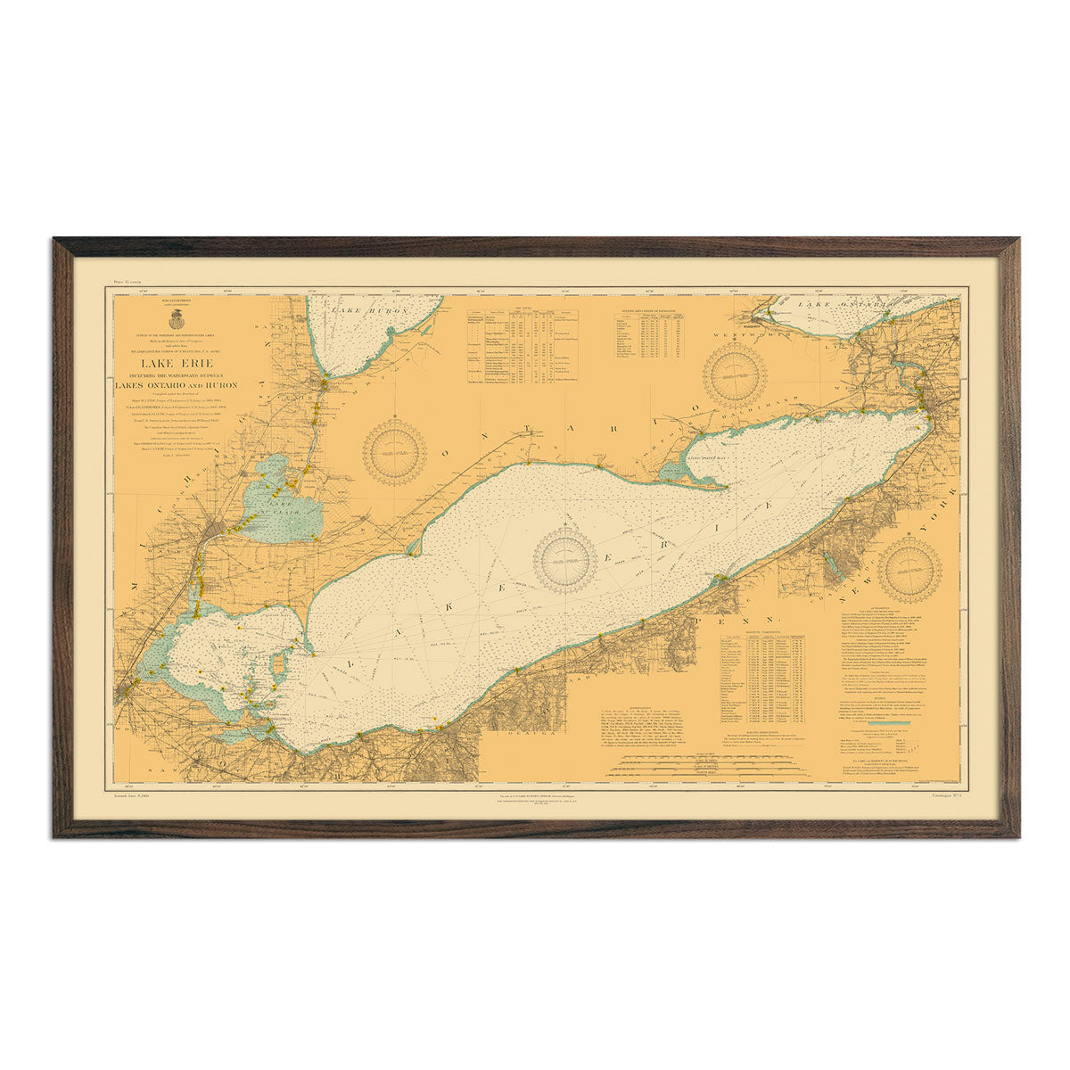
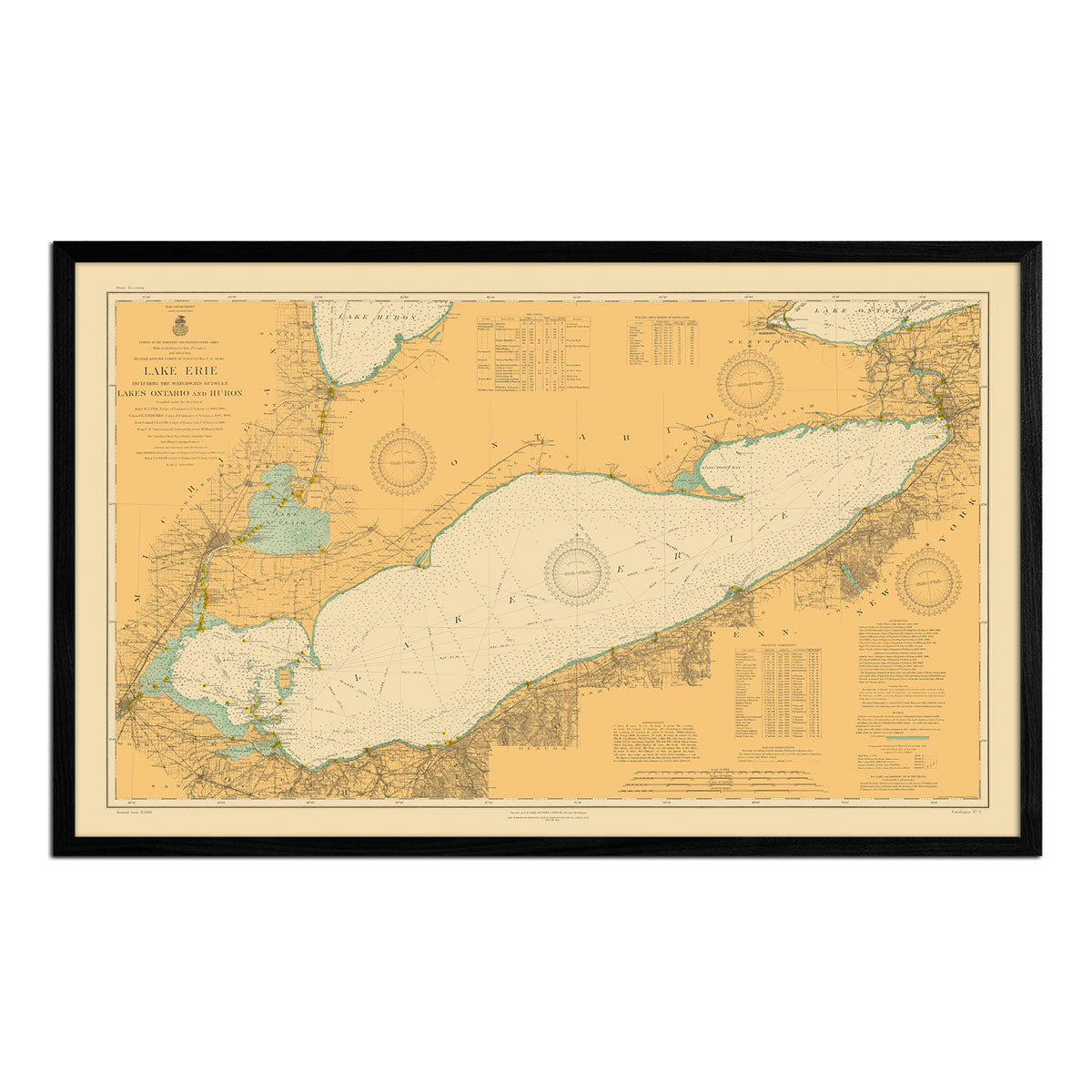
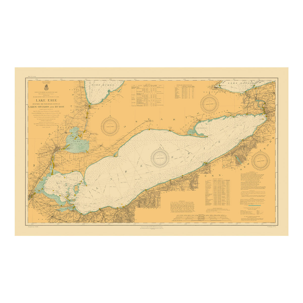
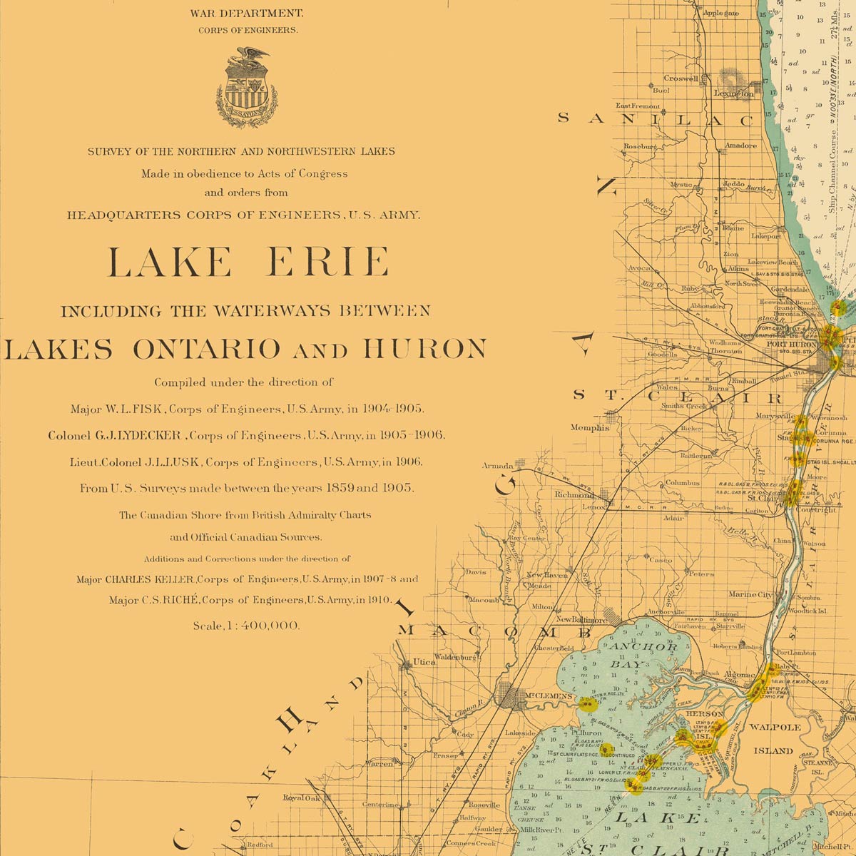
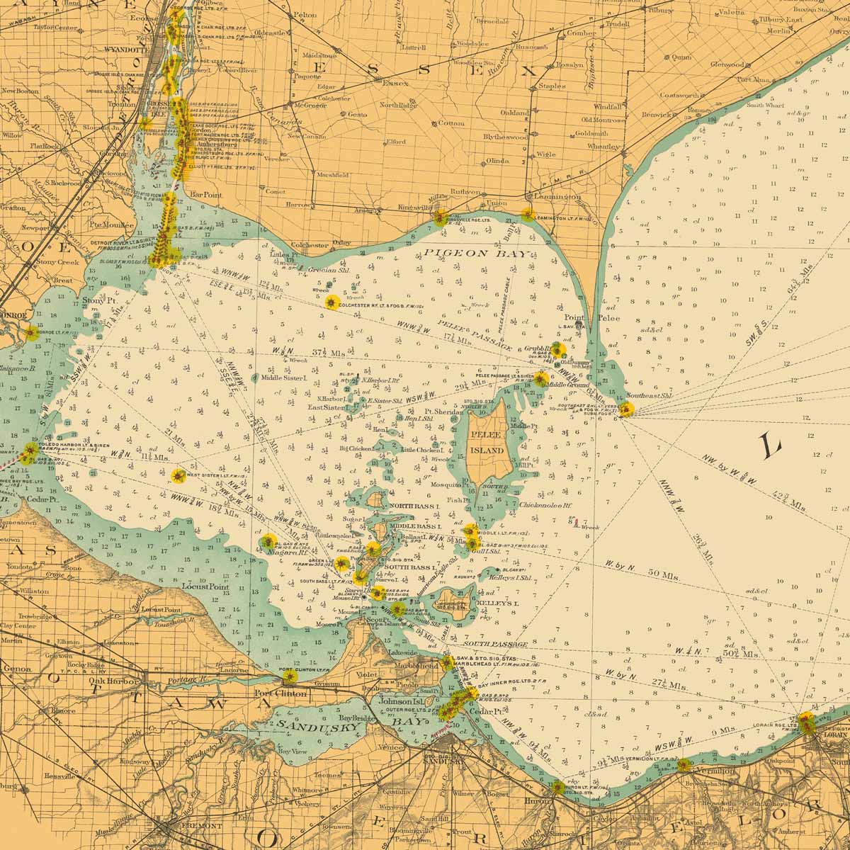
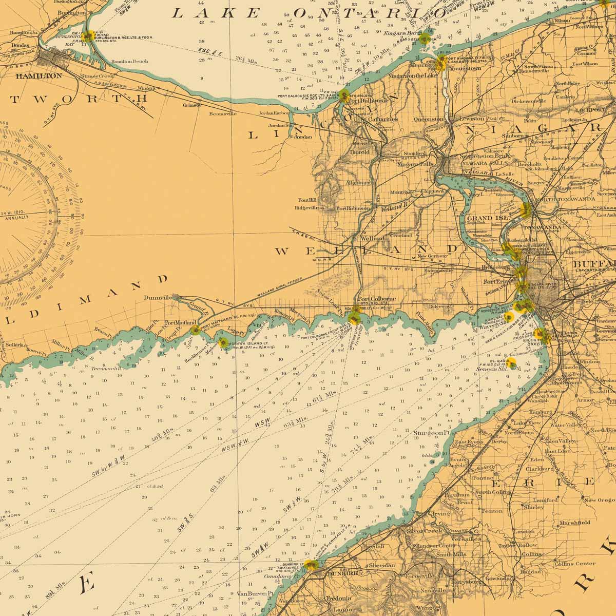
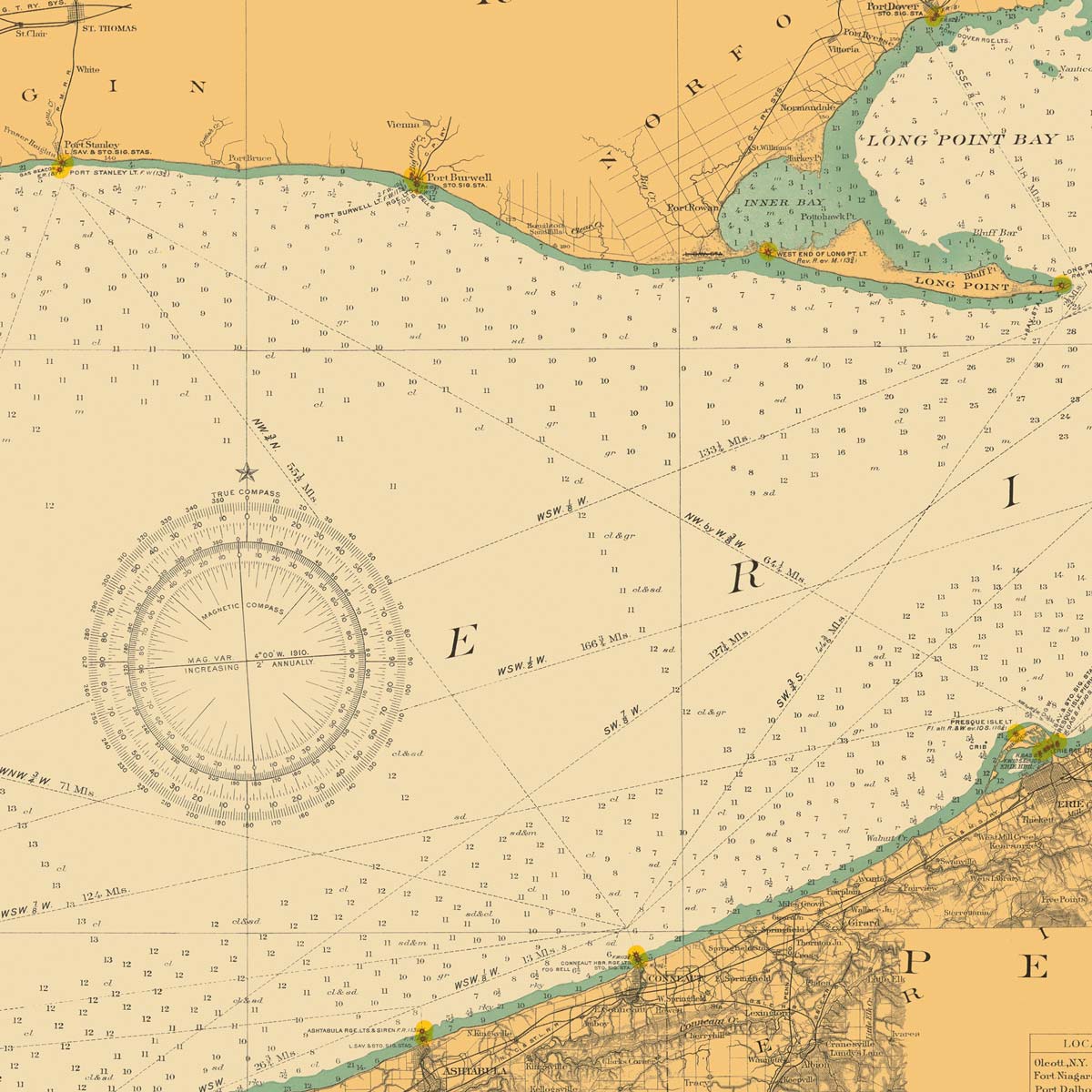
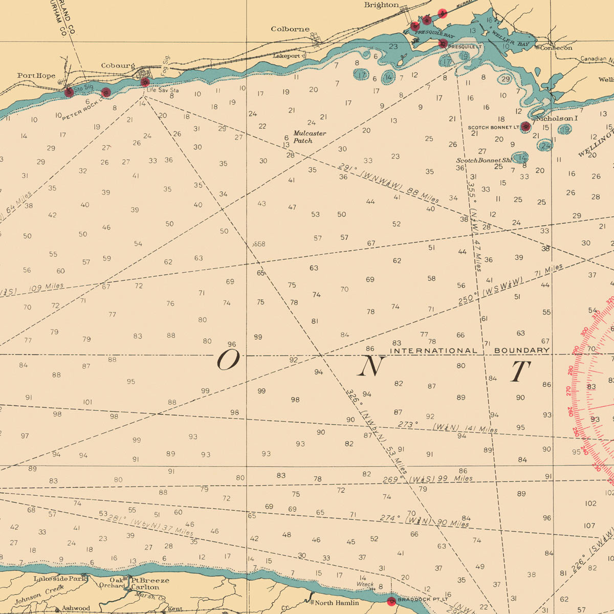
Lake Erie and Waterways between Lakes Ontario and Huron Nautical Chart 1910
From
$ 80.10 USD
$ 89.00 USD
Sale
10% off
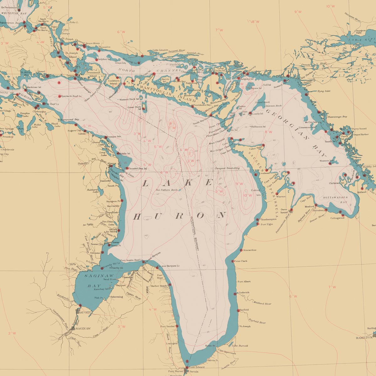
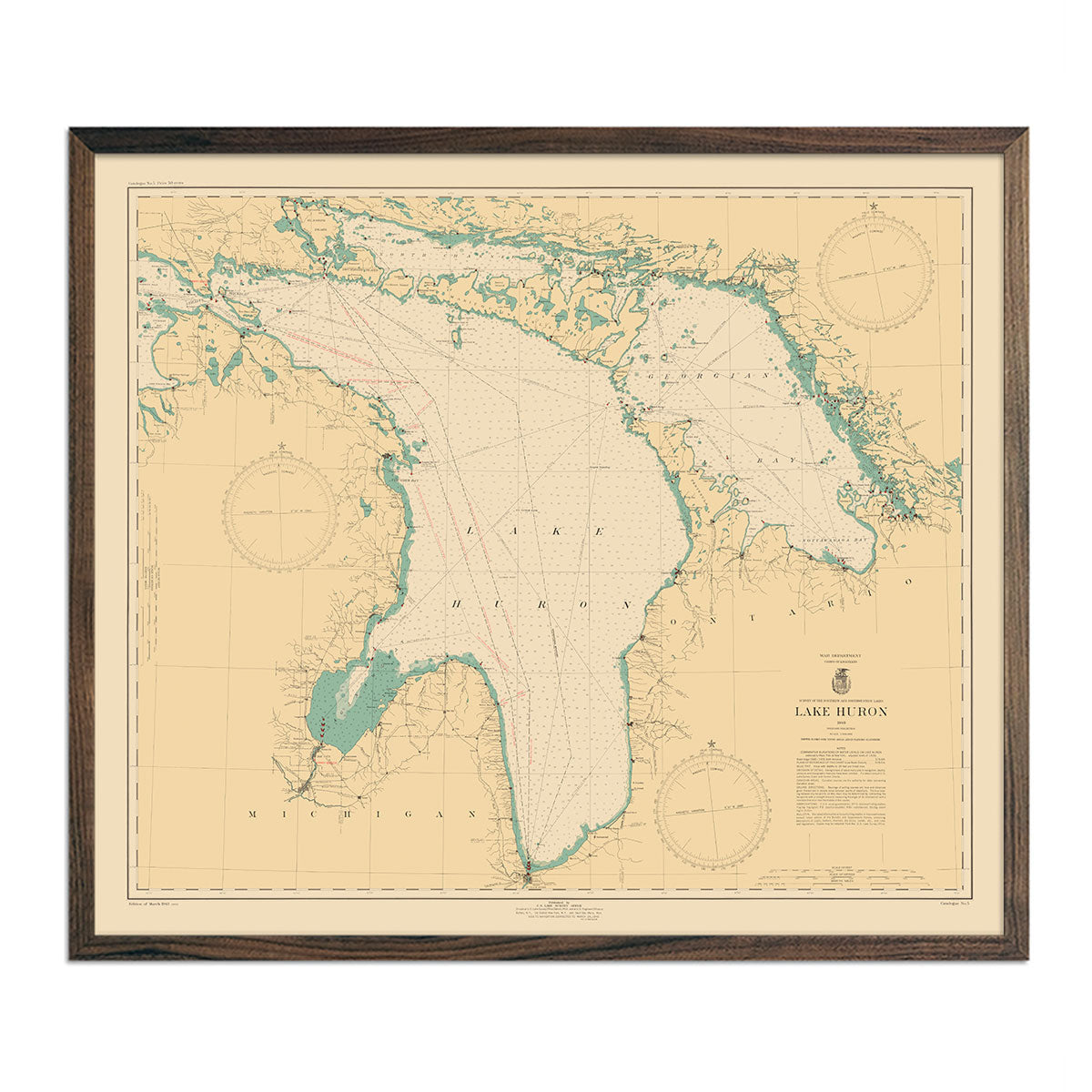
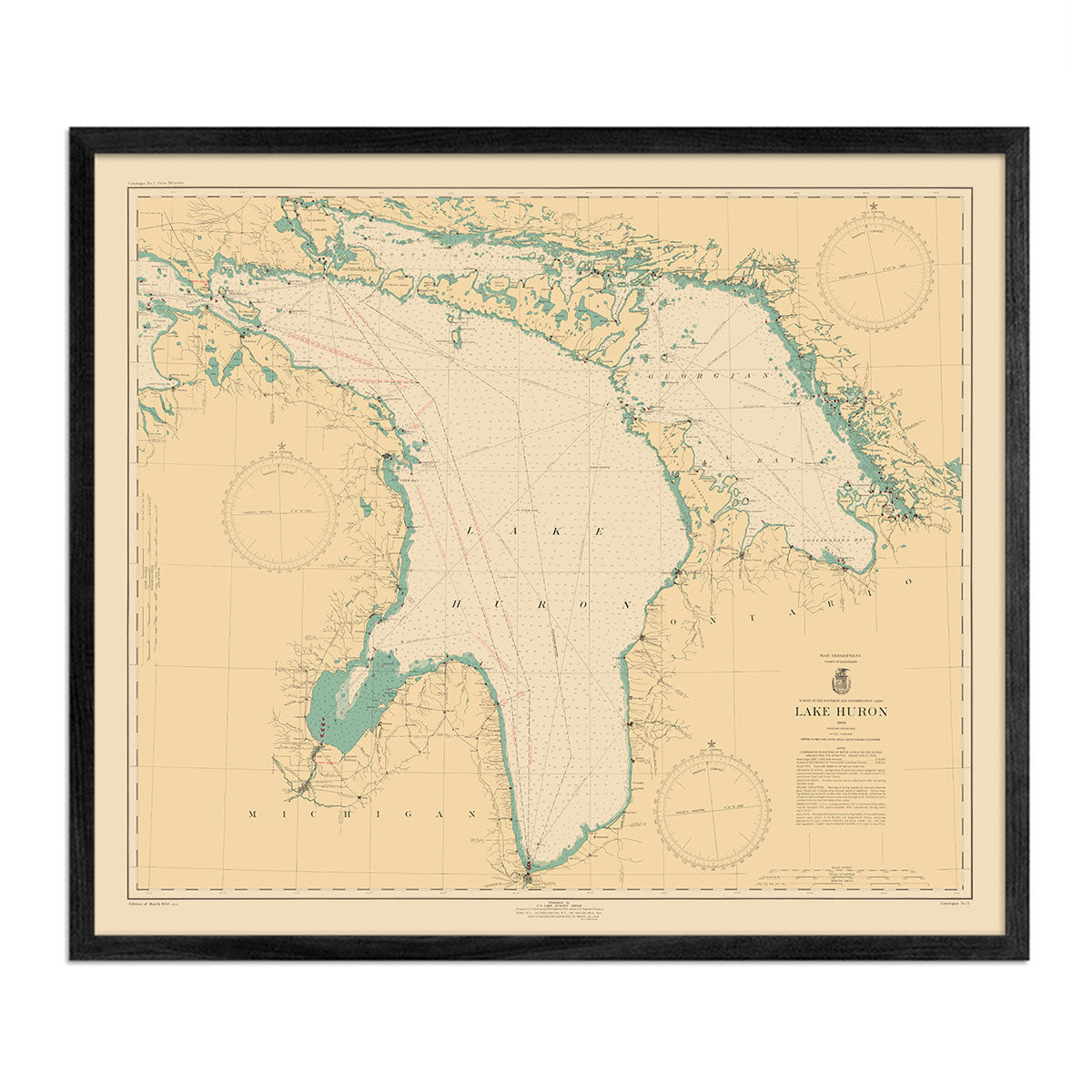
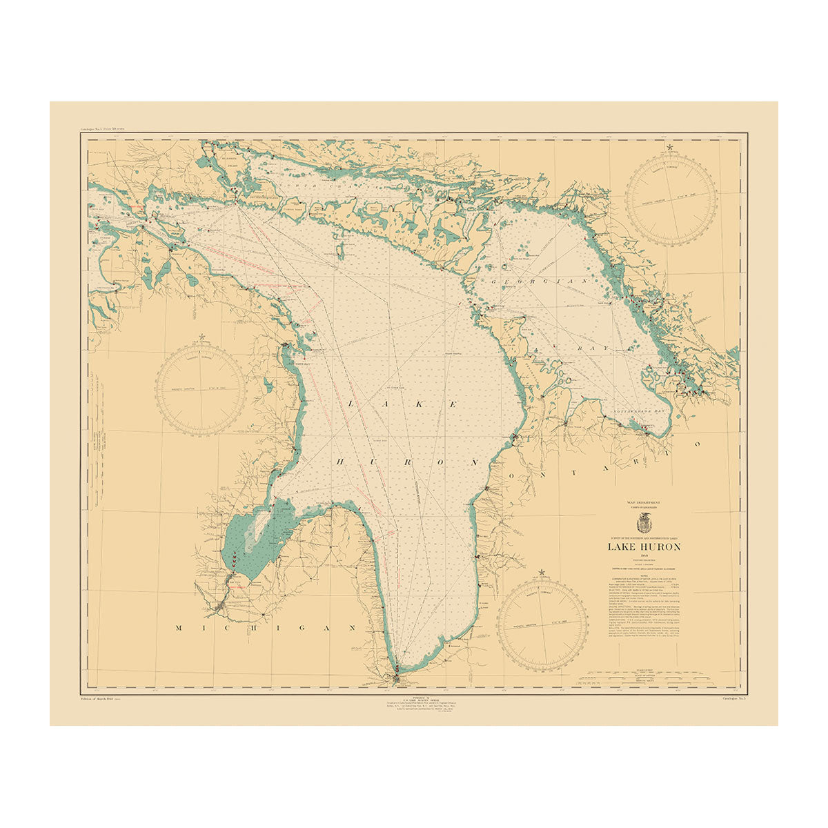
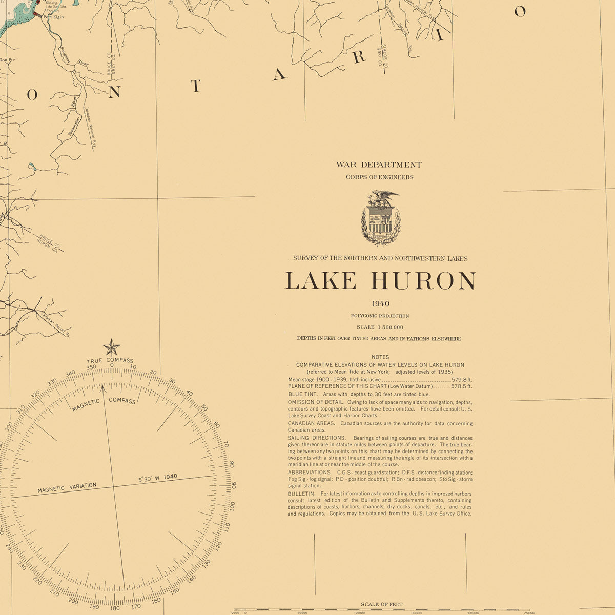
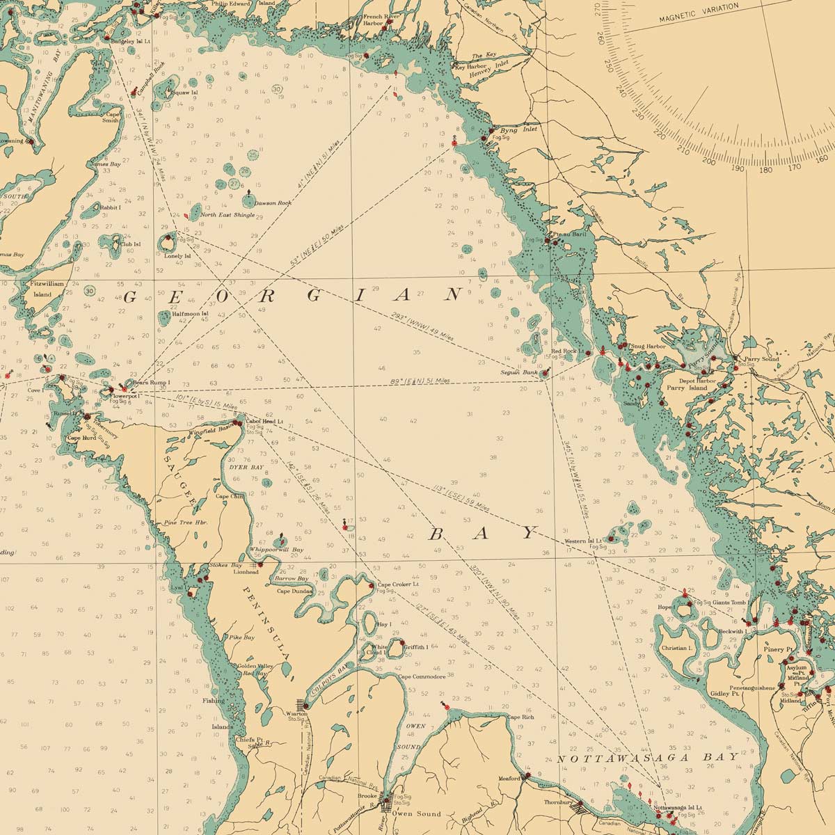
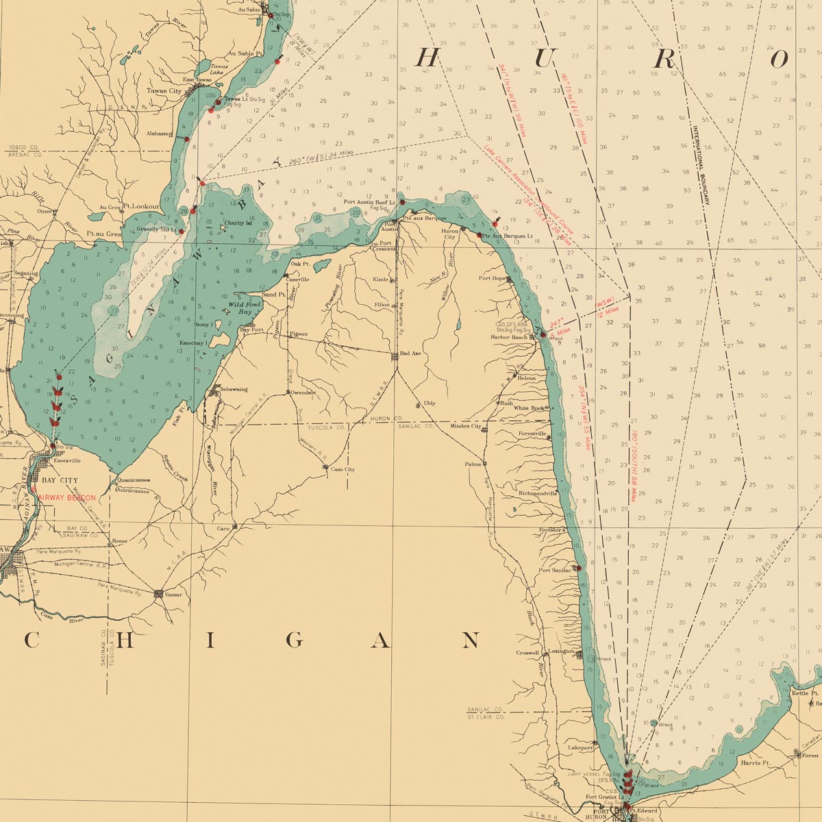
Lake Huron Nautical Chart 1940
From
$ 57.60 USD
$ 64.00 USD
Sale
10% off
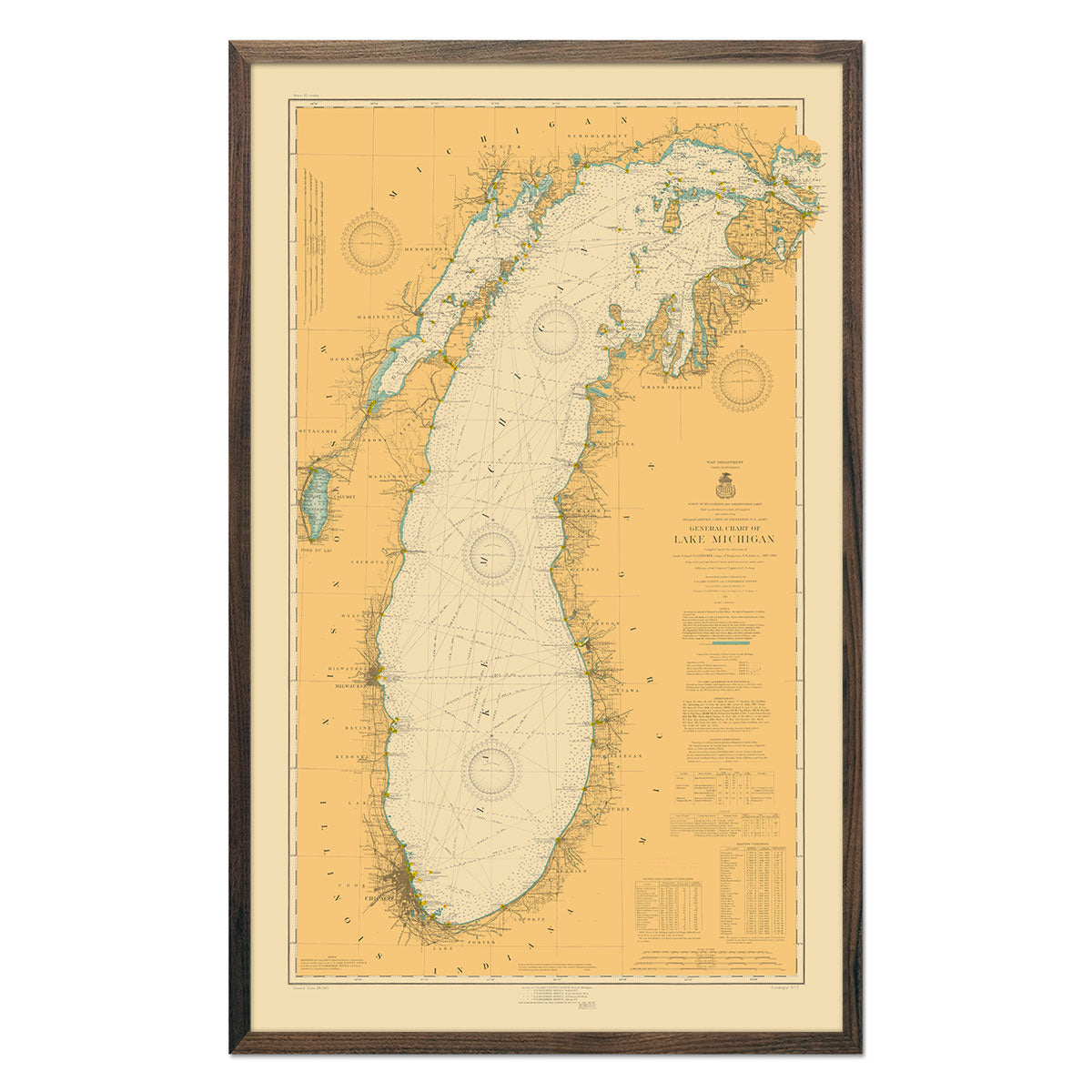
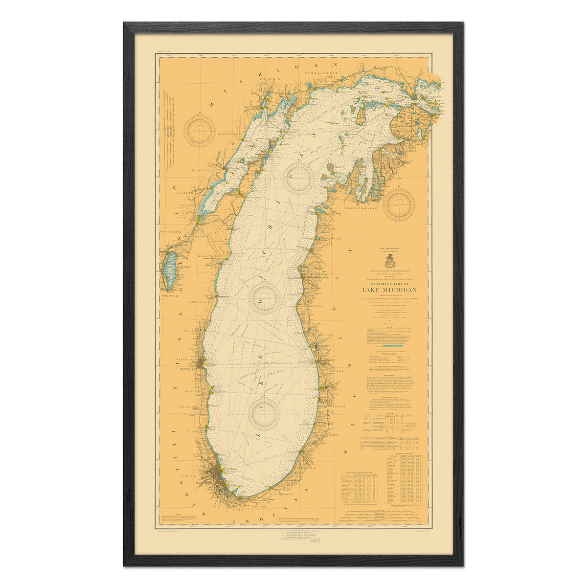
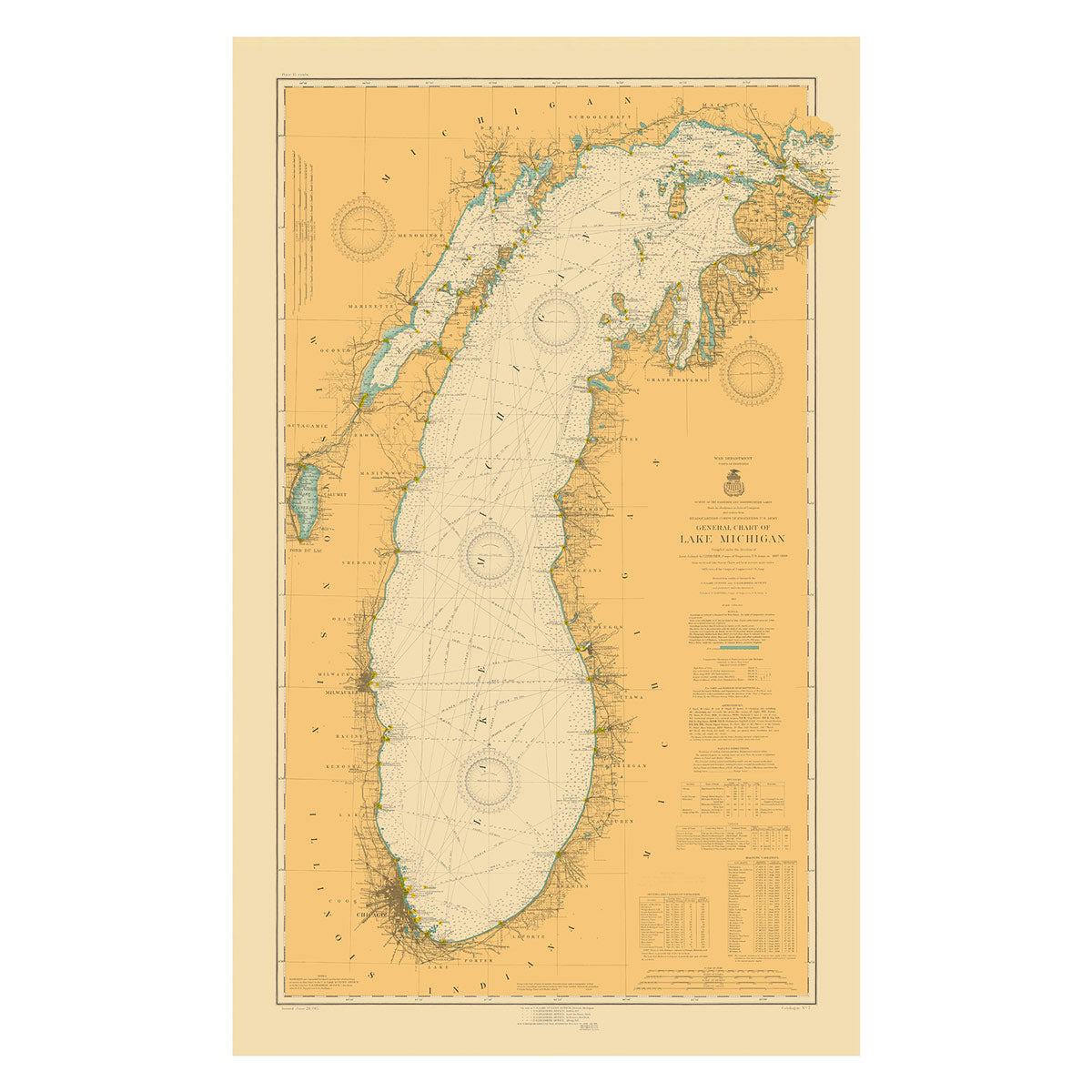
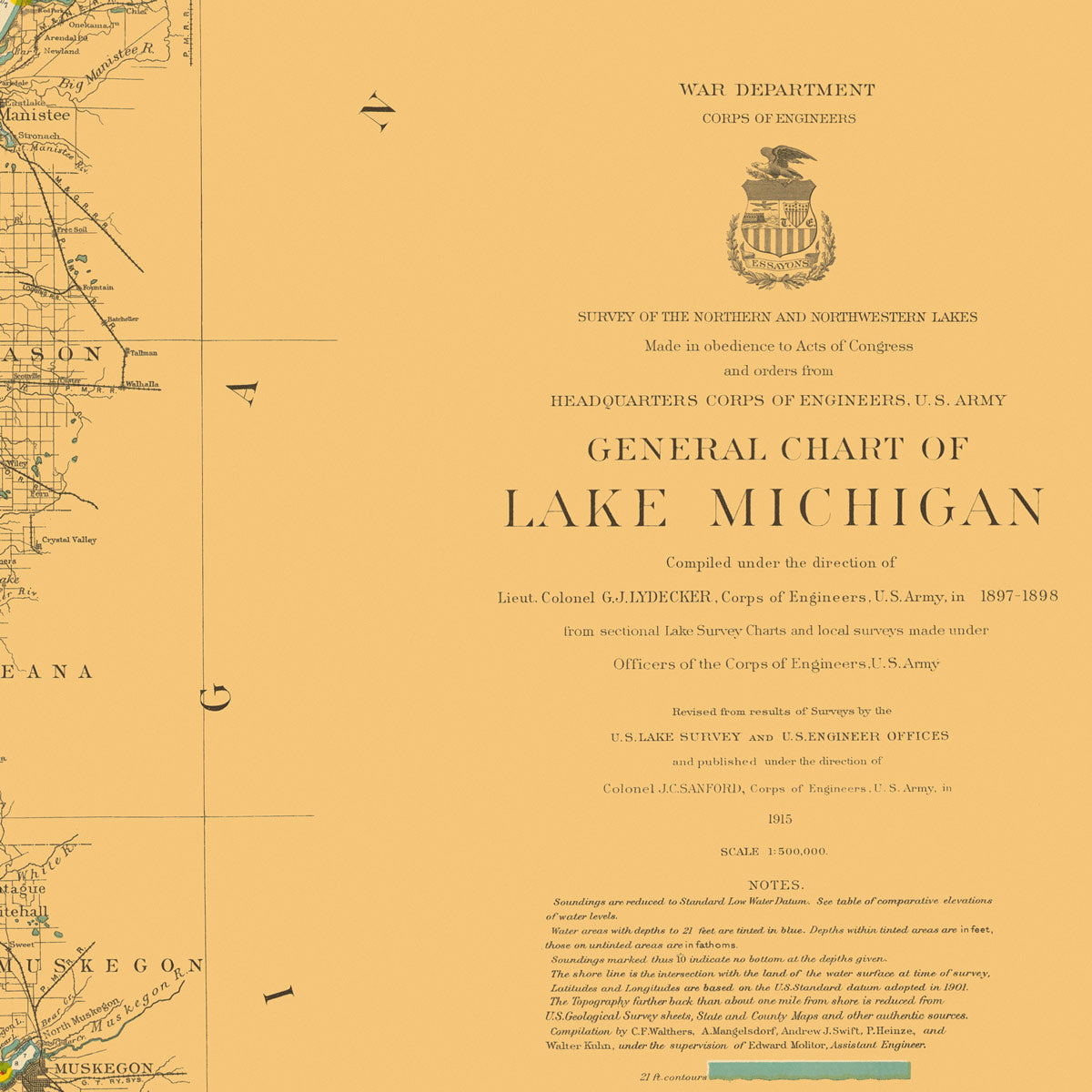
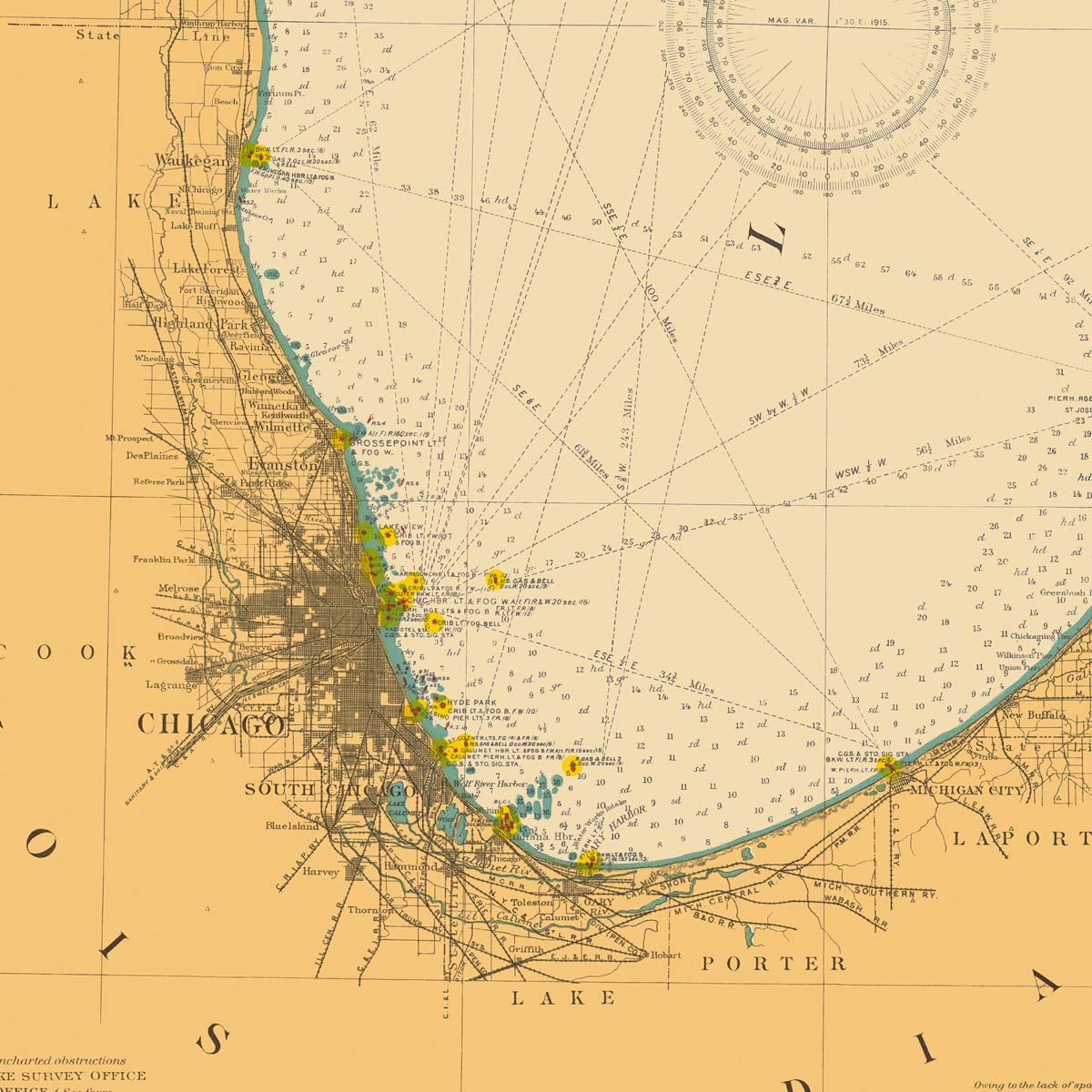
Lake Michigan Nautical Chart 1915
From
$ 80.10 USD
$ 89.00 USD
Sale
5.0 / 5.0
1 review
10% off
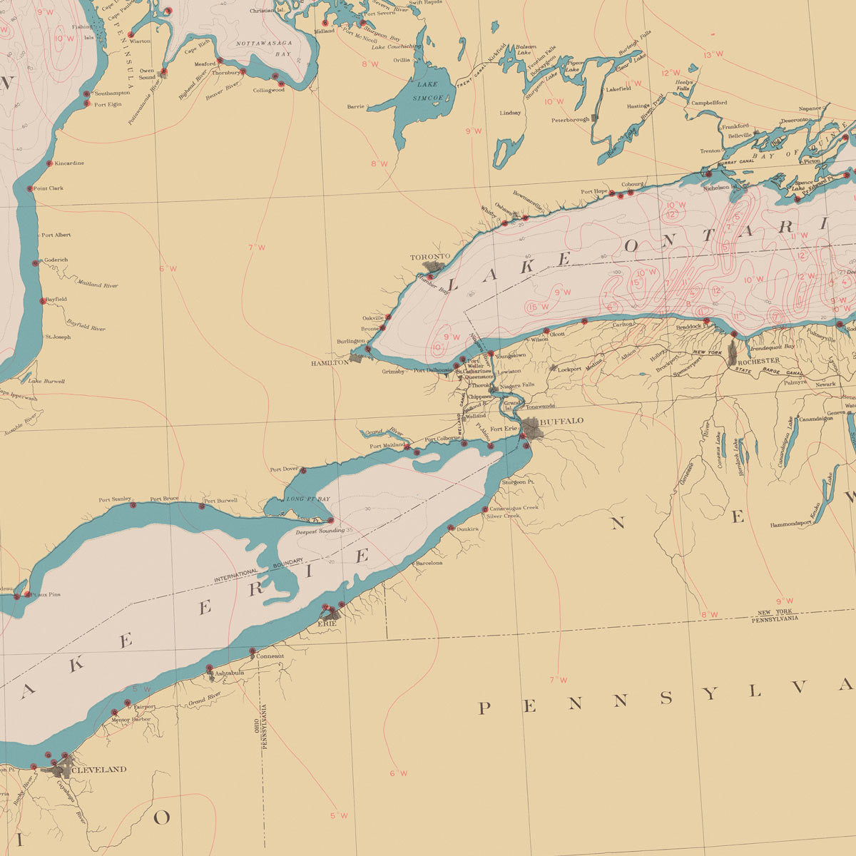
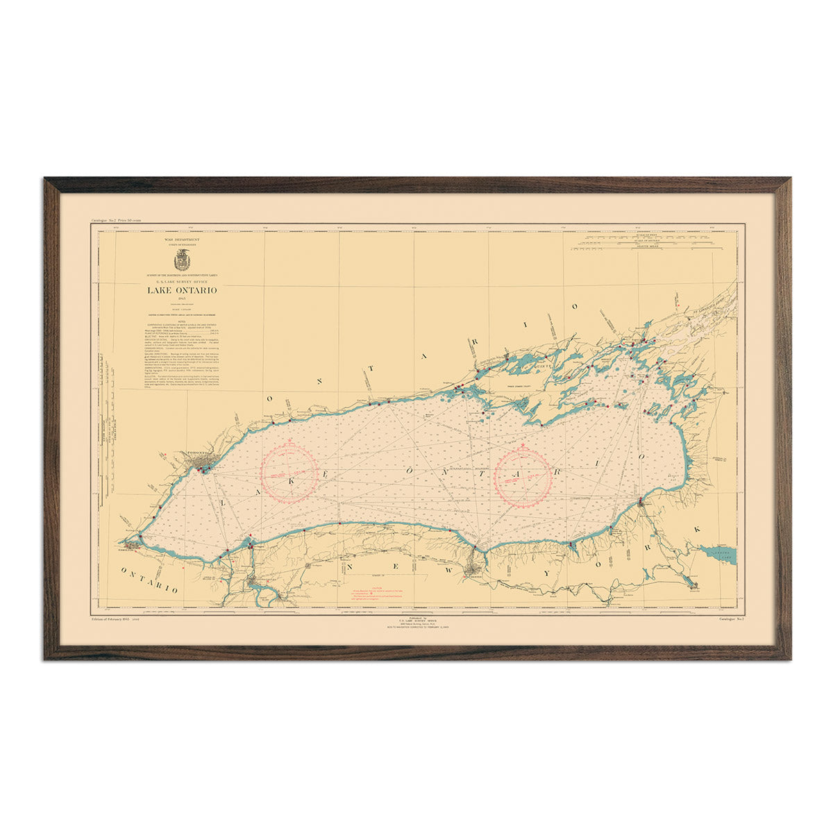
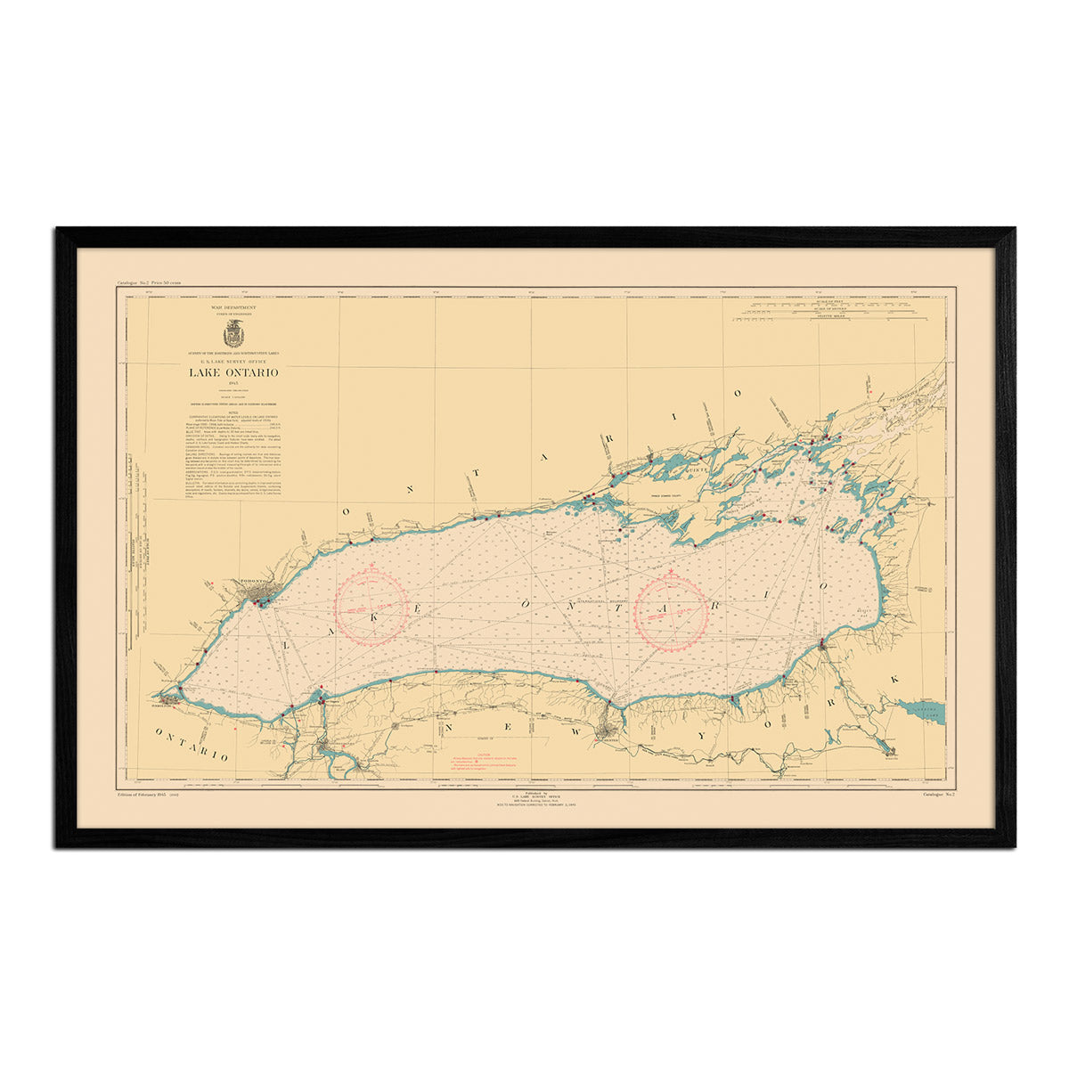
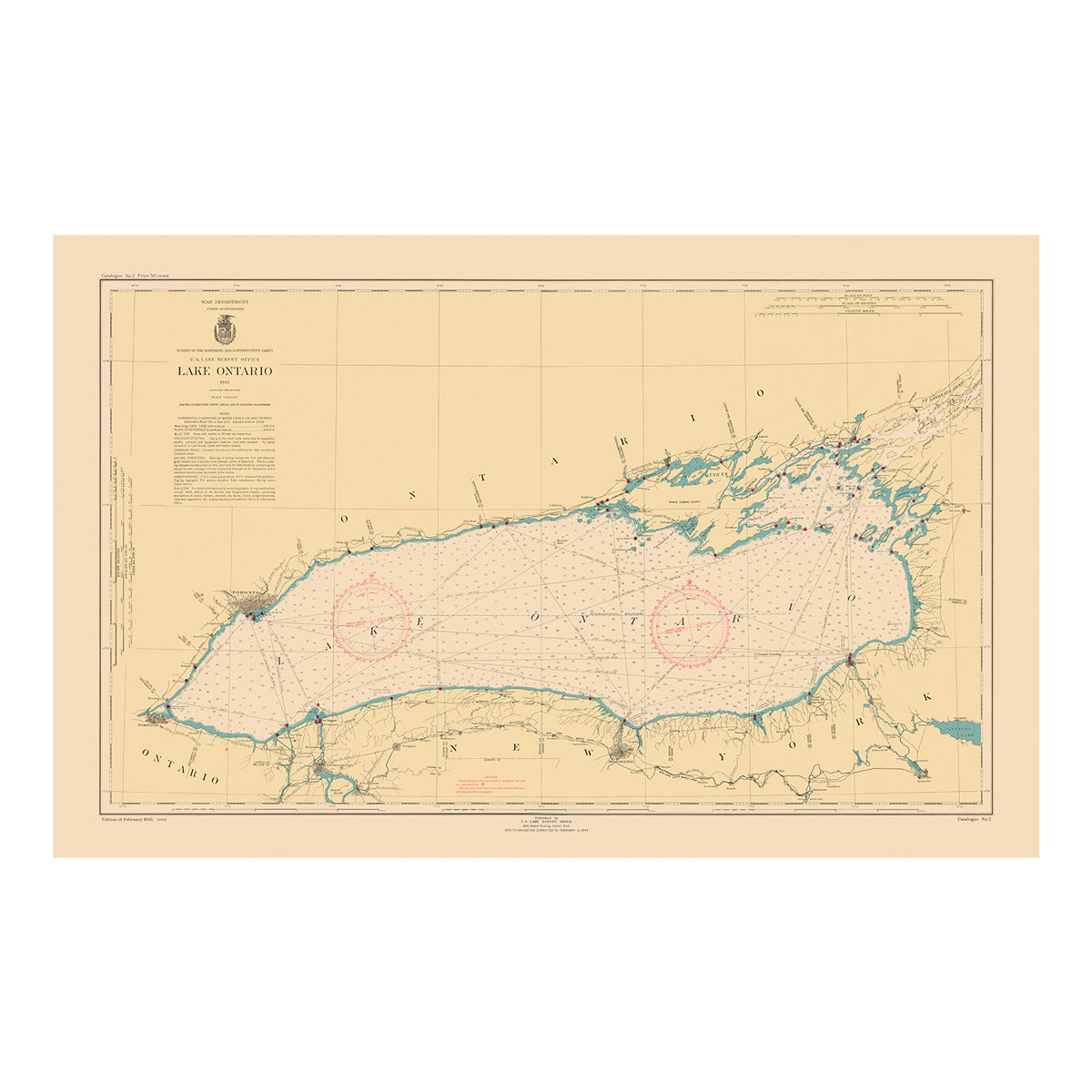
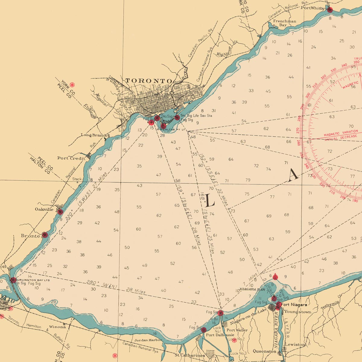
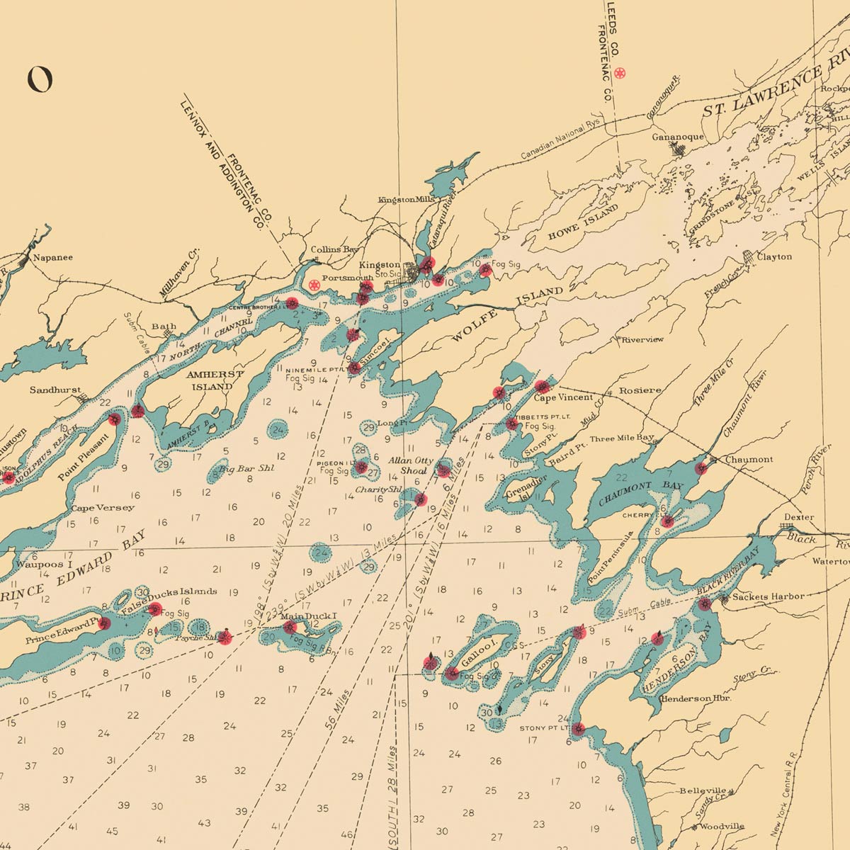
Lake Ontario Nautical Chart 1945
From
$ 80.10 USD
$ 89.00 USD
Sale
10% off
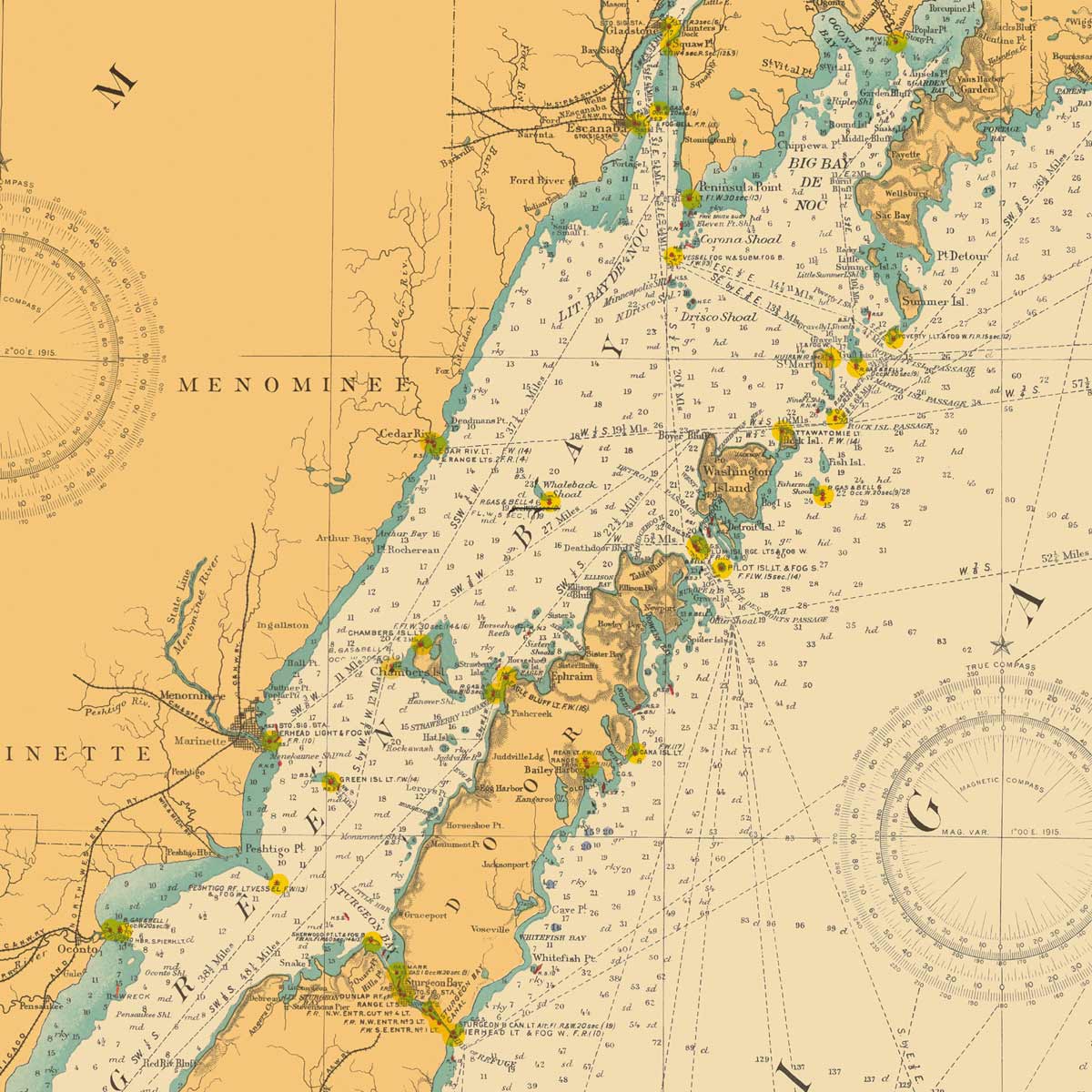
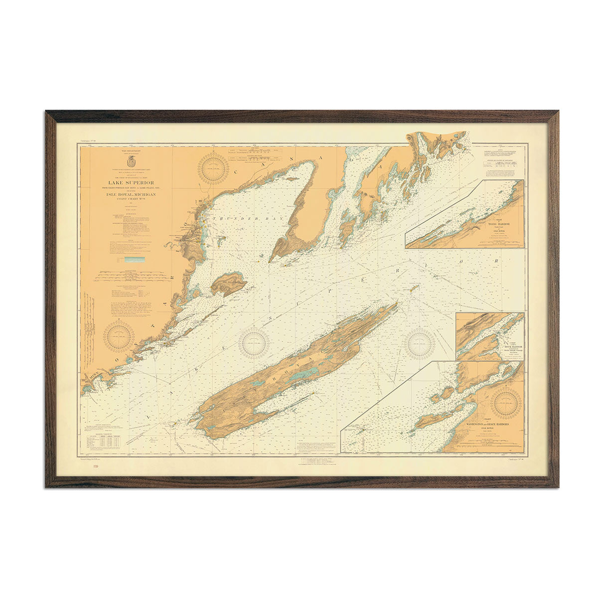
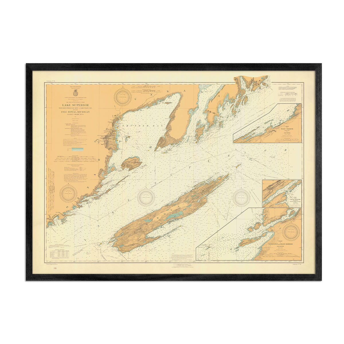
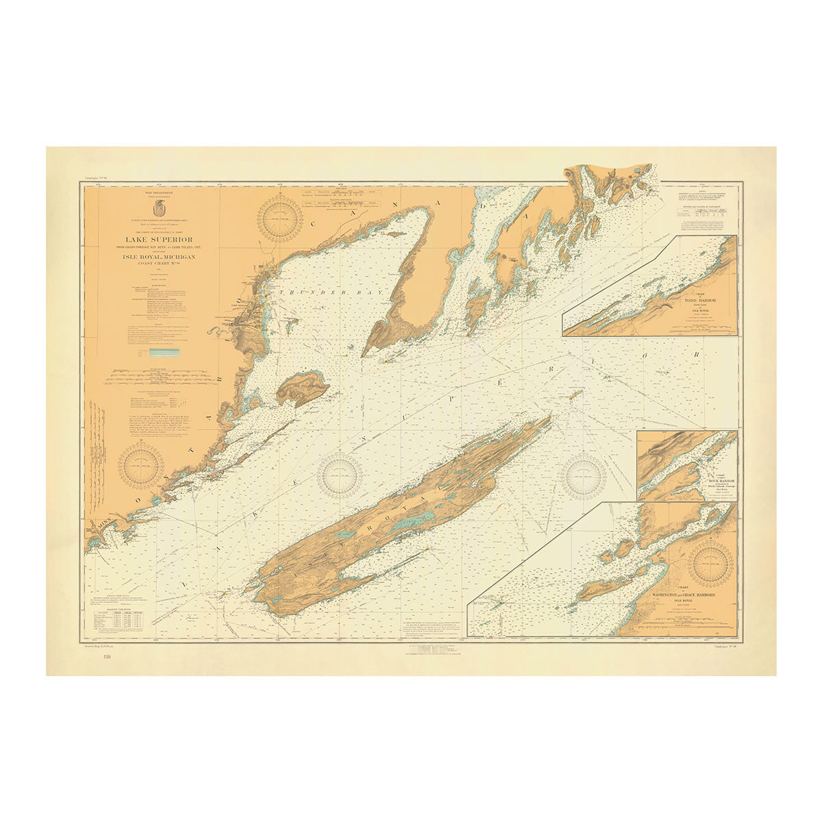
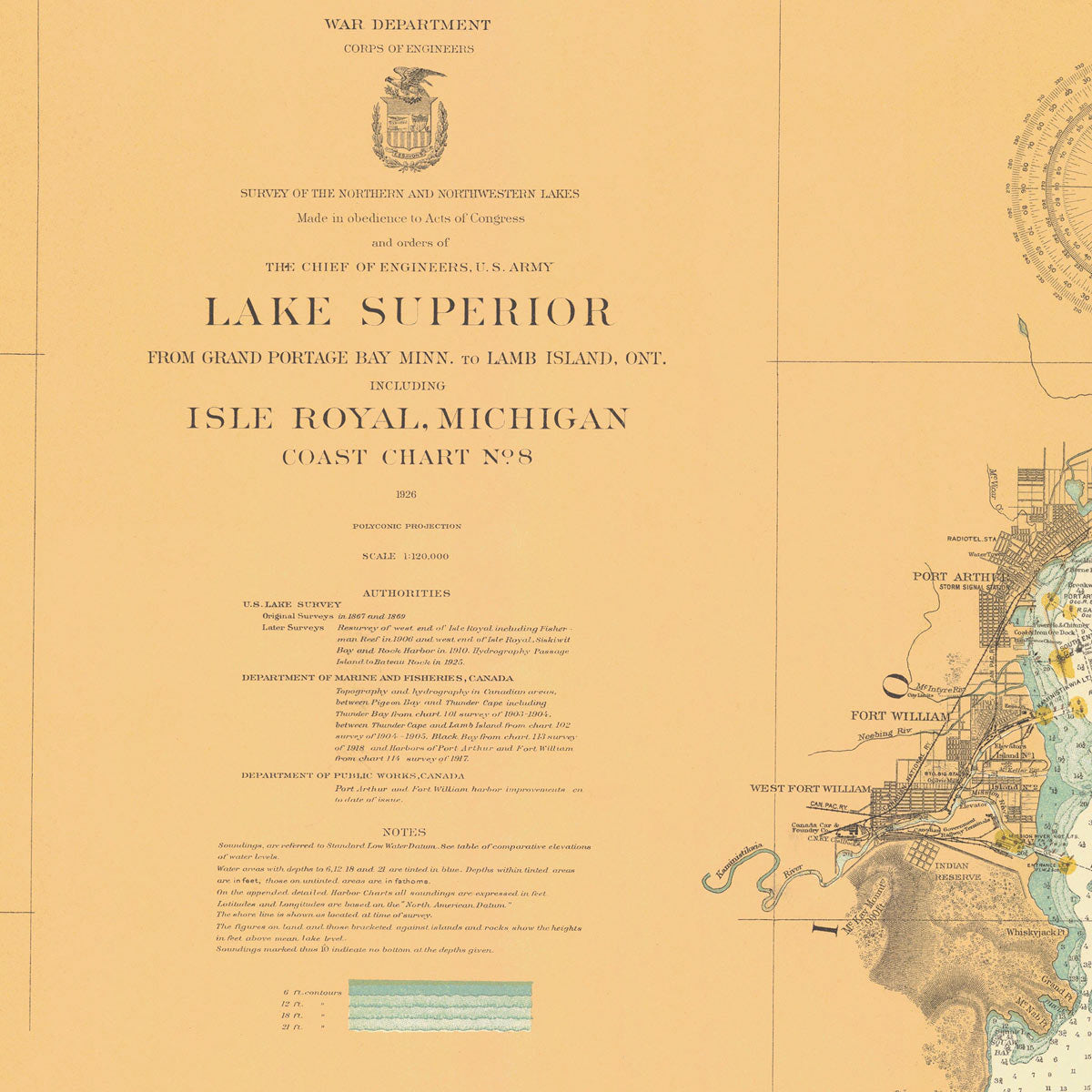
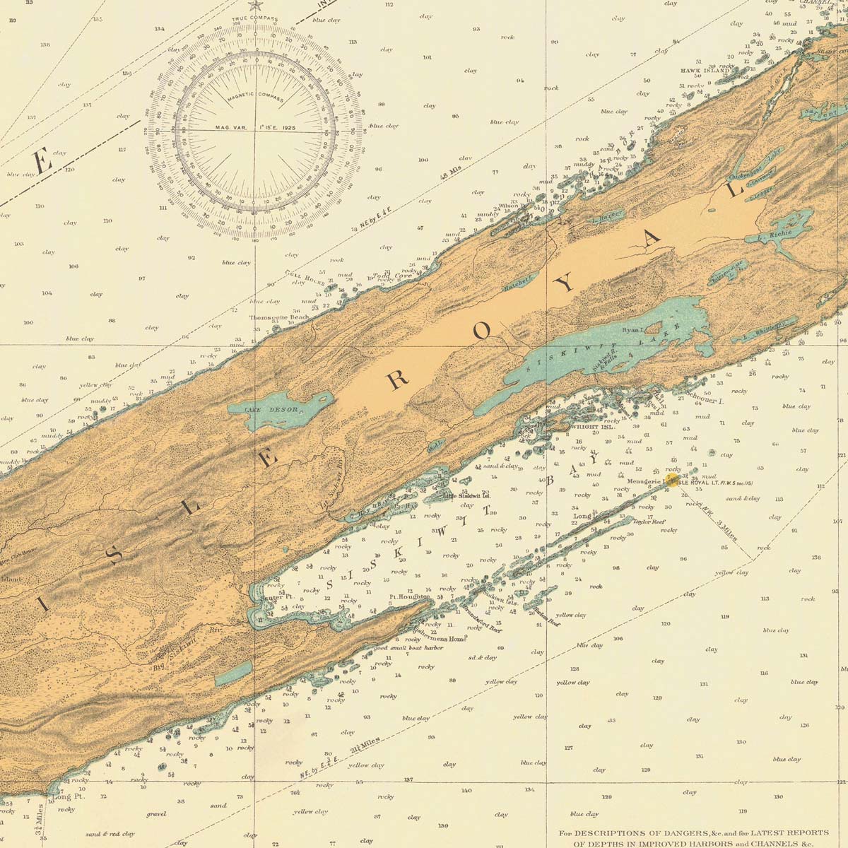
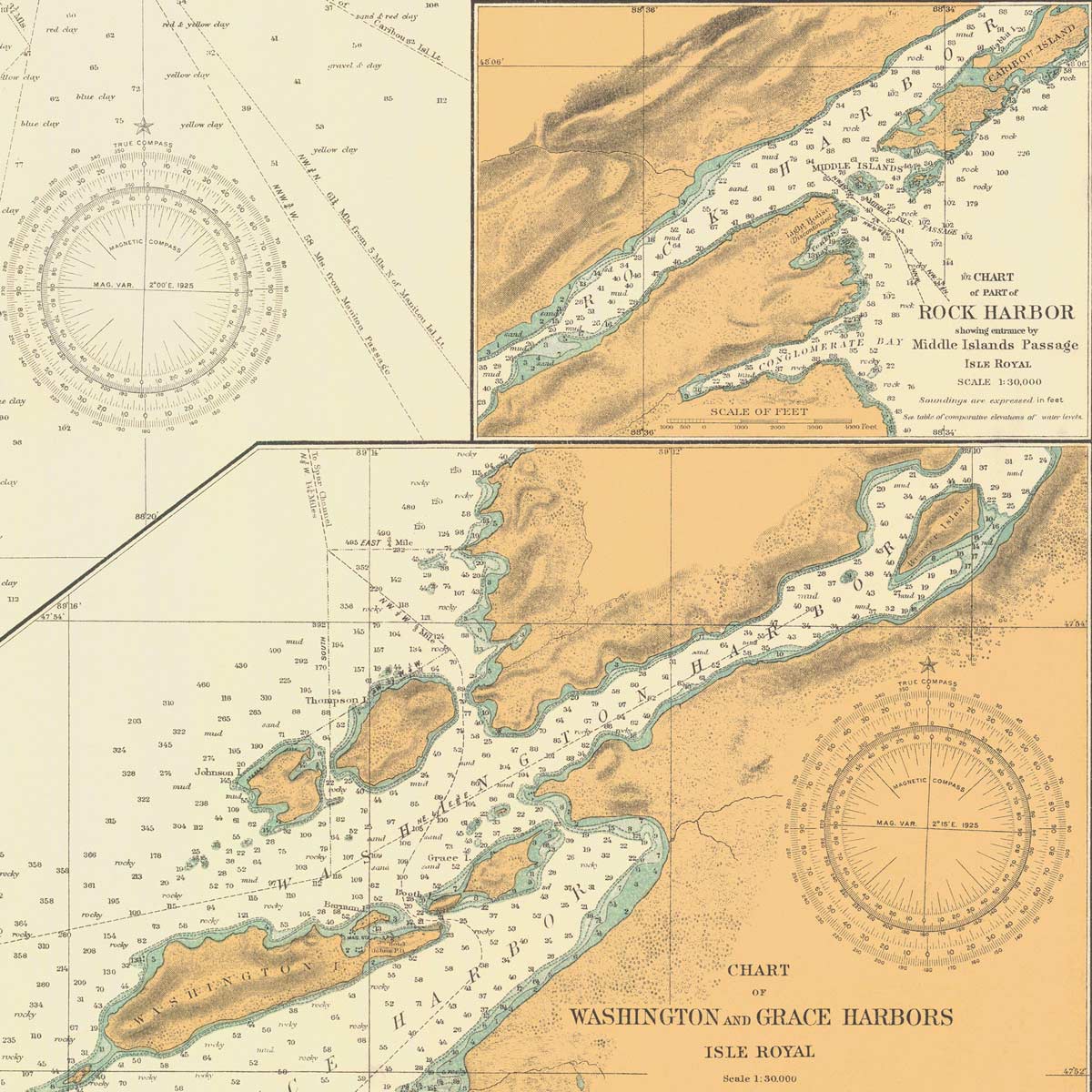
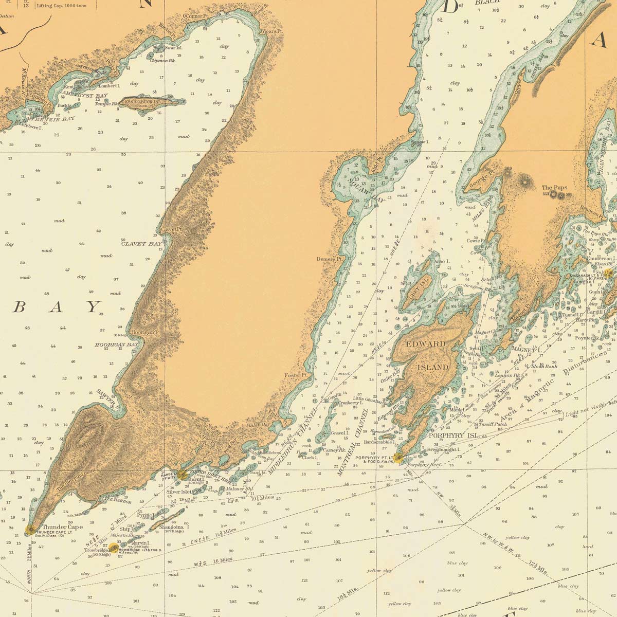
Lake Superior from Grand Portage Bay to Lamb Island Nautical Chart 1926
From
$ 71.10 USD
$ 79.00 USD
Sale
10% off
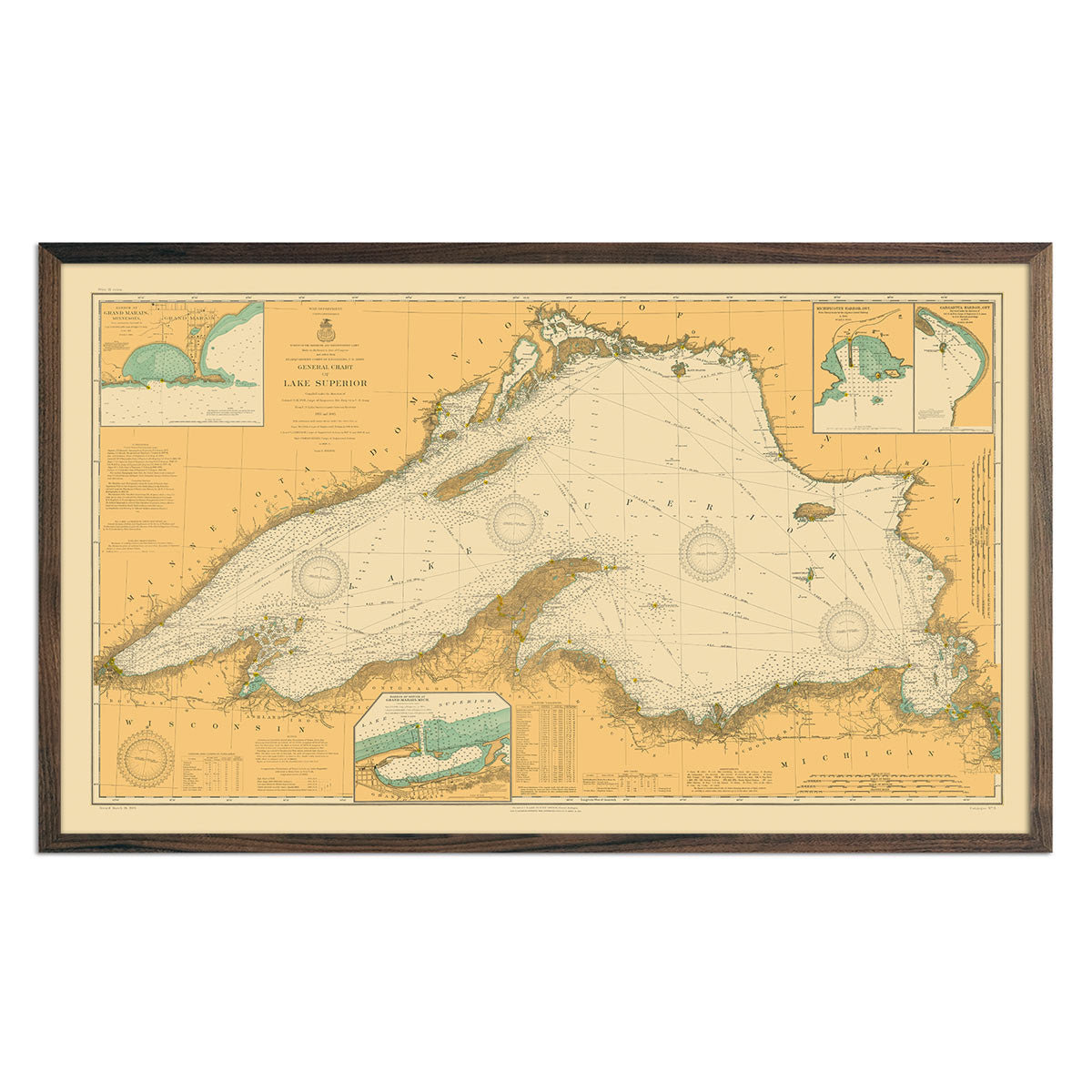
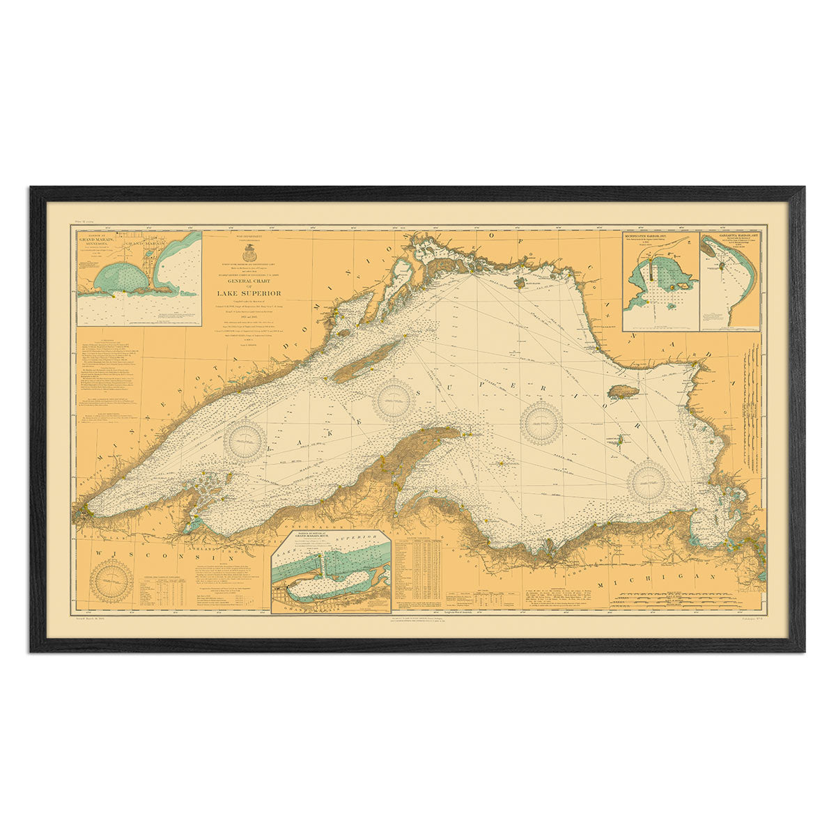
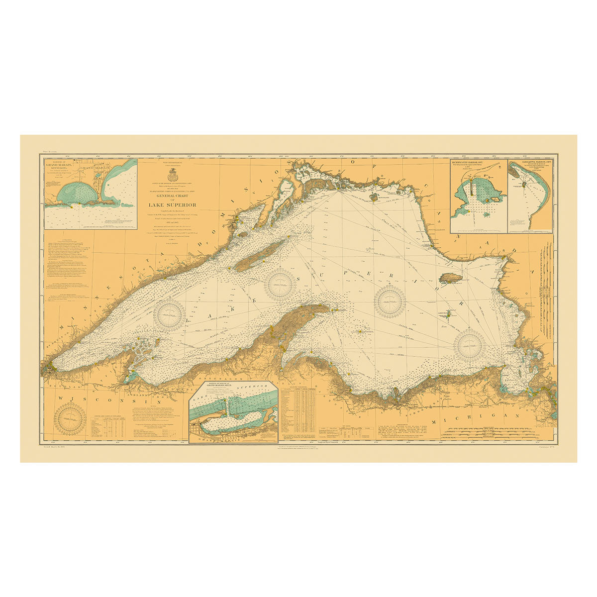
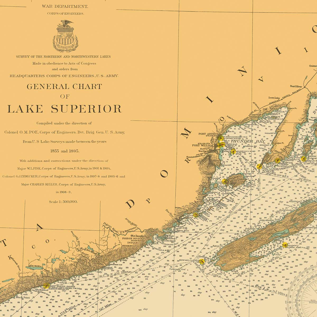
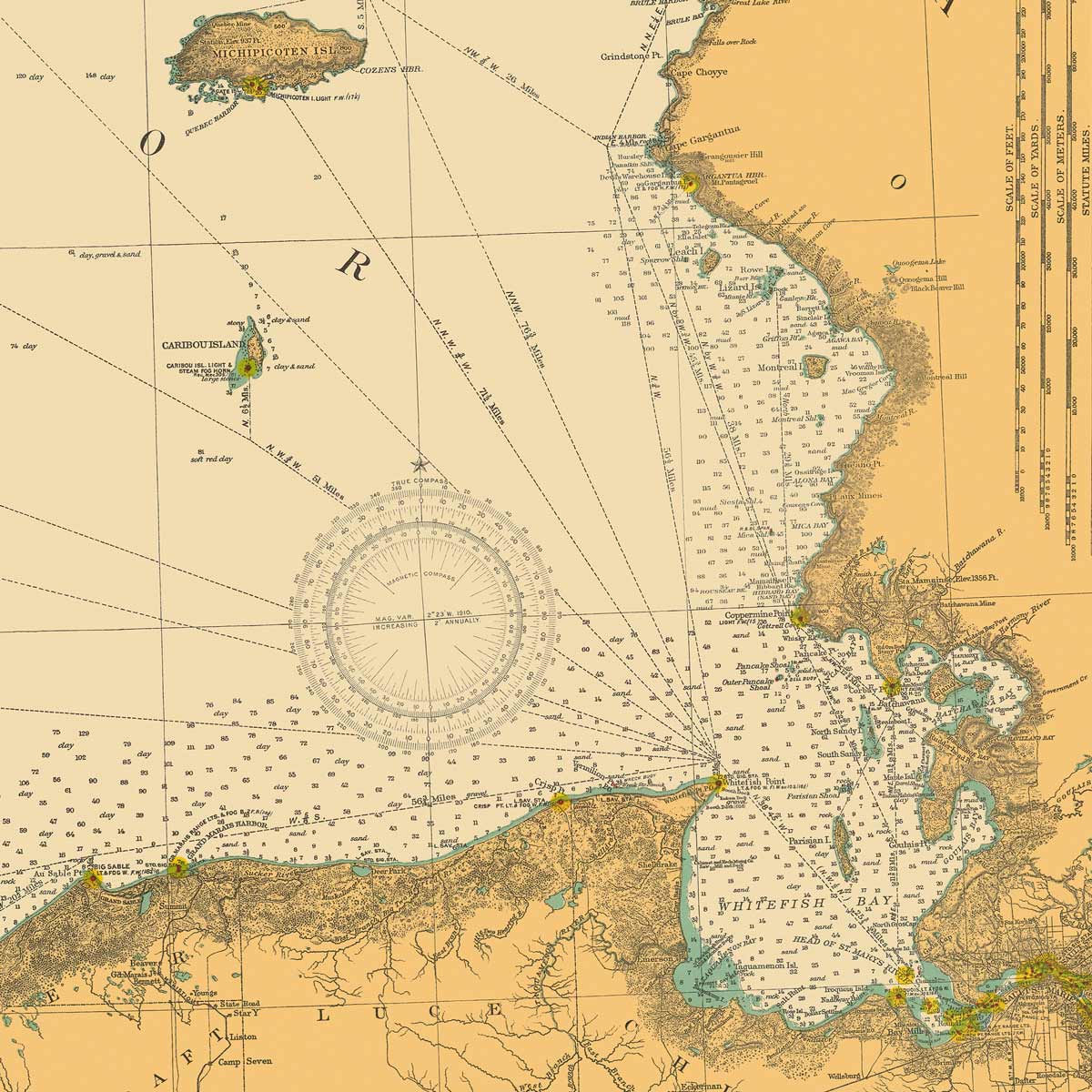
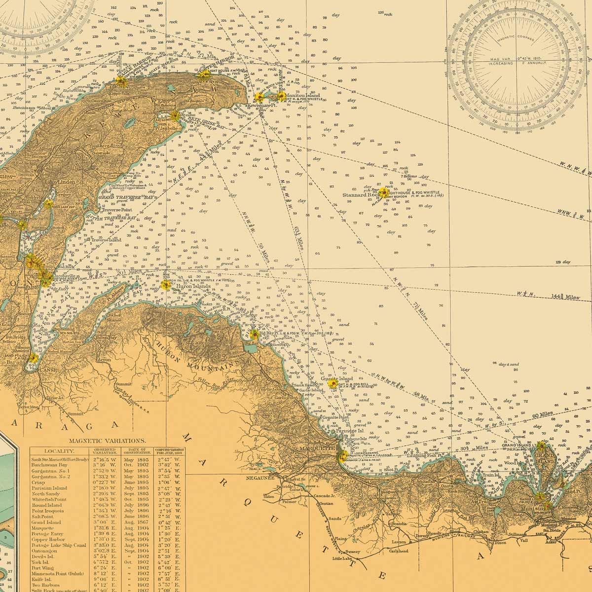
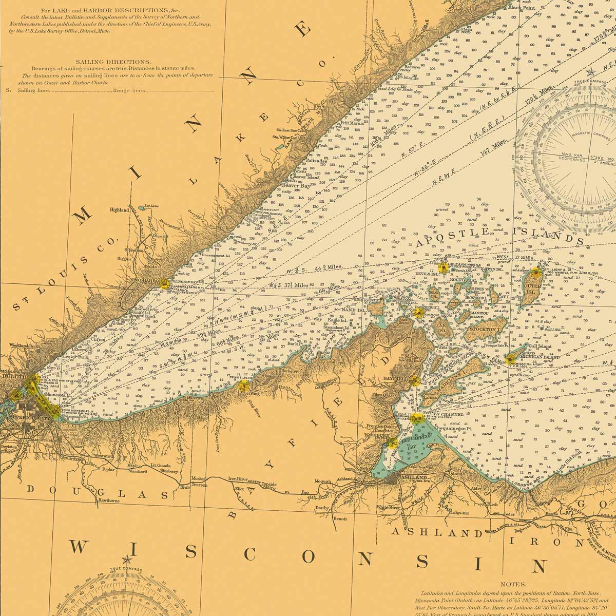
Lake Superior Nautical Chart 1909
From
$ 89.10 USD
$ 99.00 USD
Sale
10% off
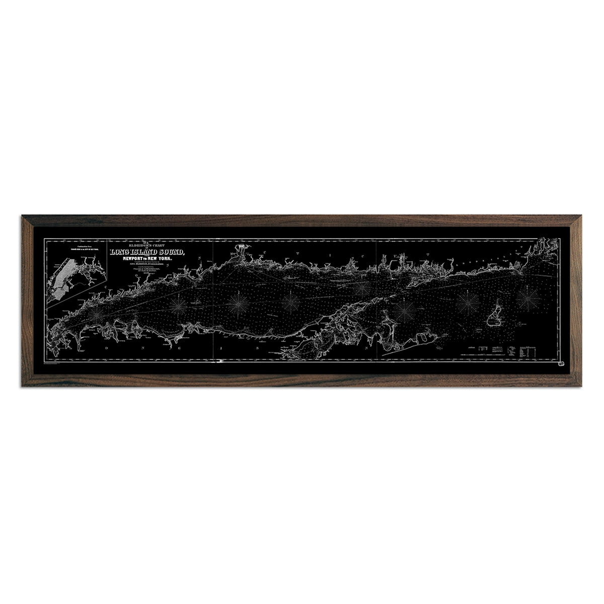
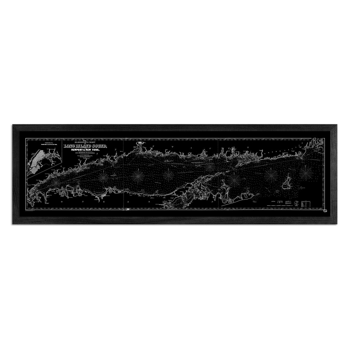
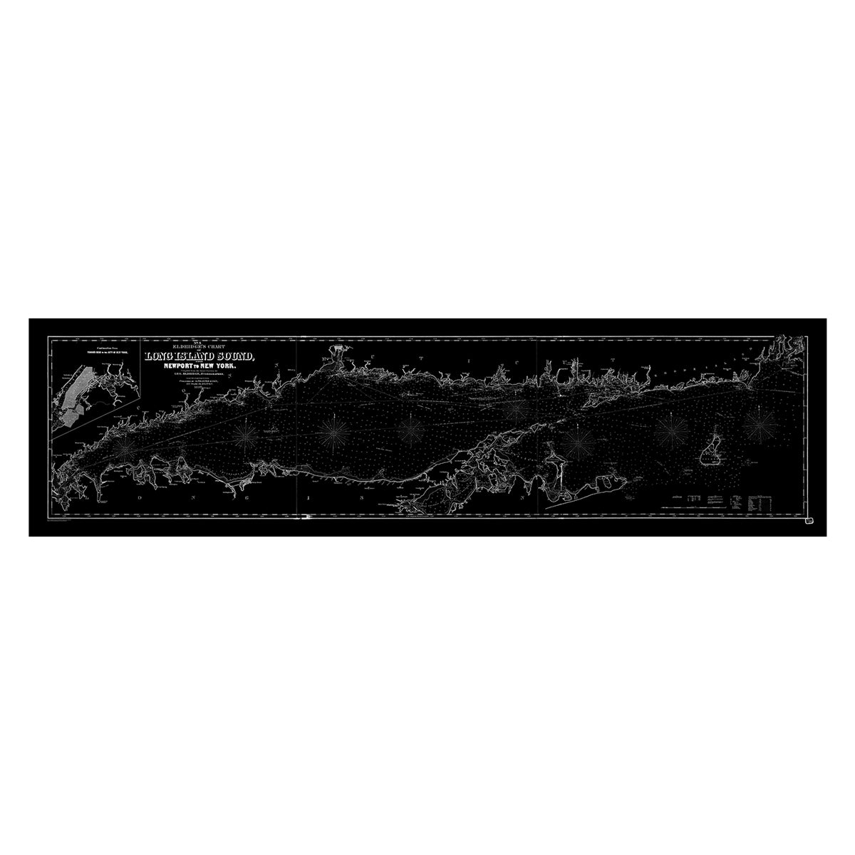
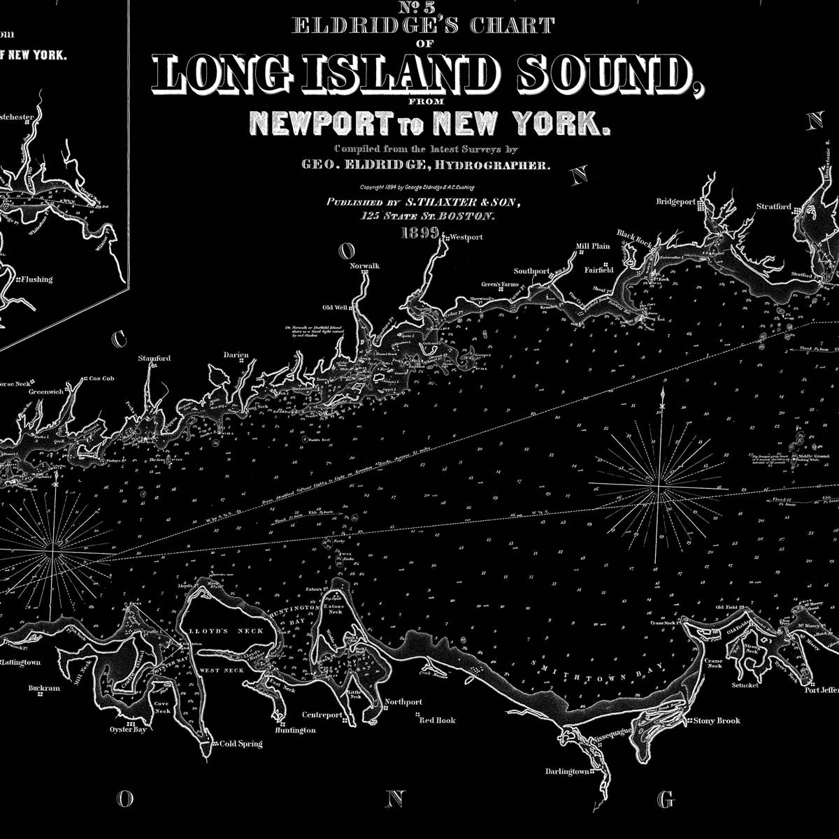
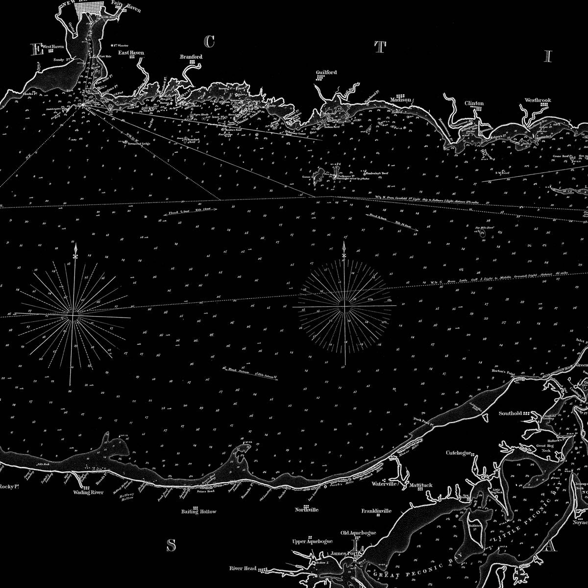
Long Island Sound Nautical Chart 1899
From
$ 89.10 USD
$ 99.00 USD
Sale
10% off
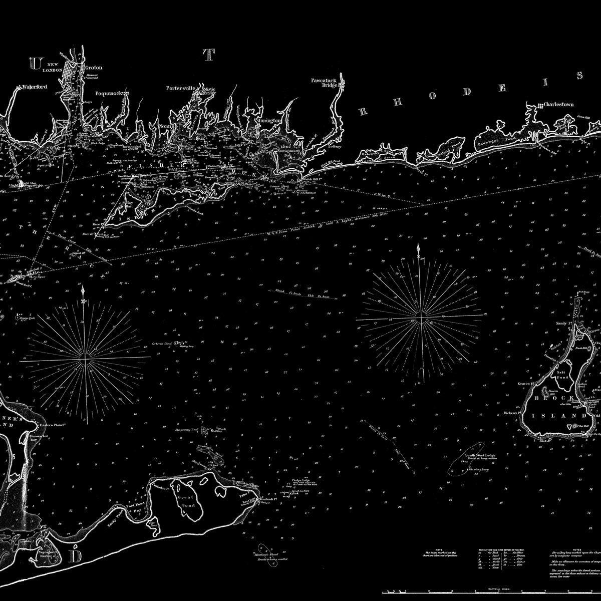
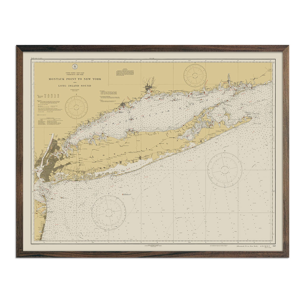
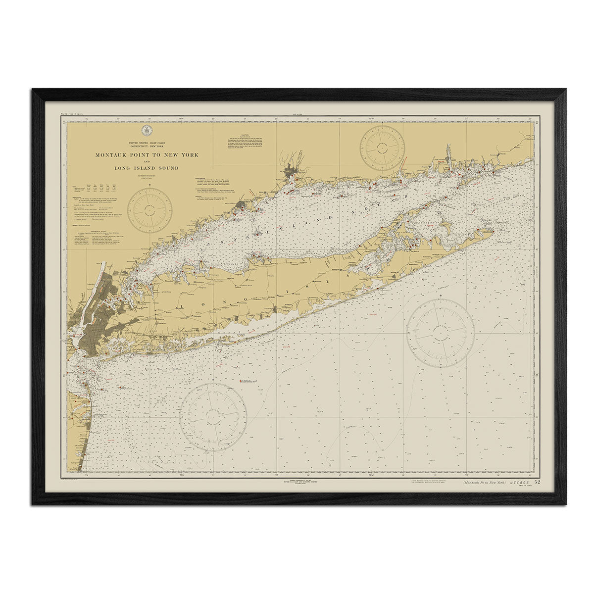
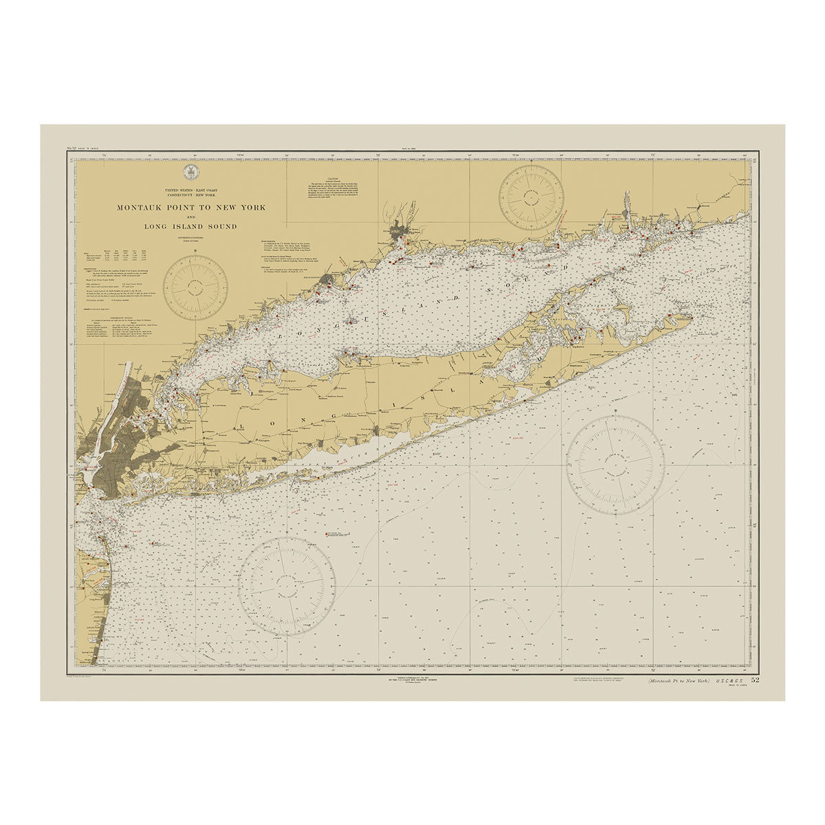
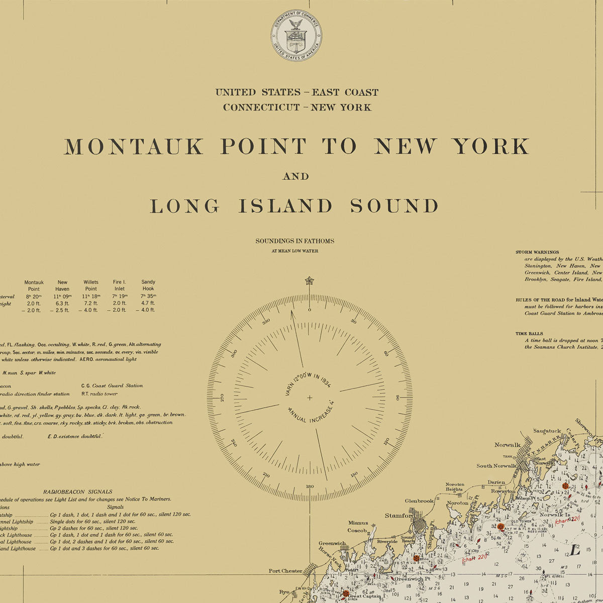
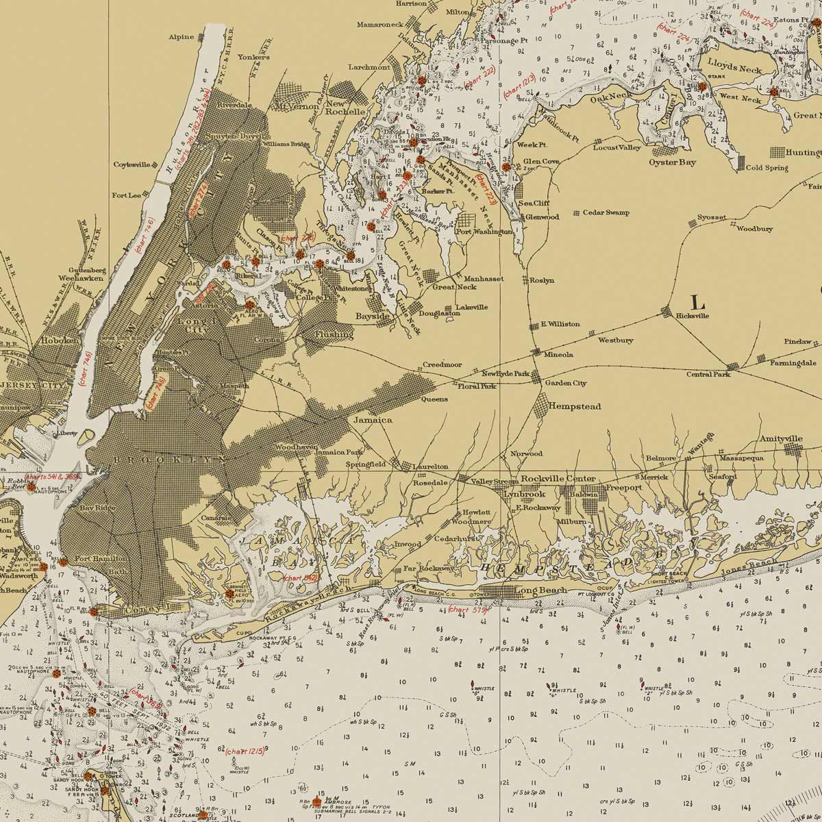
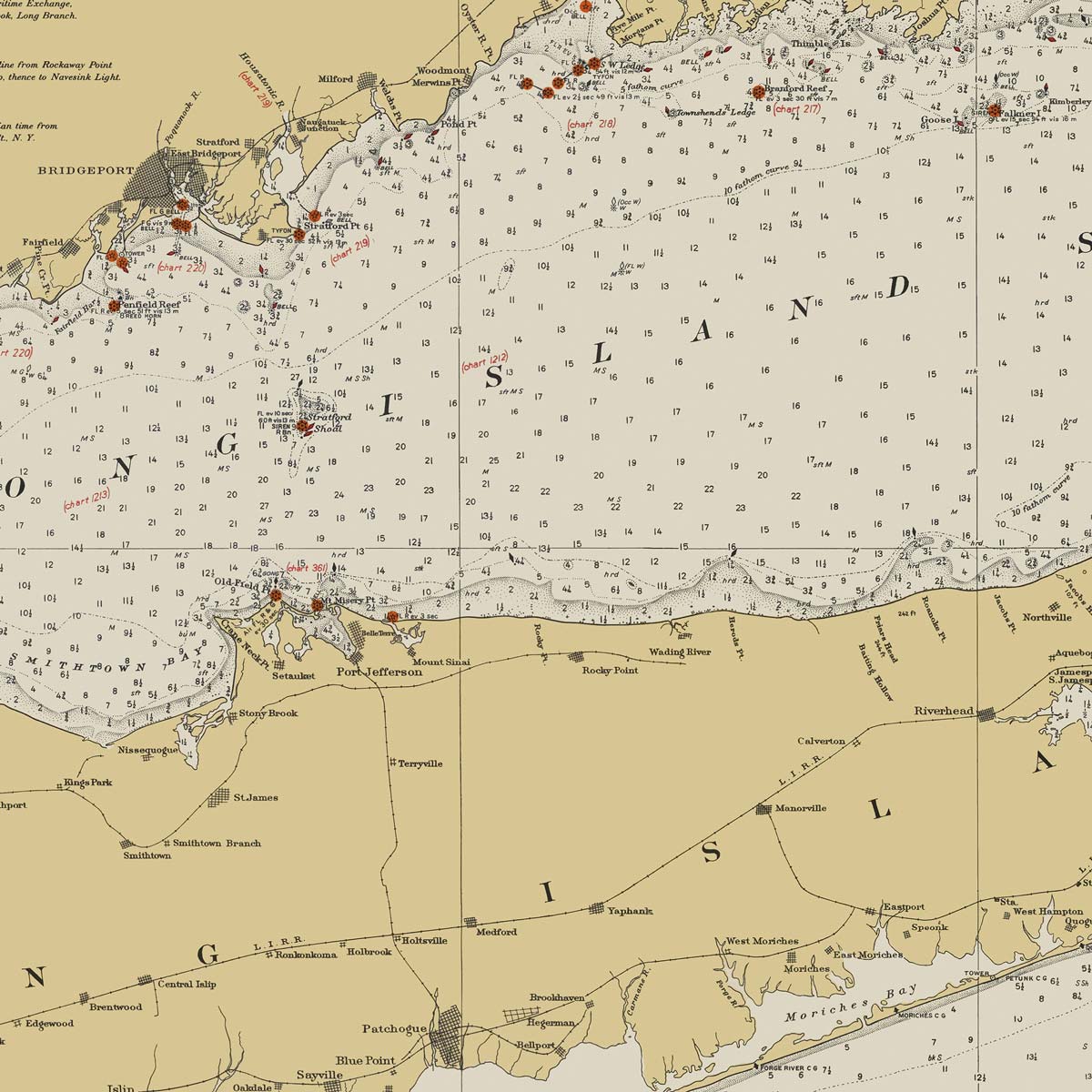
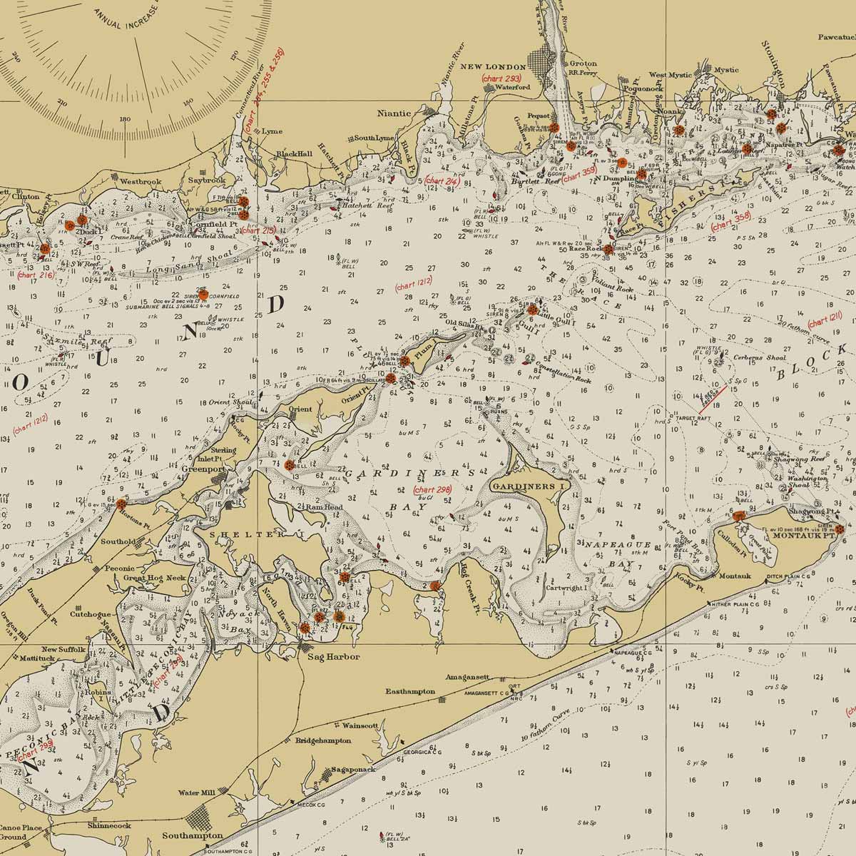
Montauk Point to New York and Long Island Sound Nautical Chart 1934
From
$ 71.10 USD
$ 79.00 USD
Sale
10% off
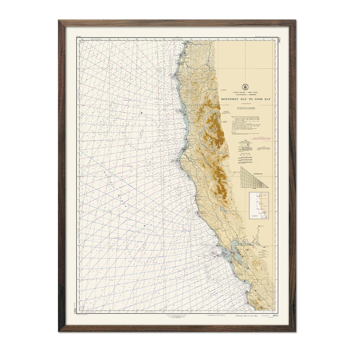
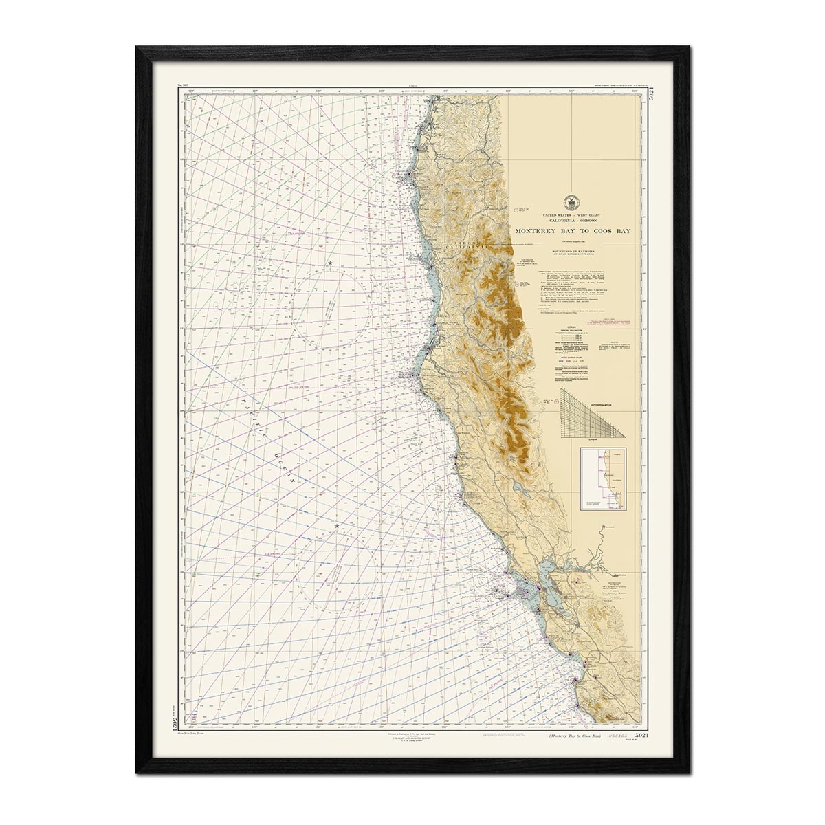
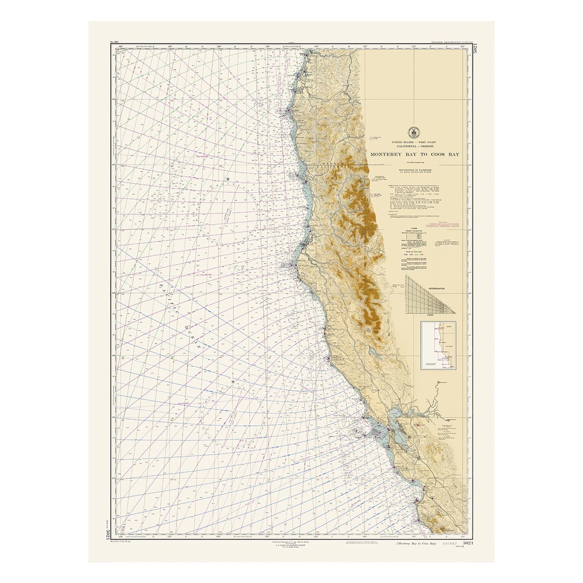
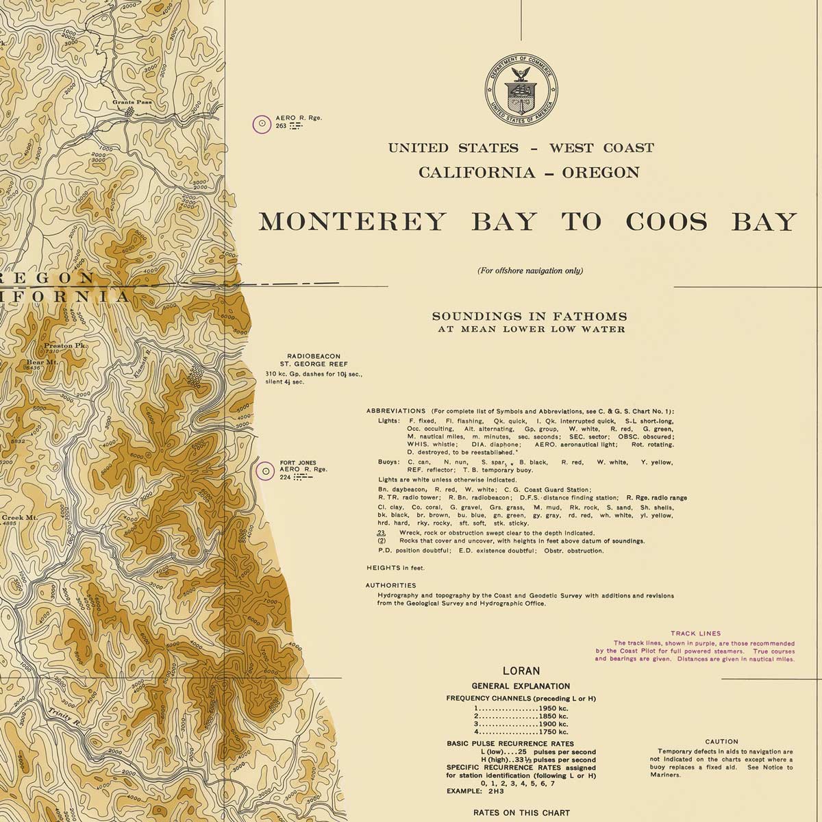
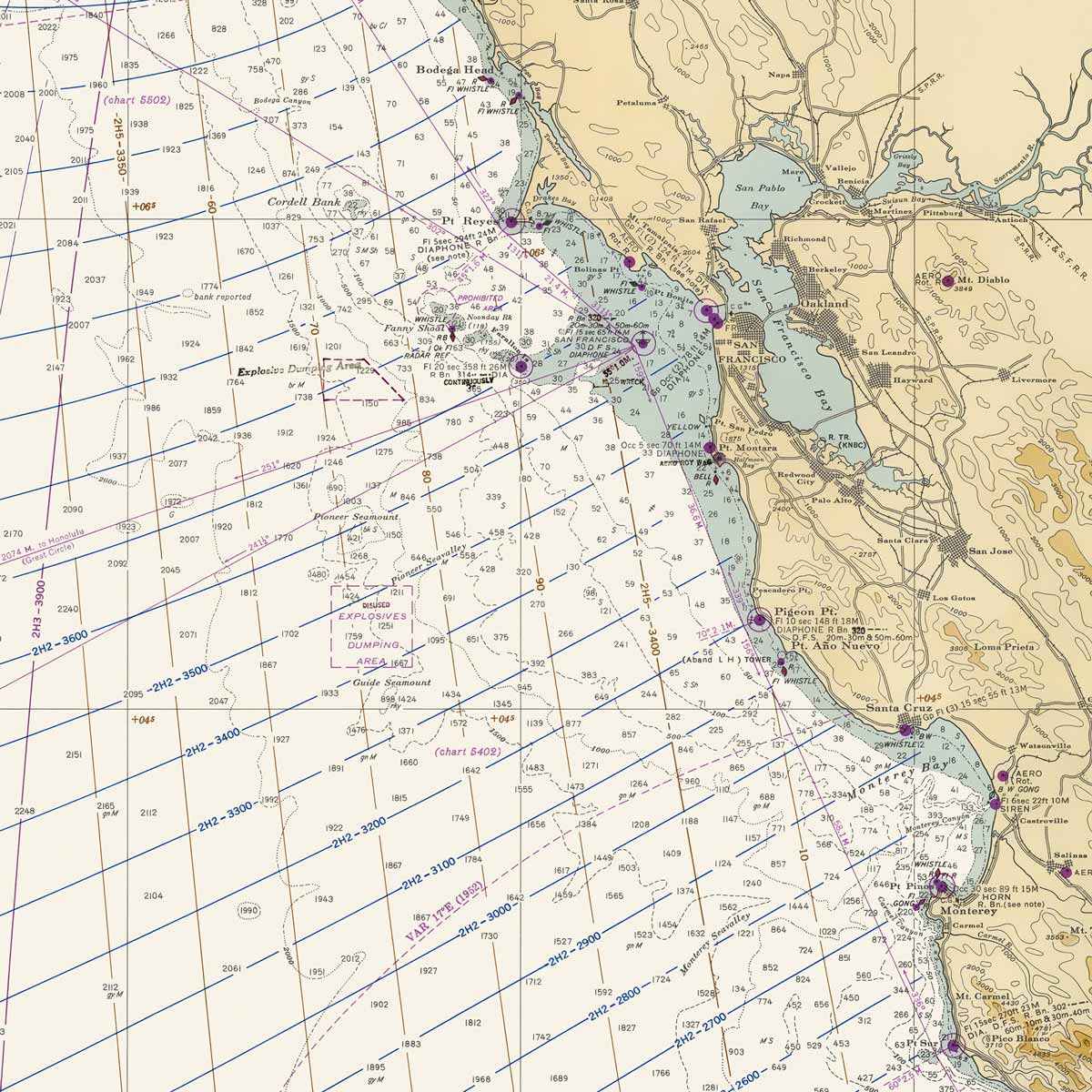
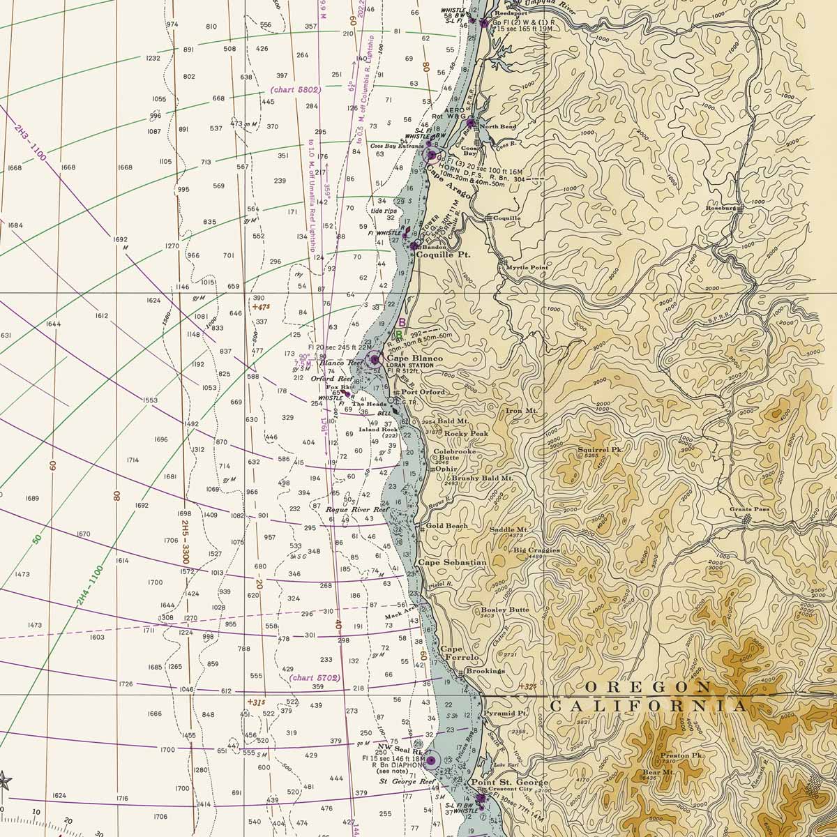
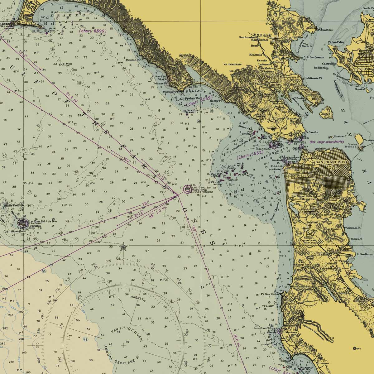
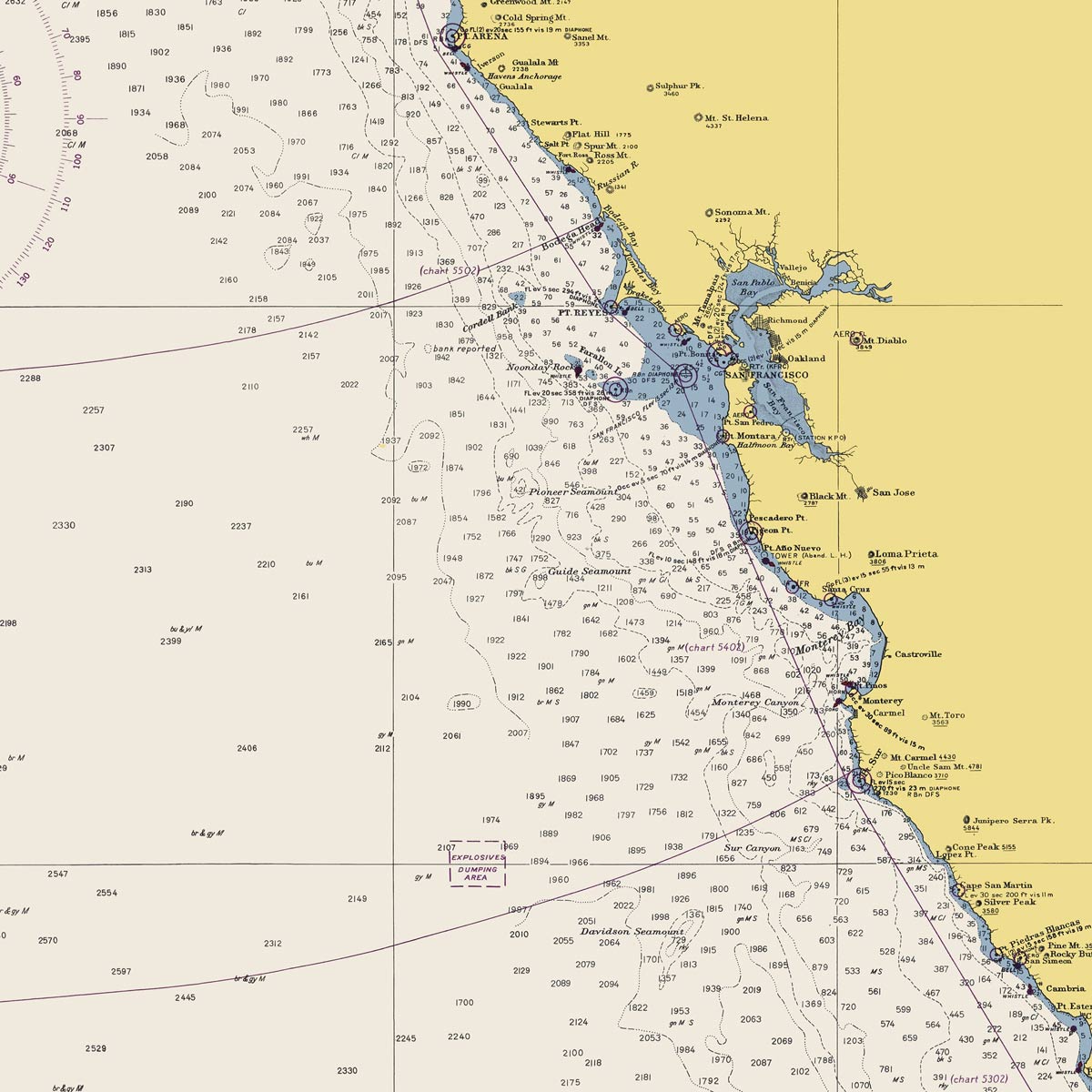
Monterey Bay to Coos Bay Nautical Chart 1948
From
$ 71.10 USD
$ 79.00 USD
Sale
10% off
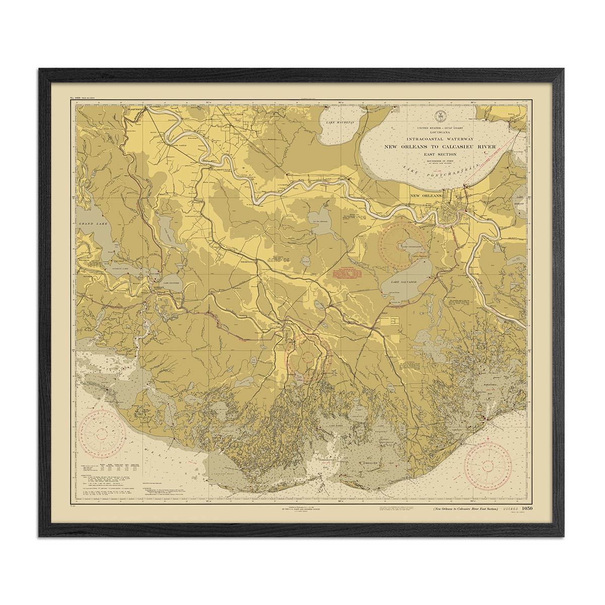
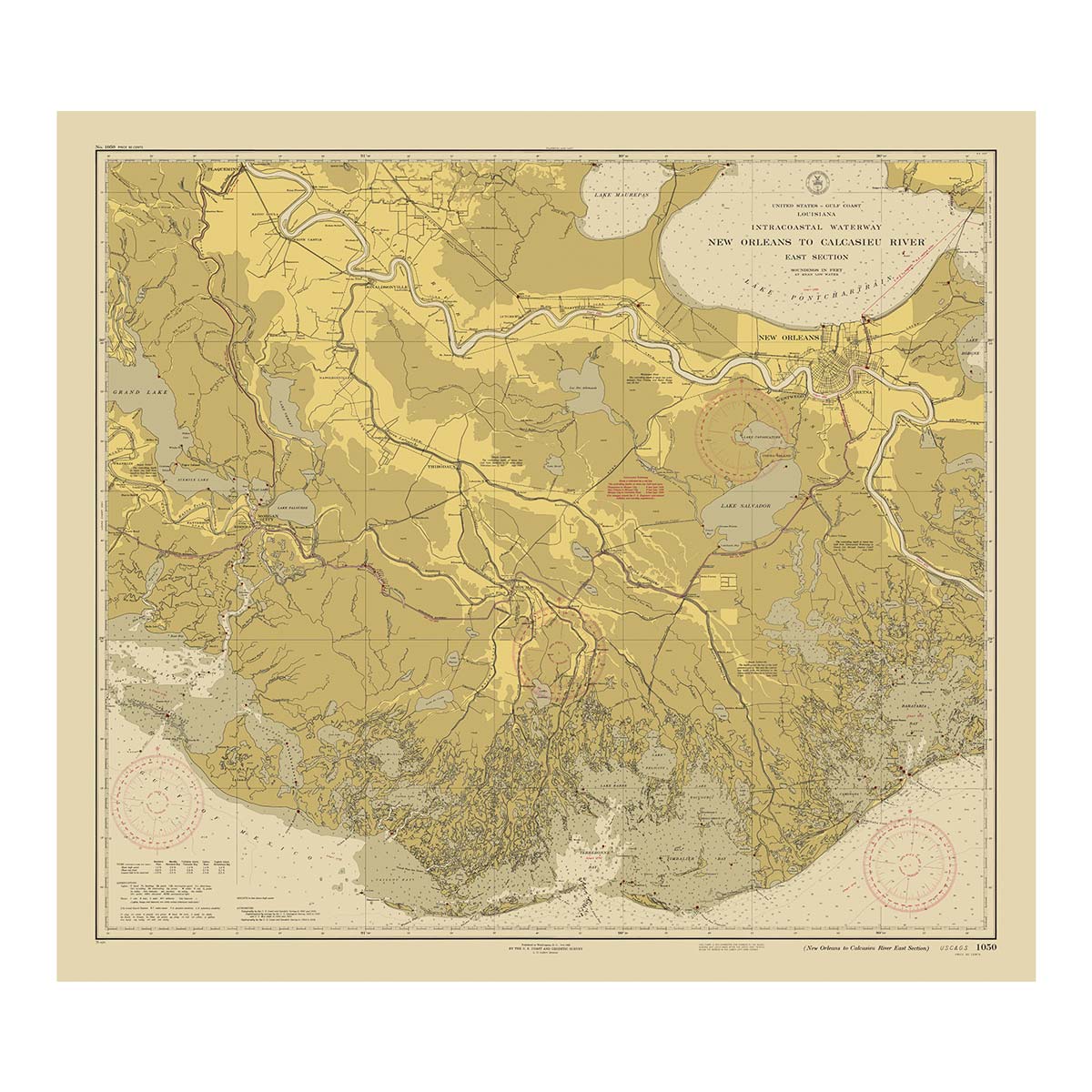
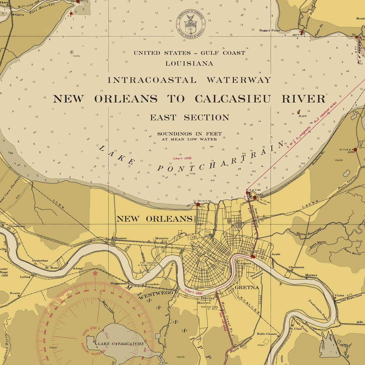
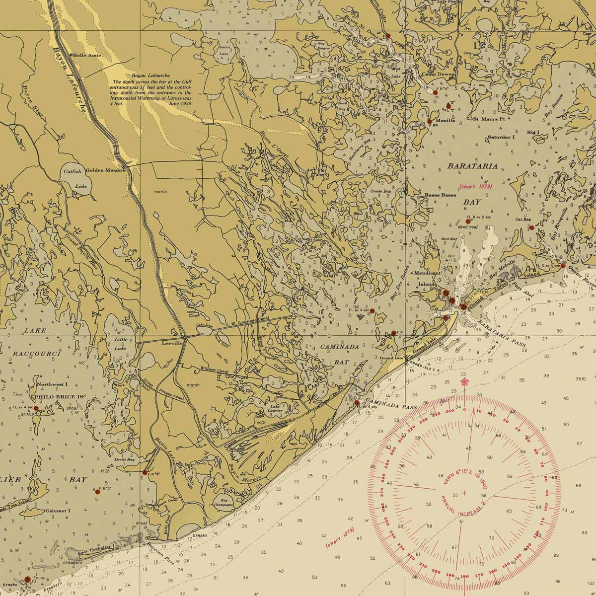
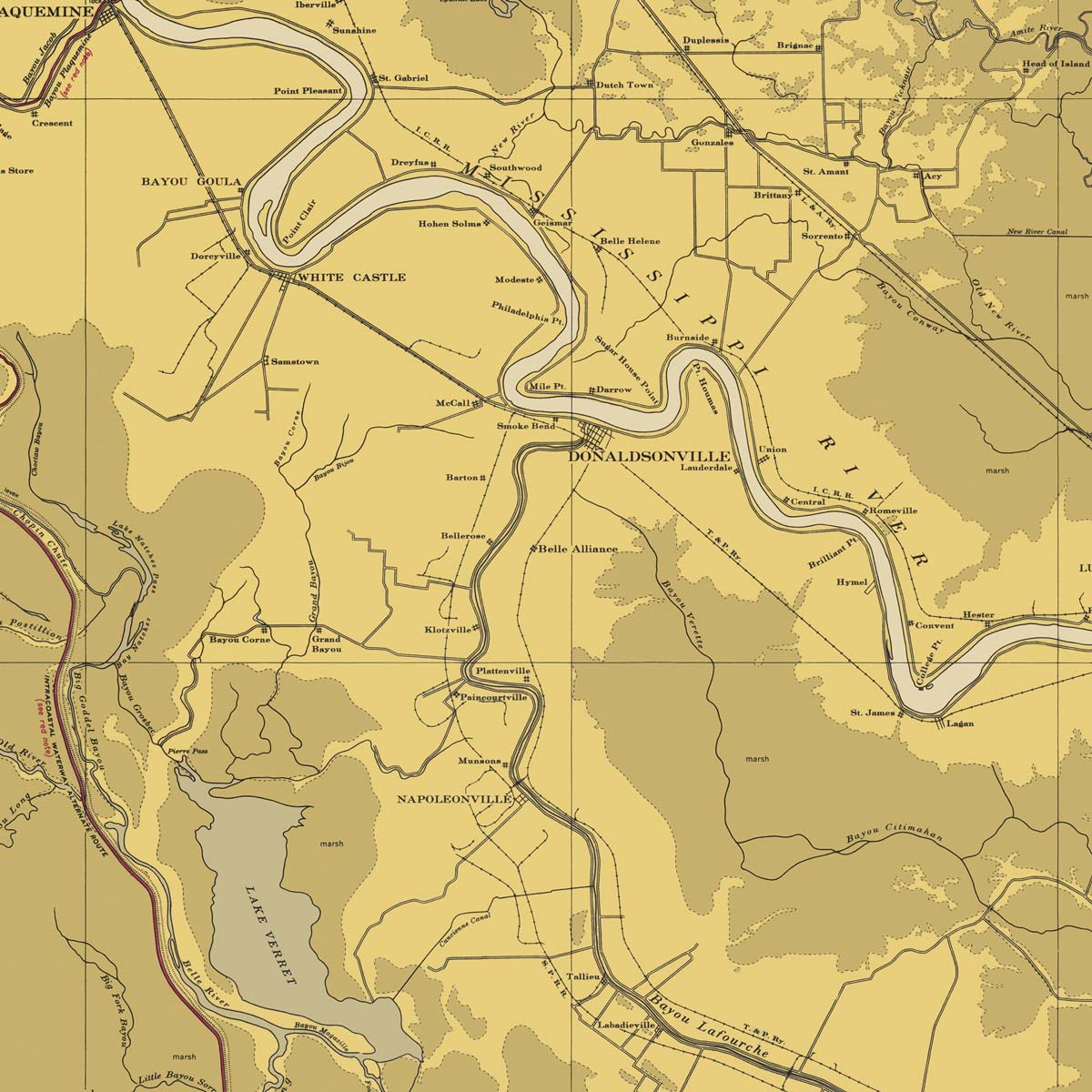
New Orleans to Calcasieu River East Section Nautical Chart 1939
From
$ 89.10 USD
$ 99.00 USD
Sale
10% off
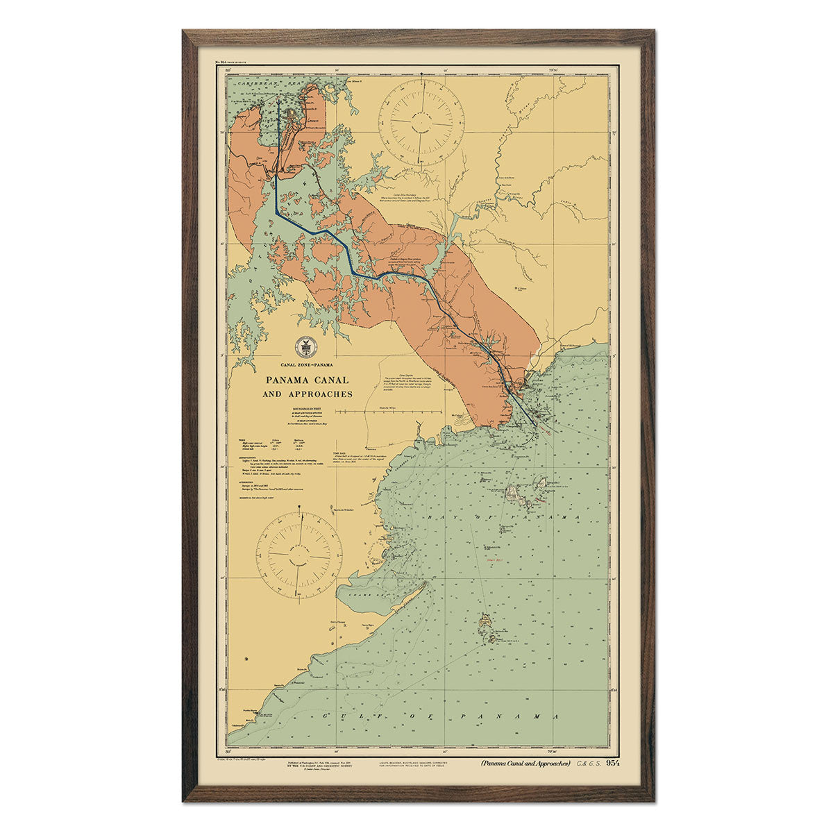
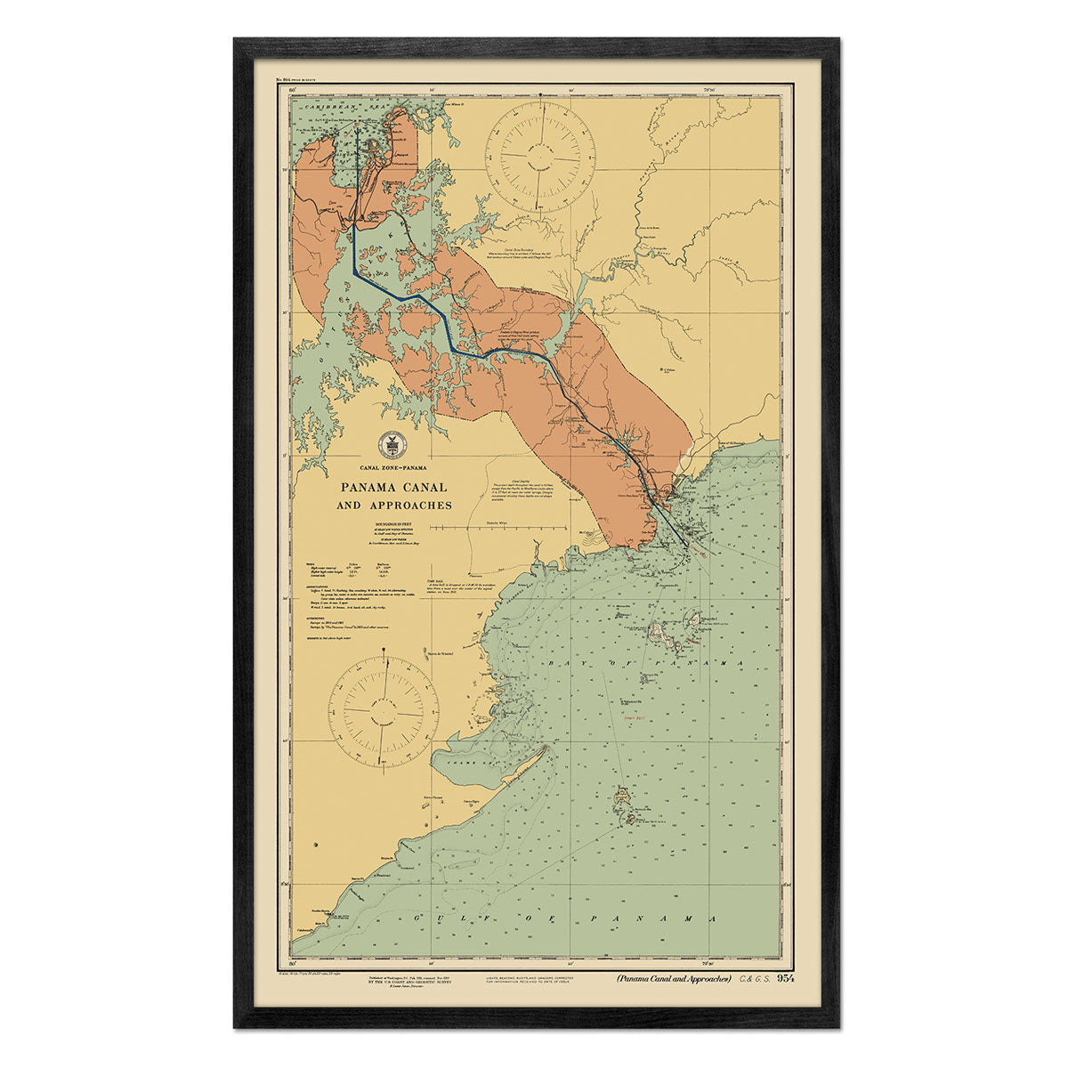
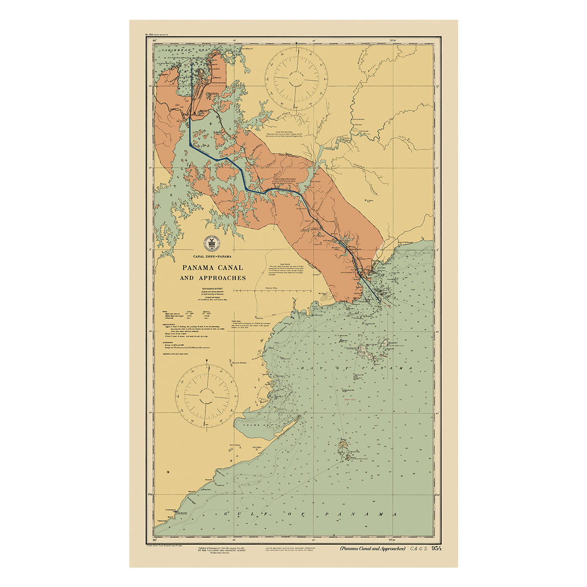
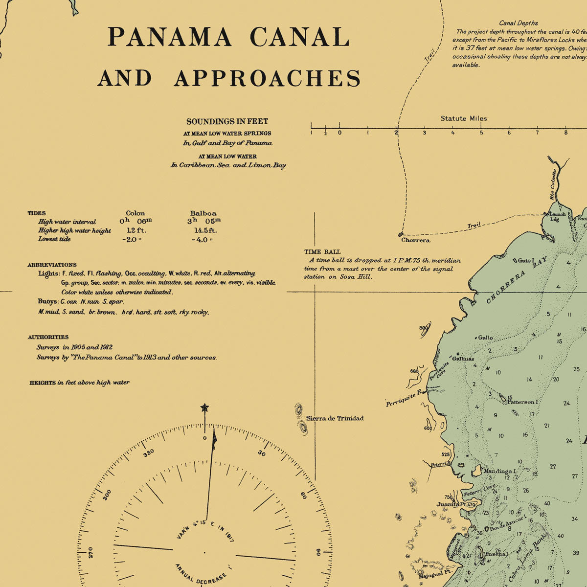
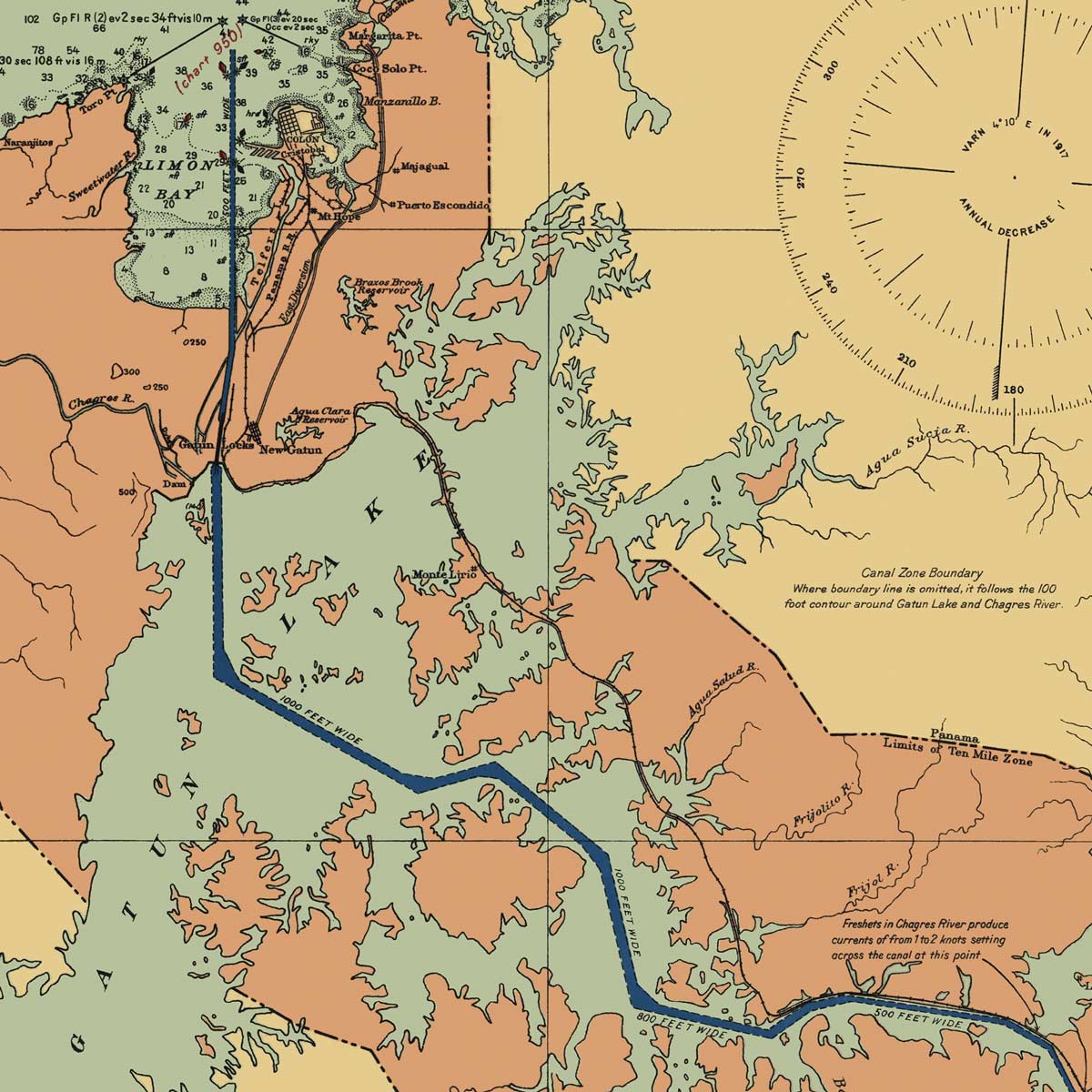
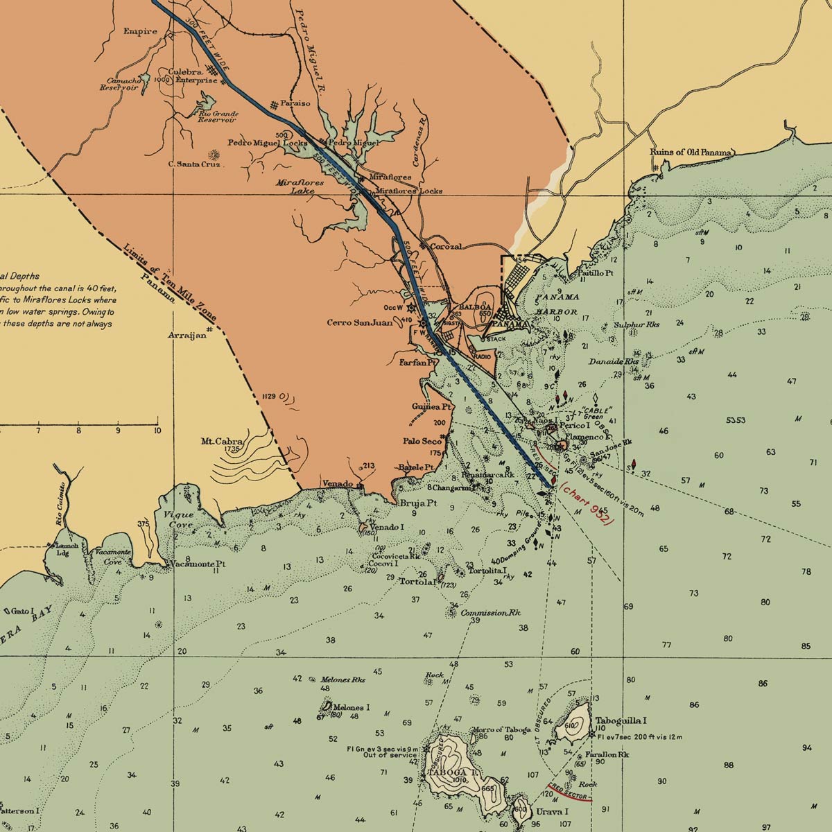
Panama Canal and Approaches Nautical Chart 1923
From
$ 62.10 USD
$ 69.00 USD
Sale
10% off
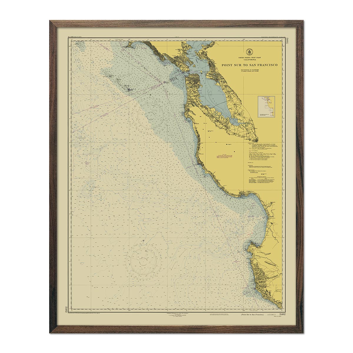
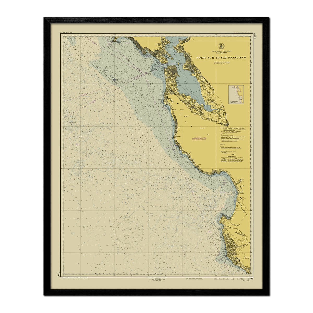
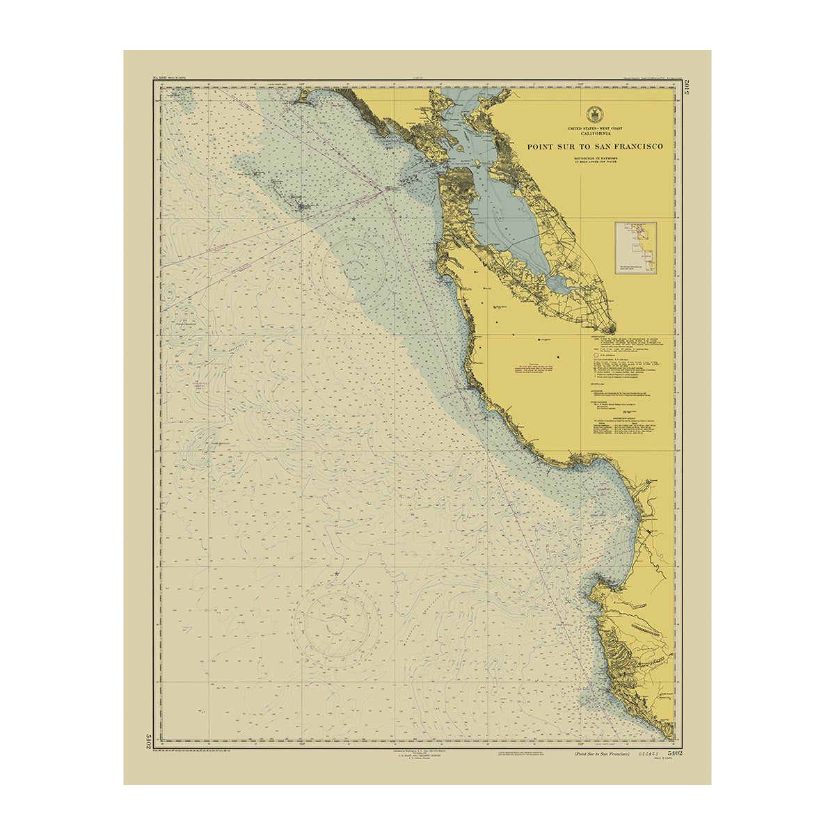
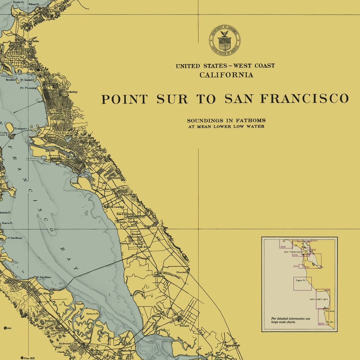
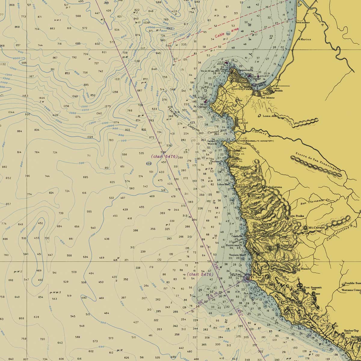
Point Sur to San Francisco Nautical Chart 1948
From
$ 57.60 USD
$ 64.00 USD
Sale
10% off
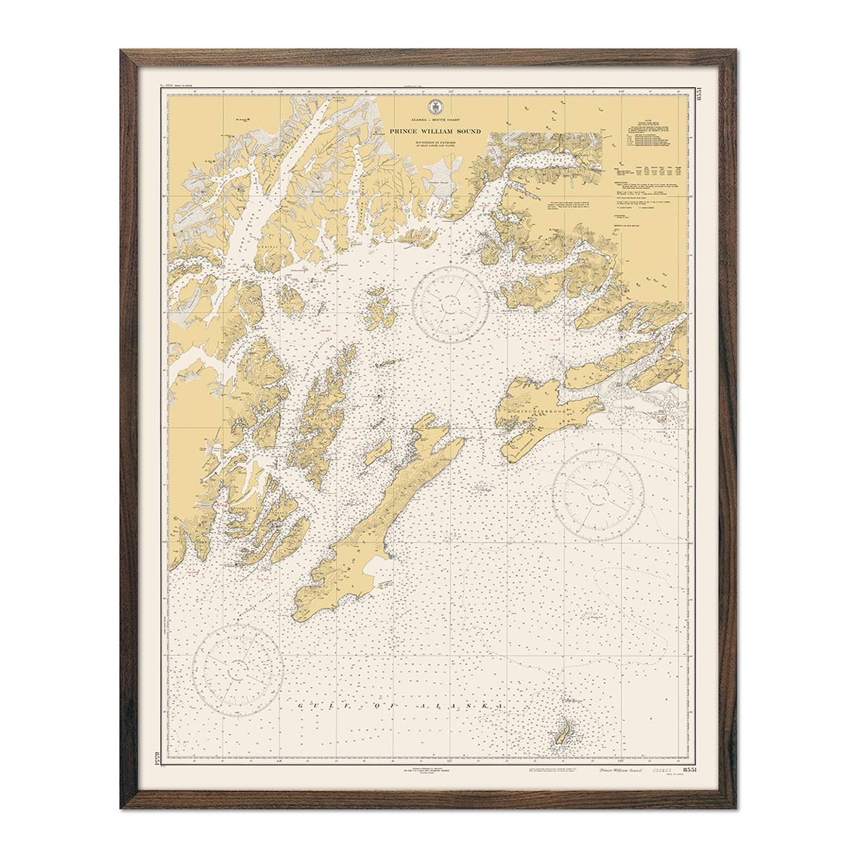
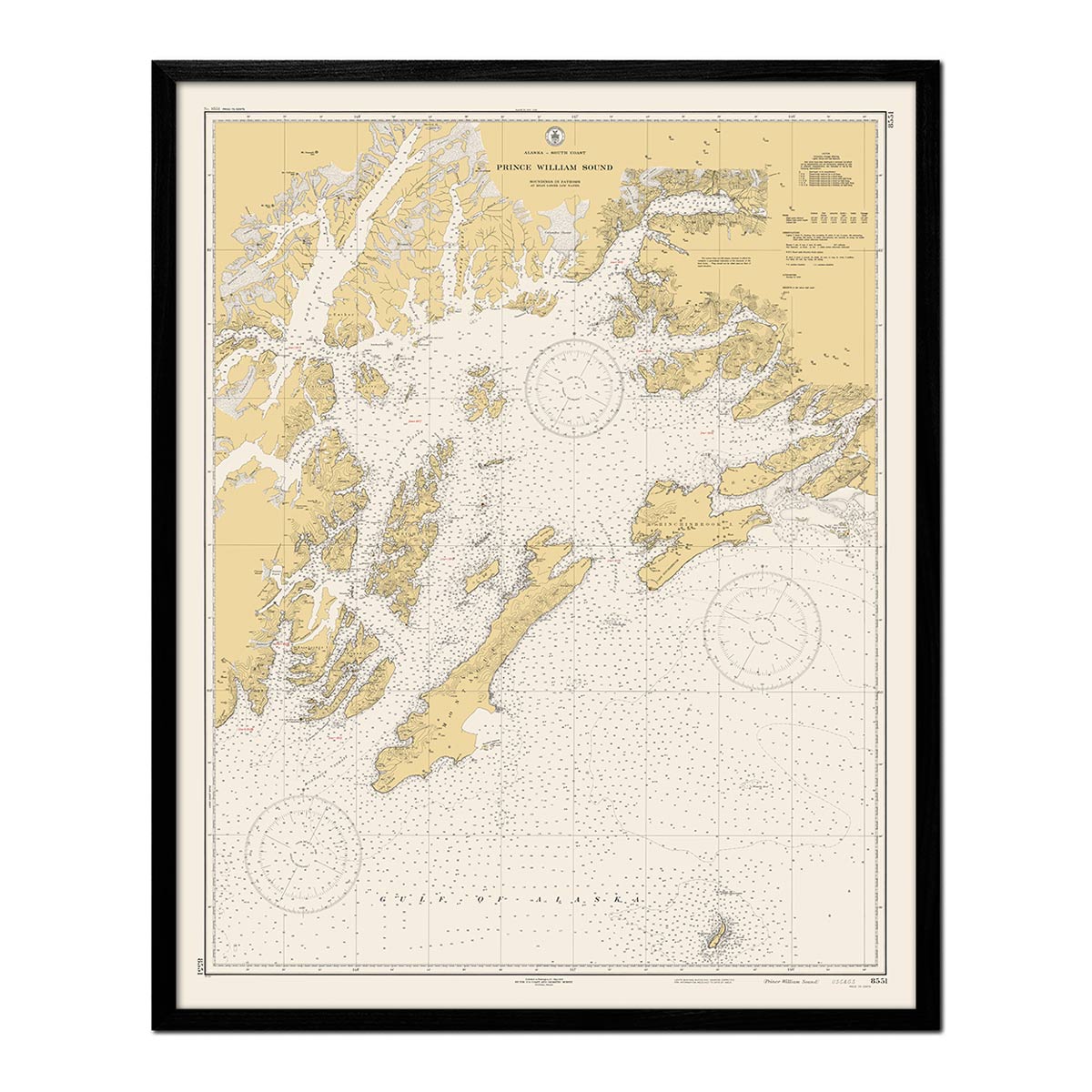
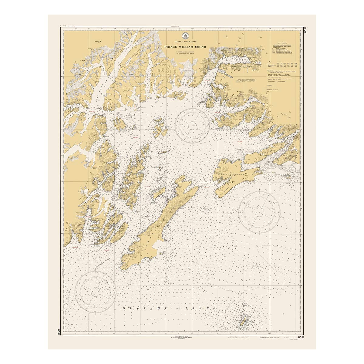
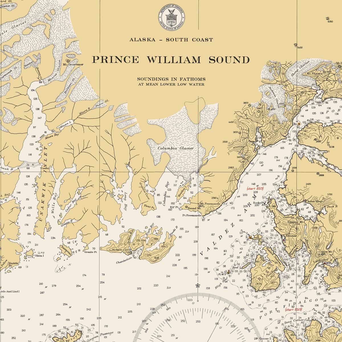
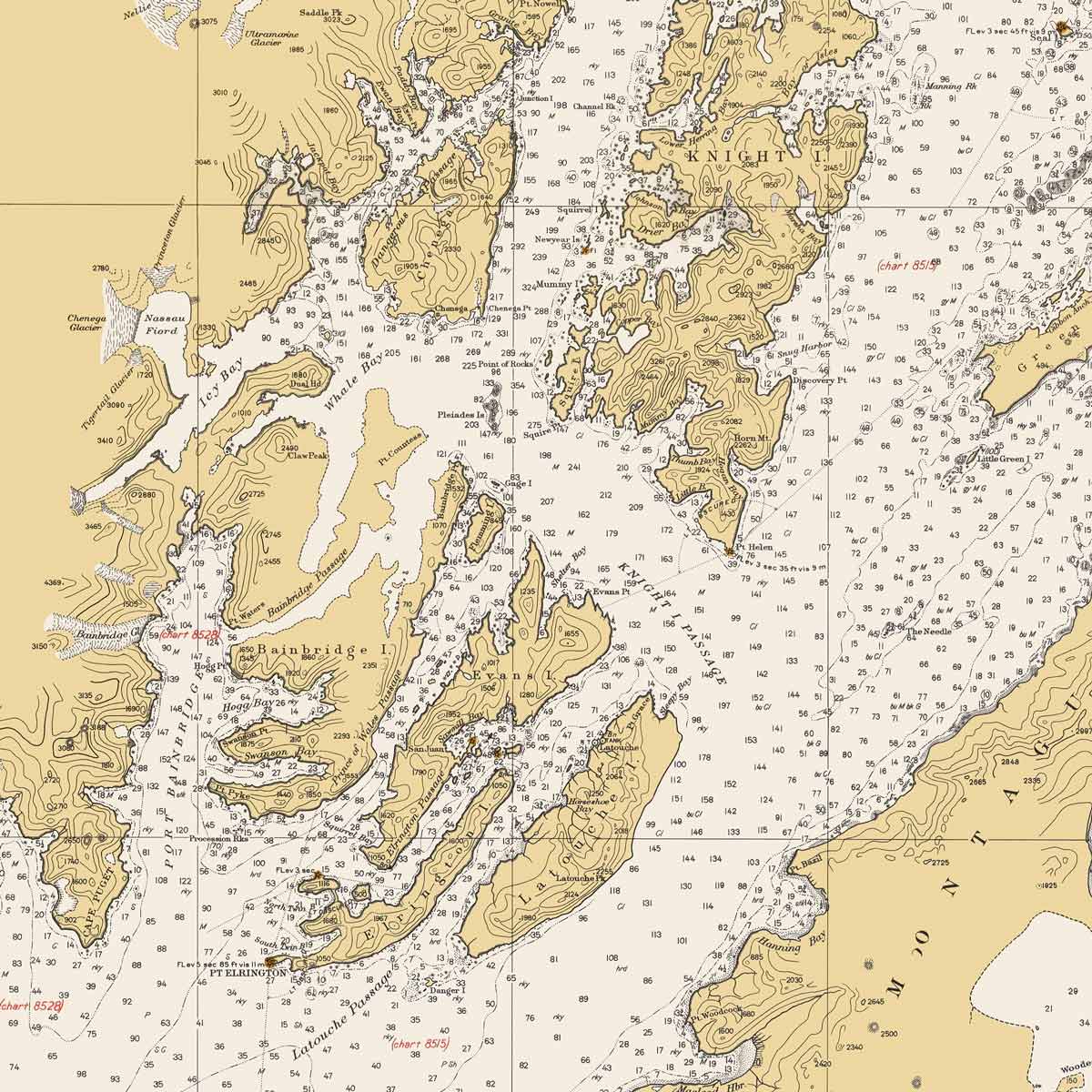
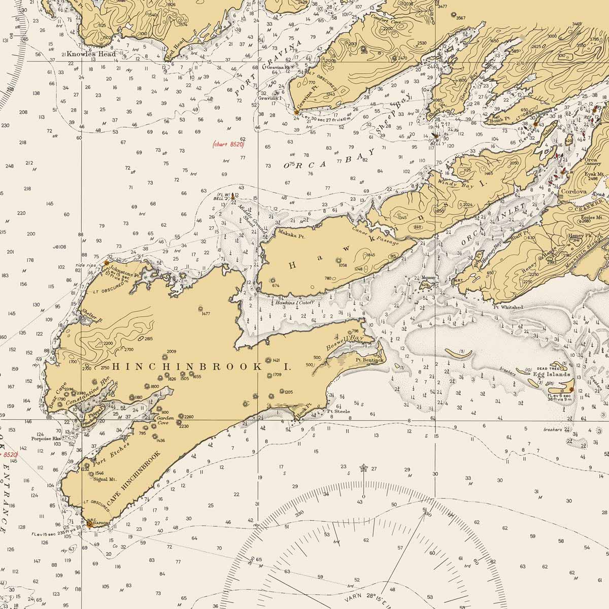
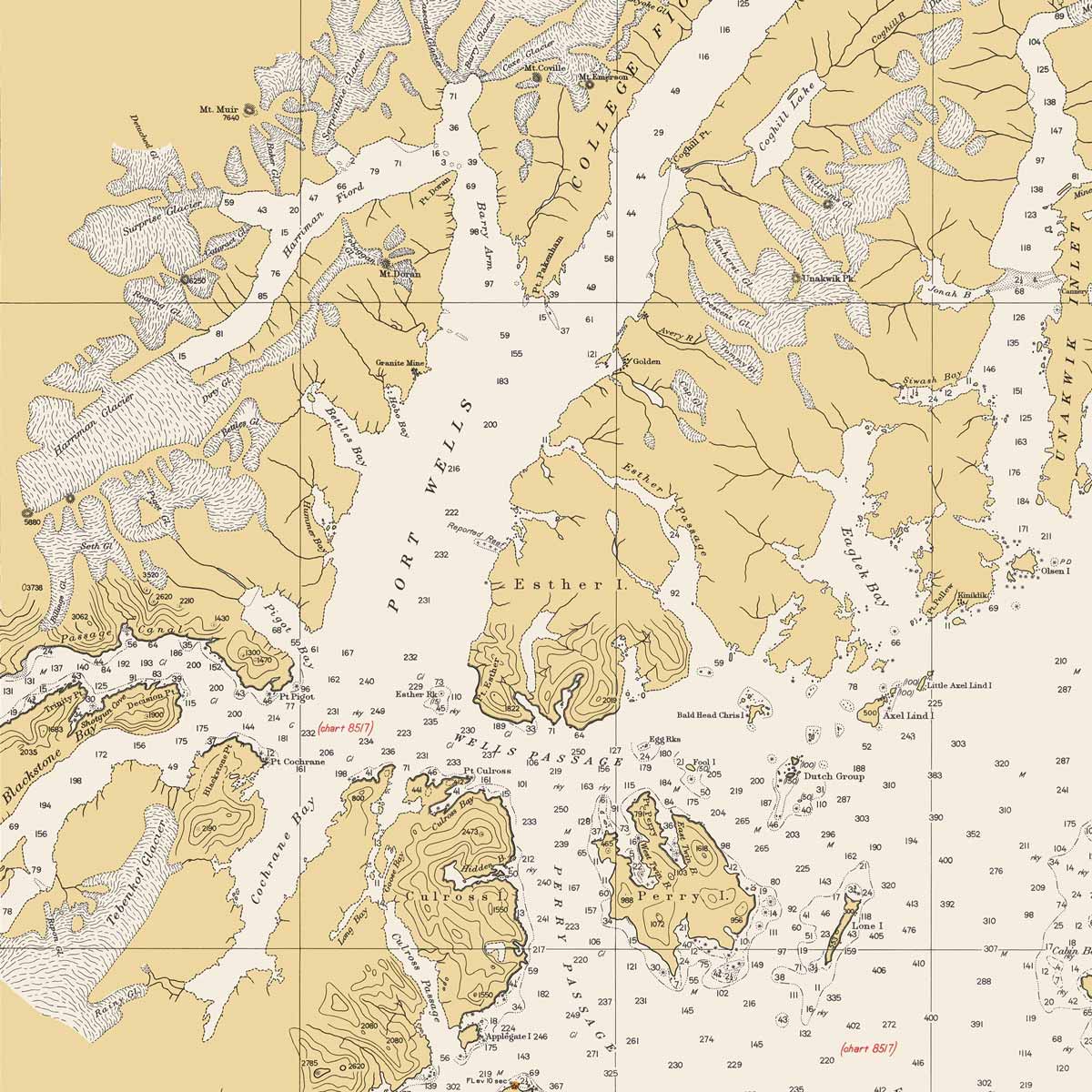
Prince William Sound Nautical Chart 1935
From
$ 57.60 USD
$ 64.00 USD
Sale
10% off
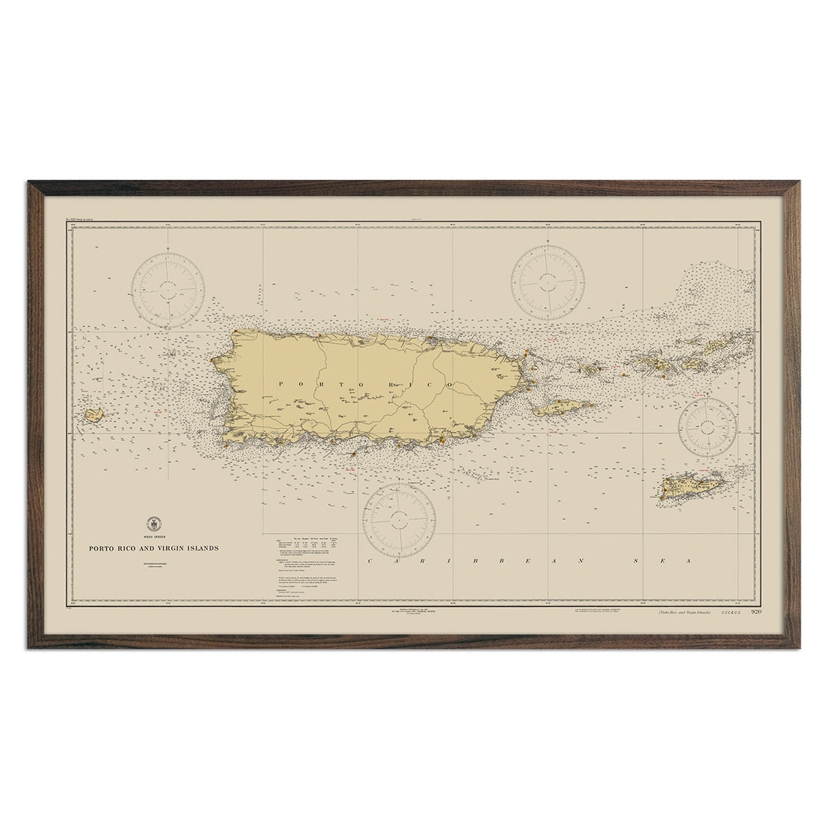
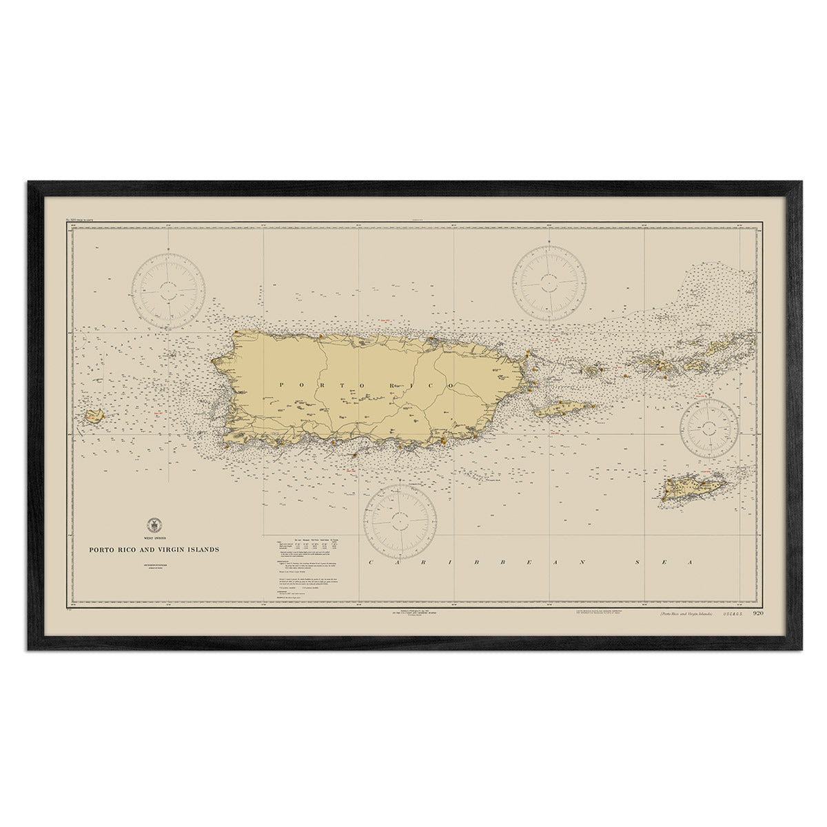
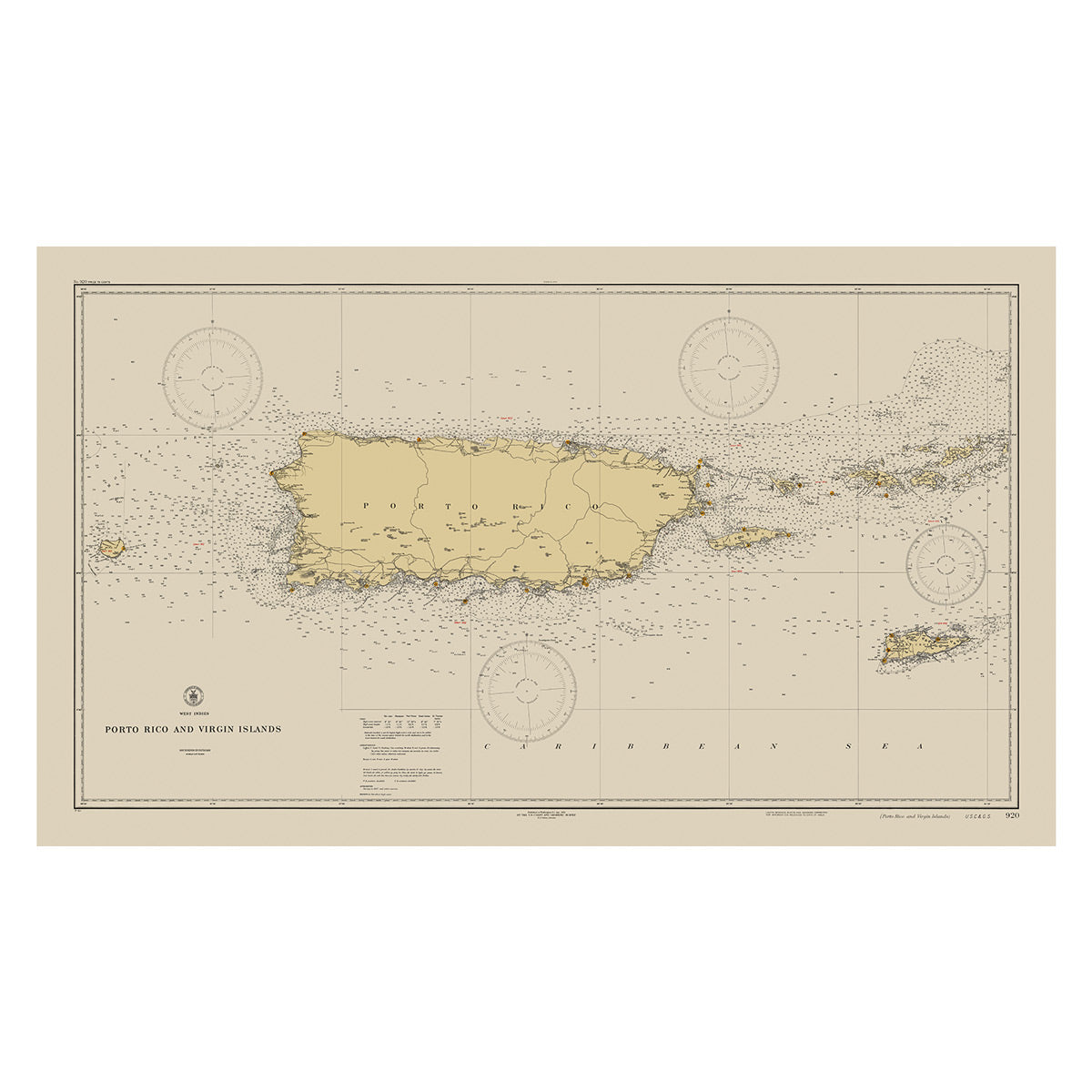
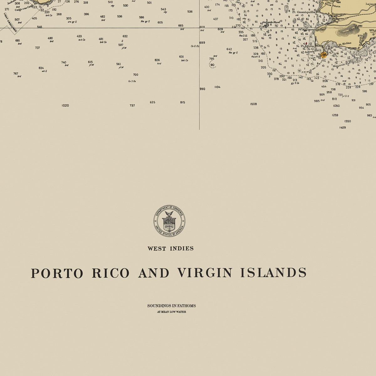
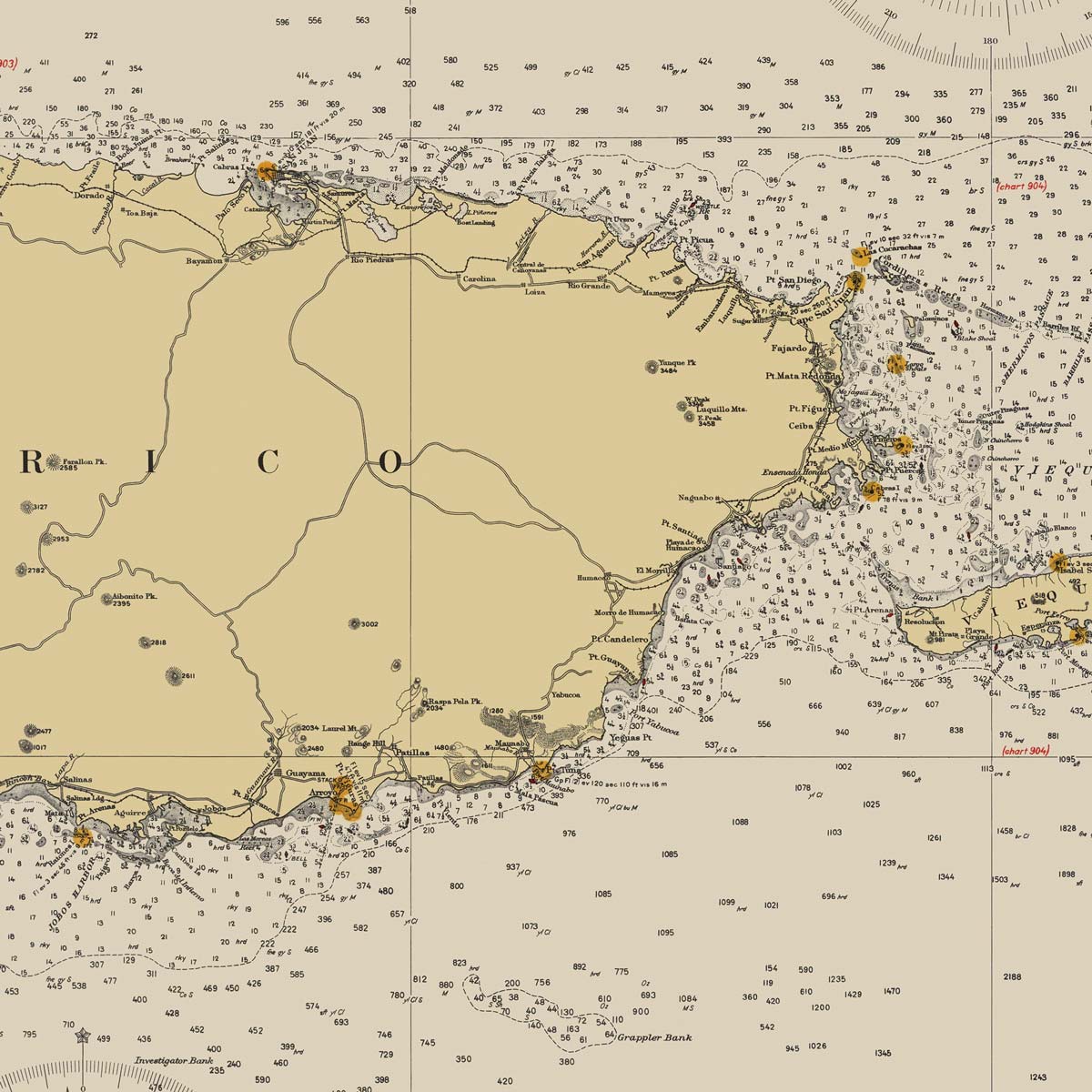
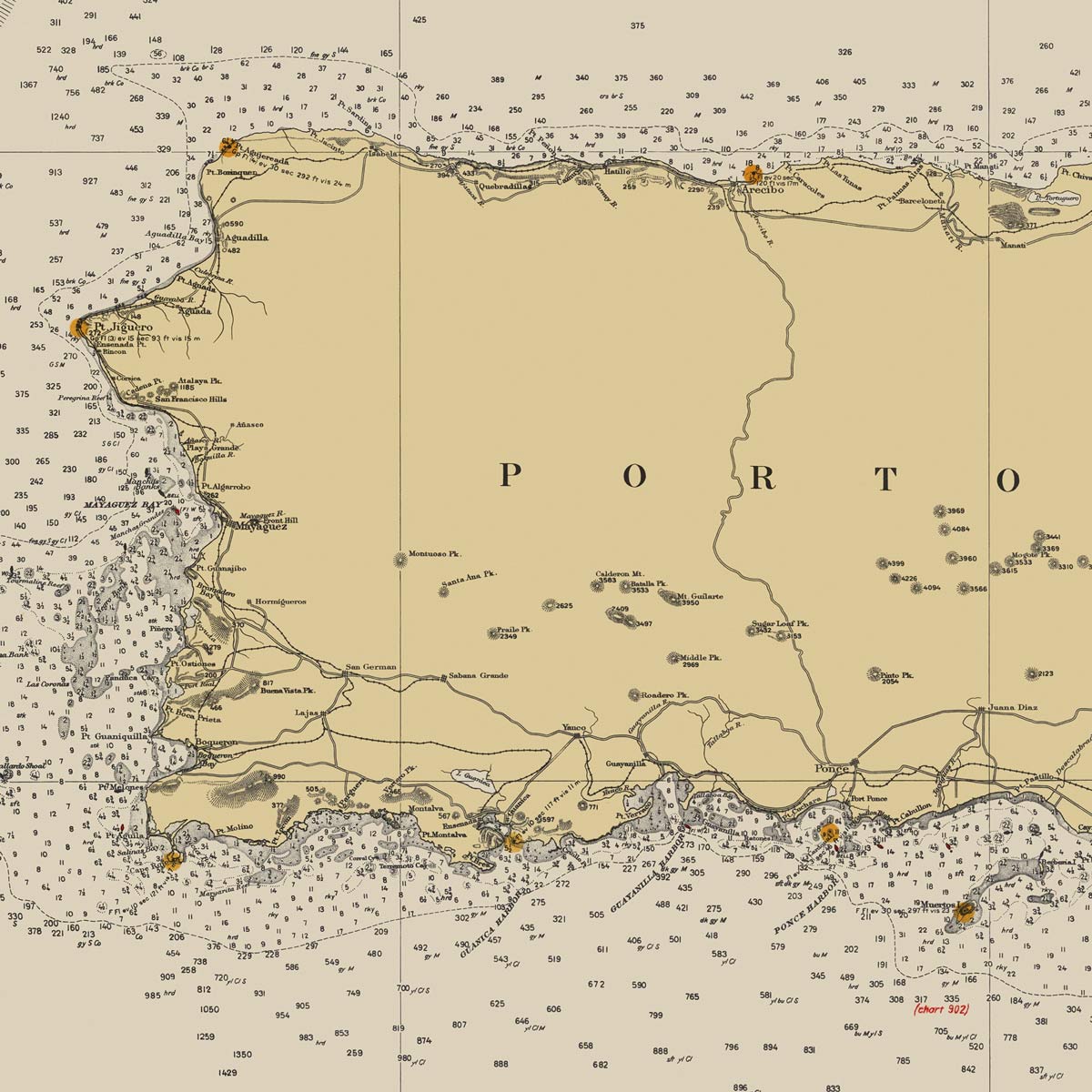
Puerto Rico and Virgin Islands Nautical Chart 1931
From
$ 89.10 USD
$ 99.00 USD
Sale
10% off
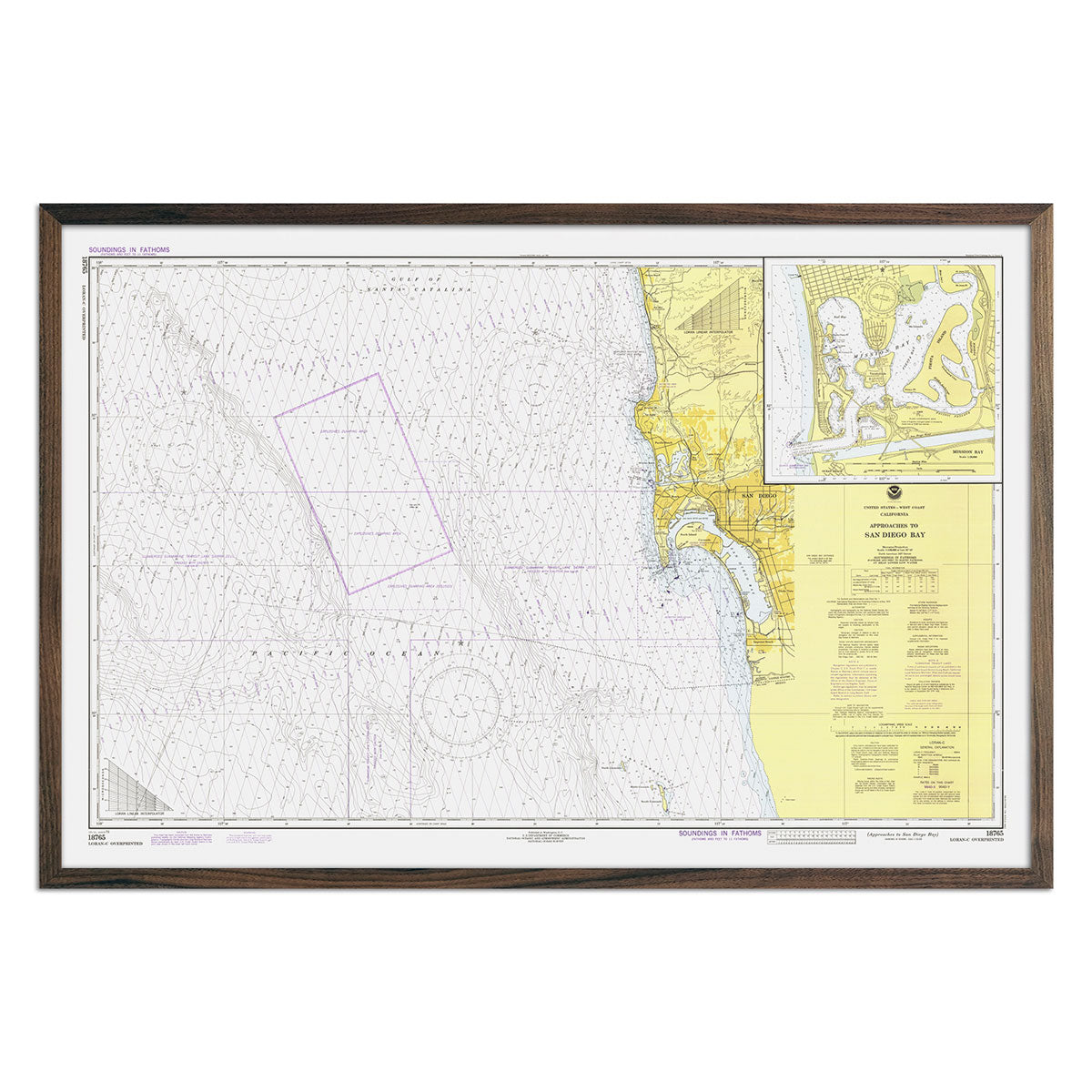
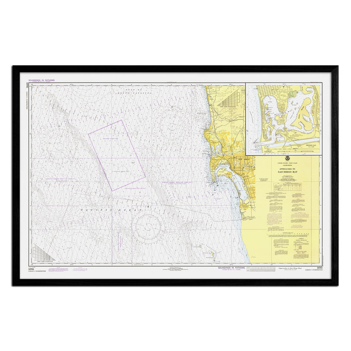
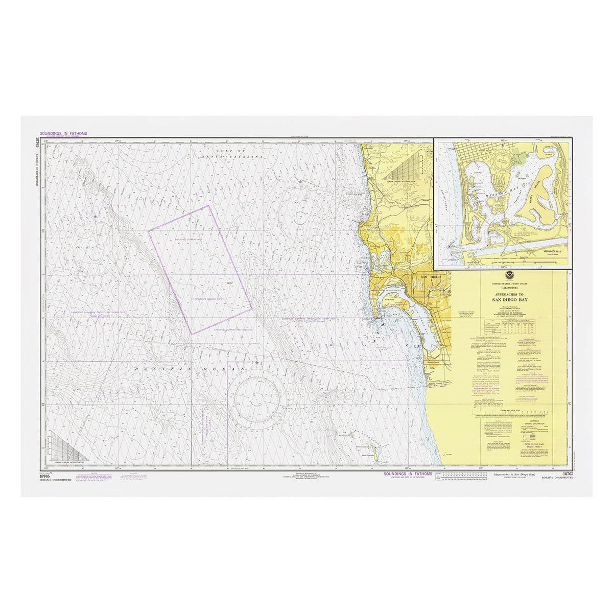
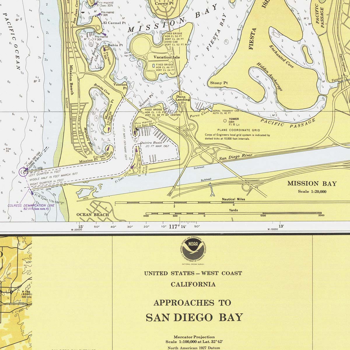
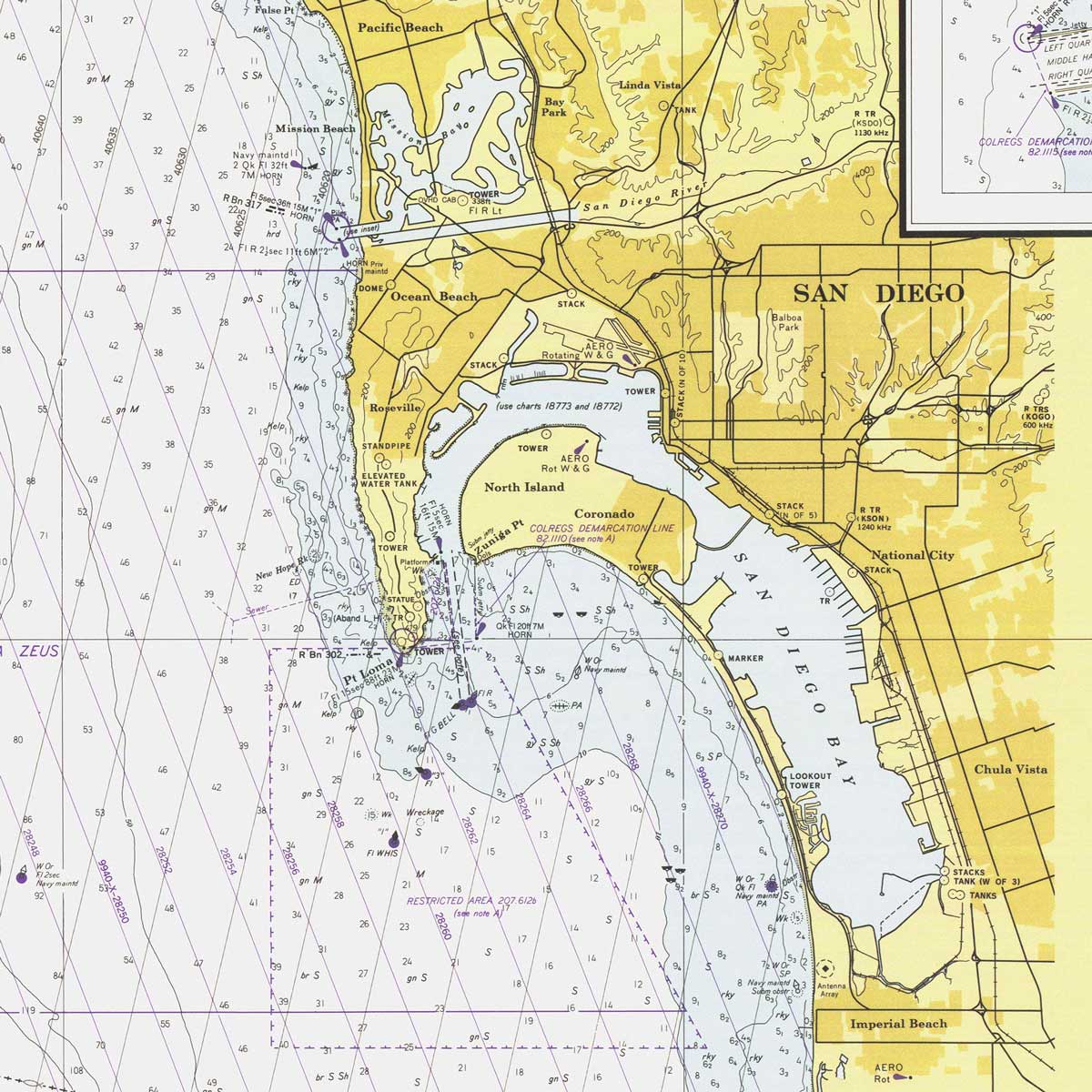
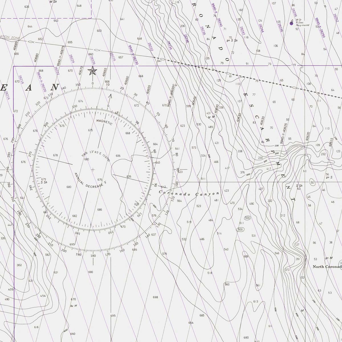
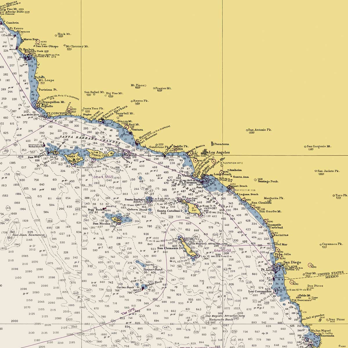
San Diego Bay Approaches Nautical Chart 1979
From
$ 71.10 USD
$ 79.00 USD
Sale
10% off
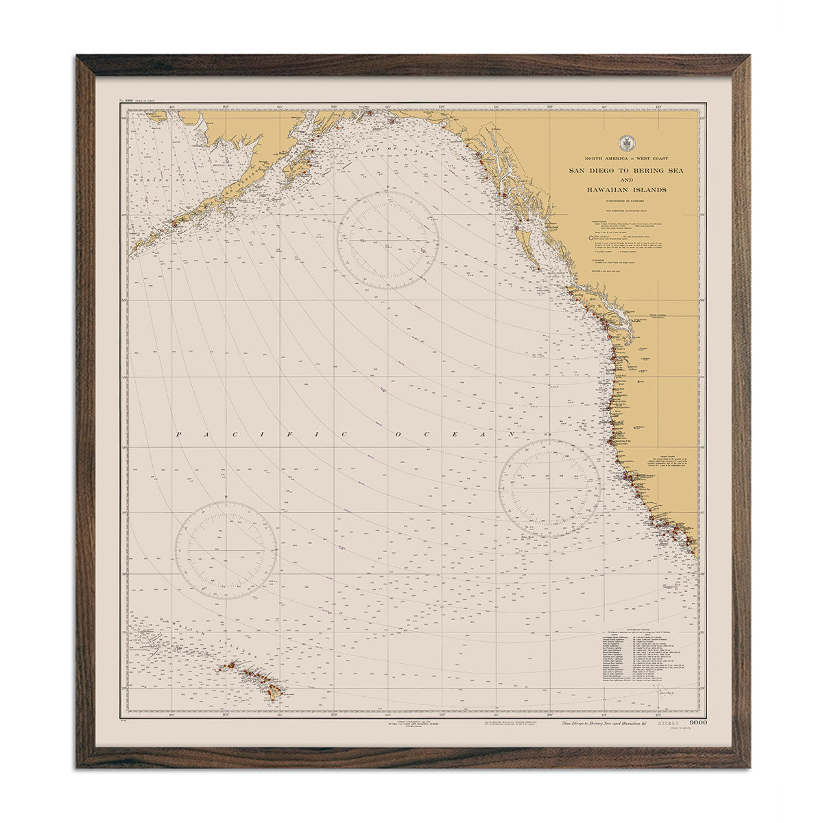
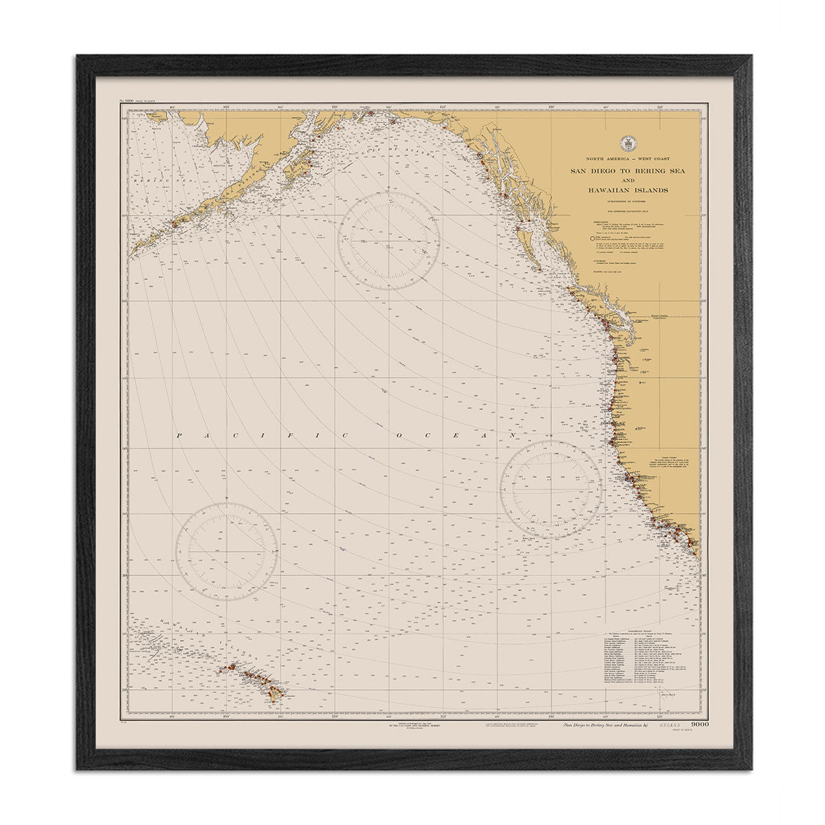
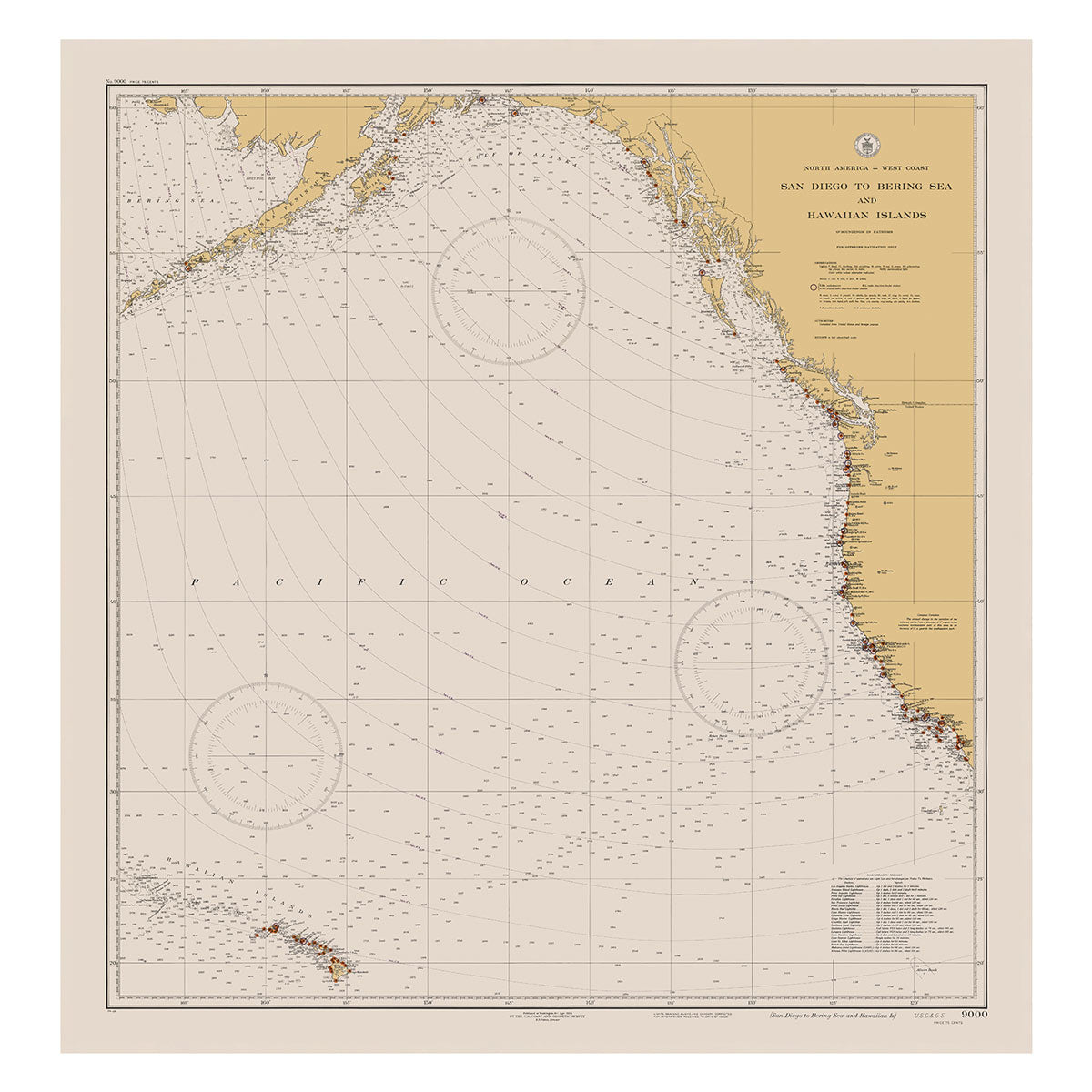
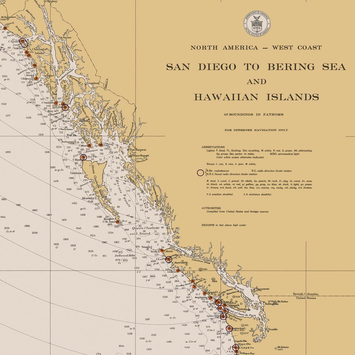
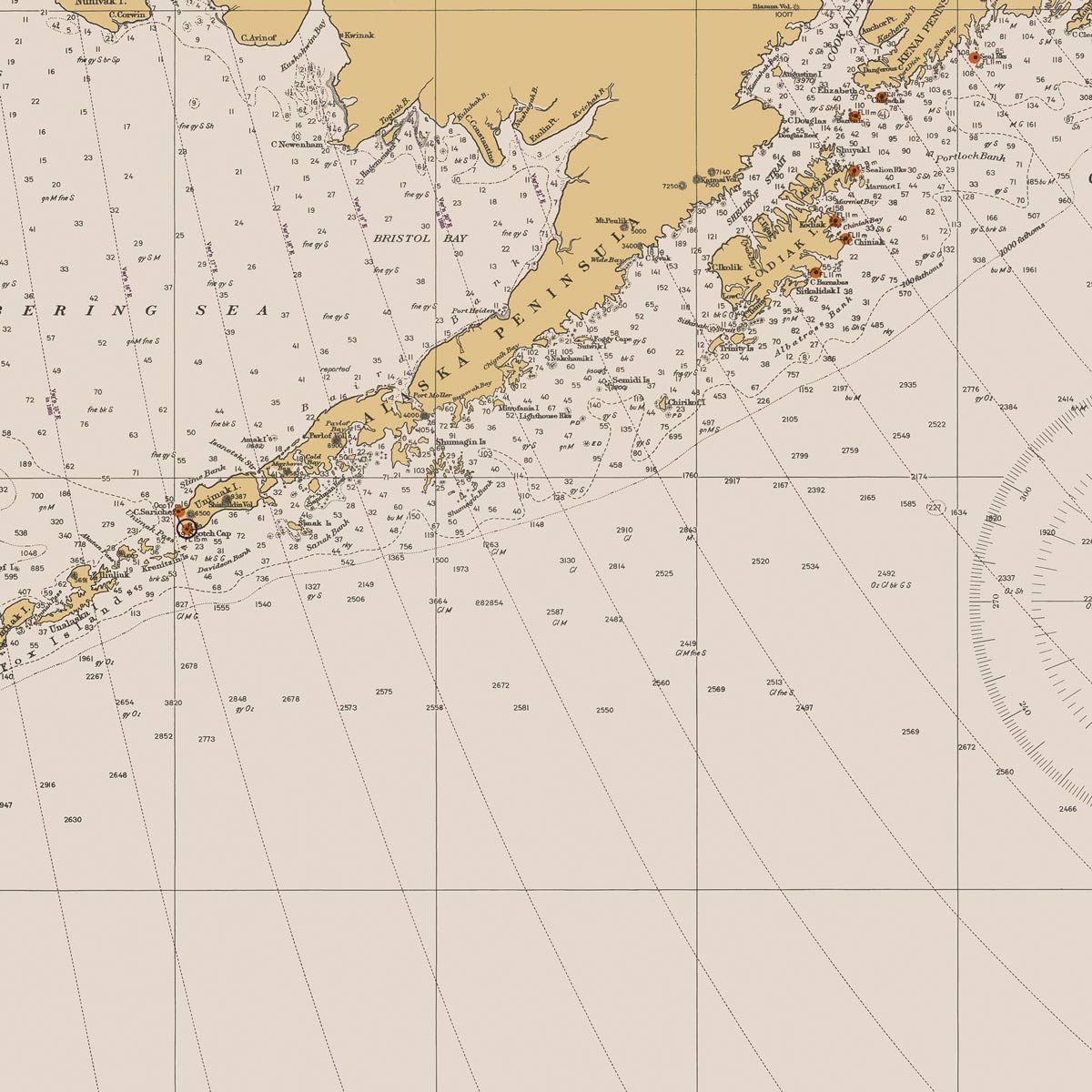
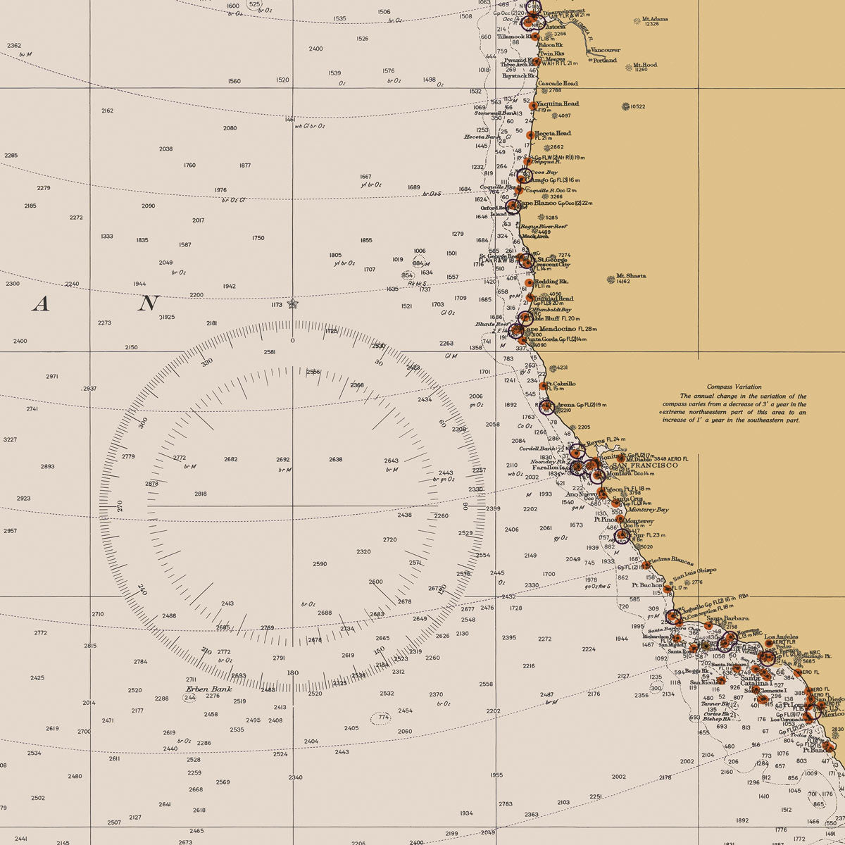
San Diego to Bering Sea and Hawaiian Islands Nautical Chart 1934
From
$ 80.10 USD
$ 89.00 USD
Sale
10% off
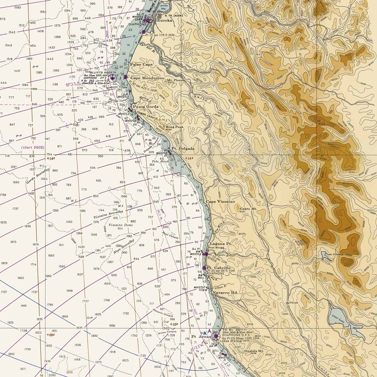
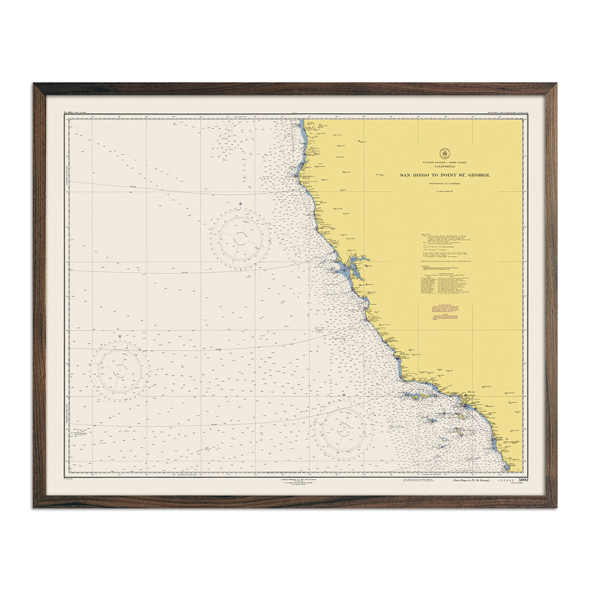
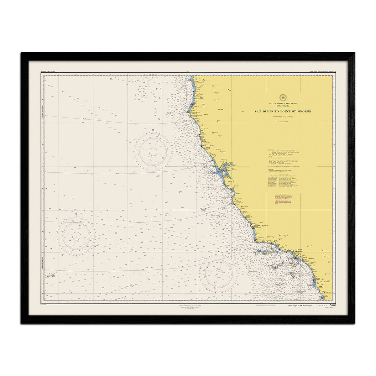
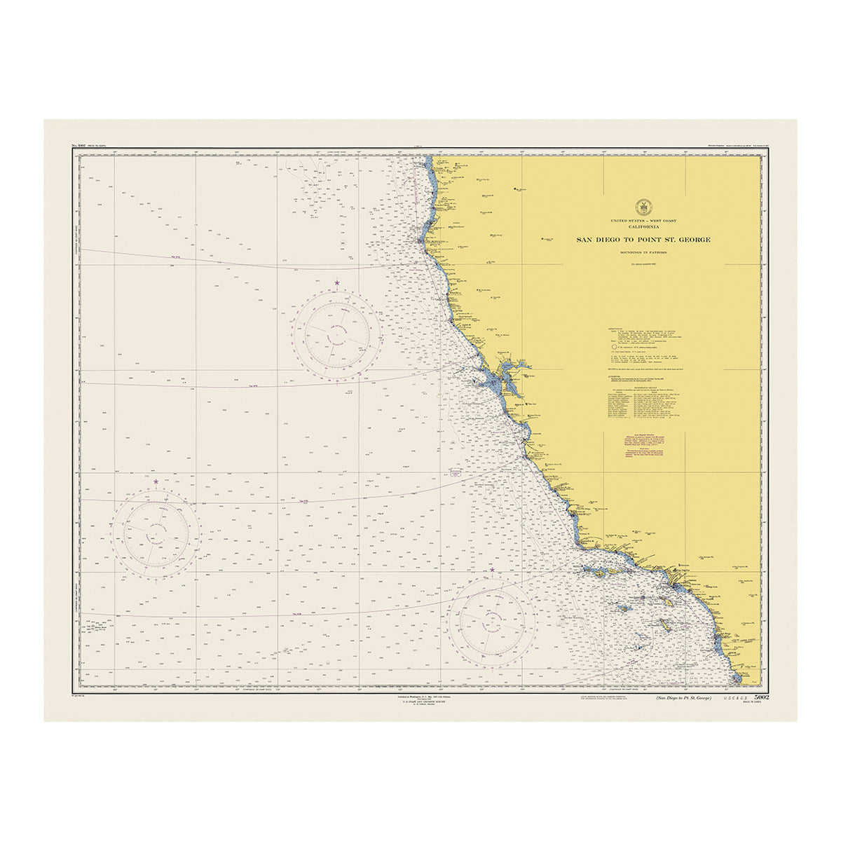
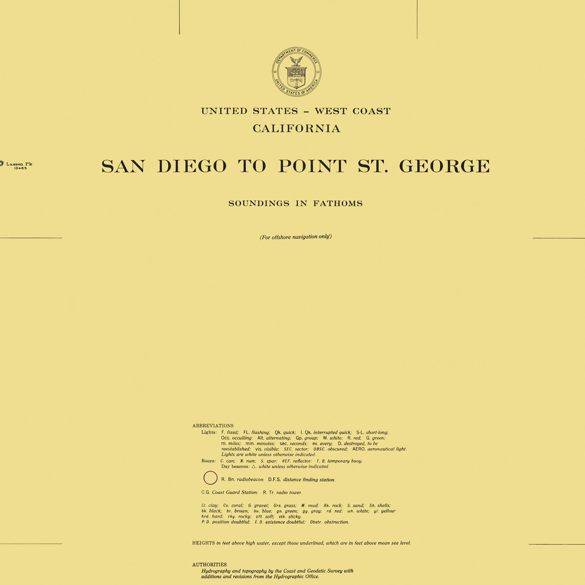
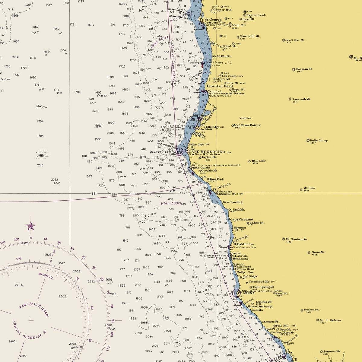
San Diego to Point St. George Nautical Chart 1948
From
$ 57.60 USD
$ 64.00 USD
Sale
10% off
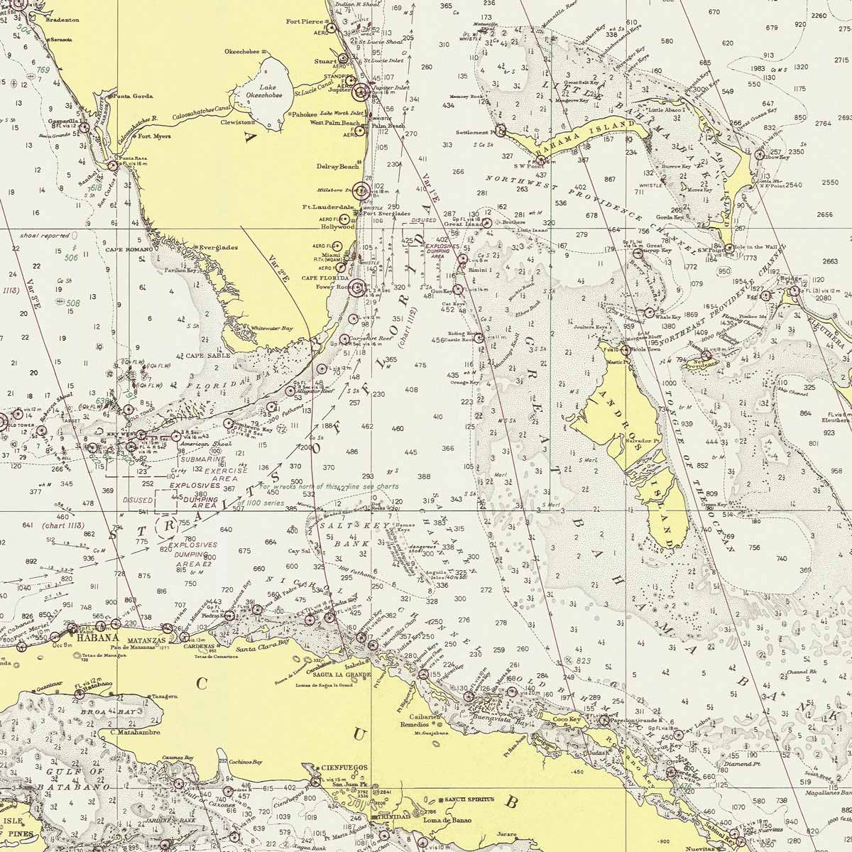
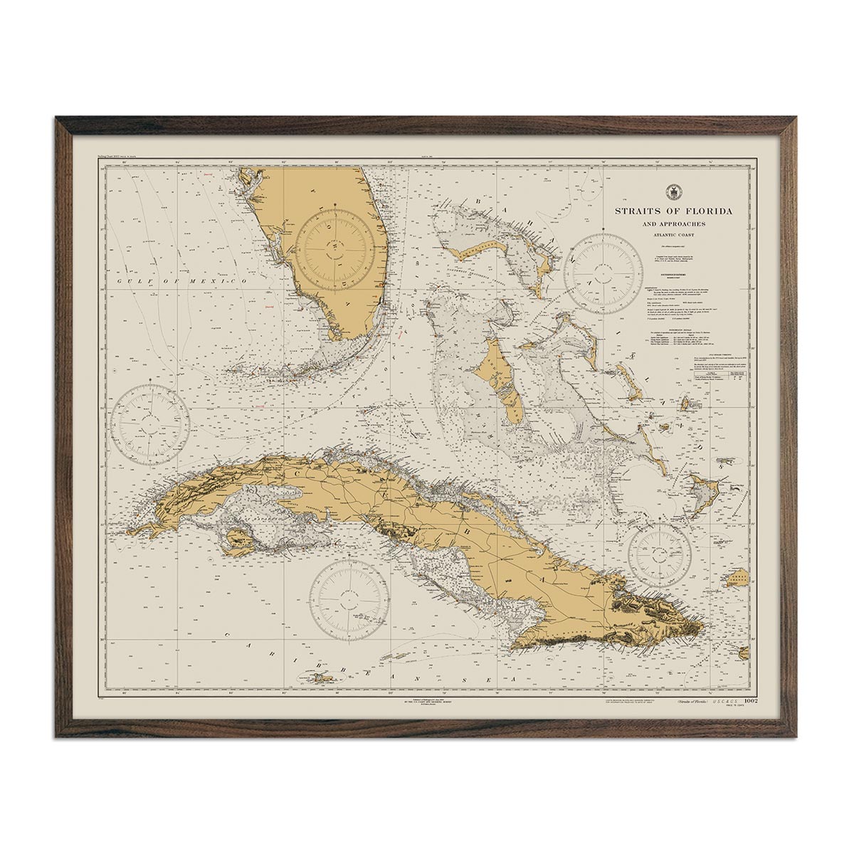
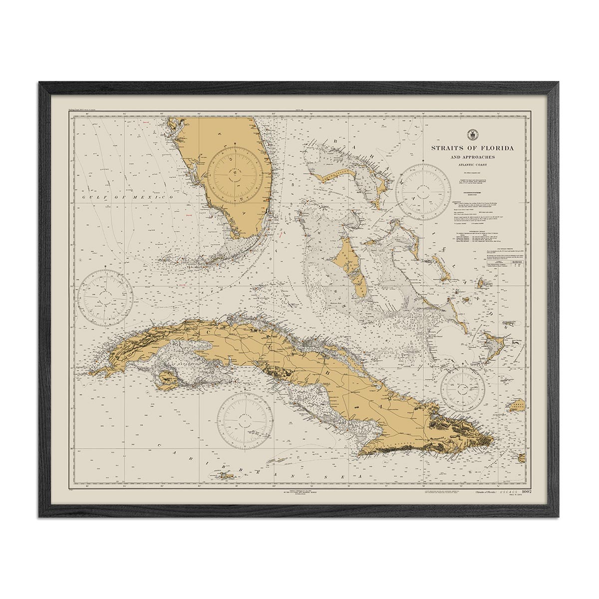
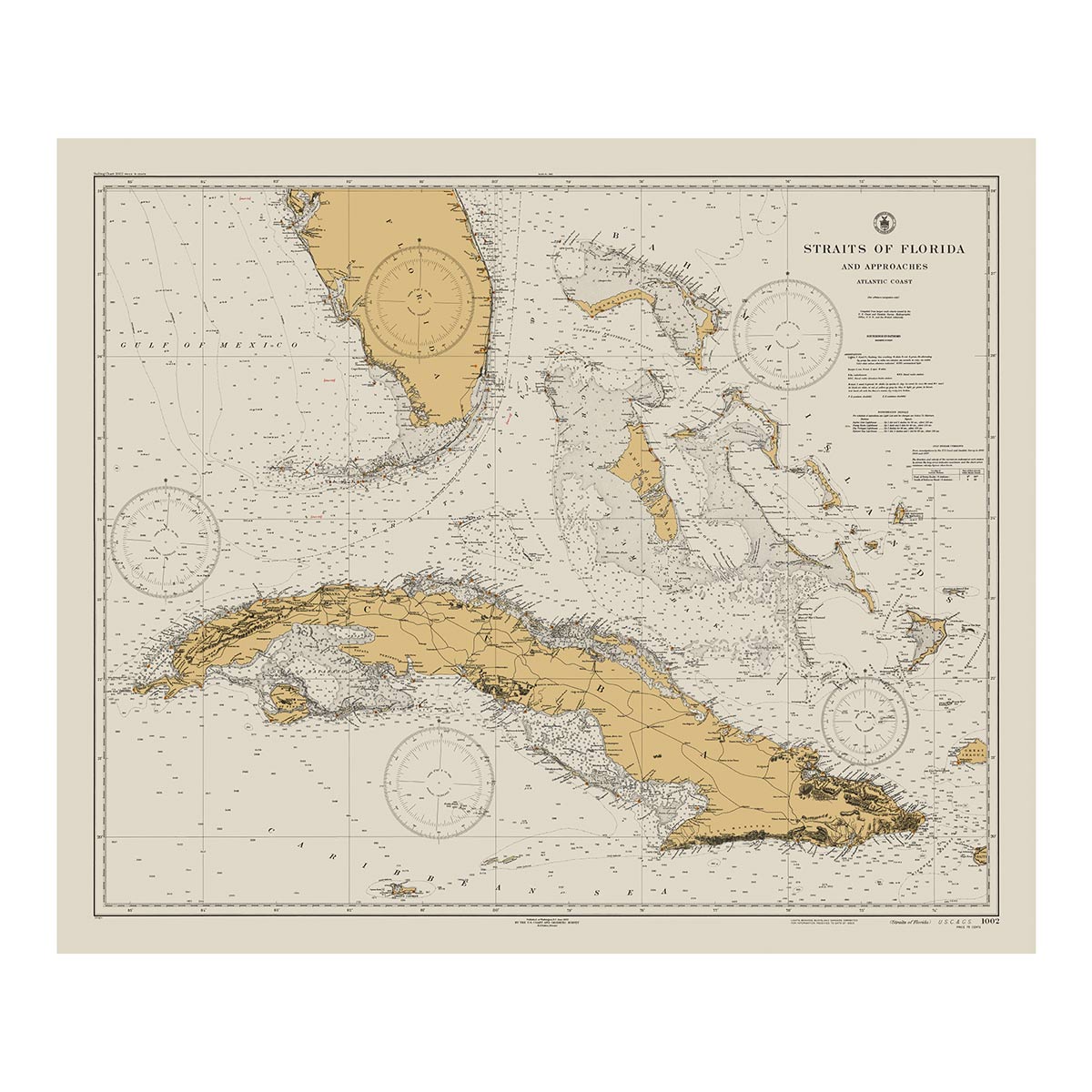
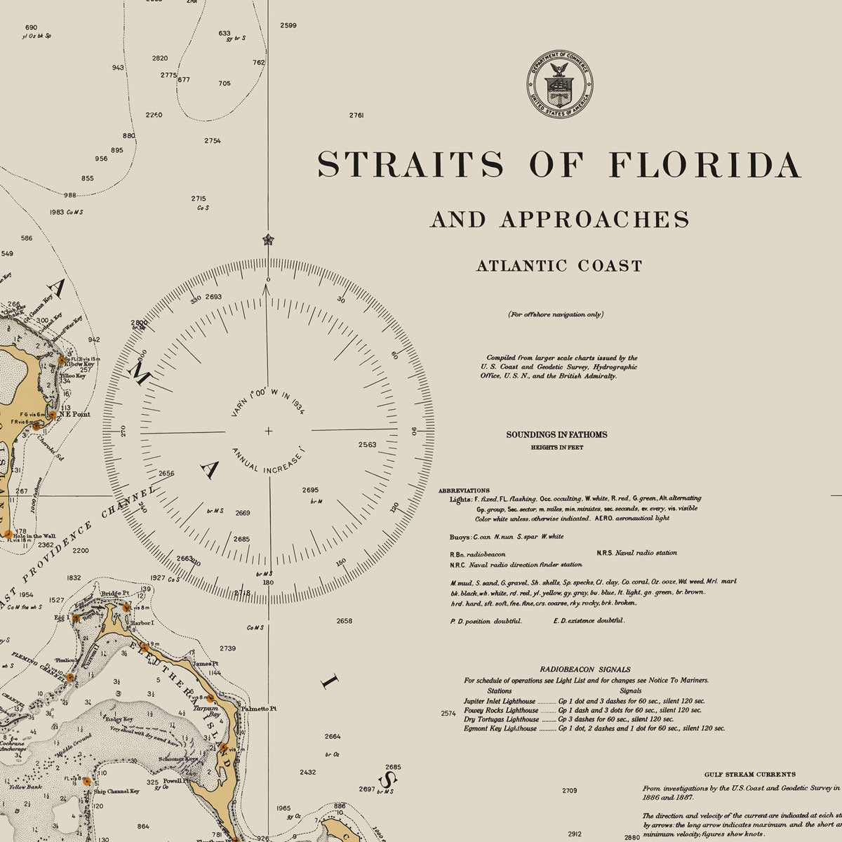
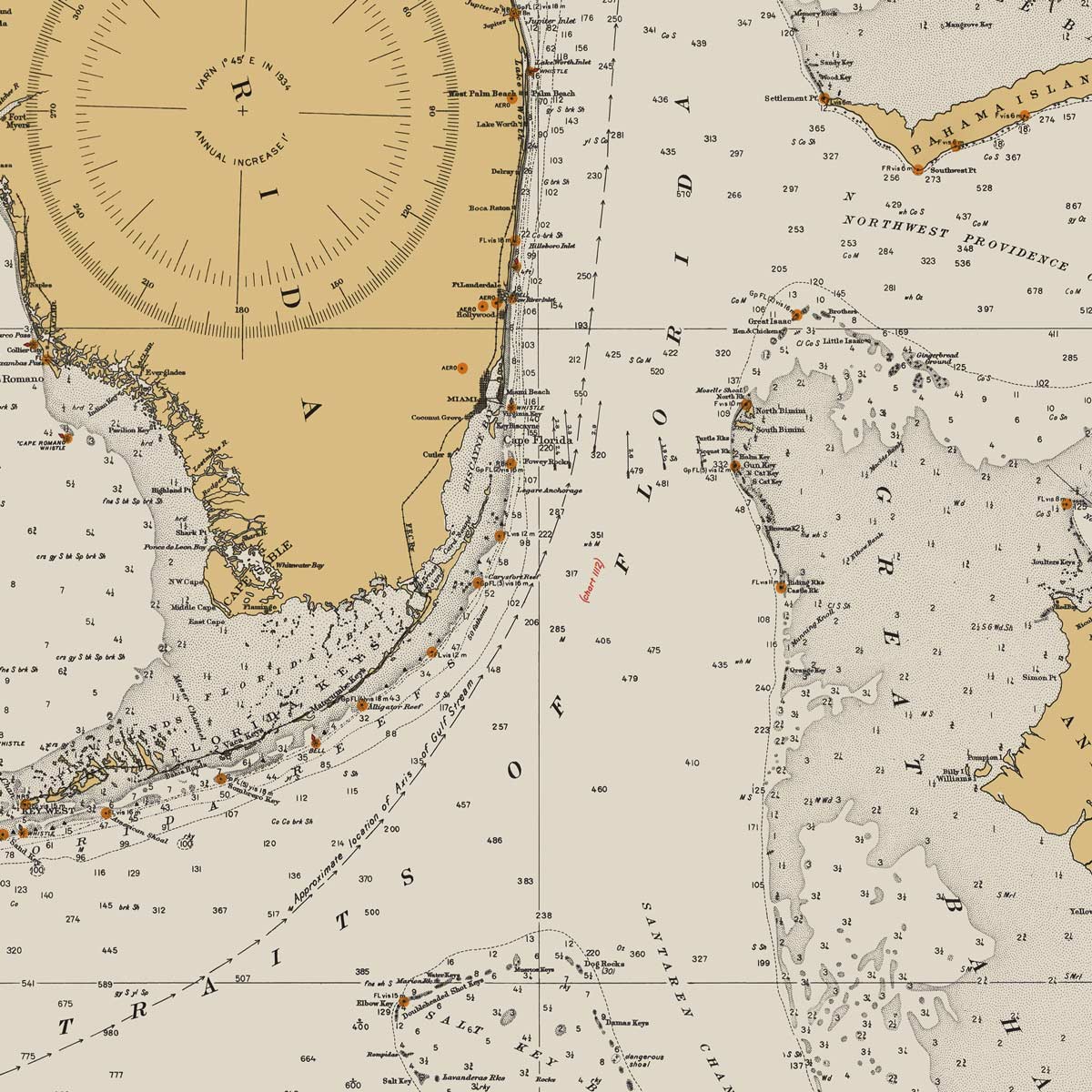
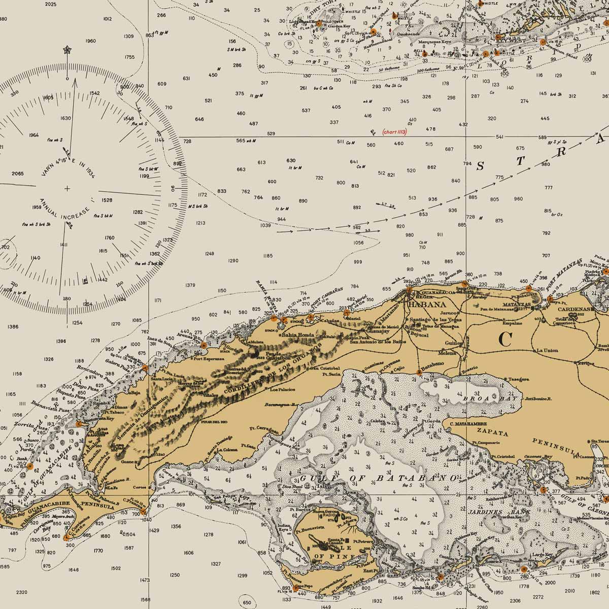
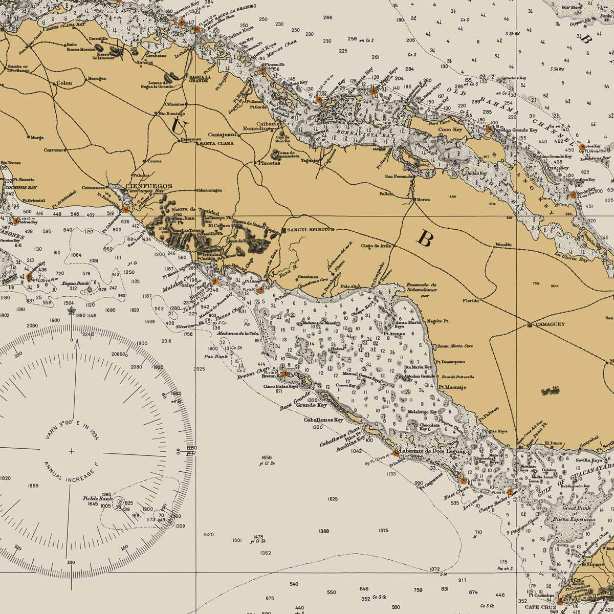
Straits of Florida Nautical Chart 1933
From
$ 71.10 USD
$ 79.00 USD
Sale
10% off
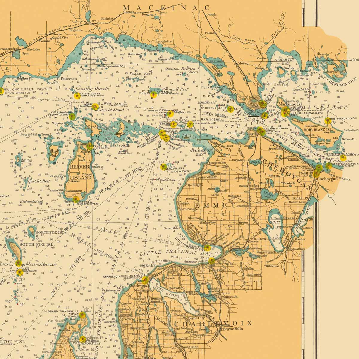
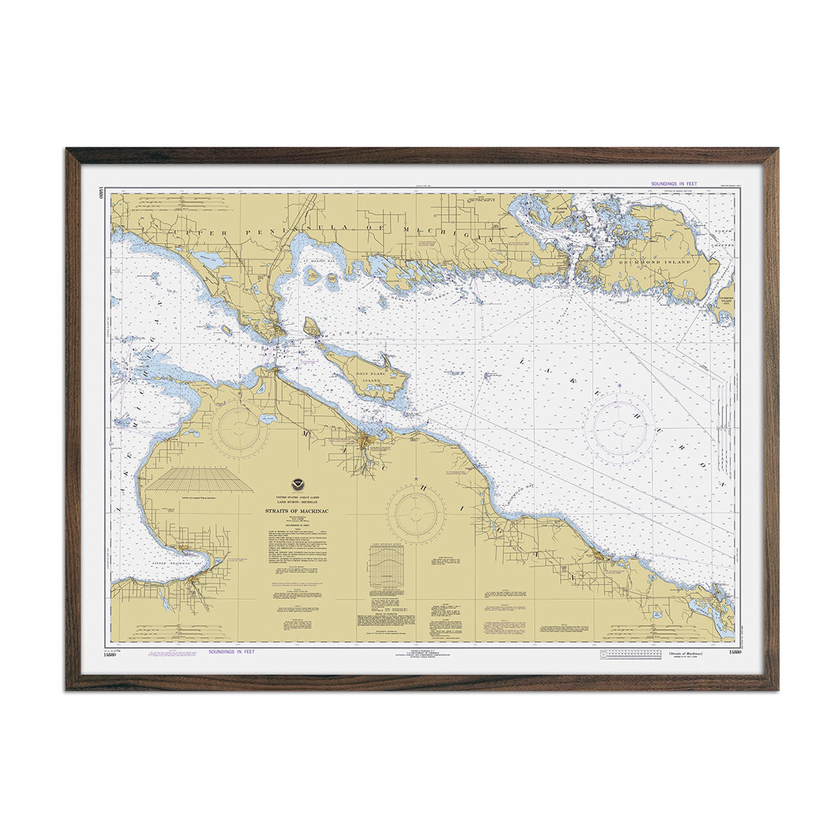
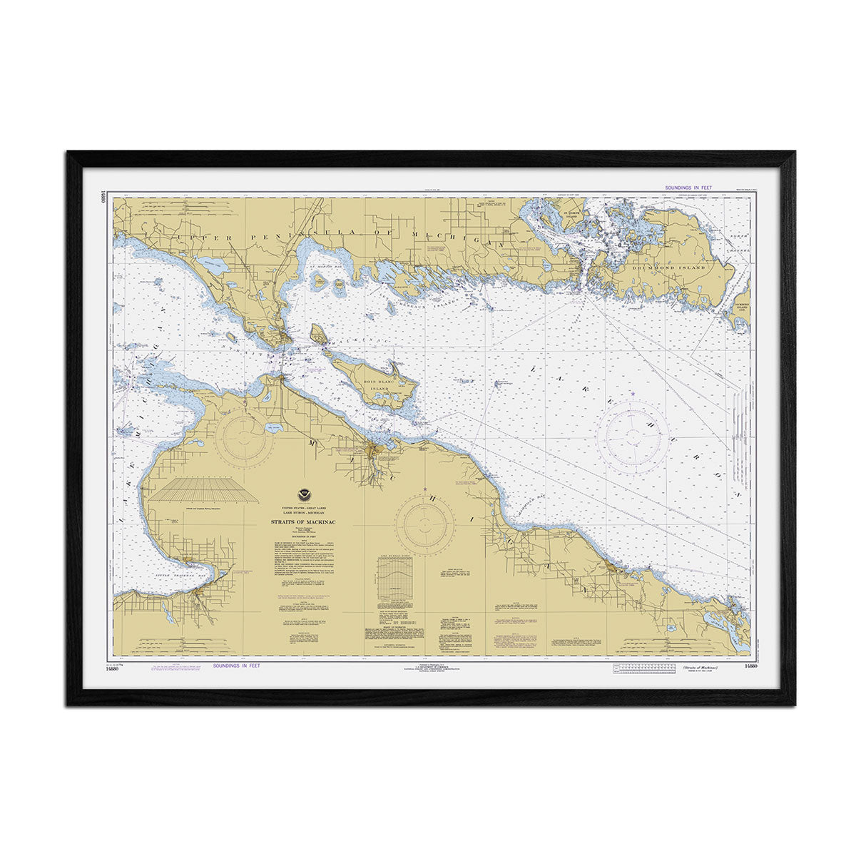
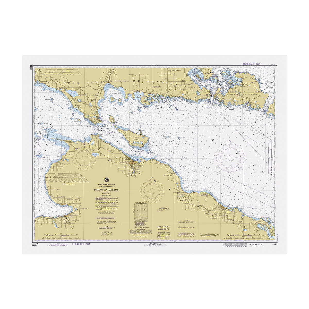
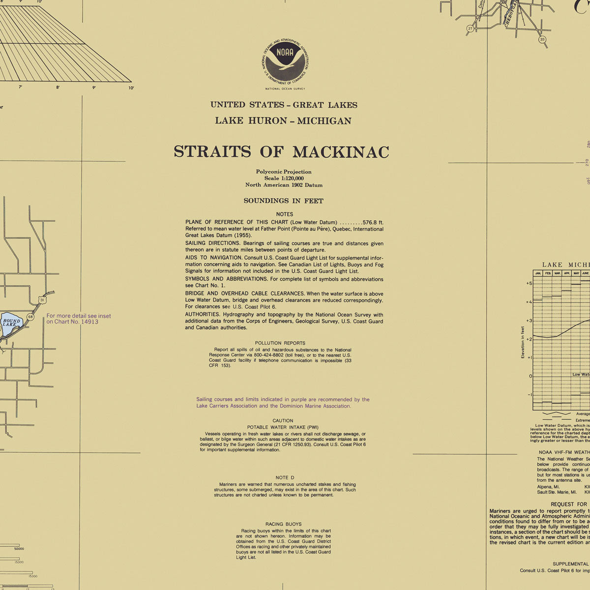
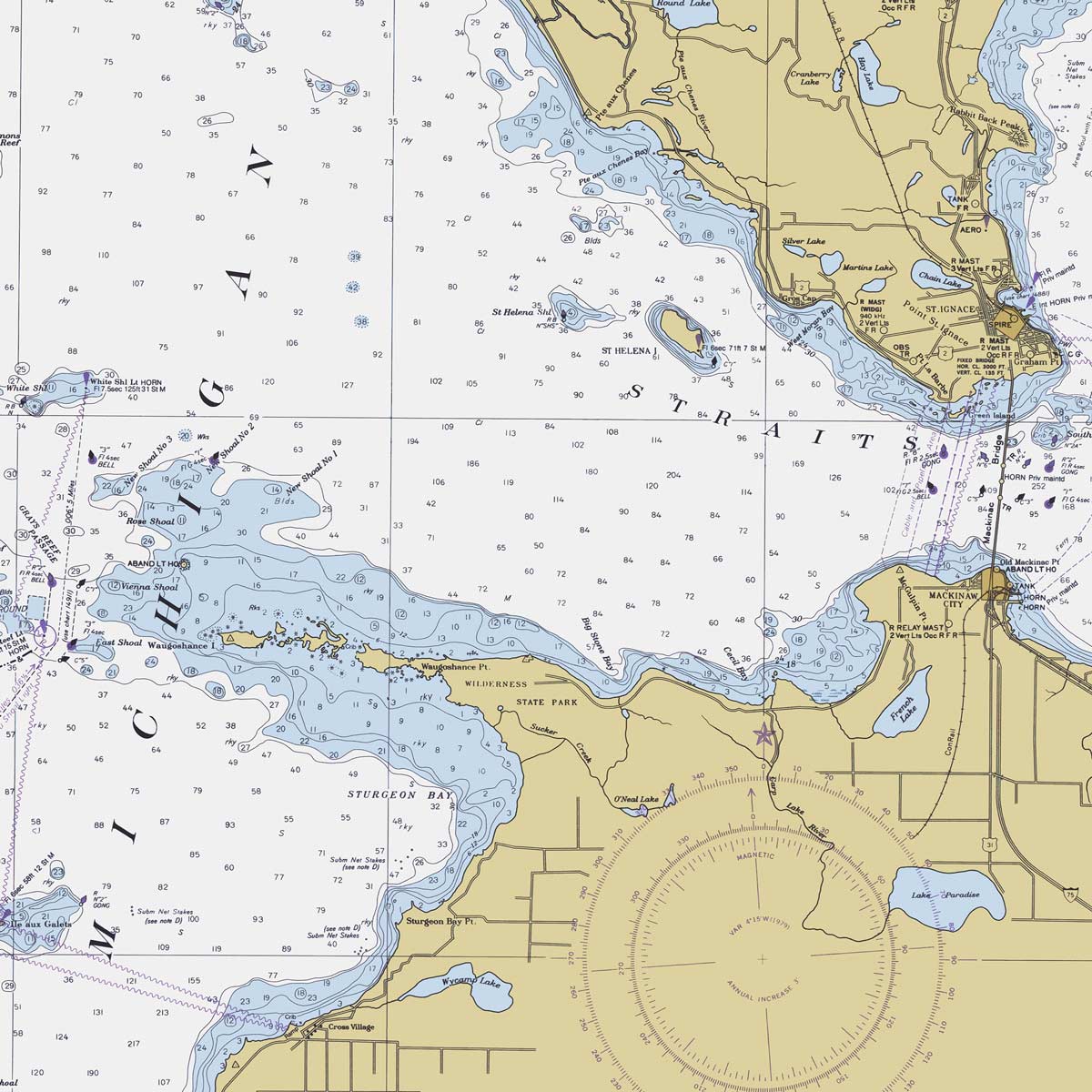
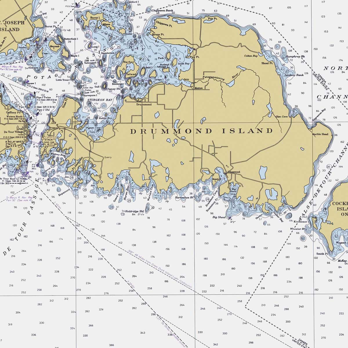
Straits of Mackinac Nautical Chart 1979
From
$ 71.10 USD
$ 79.00 USD
Sale
10% off
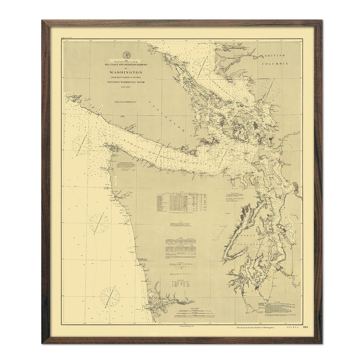
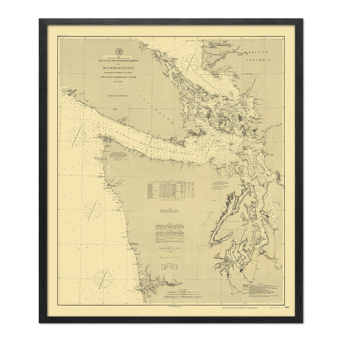
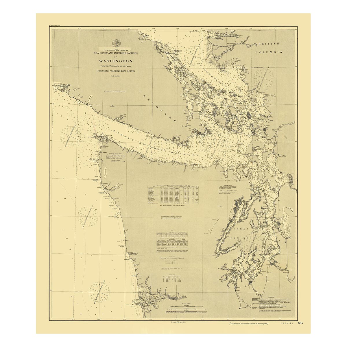
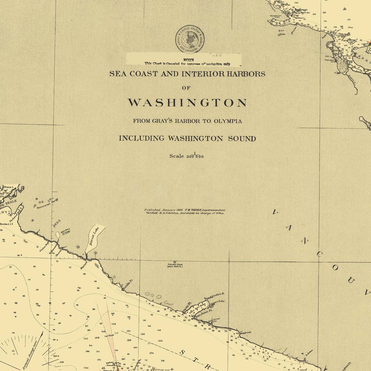
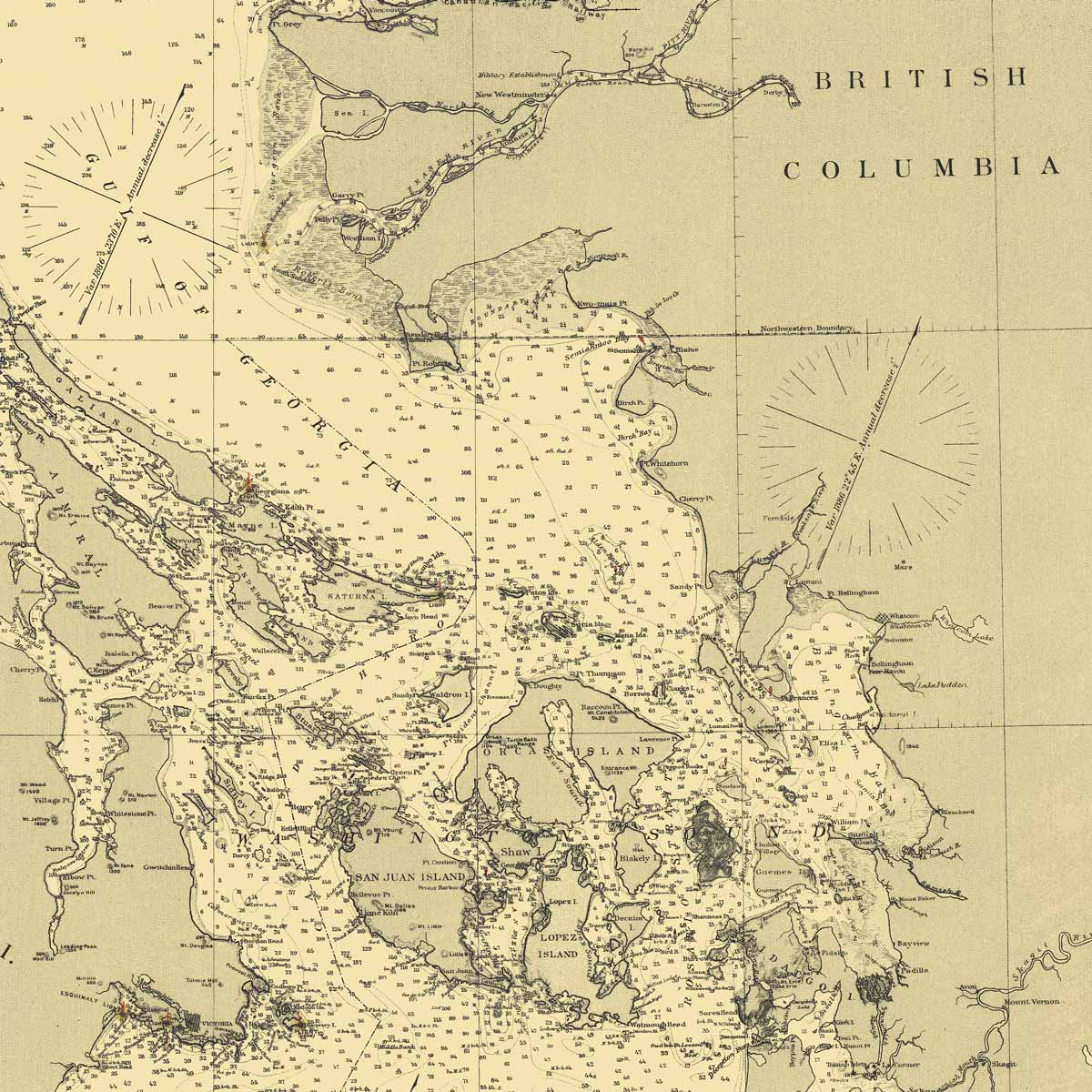
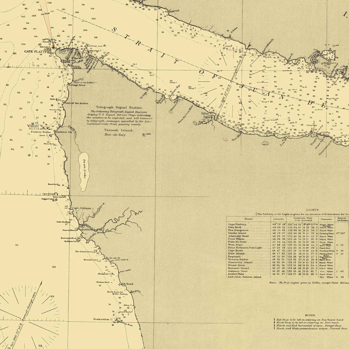
Washington Coast and Interior Harbors - Gray's Harbor to Olympia Nautical Chart 1888
From
$ 57.60 USD
$ 64.00 USD
Sale
Your cart
Close
Close
Your cart is empty
Start shopping
Added to your
Cart