


Iowa Maps


Iowa Map Prints, Elevation & Hydrological Maps
Our custom printed Iowa wall maps allow you to see the Hawkeye State in a whole new way. From our stunning elevation maps and geological relief maps to our meticulously restored historical maps, every product we offer reflects the high quality and attention to detail our customers have come to love and expect from Muir Way.
What makes Muir Way maps of Iowa unique?
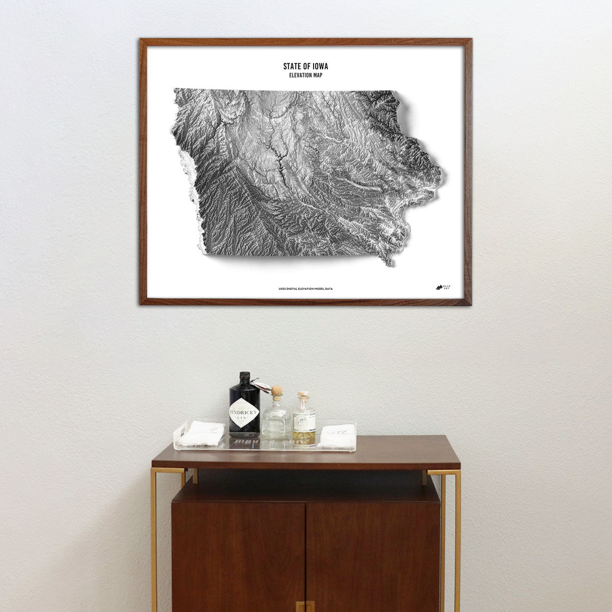
When you purchase a map of Iowa from Muir Way, you are not purchasing a rolled up poster. We custom print every Iowa map on 100% cotton fine art paper using archival inks certified to last 100 years. The artwork of our maps is designed to bring new light to the beautiful terrain they feature. For example, our elevation maps add hand-shaded relief and combine Digital Elevation Data with historical map imagery for a unique 3D effect on a flat surface, and our hydrological maps depict every river--even intermittent streams--and every body of water over 0.2 miles in diameter in crisp detail. At Muir Way, we make more than just maps--we create beautiful, heirloom-quality artwork meant to last for generations.
Can I get a custom framed Iowa map?
Yes! Many of our Iowa wall maps are available on both fine art paper and beautiful gallery-wrapped canvas, and all are available professionally custom-framed with real wood. Choose from several different colors and wood finishes to perfectly match your decor. Or, if you’d prefer to use your own frame, all of our maps are available unframed and come in standard sizes.
Does a Muir Way map of Iowa make a good gift idea?
A Muir Way map is a great gift idea. Our custom-printed maps are popular choices for everything from wedding gifts and to retirement gifts, graduation gifts, Christmas gifts, thank-you gifts, even corporate gifts. Our thousands of happy customer reviews are a testament to the quality we stand by when you purchase one of our maps as a gift.
How should I display my Iowa map?
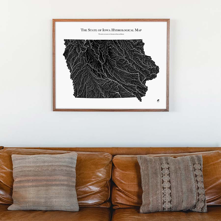
Our maps are designed to offer something new whether viewing up close or from across the room. Hang a framed Iowa map as a central focus, or purchase several regional maps and arrange them near each other for a complementary series. Our hydrological maps come in several colors or the quintessential black and white, and our geological relief maps feature bolder colors. No matter which you choose, you’re sure to find an Iowa illustration that will work for you.
What are the different types of maps of Iowa available on Muir Way?
Our Iowa maps are available in several different styles, including:
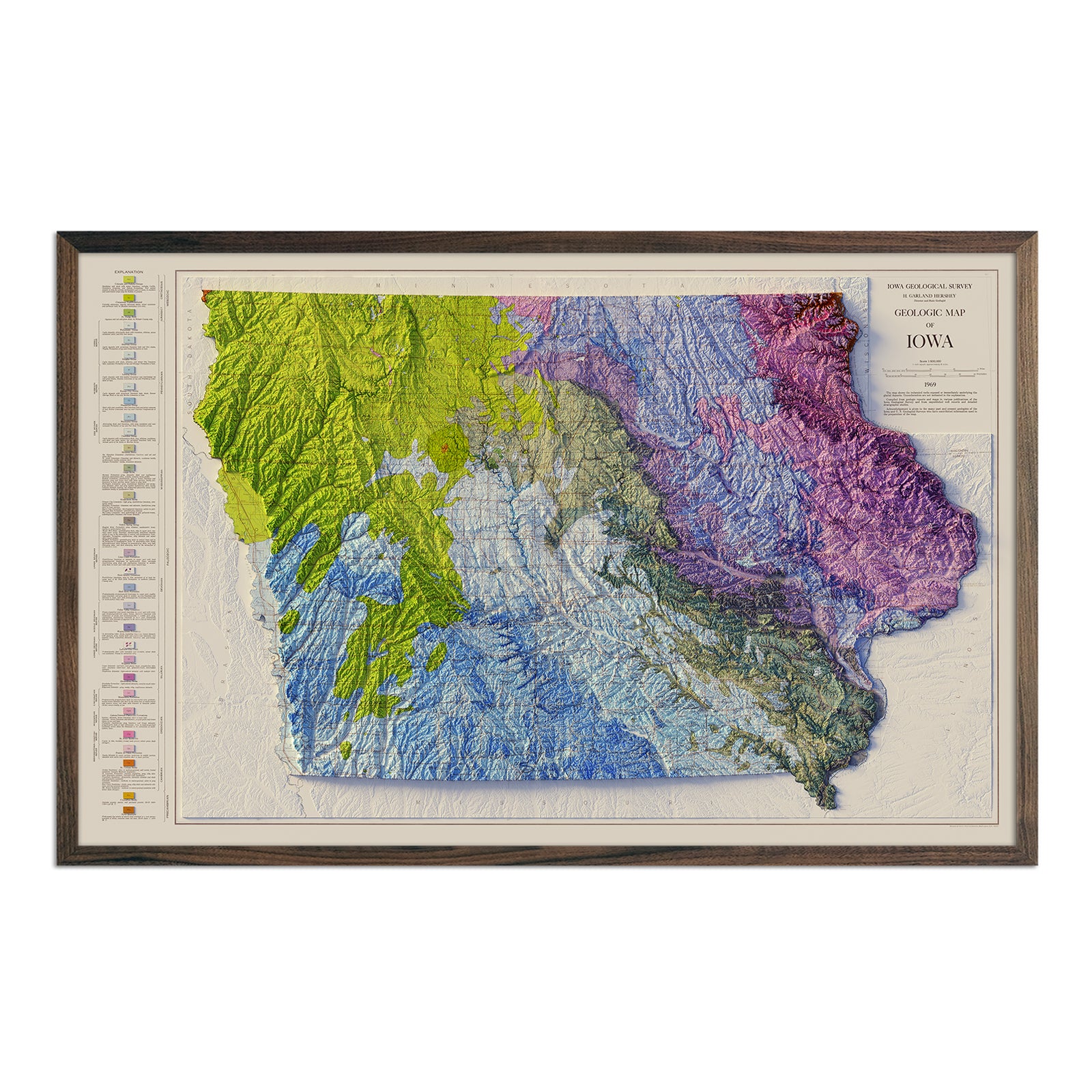
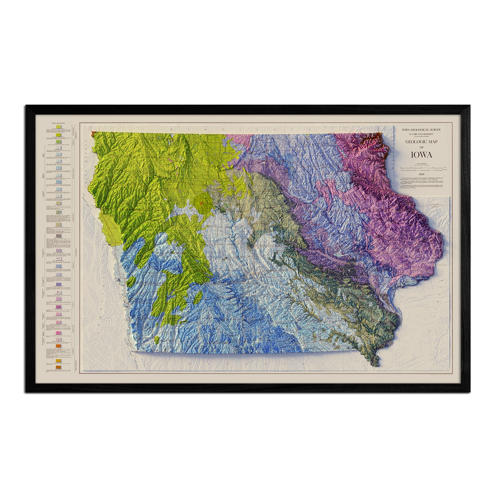
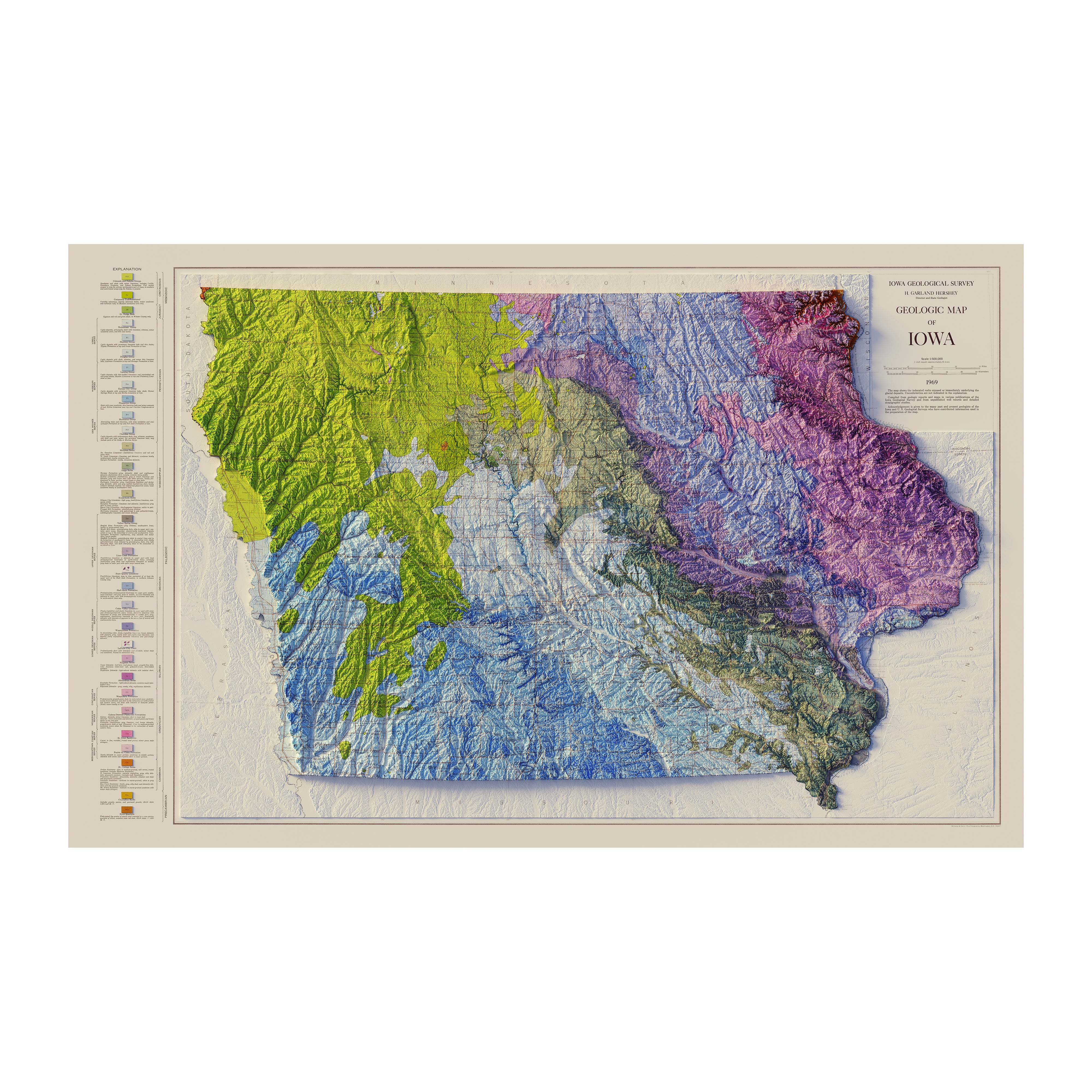
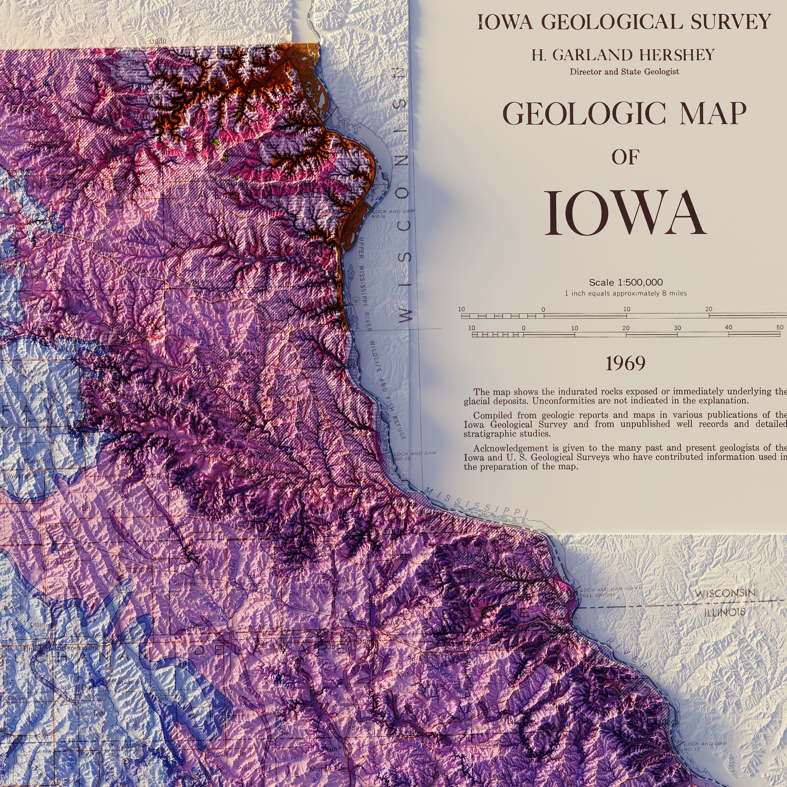
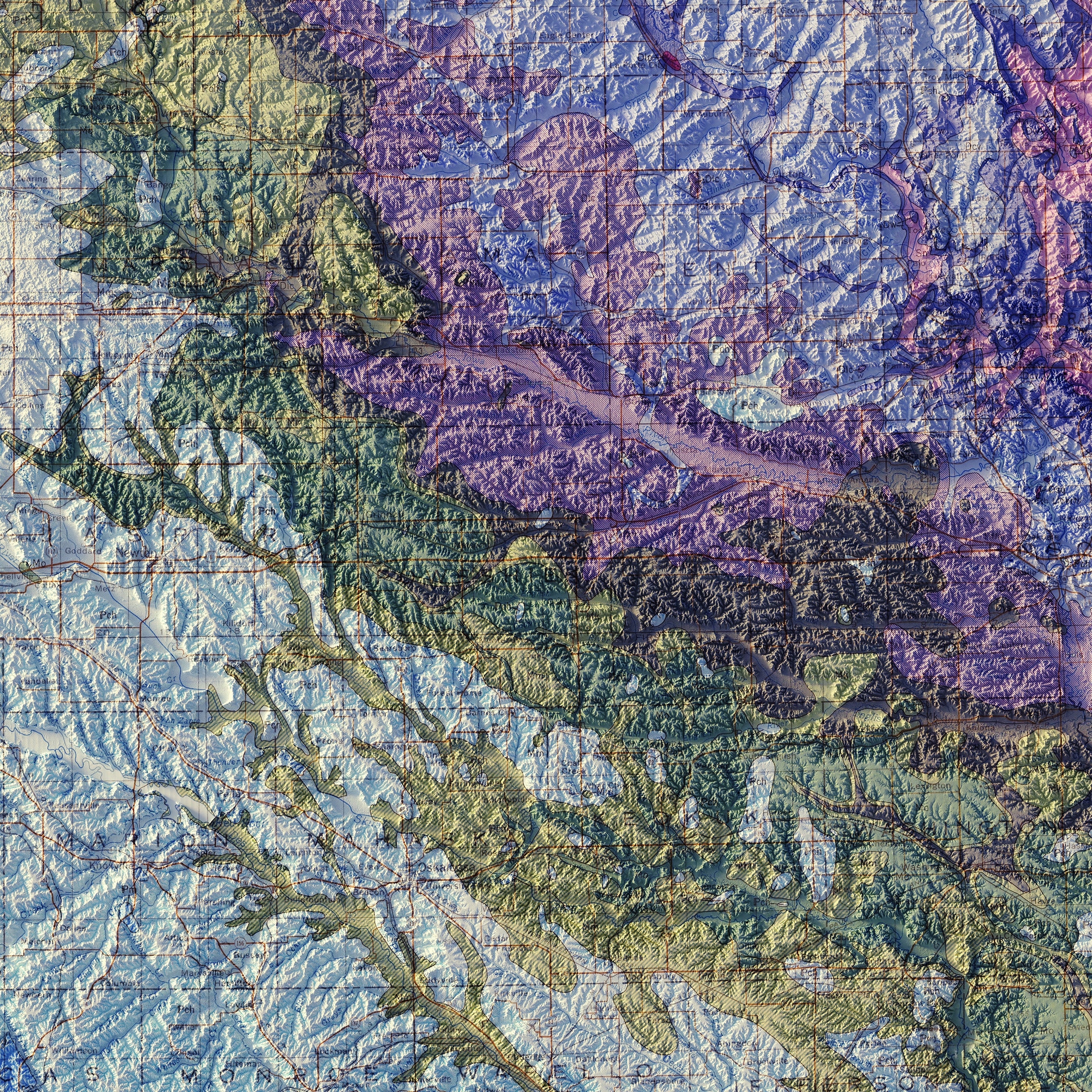
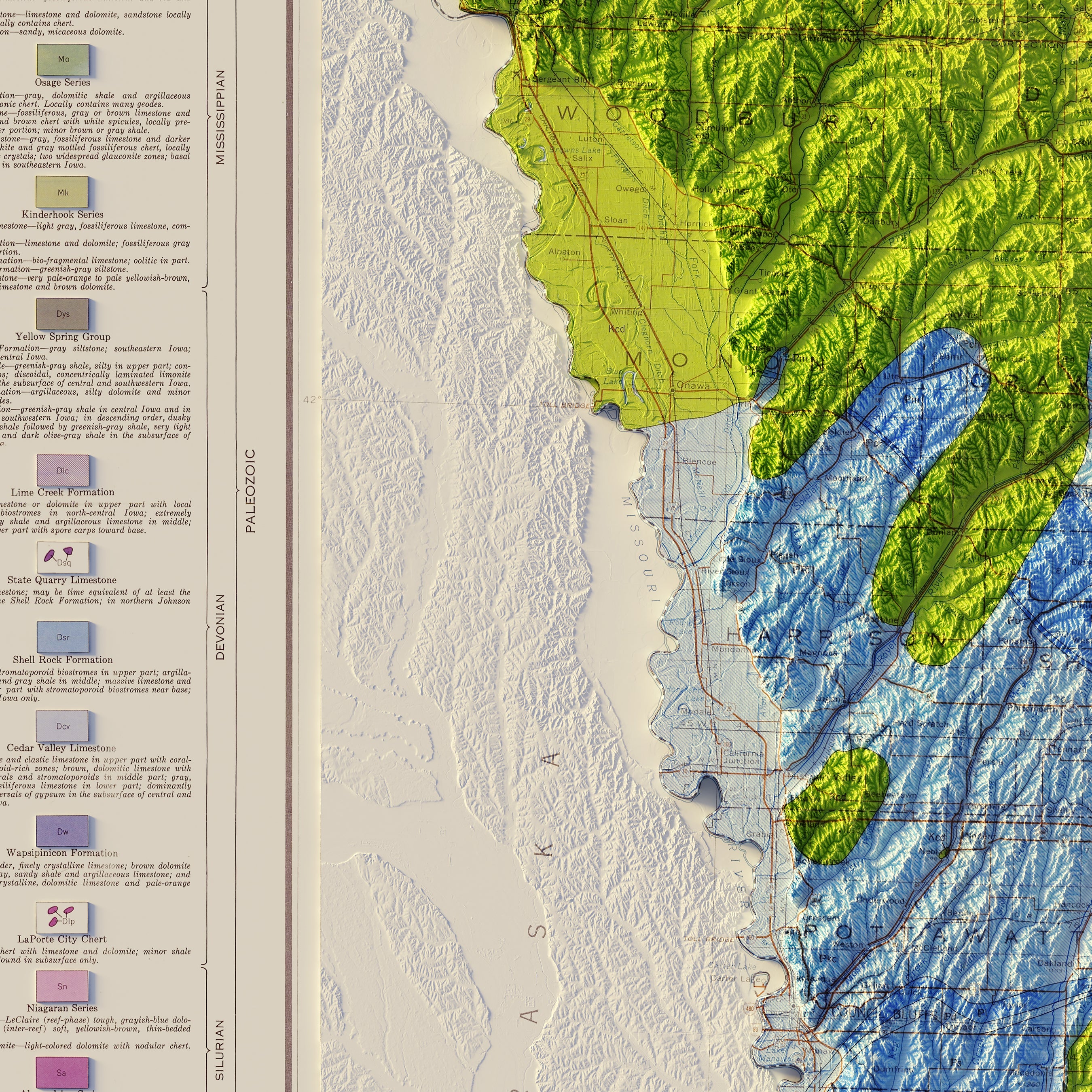
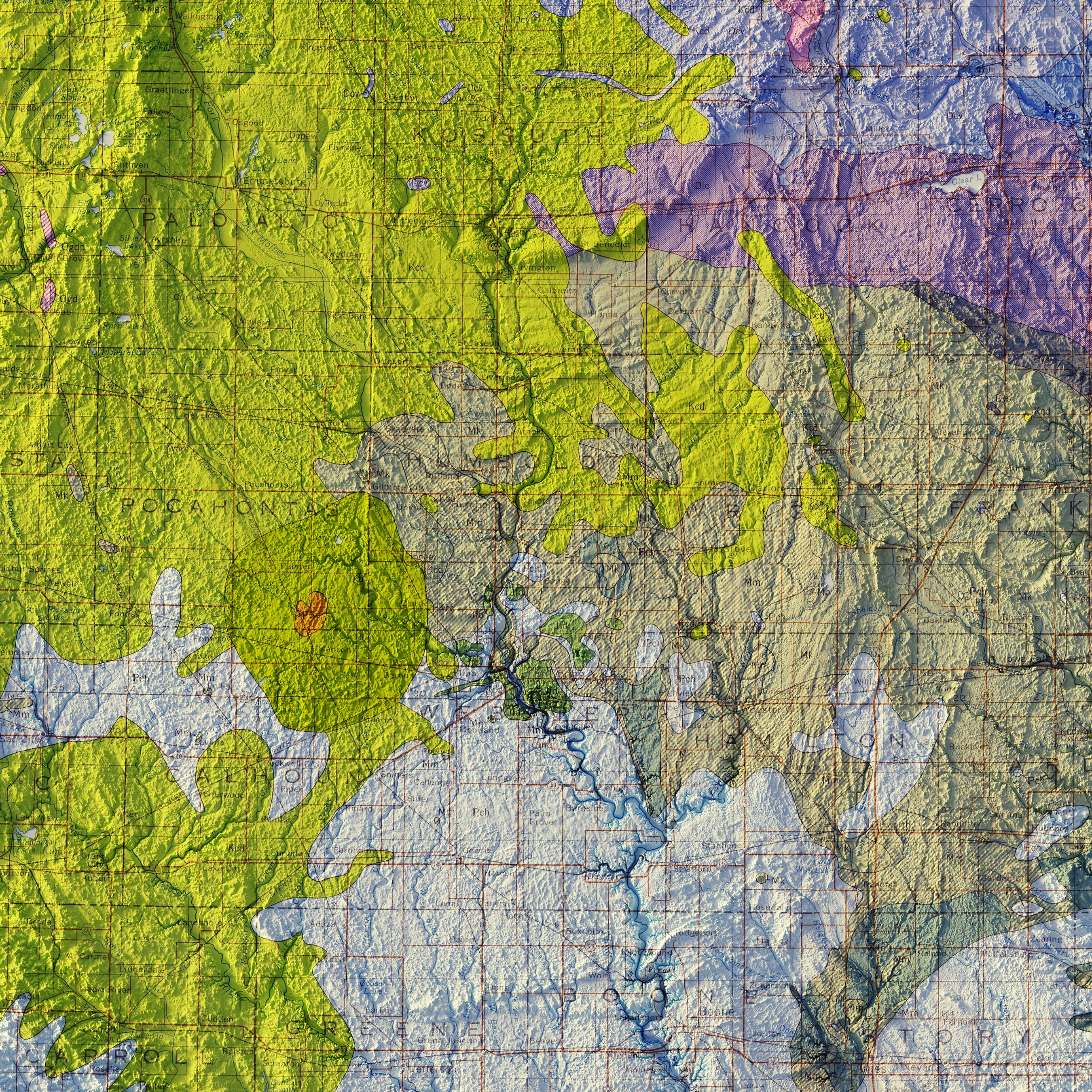
Iowa relief map - Our enhanced vintage Iowa relief map combines historical map landscapes with modern technology to display Iowa’s topography in an exciting new way. Using Digital Elevation Data and hand-shaded relief, we custom enhance a 1969 map of Iowa to bring a vibrant visual “pop” that looks three-dimensional but is completely flat.
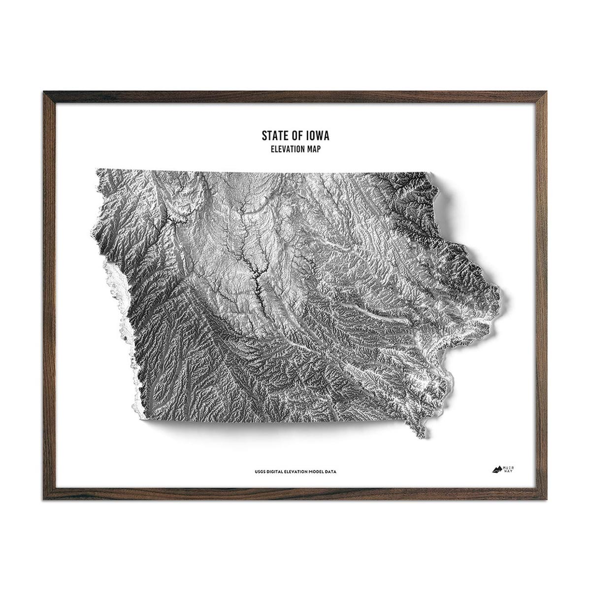
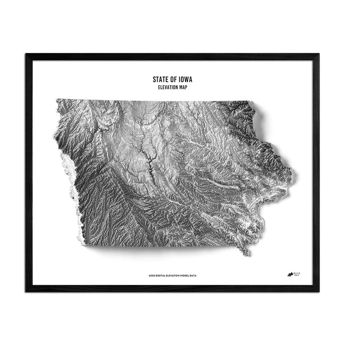
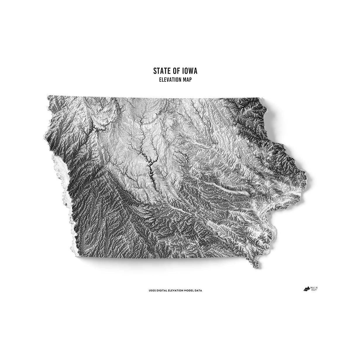
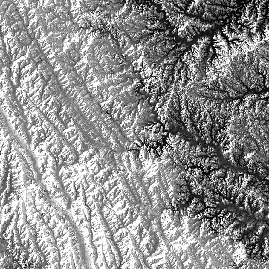
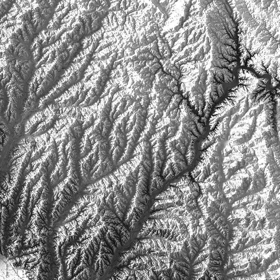
Iowa elevation map - Like our relief map, our state of Iowa elevation map also uses Digital Elevation Data from the USGS to create a high-contrast 3-dimensional effect, but this time in stunning black and white without the additional color key and map text.
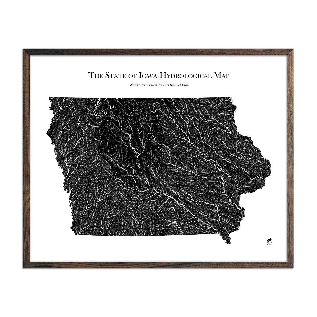
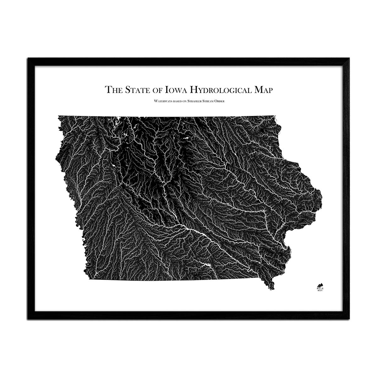
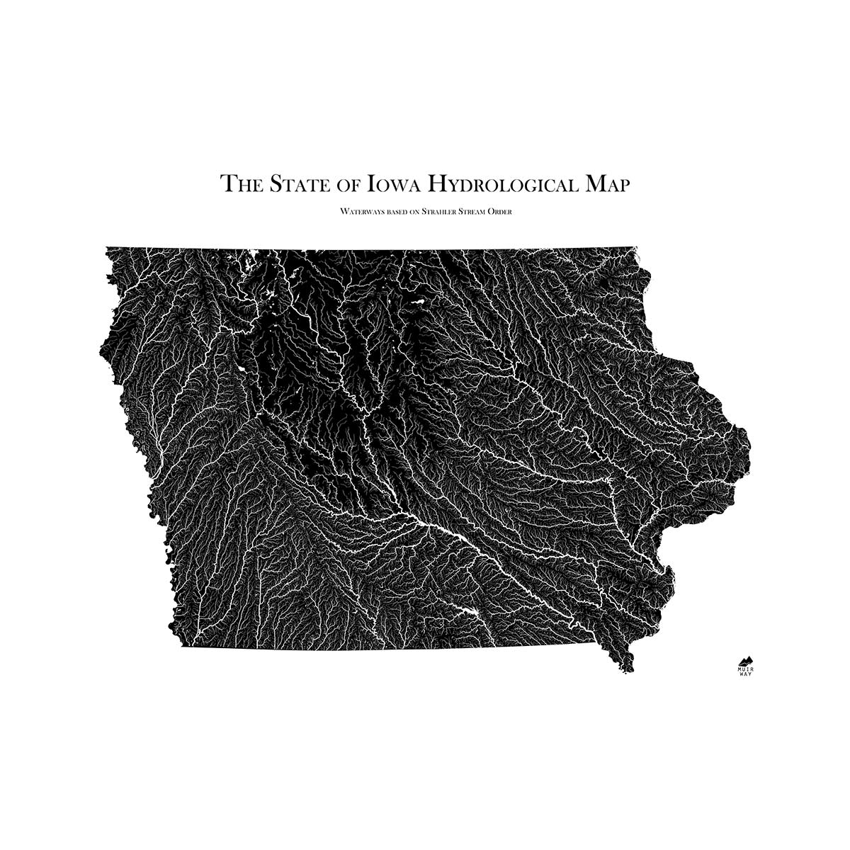
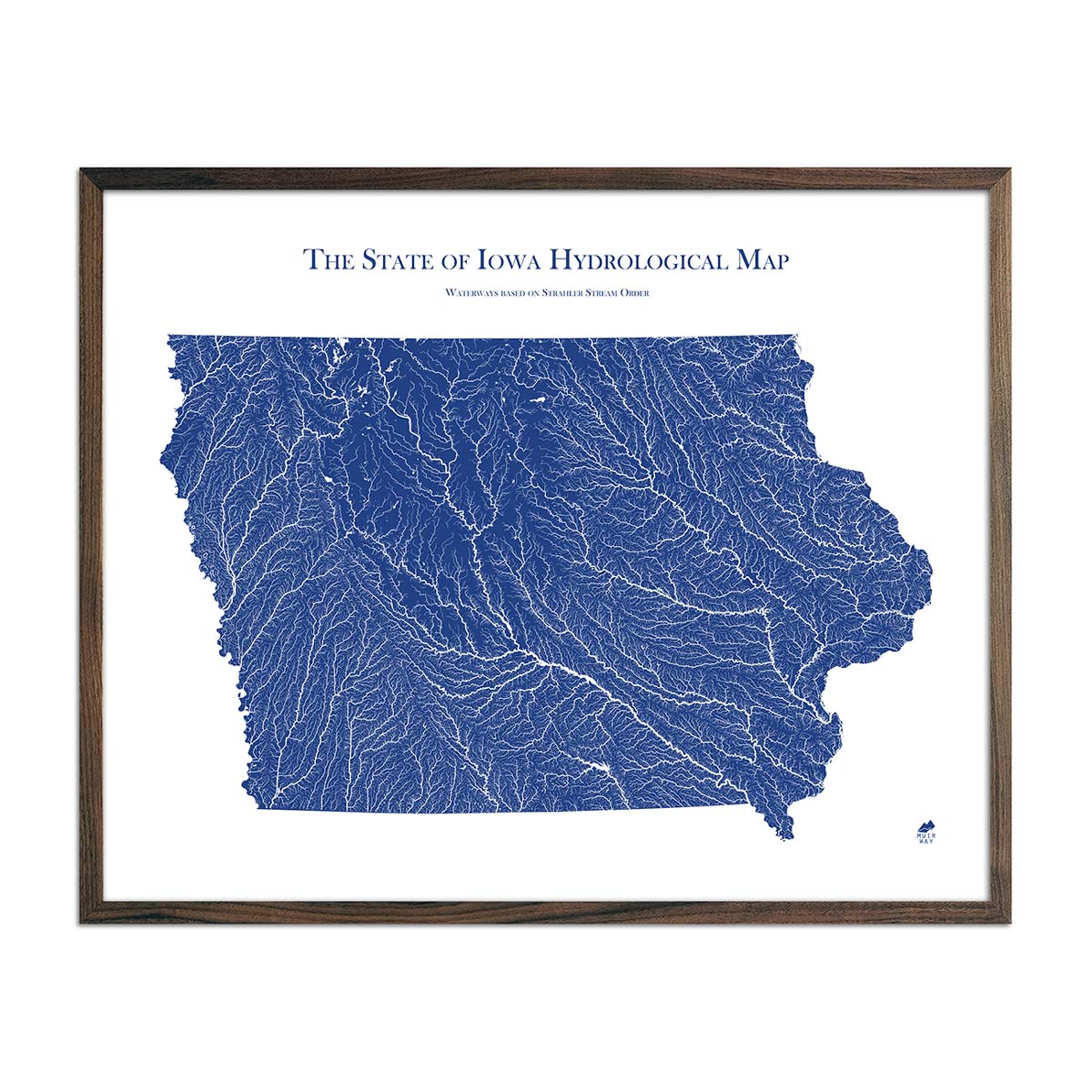
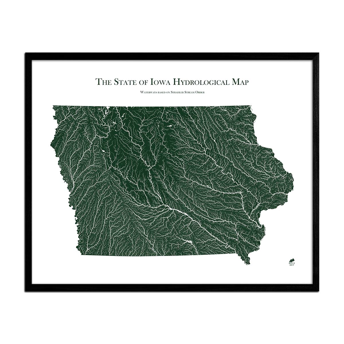
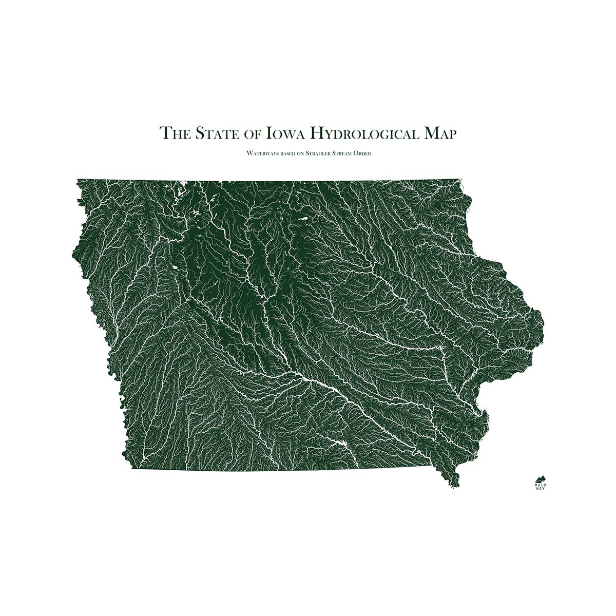
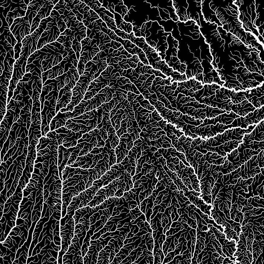
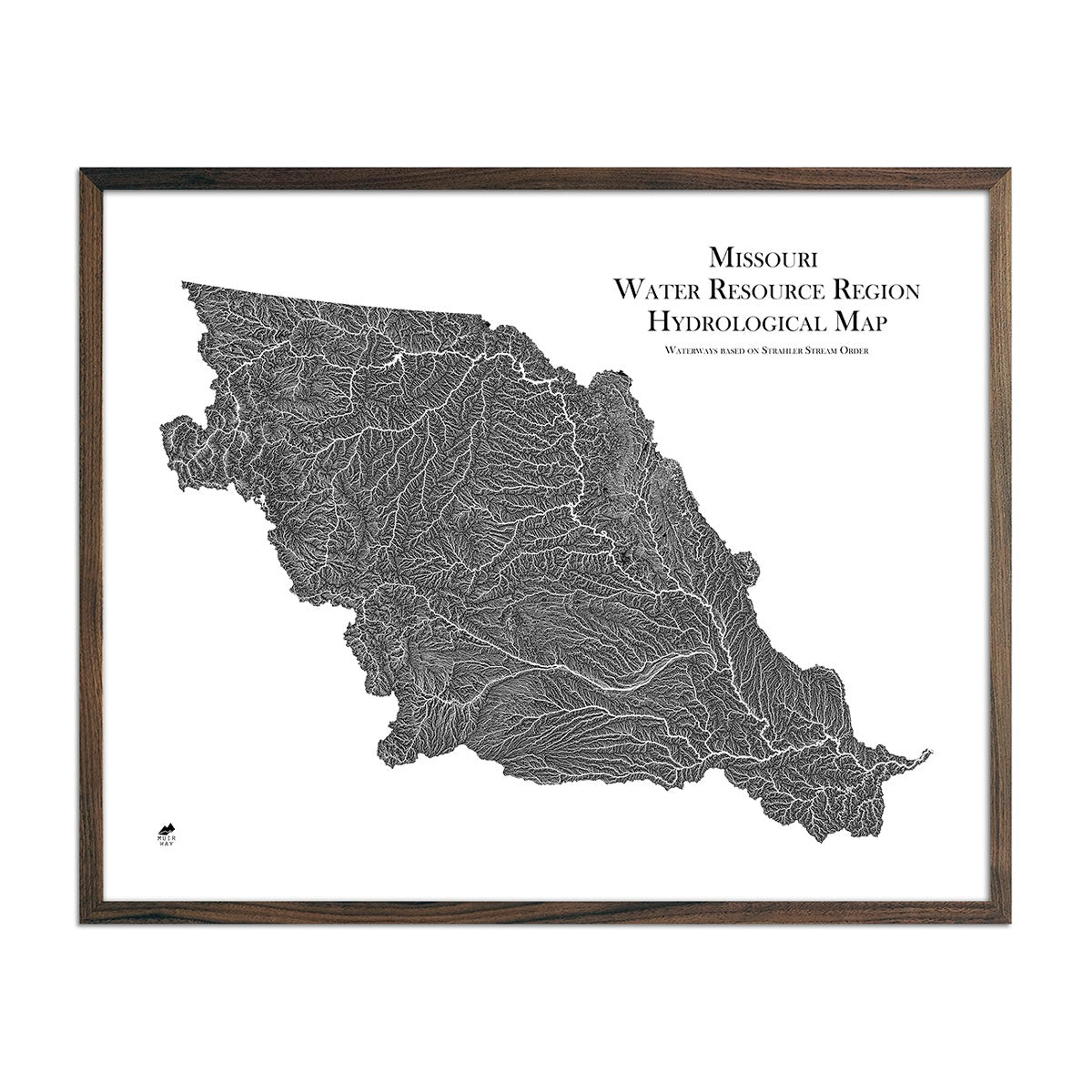
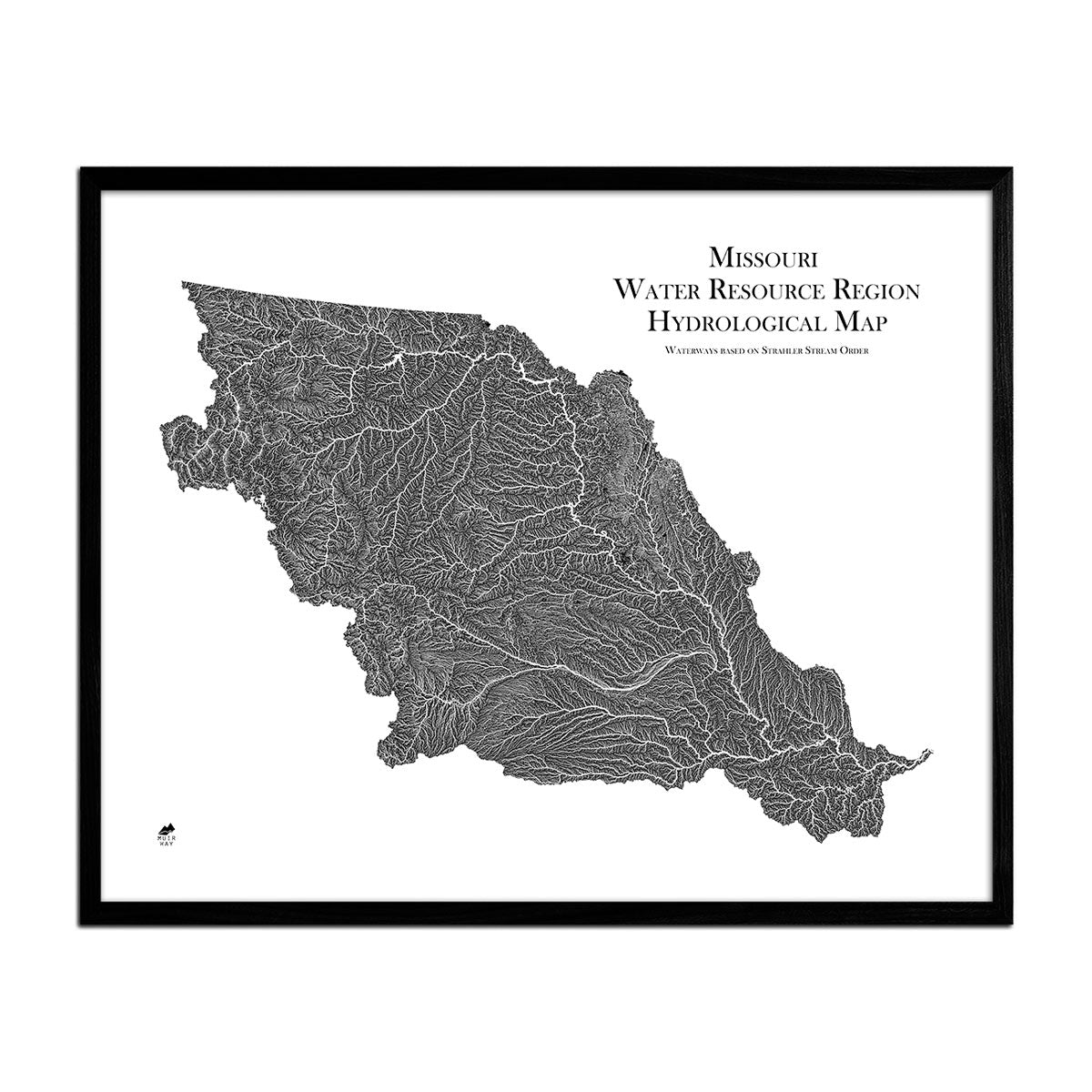
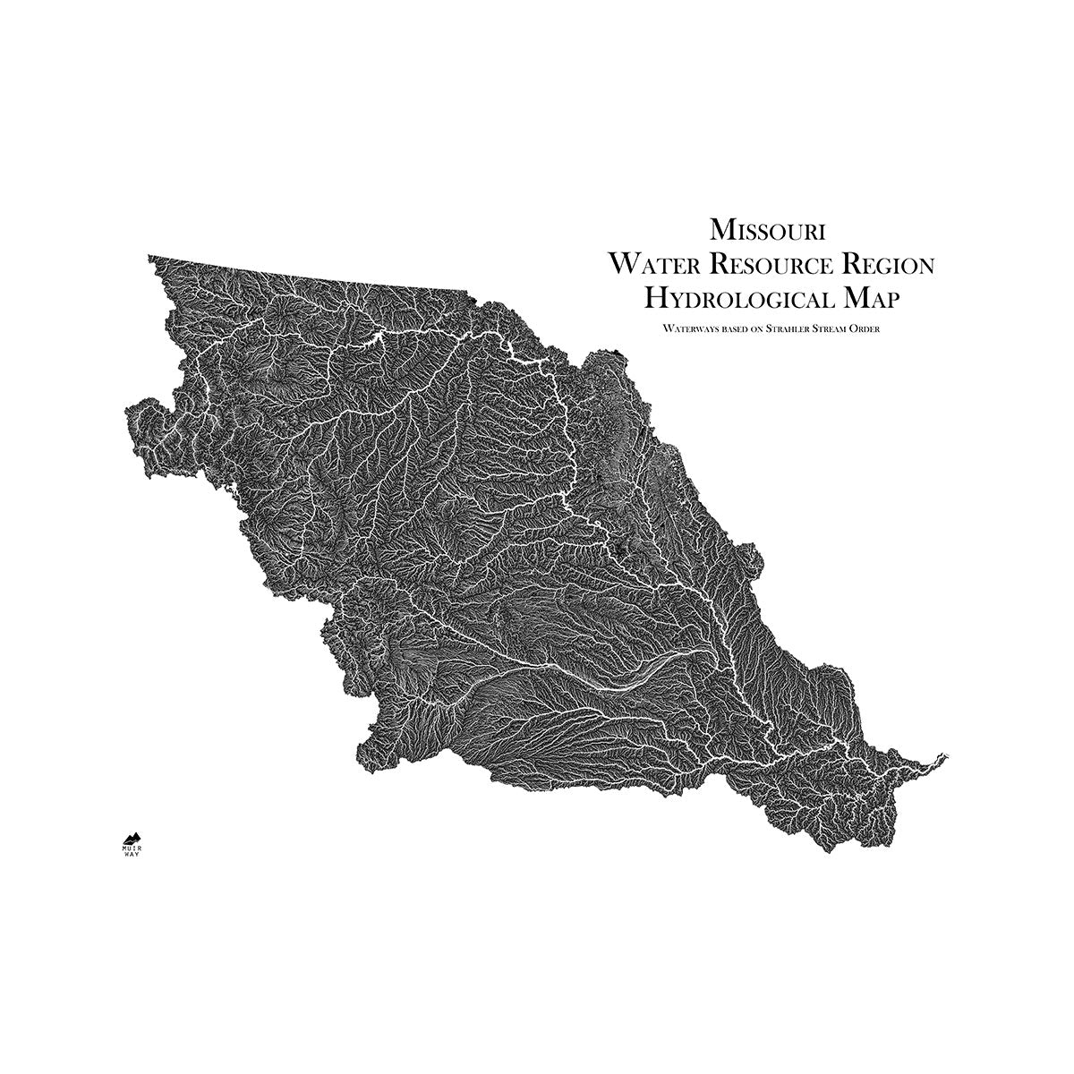
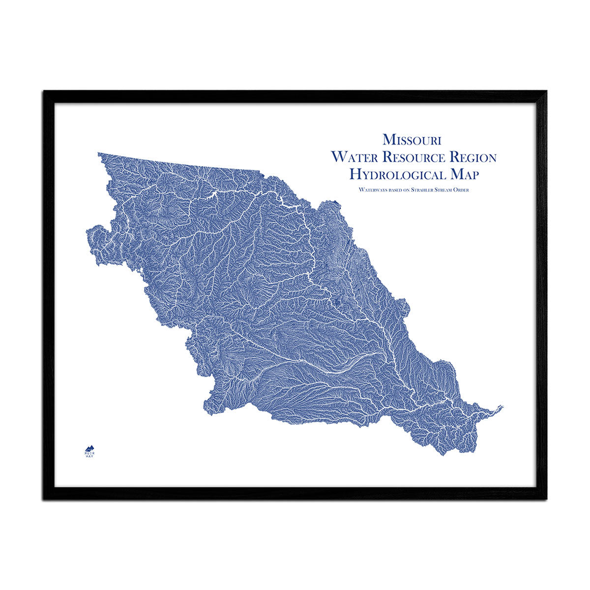
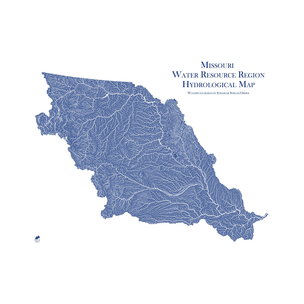
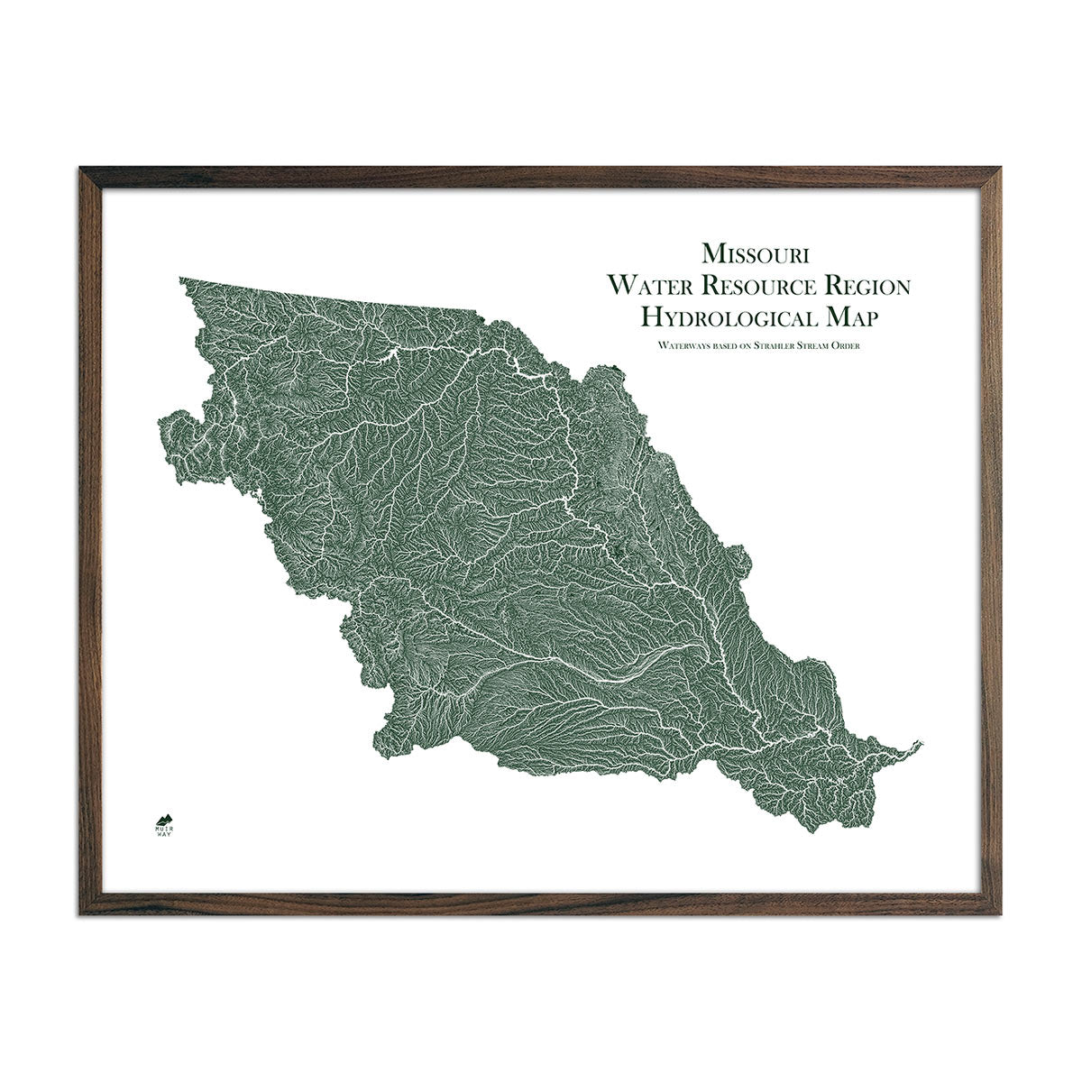
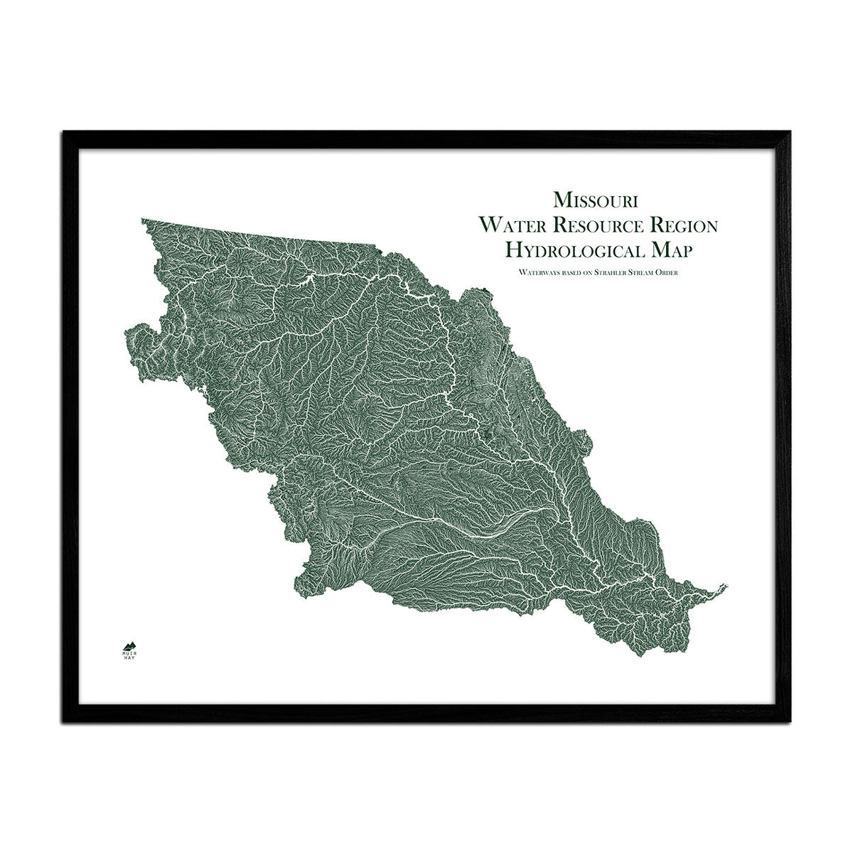
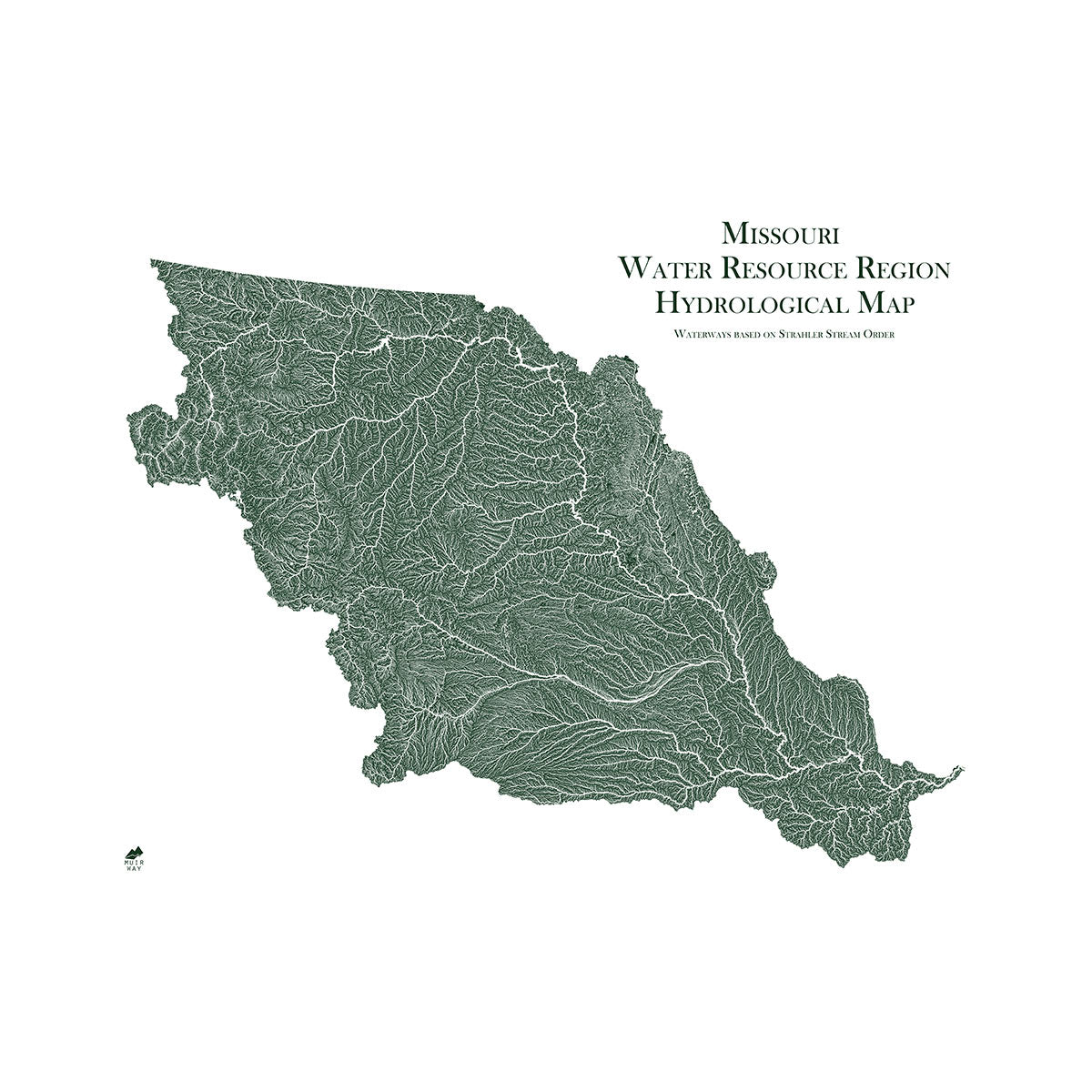
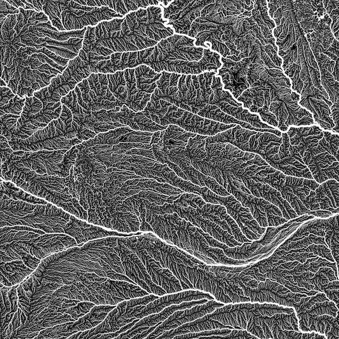
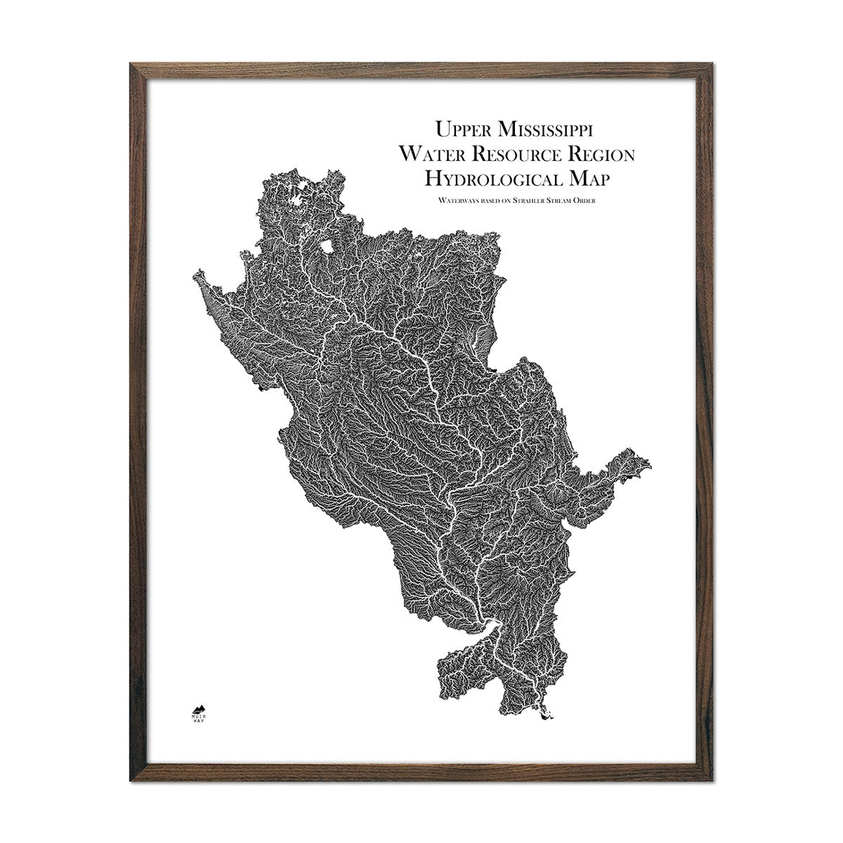
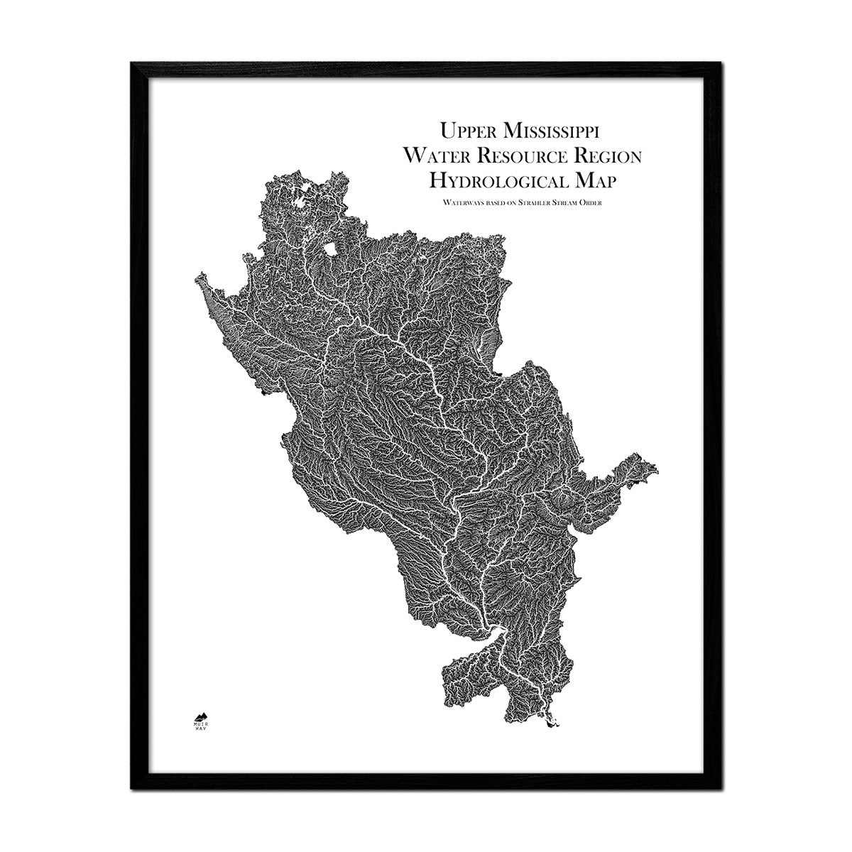
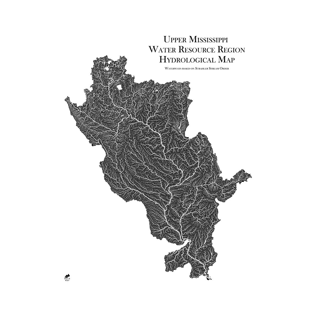
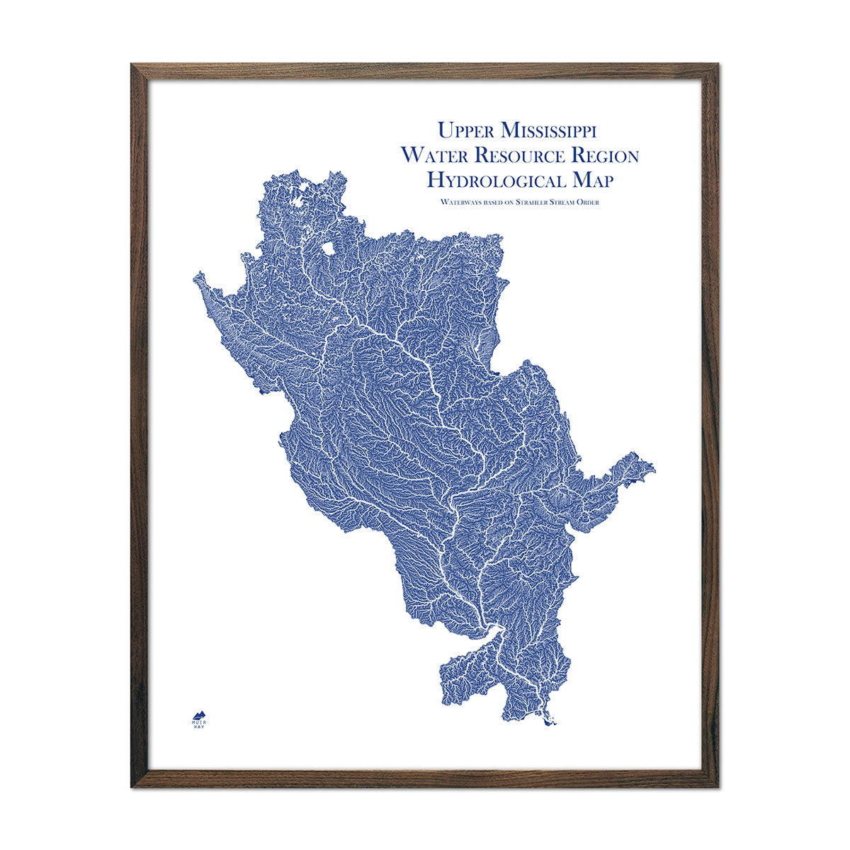
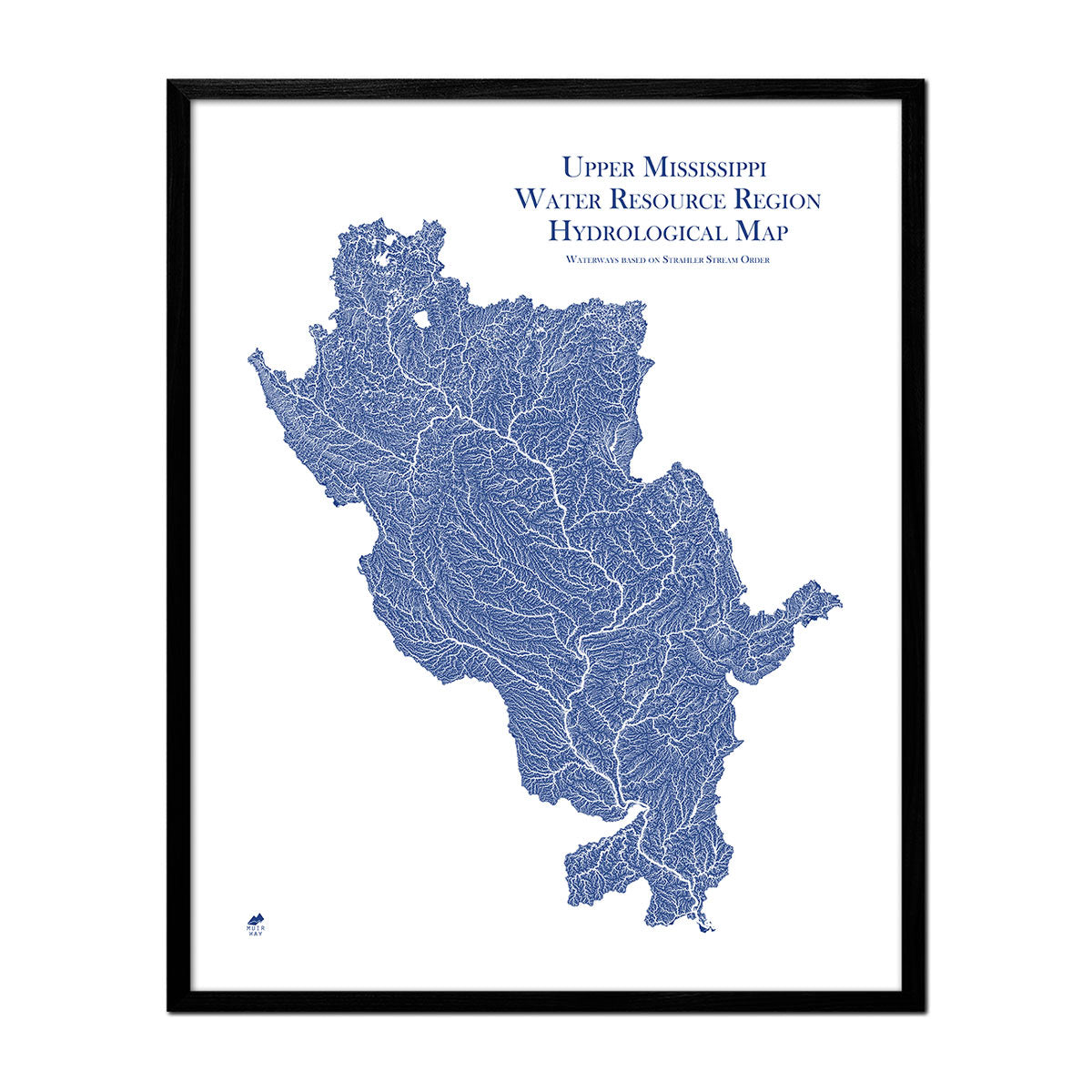
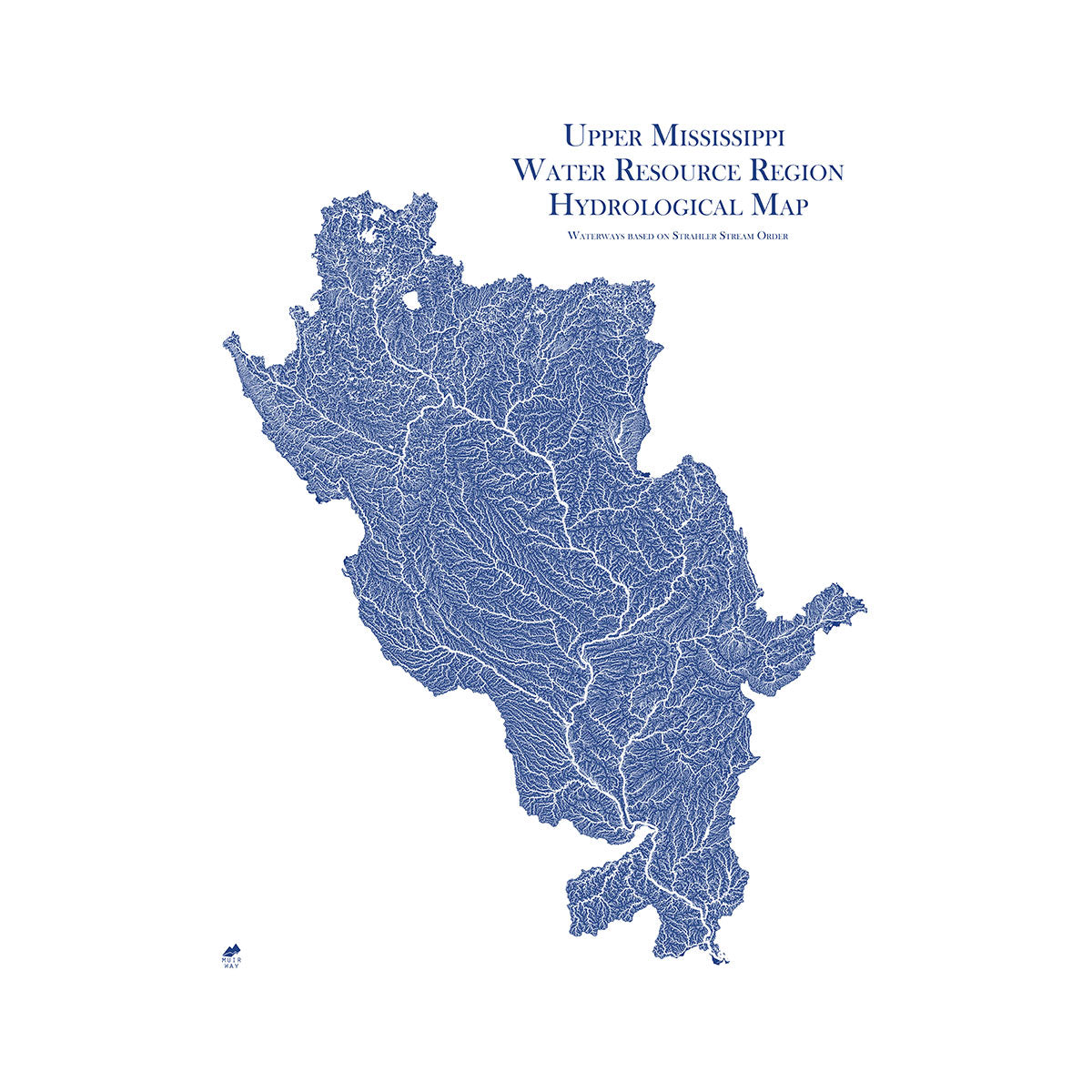
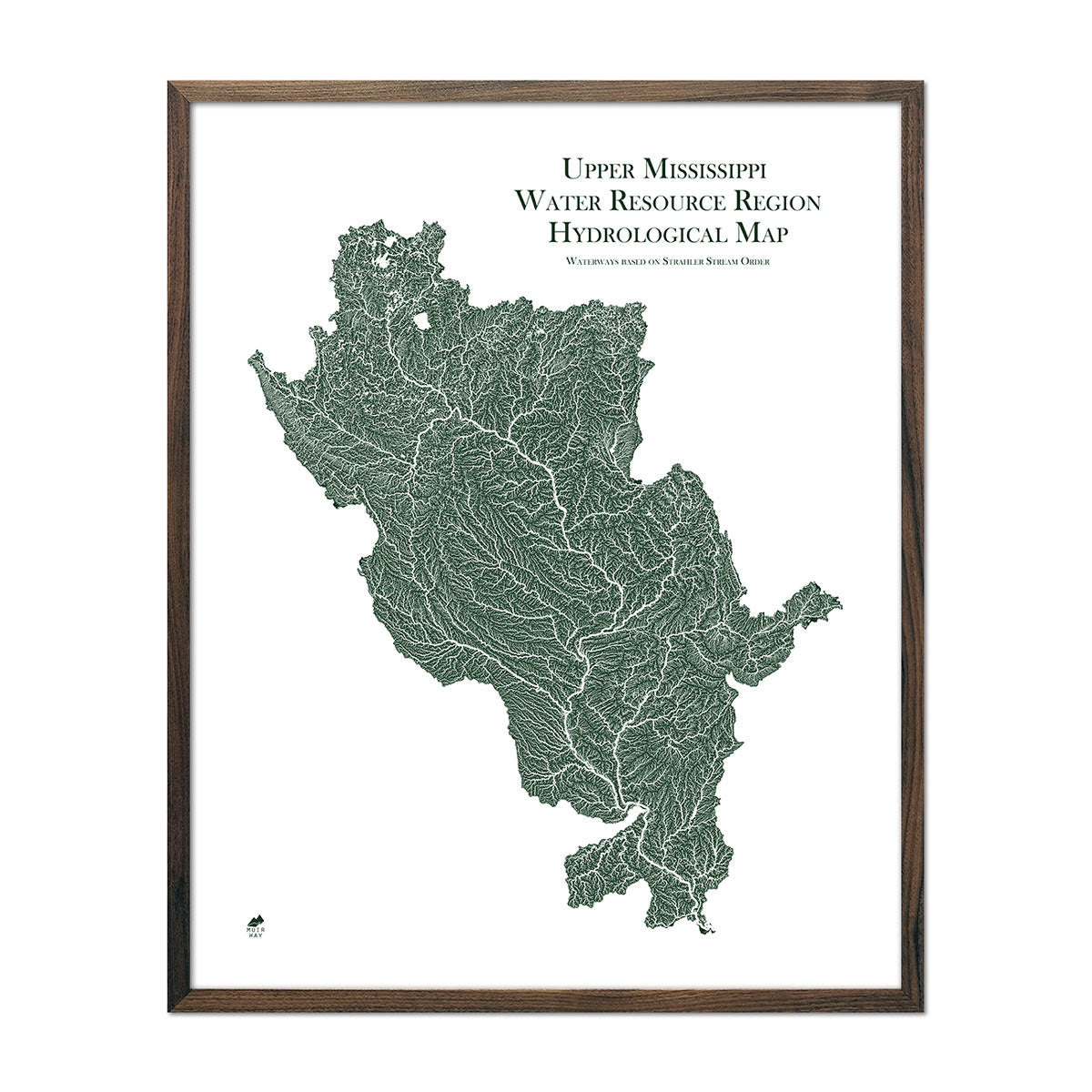
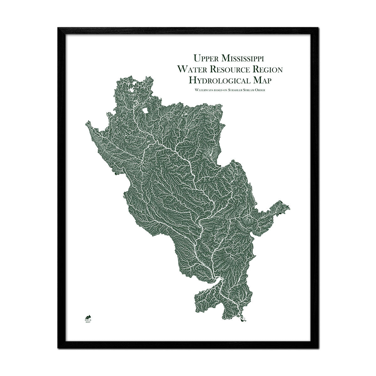
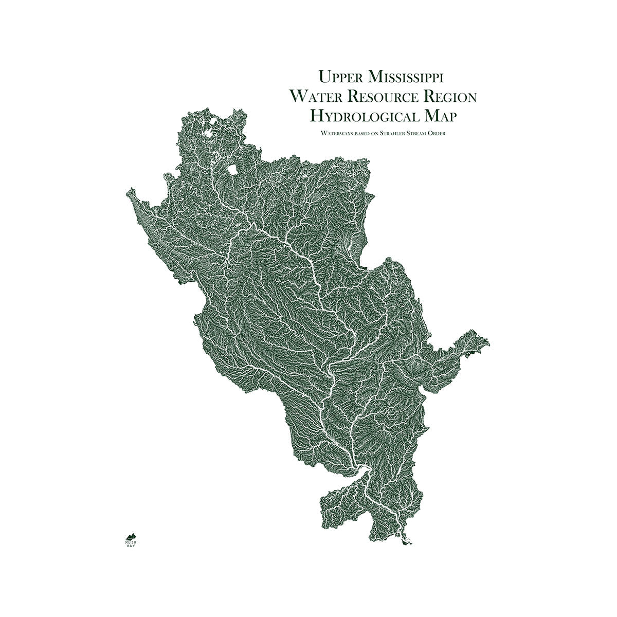
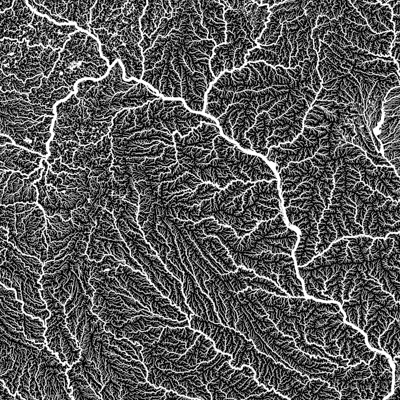
Iowa hydrological maps - Our hydrological maps showcase every single river and intermittent stream, as well as all bodies of water greater than 0.2 mi in diameter. Available in black, green, or blue, our Iowa hydrological map is eye-catching whether viewing across the room or up close. You can also find Iowa included on our Missouri regional hydrological map and our Upper Mississippi regional hydrological map. For an extra aesthetic touch, we apply a method called the Strahler Stream Order to show the hierarchy of streams as they flow from their source, with rivers shown thicker as they acquire the flow of tributaries.
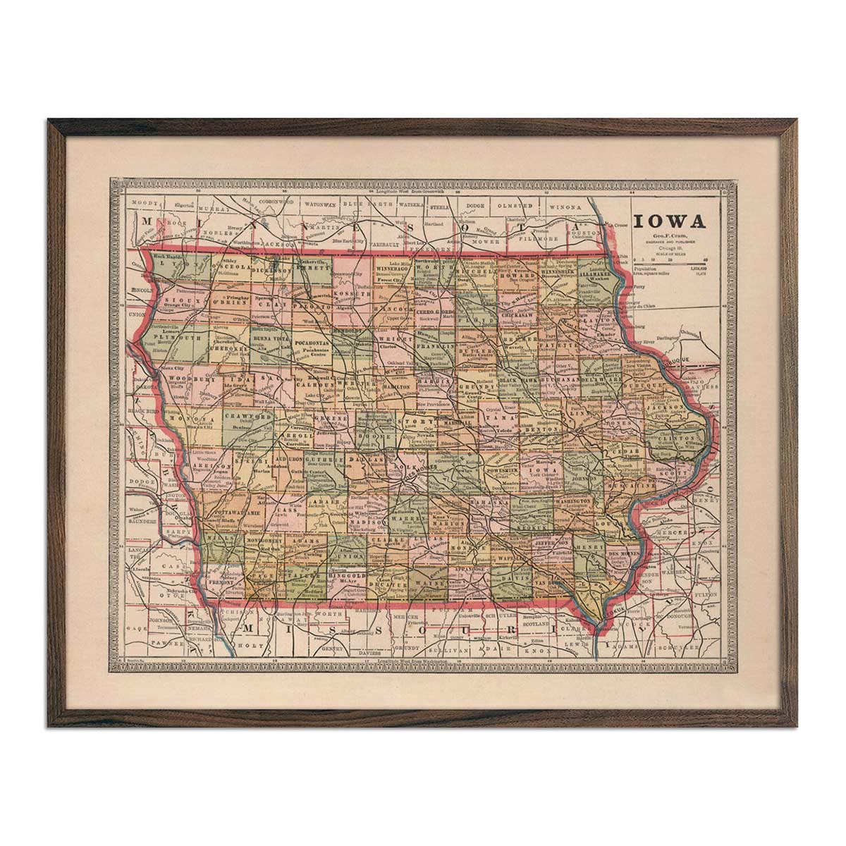
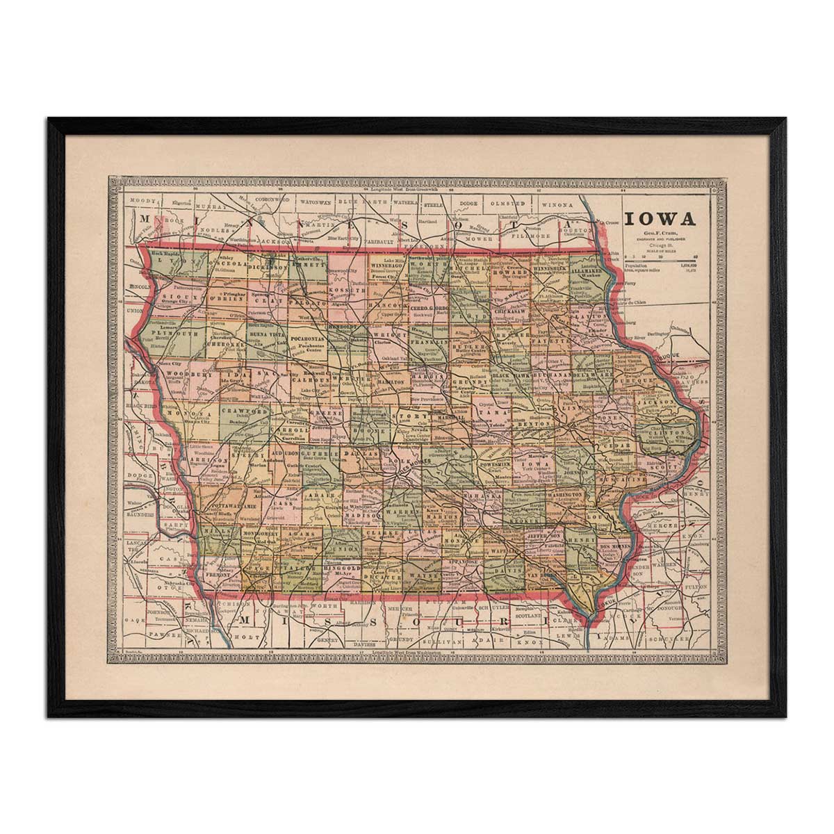
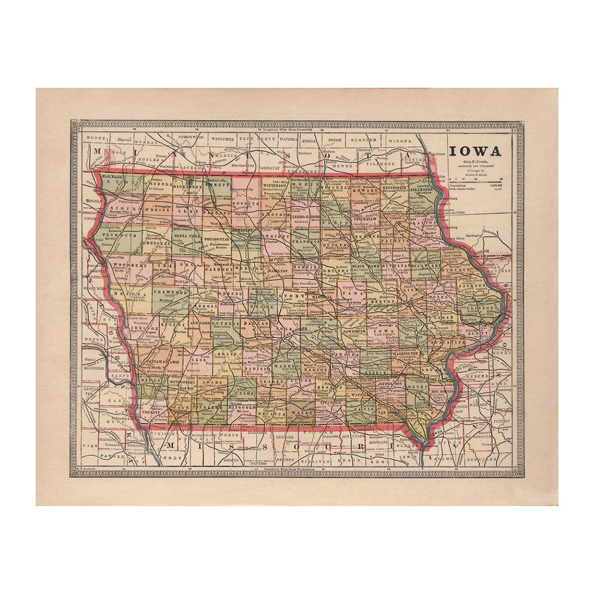
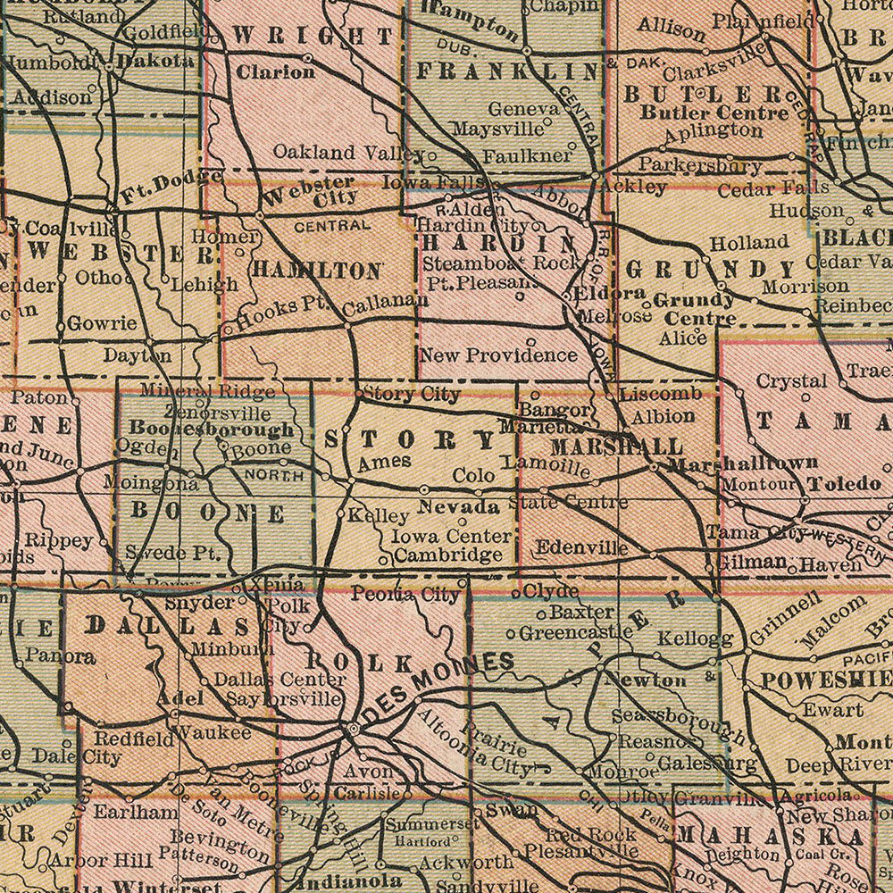
Vintage Iowa map - If you like vintage maps, you’ll love our enhanced vintage map of Iowa (1883). Unlike our relief map series, our historical maps don’t feature shaded elevation, but what they do feature is a record of history beautifully printed and ready to display. Our vintage maps are reproduction prints, carefully restored to maintain their charm without the wear & tear.
What are some prominent features on the map of Iowa?
Our Iowa relief map showcases Iowa’s geological landscape with a color-coded key for different types of mineral composition. View its indurated rocks and glacial deposits in vivid detail.
As a state comprised largely of flat, fertile soil, Iowa features several major rivers including the Mississippi River, the Missouri River, the Iowa River, the Des Moines River and the Cedar River, among many smaller streams and tributaries. You can view Iowa’s waterways in detail on our hydrological maps.
On our Iowa vintage map you can see Iowa’s clearly outlined and labeled counties and cities frozen in time and see what’s changed since 1883.
No matter which Iowa state map you choose, you’ll enjoy an up-close look at a state responsible for providing 1/10 of the food for the whole country.
What are the regions in Iowa?
Iowa has three geographic regions:
- The Young Drift Plains - Covering most of the northern and central parts of Iowa, this region is mostly flat fertile land, and features some of the most fertile topsoil on earth thanks to the mineral deposits left by glaciers.
- The Driftless Area - Parallel to the Mississippi River in northern Iowa, this region has more hills and cliffs and is not a fertile area for farming. Its beautiful hills and pine forests have earned its nickname “The Switzerland of America”.
- The Dissected Till Plains - Stretching from southern Iowa to Northwestern Iowa, this region features low rolling hills and ridges and bluffs above the Missouri River.
If you like our collection of Iowa maps, you may also be interested in maps of other Midwest states. Click below to browse:


