


Louisiana Maps


Louisiana Map Prints, Hydrological & Elevation Maps
Our custom printed Louisiana wall maps will bring the melting pot of the American South to your home or office. From our eye-catching elevation maps and geological relief maps to our meticulously restored historical maps, every map of Louisiana we offer reflects the high quality and attention to detail our customers have come to love and expect from Muir Way.
What makes Muir Way maps of Louisiana unique?
When you purchase a Louisiana wall map from Muir Way, you get a custom-printed archival print designed to last for generations, not a rolled up flimsy poster. Our maps are certified to last 100 years, and our map artwork is designed to bring new light to the beautiful terrain it features. Our elevation maps incorporate hand-shaded relief and Digital Elevation Data with historical imagery, creating a beautiful 3D effect on a flat surface, and our hydrological maps show every river and stream in crisp detail. The meticulous craftsmanship we bring to our maps creates heirloom quality artwork we’re proud of.
Does my Louisiana map come framed?
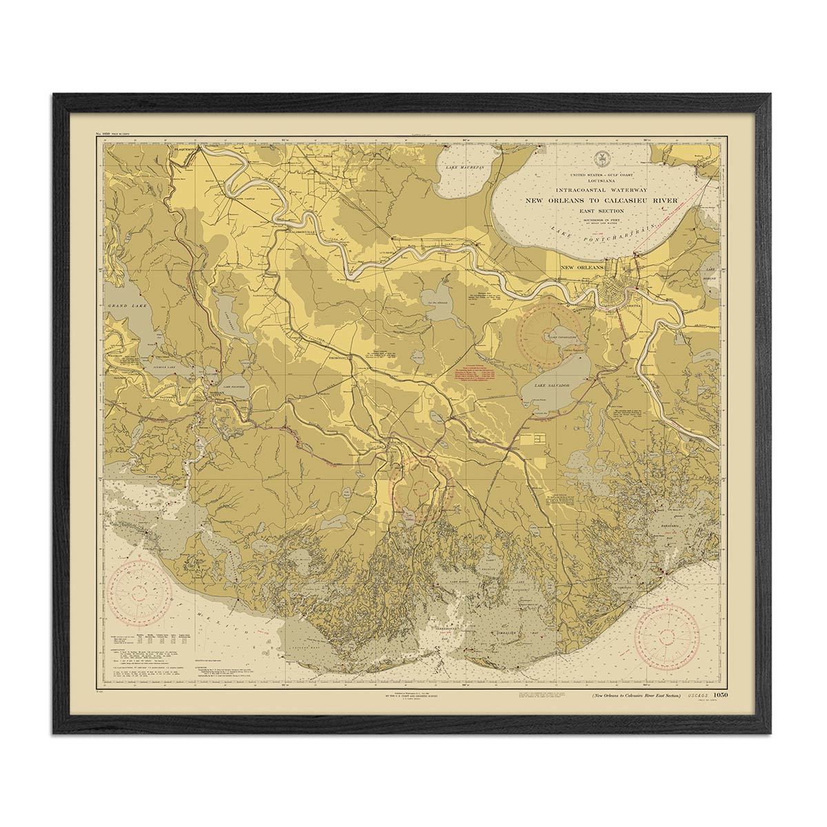
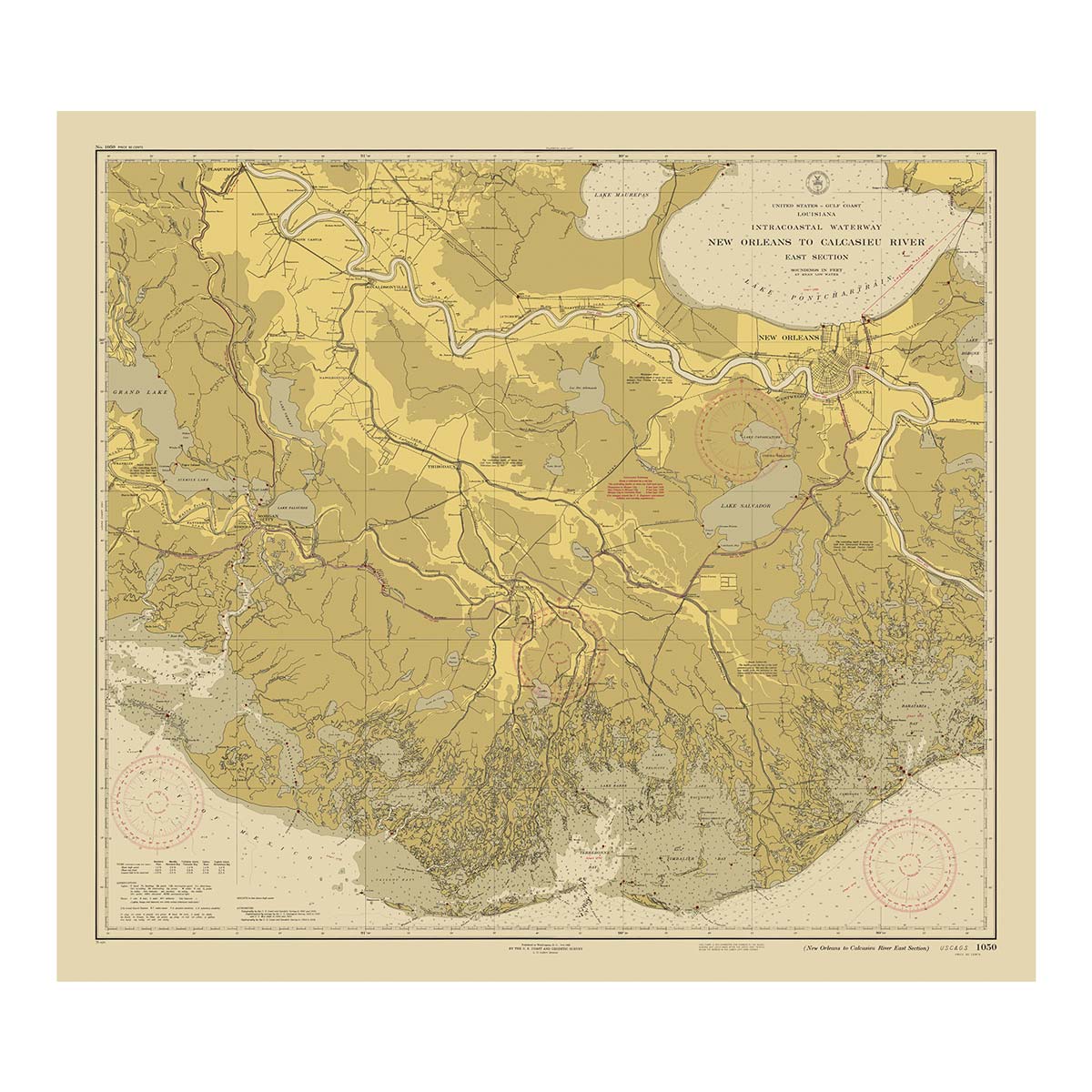
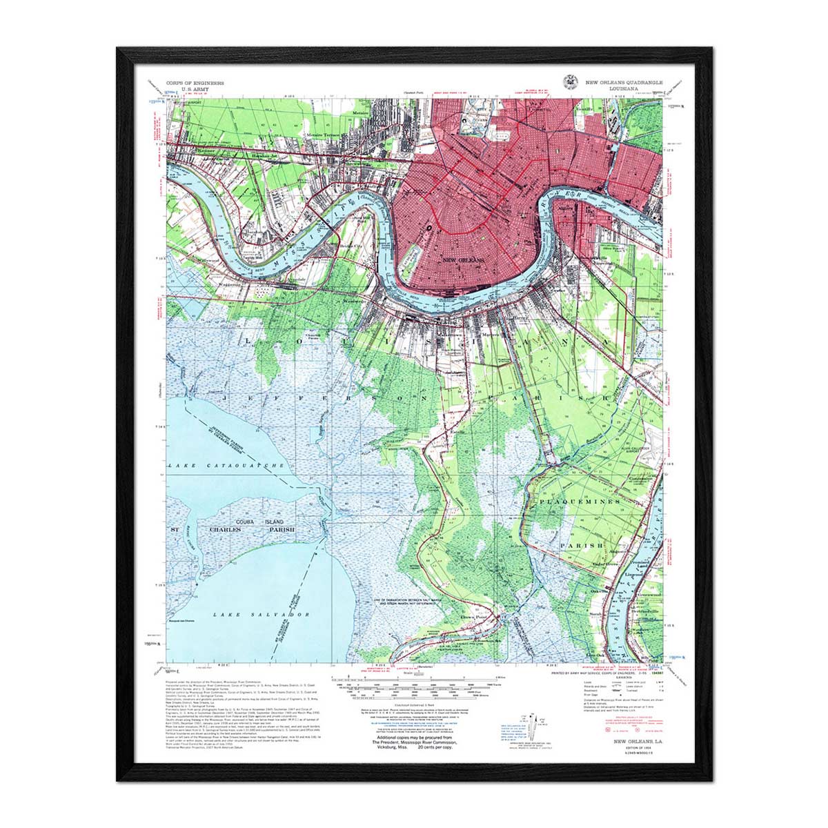
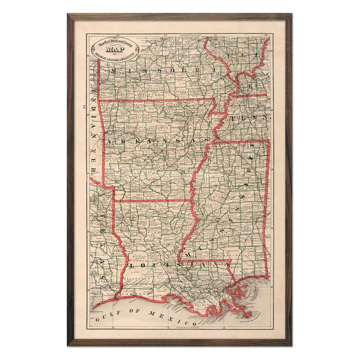
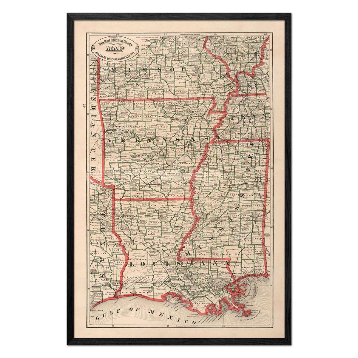
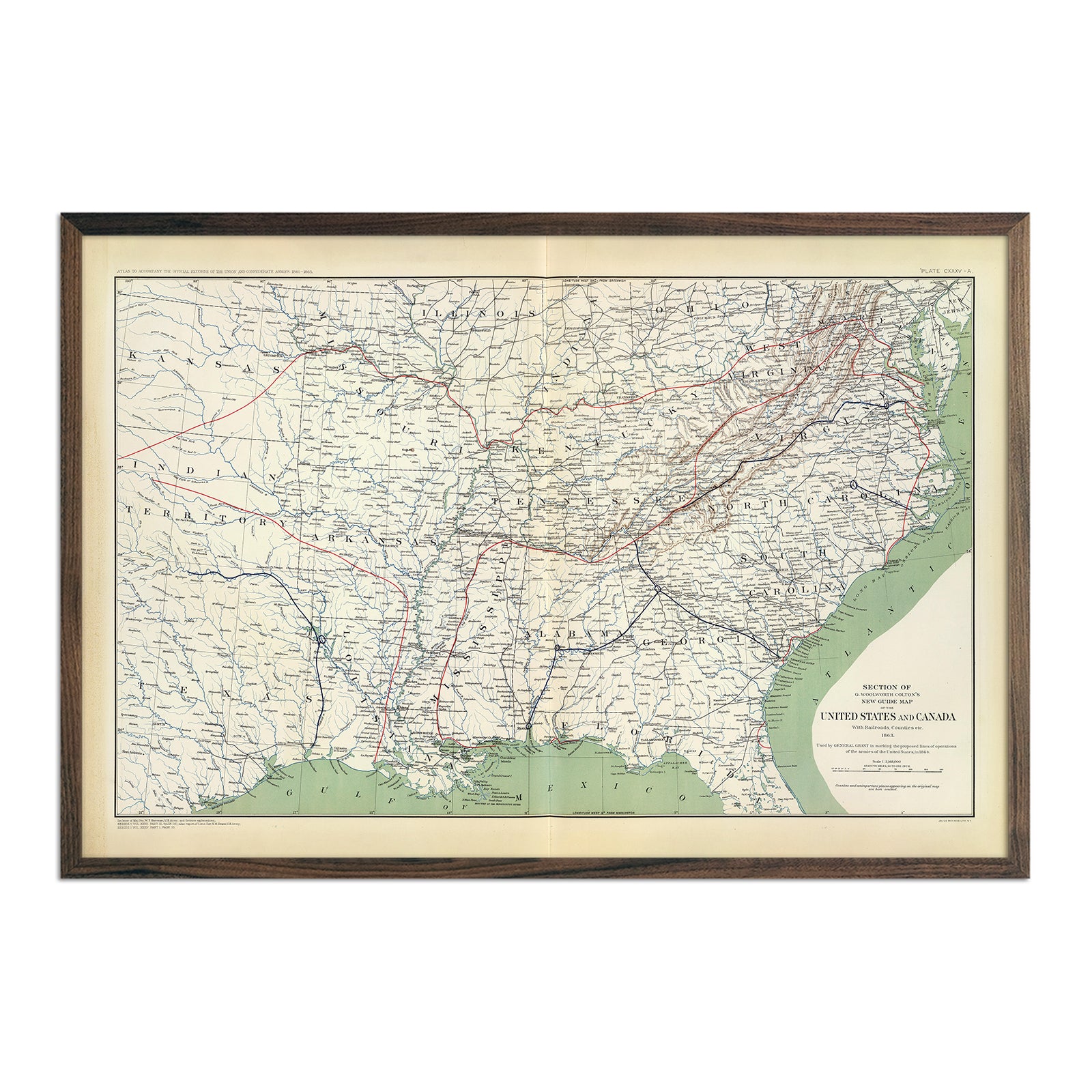
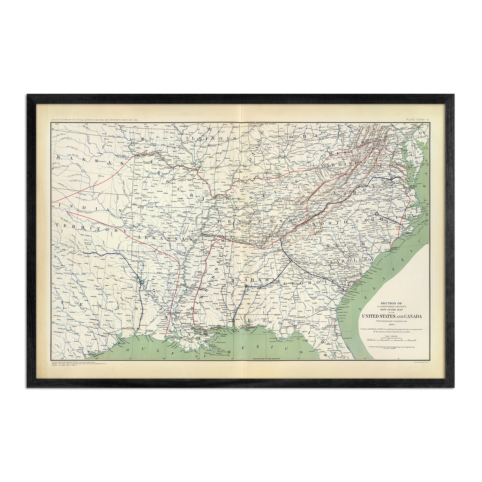
Whether you’d like to frame your own map or want your map to arrive framed and ready to hang, we have an option for you. Our Louisiana maps are available professionally custom-framed with real wood, or unframed if you prefer to use your own. If you’d like to purchase a framed Louisiana wall map, you can choose from several different wood colors and finishes. All of our maps come in standard sizes for easy framing.
Does a Muir Way map of Louisiana make a good gift?
Yes! Our custom-printed maps of Louisiana make the perfect gift for a “person who has everything”. They can hold special memories for anniversaries, weddings, college graduations, when placed under the tree as Christmas presents, or presented as a thank-you gift for someone special. Our maps also make memorable corporate gifts that will remind your clients or colleagues of you every time they see it.
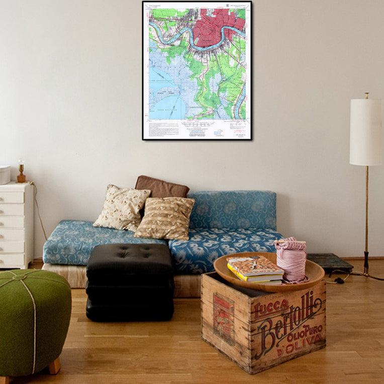
Where should I display my Louisiana map?
Our maps are designed to catch your eye from afar or up close. Hang a framed wall map as a central focus, or purchase several maps in a similar style or from a particular region and arrange them near each other for a complementary series. No matter which you choose, you’re sure to find a map of Louisiana to suit your décor.
What are the different types of maps of Louisiana available on Muir Way?
Our Louisiana maps are available in several different styles, including:
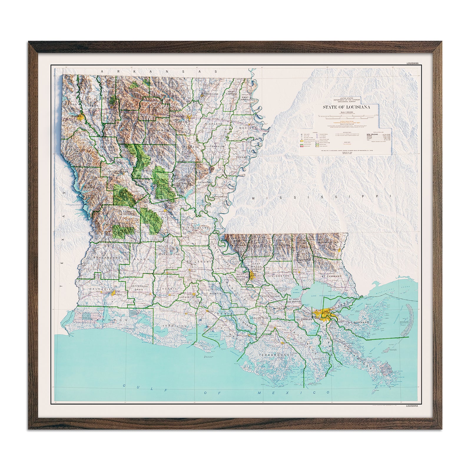
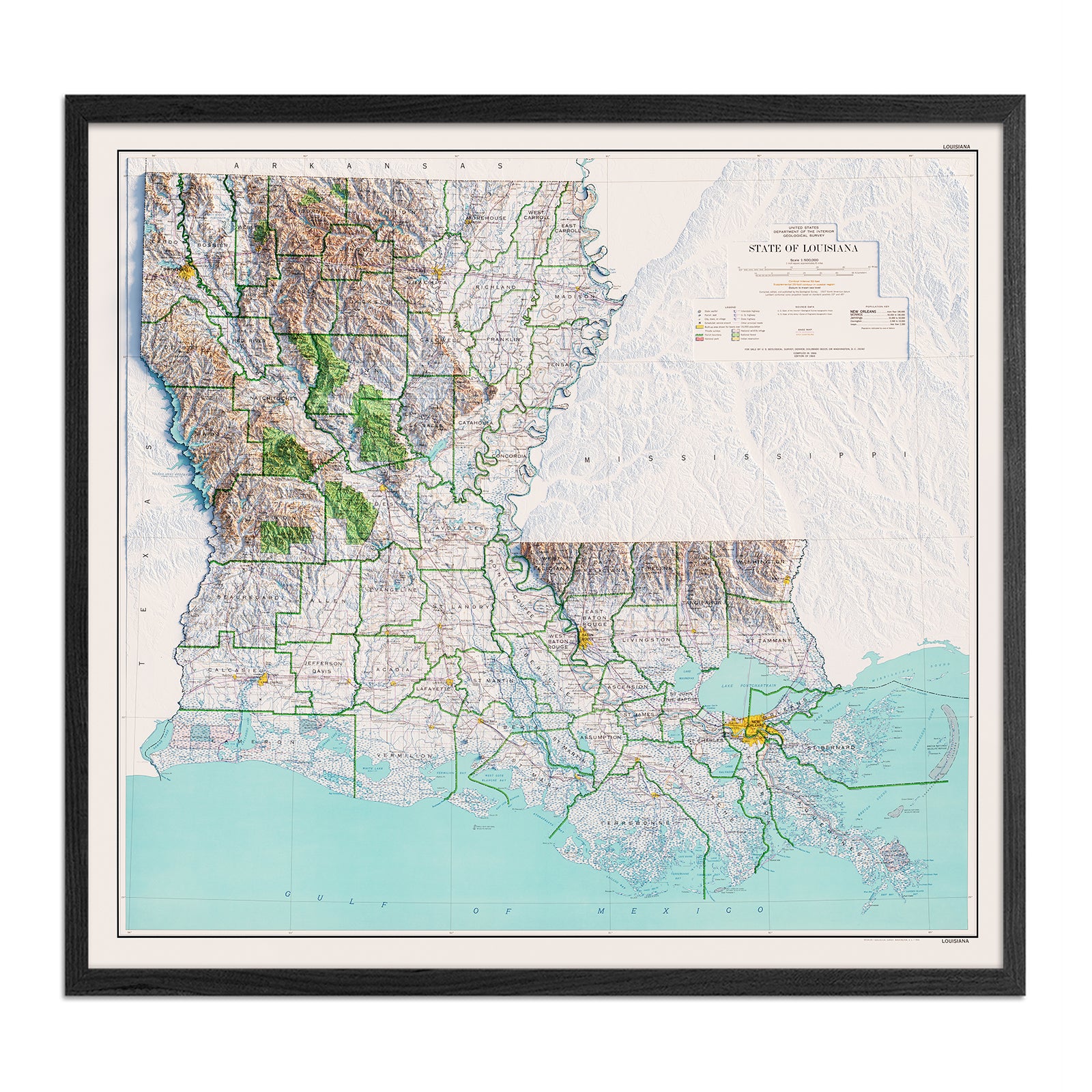
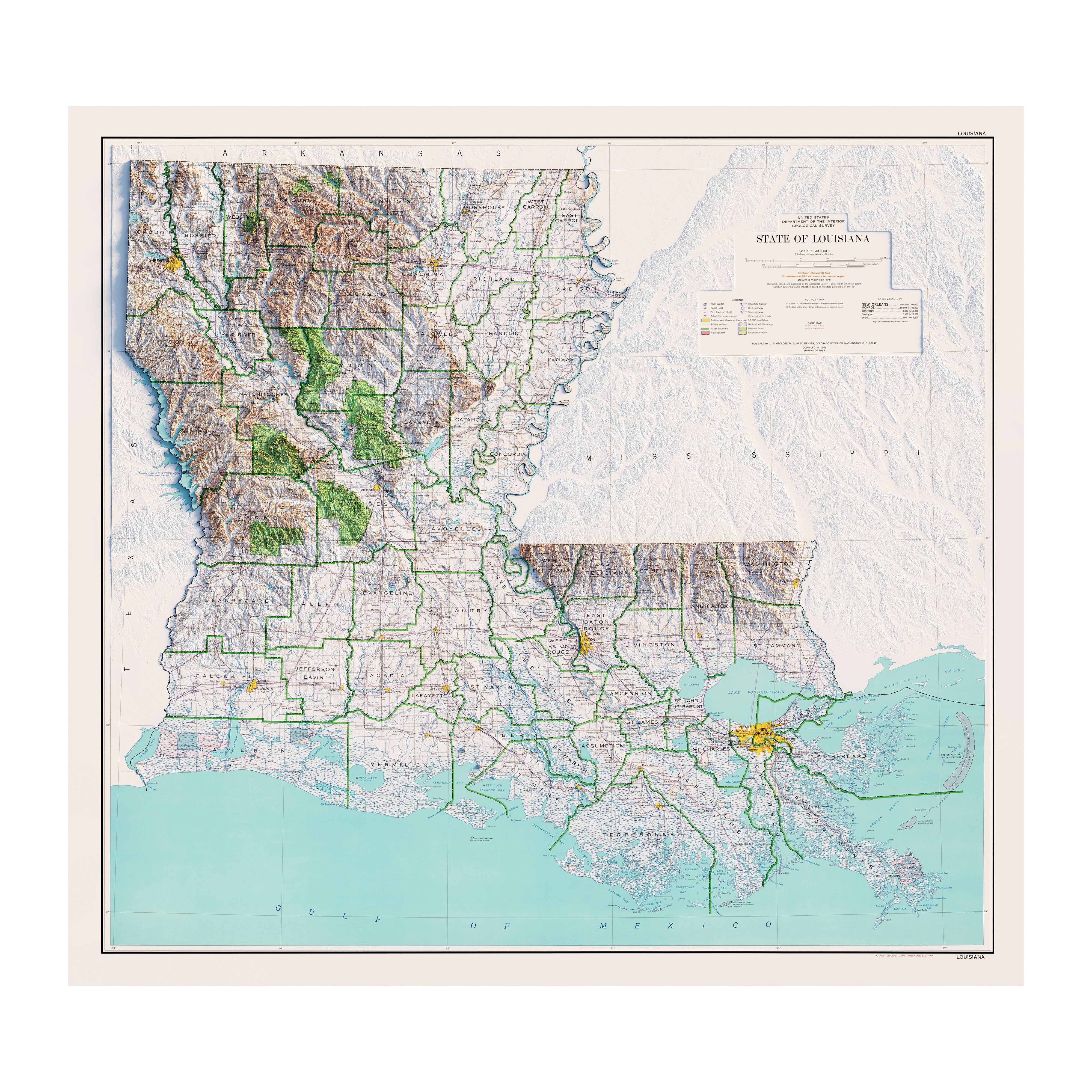
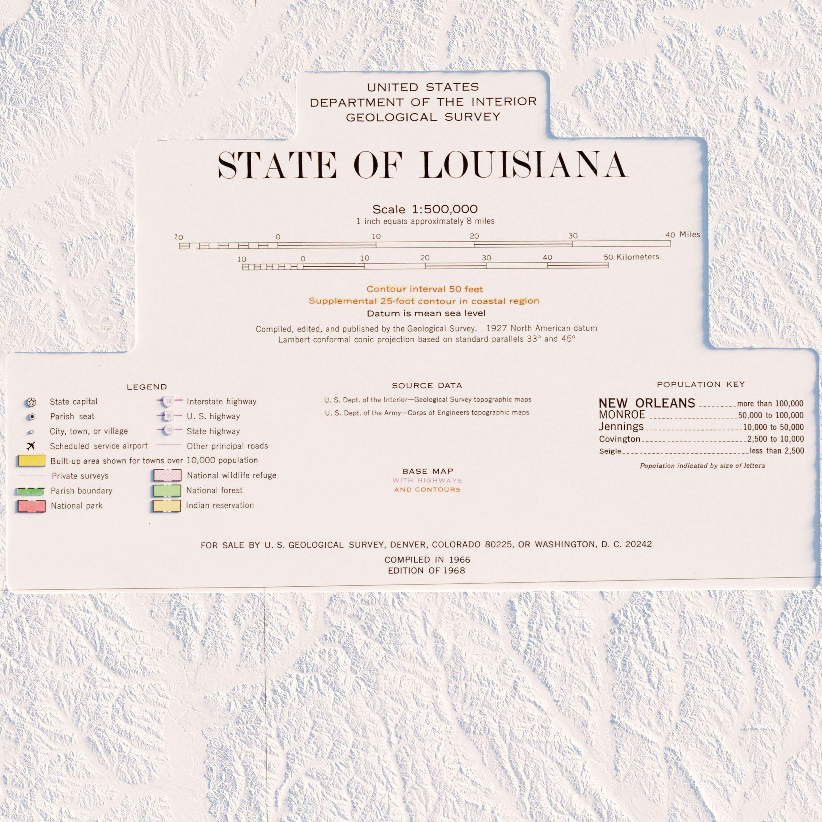
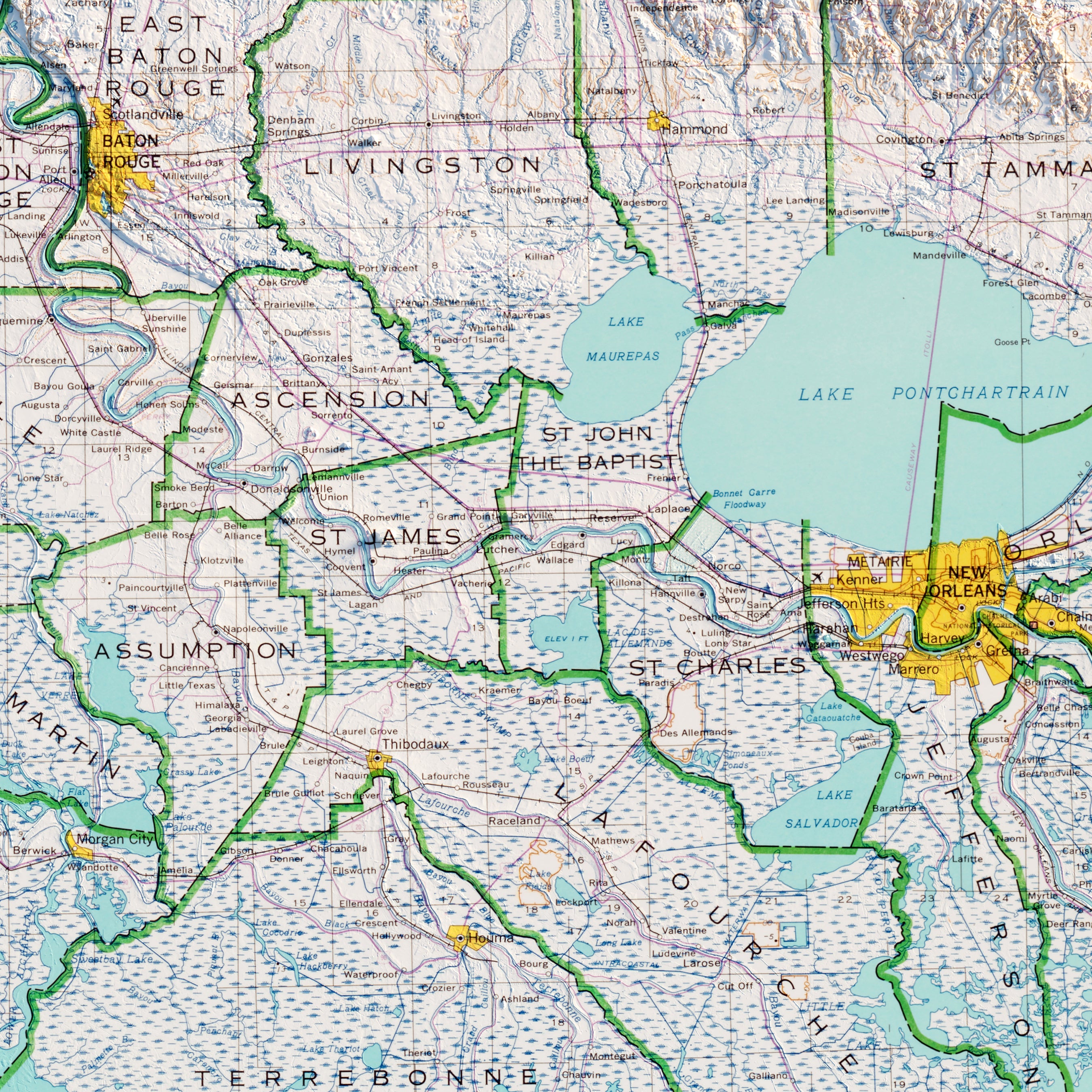
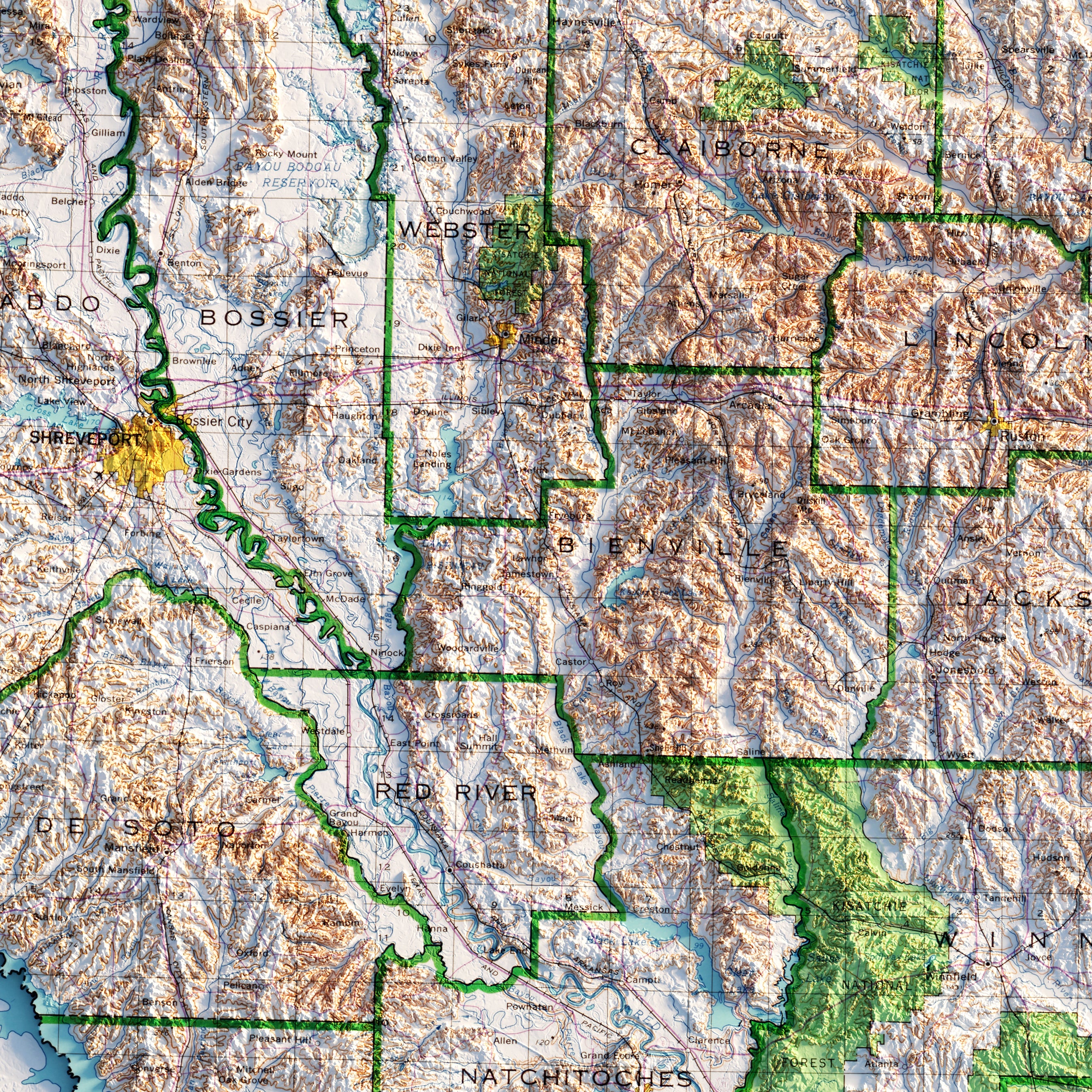
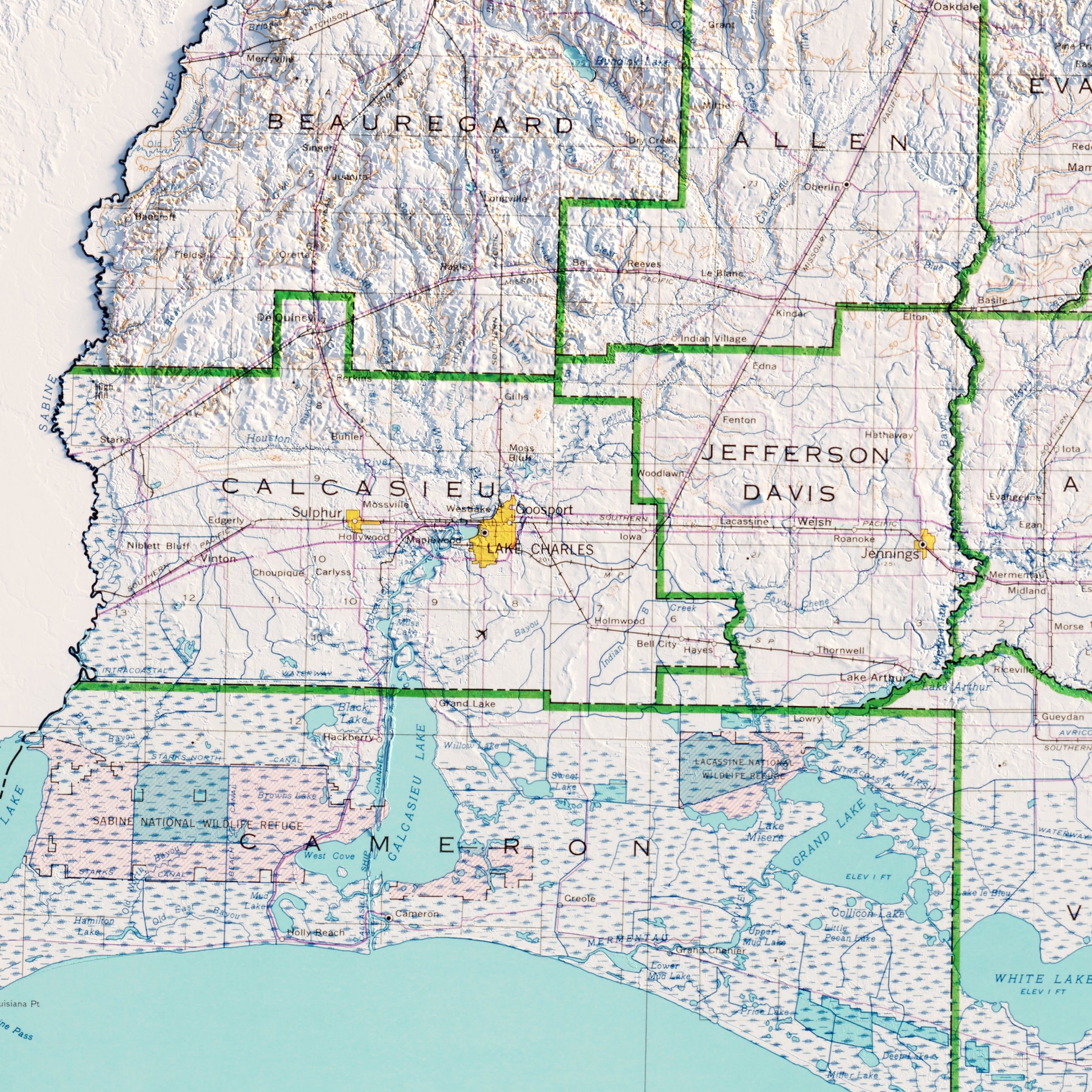
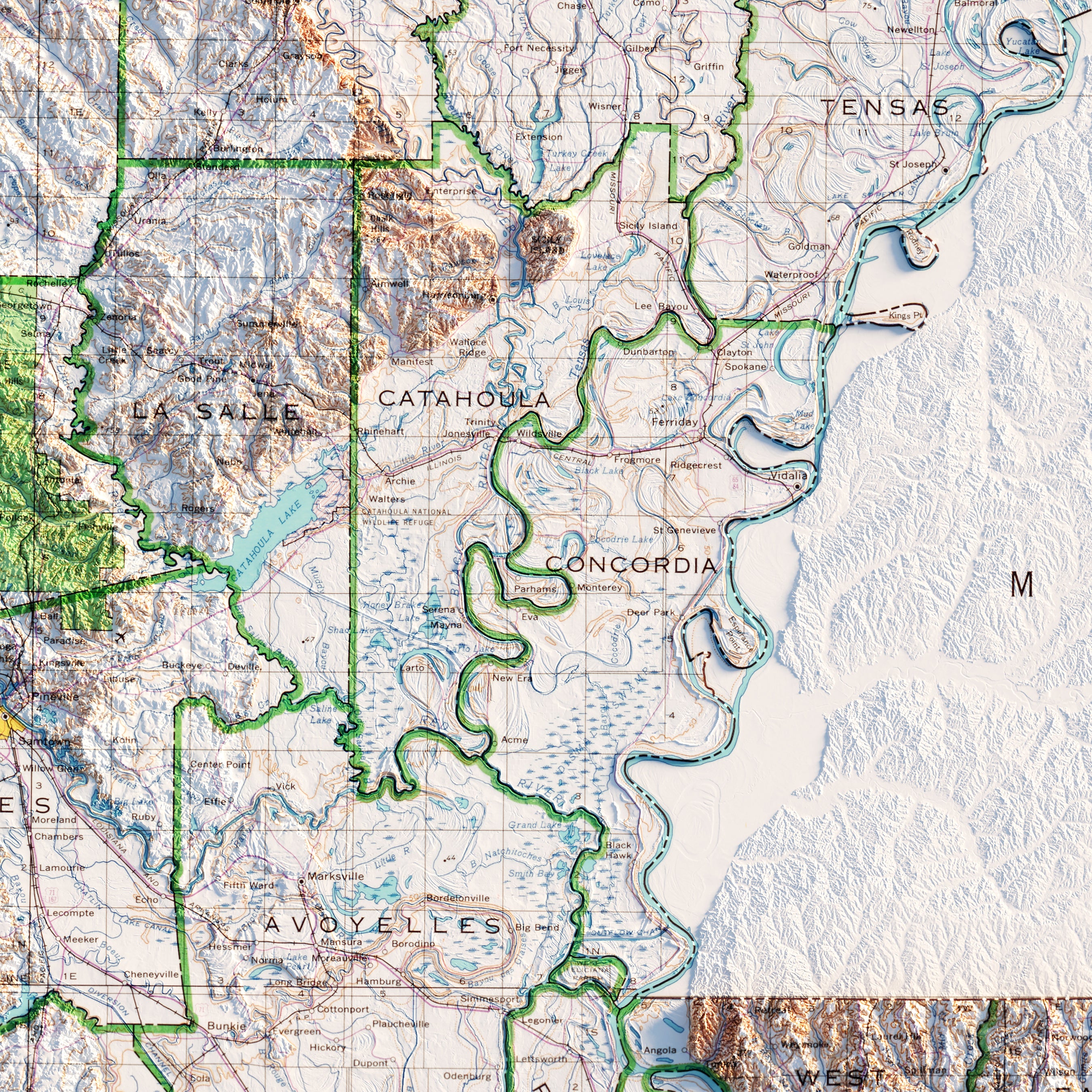
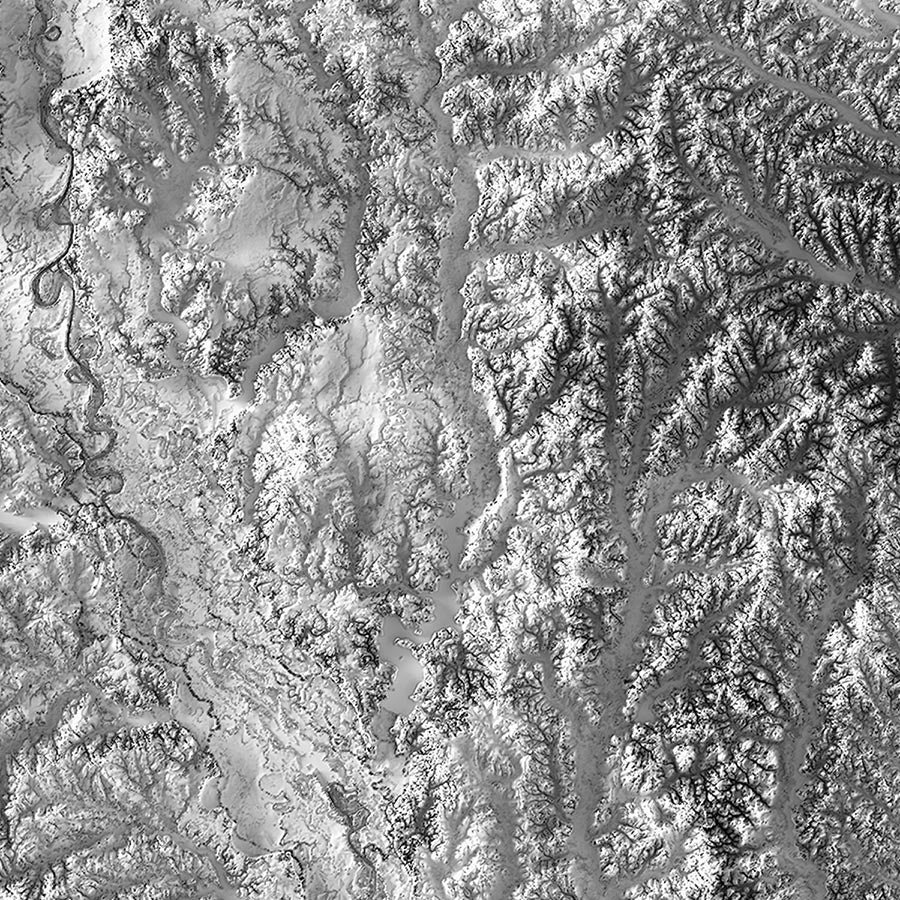
Louisiana relief maps - Our relief map of Louisiana combines historical map topography from 1968 USGS data with modern technology to showcase Louisiana’s landscape in a new and exciting way. Enhancing the vintage elevation map with Digital Elevation Data and hand-shaded relief, our customized maps have a stunning 3D effect on flat paper.
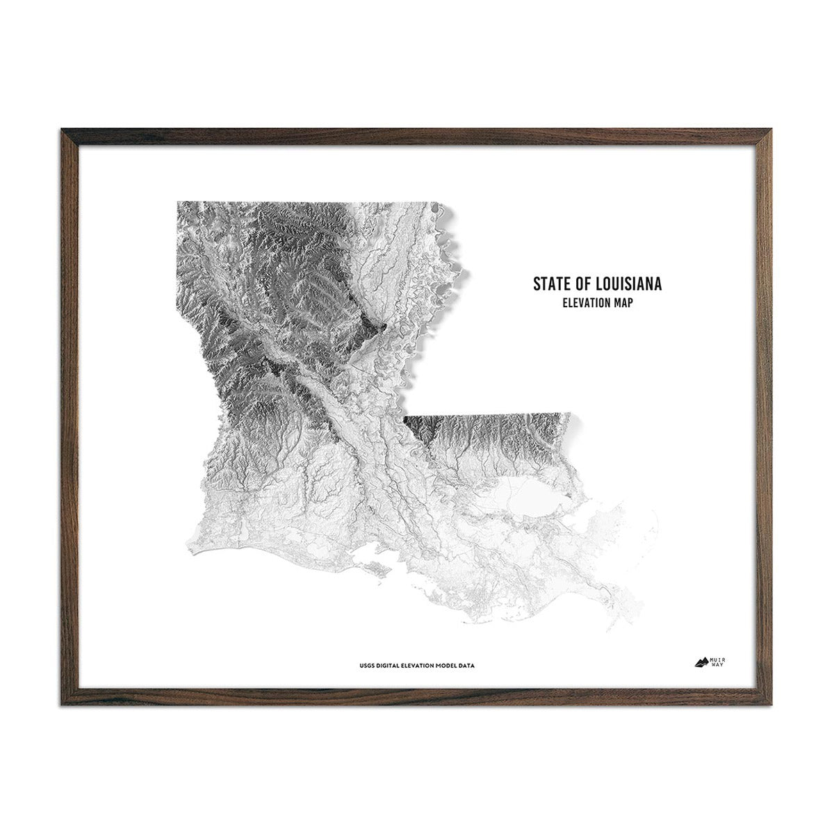
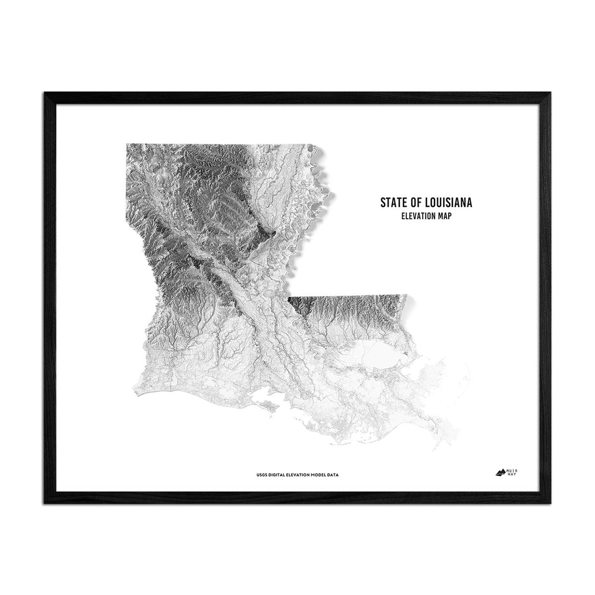
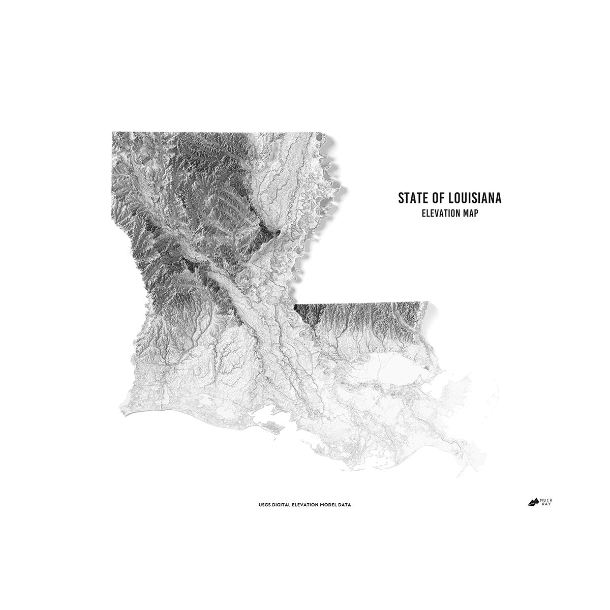
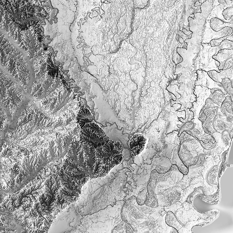
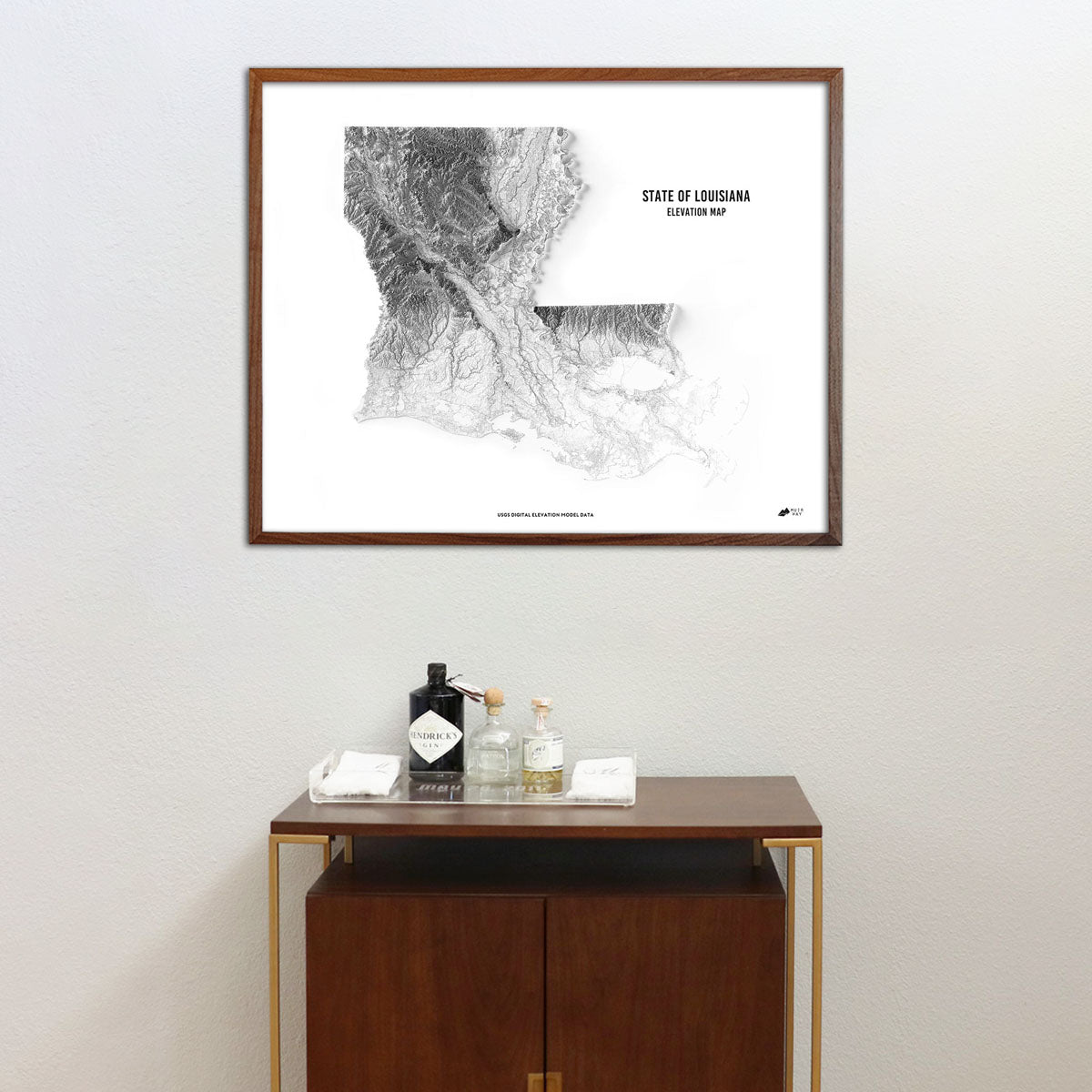
Louisiana elevation maps - Our state of Louisiana elevation map also uses Digital Elevation Data from the USGS to create a high-contrast 3-dimensional effect, this time in black and white with a blank, white background. This lets the state really stand for itself and visually ‘pop’ off the page.
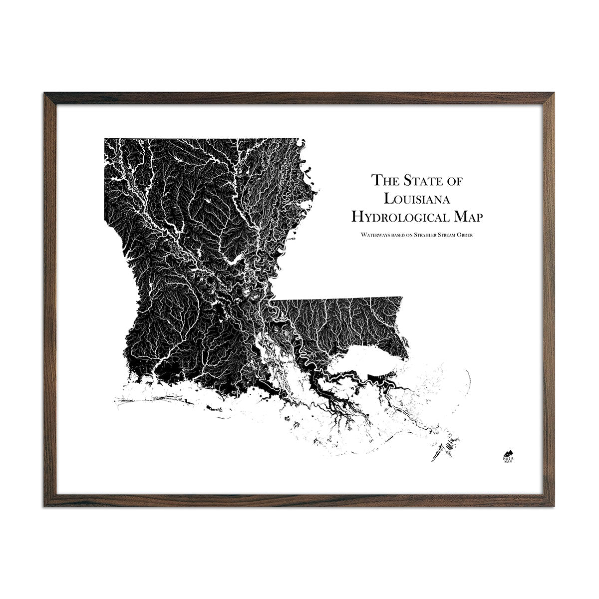
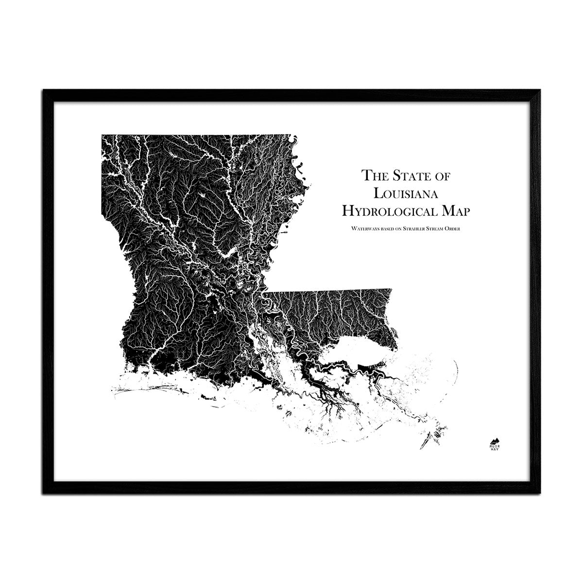
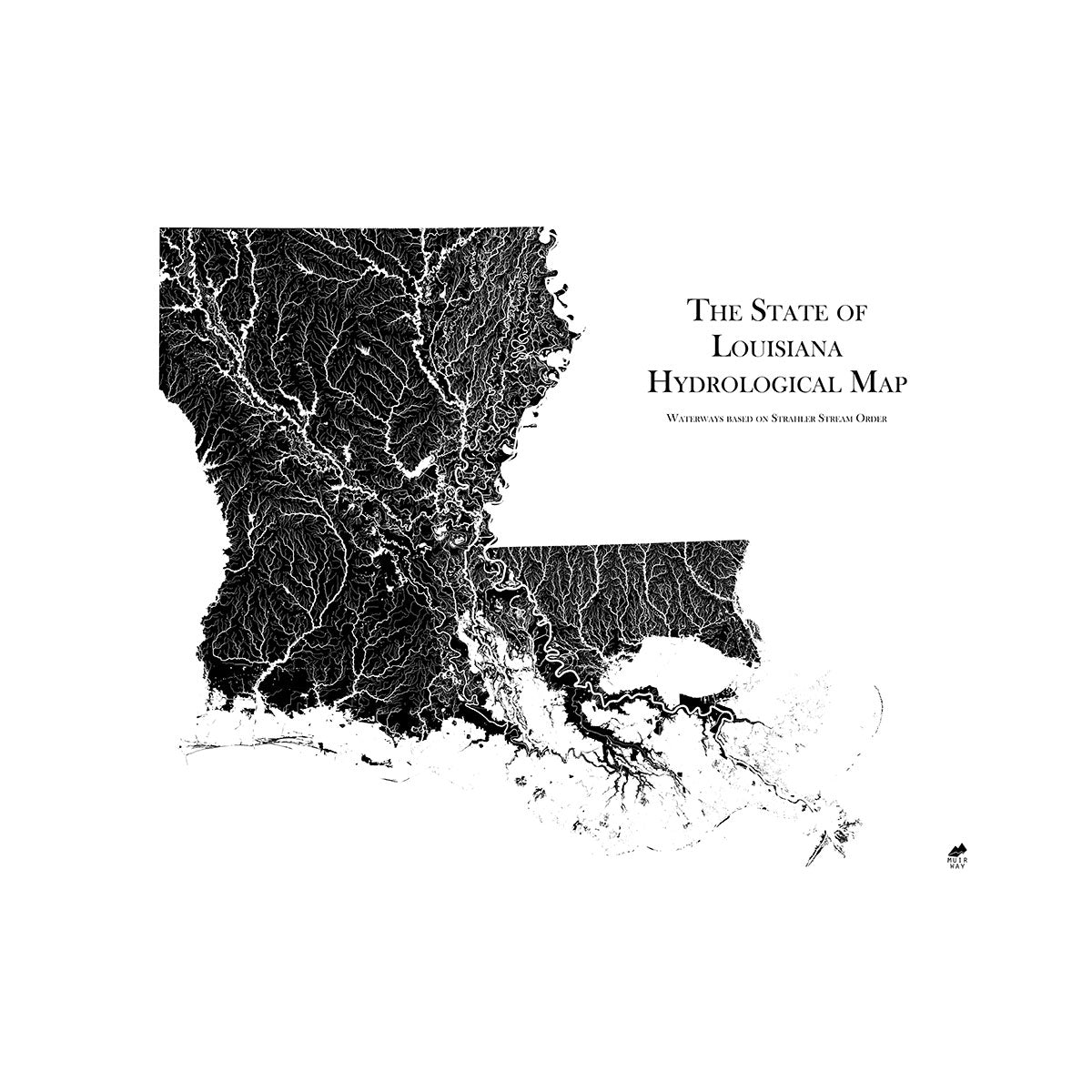
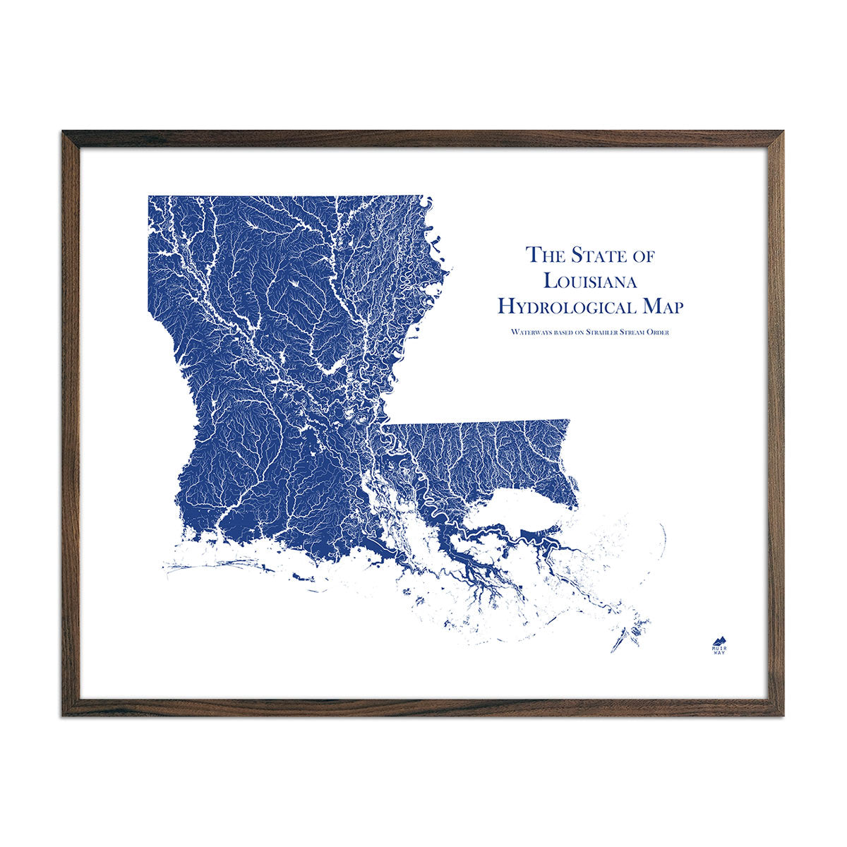
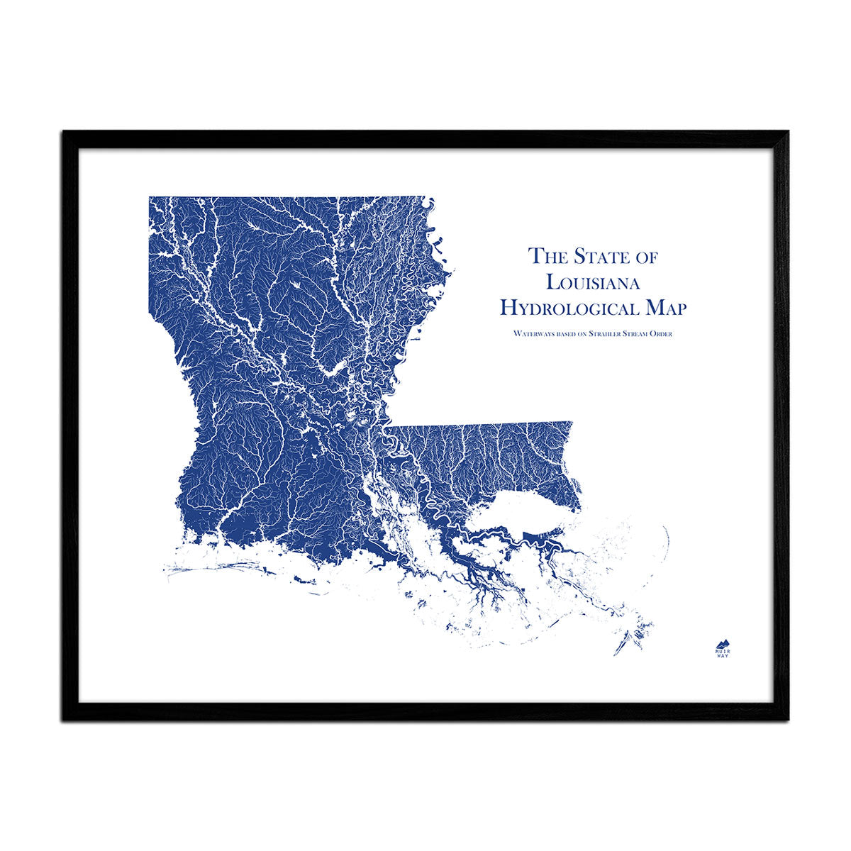
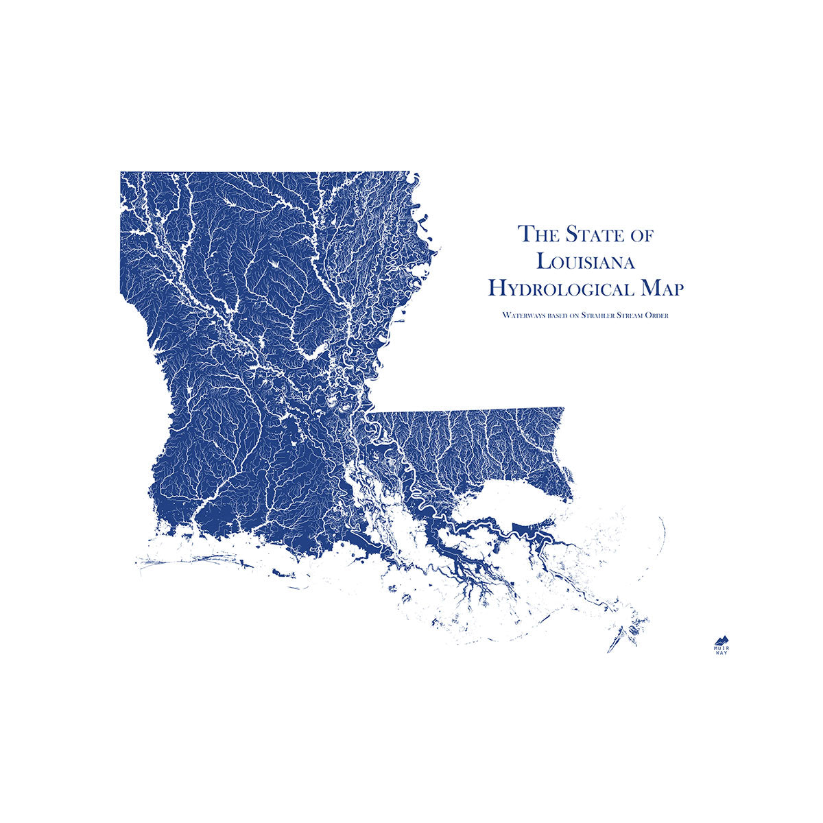
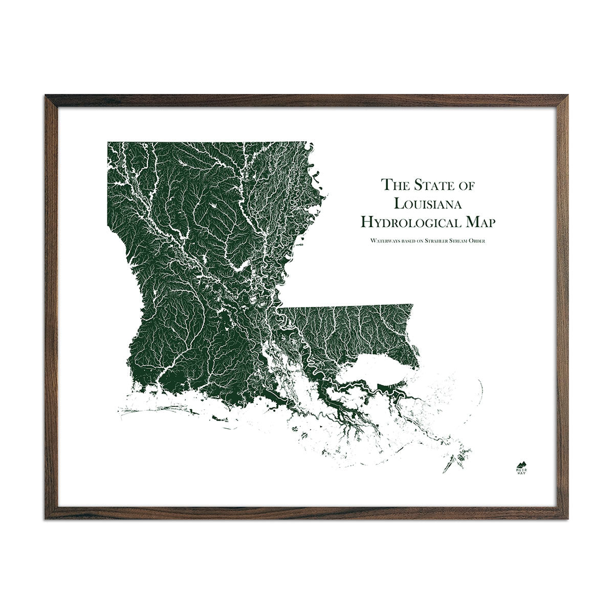
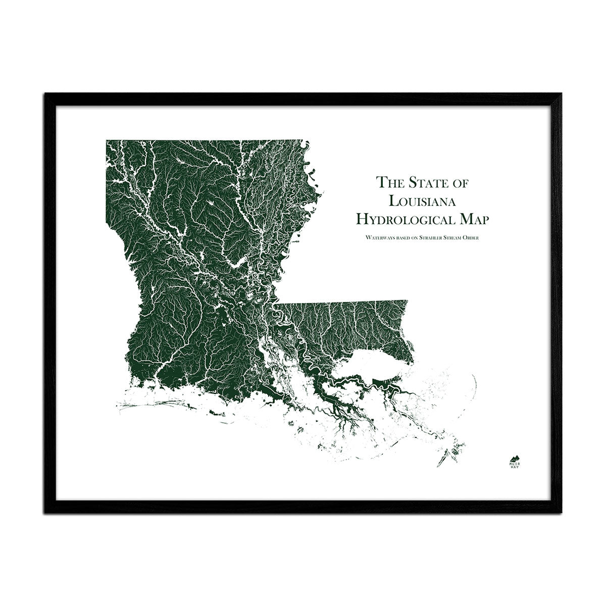
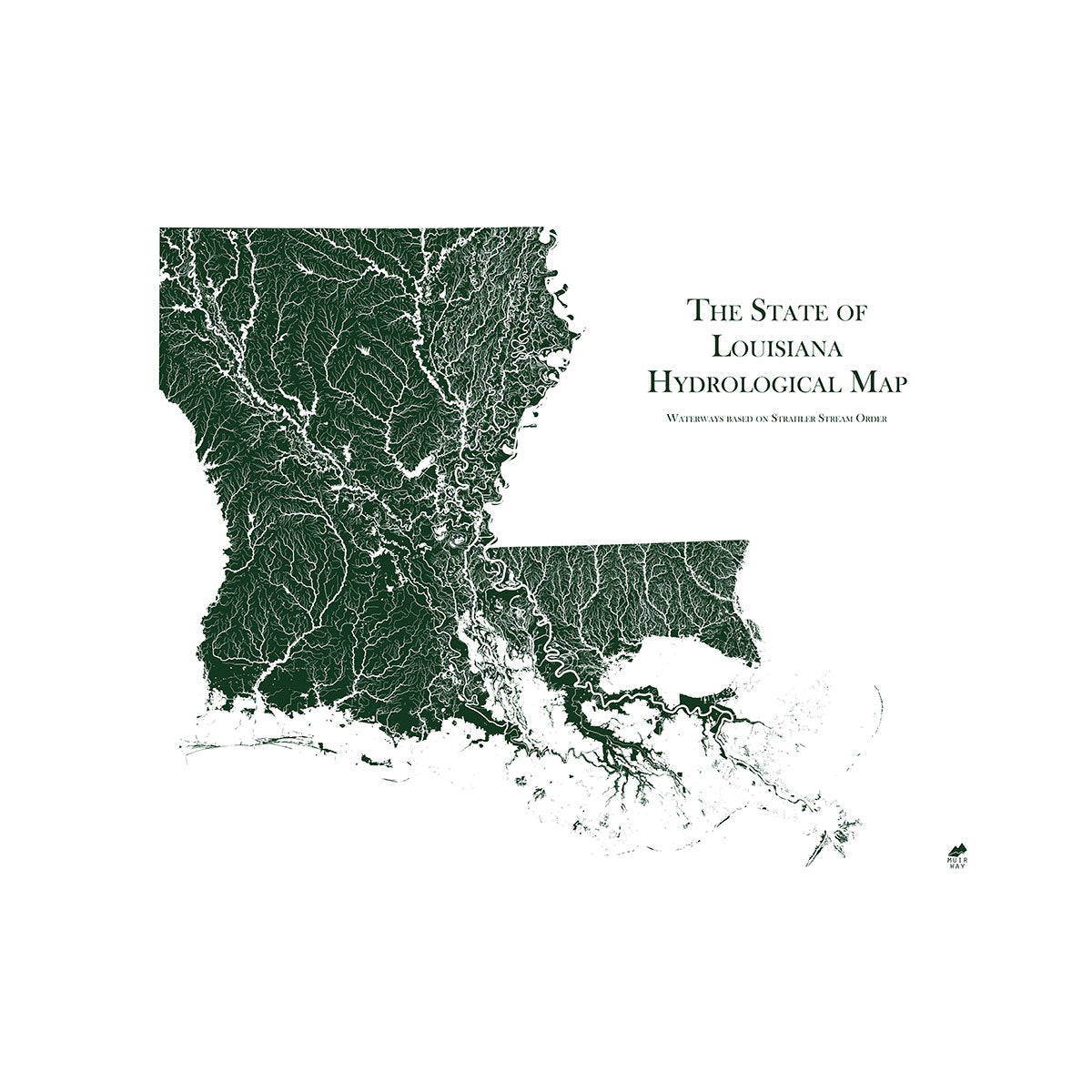
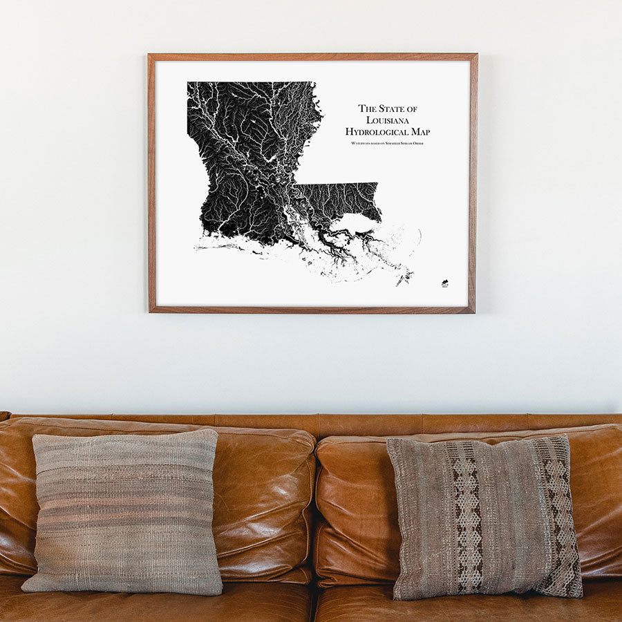
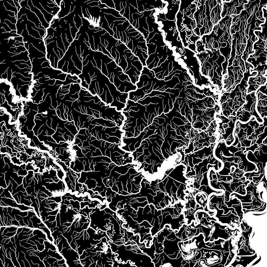
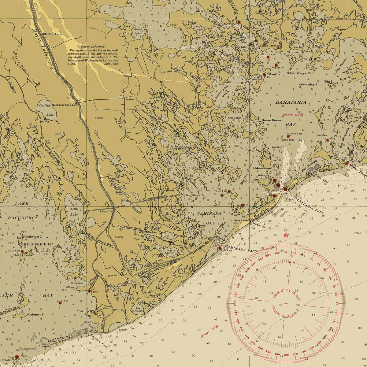
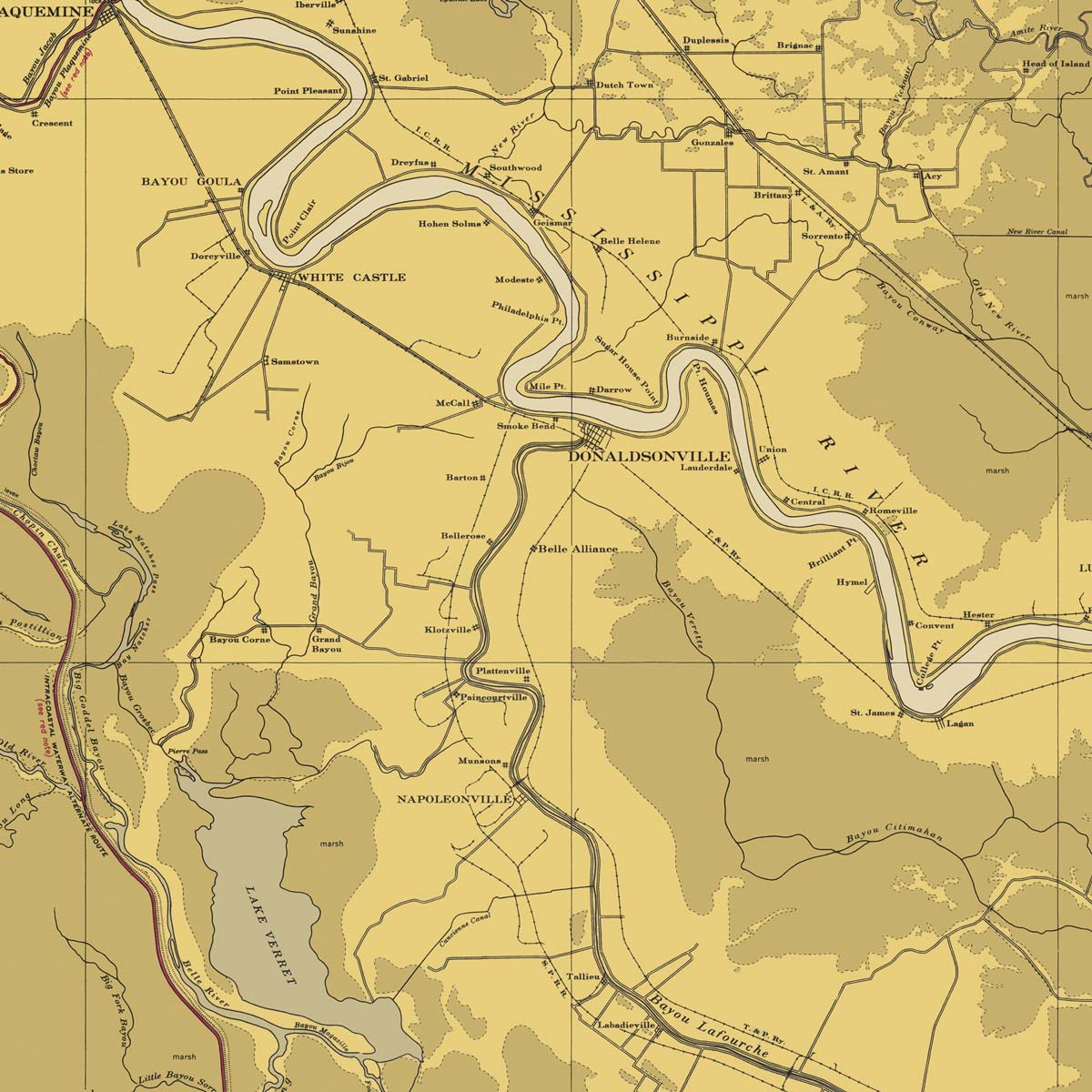
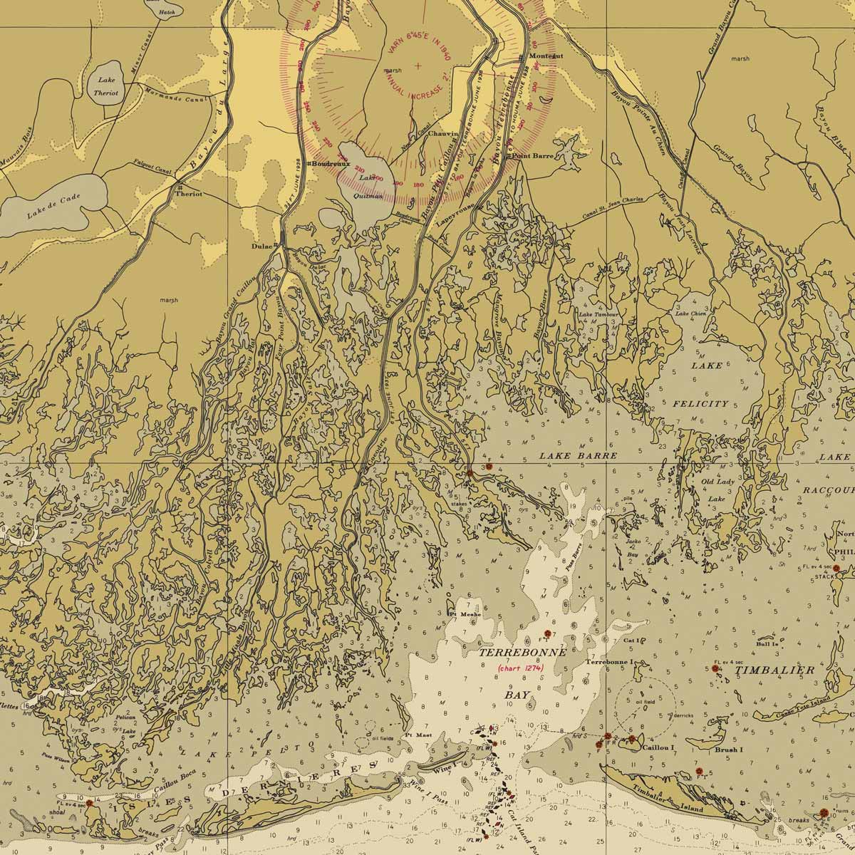
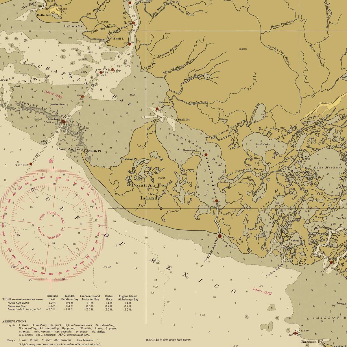
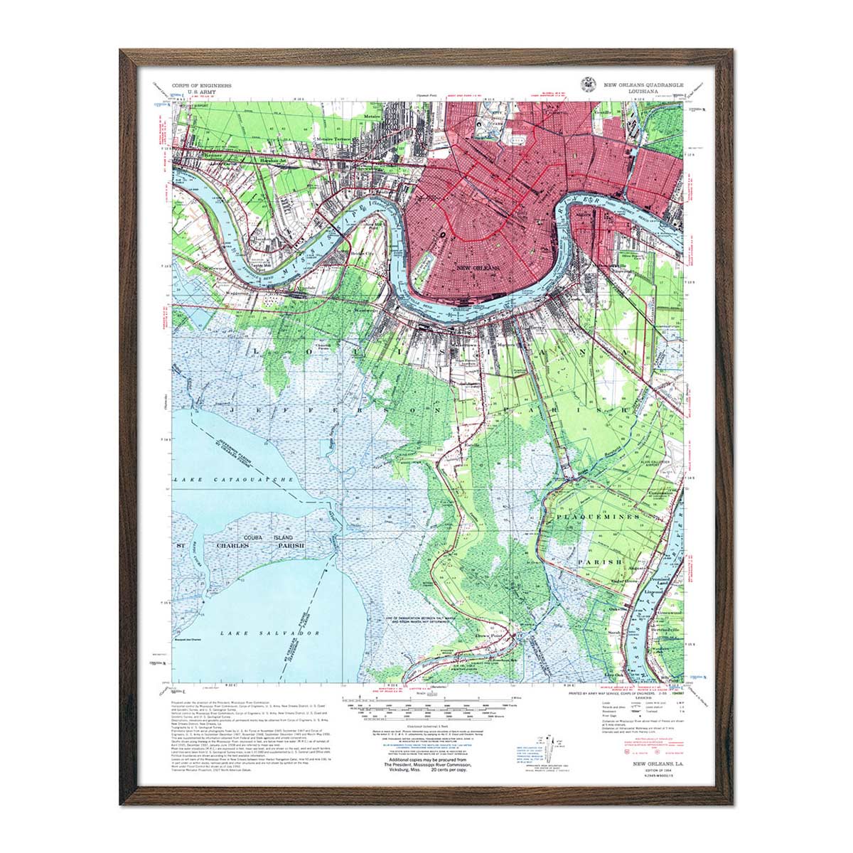
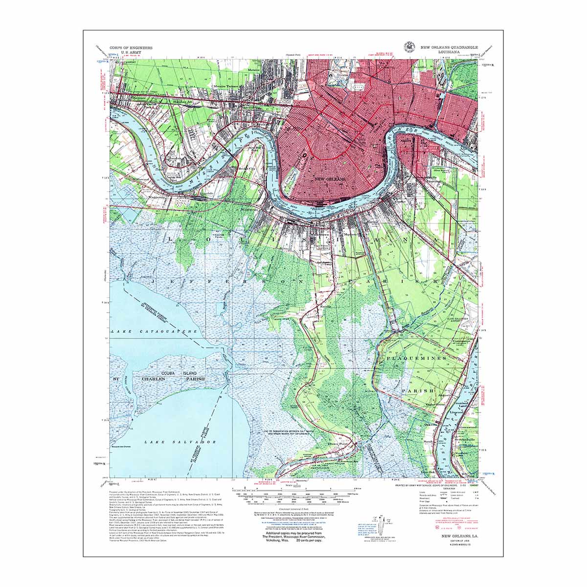
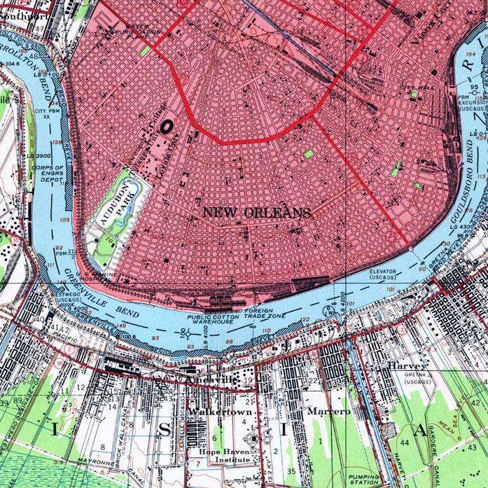
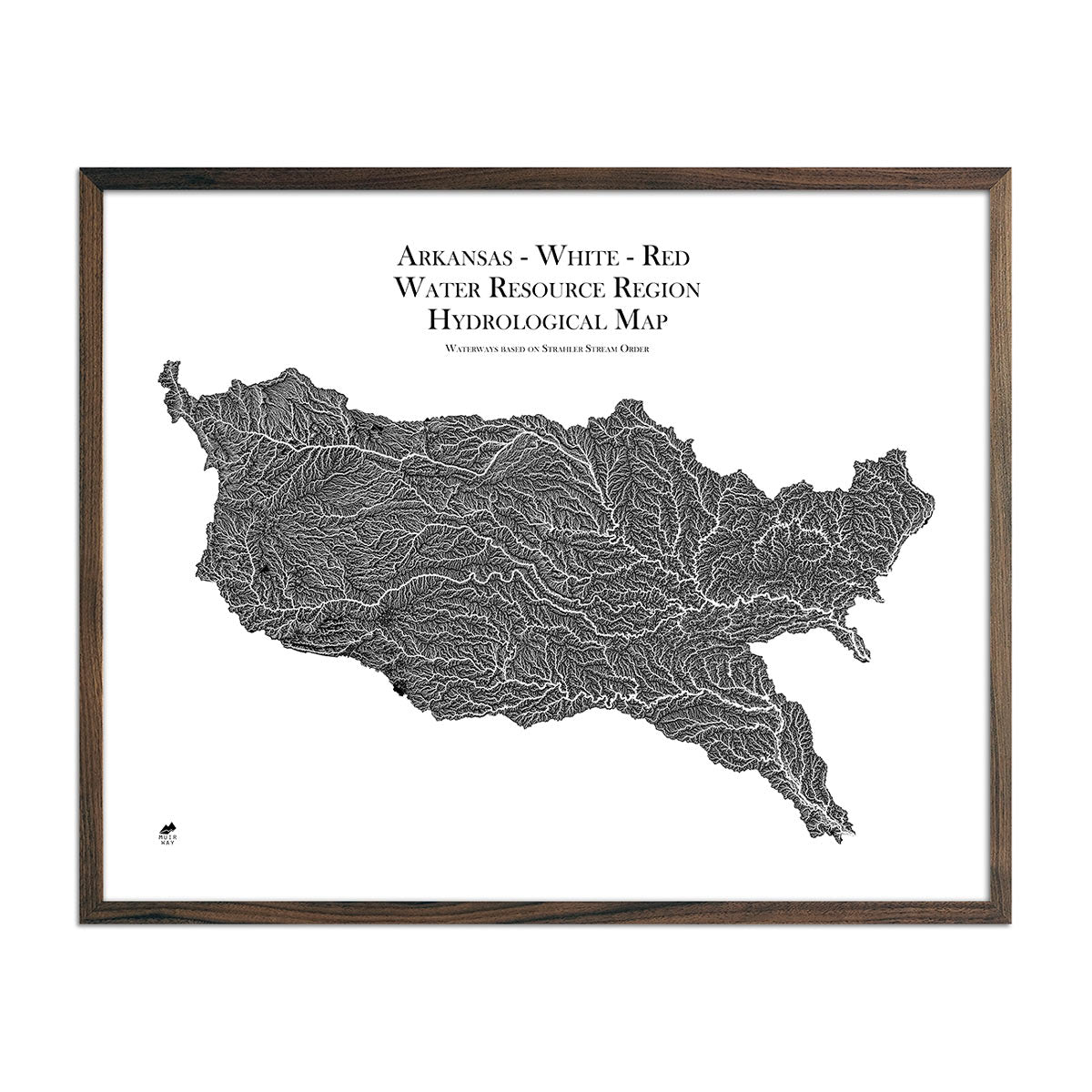
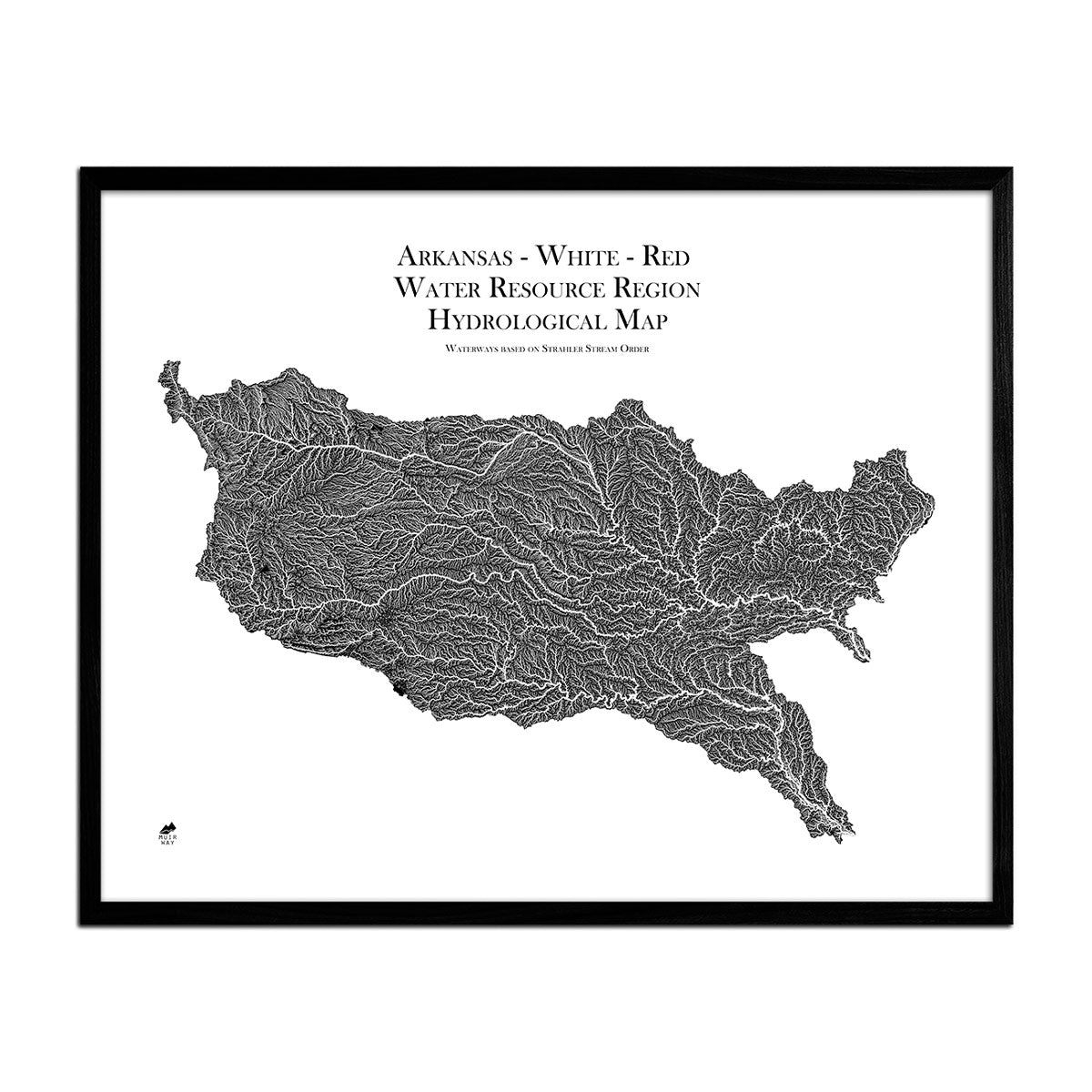
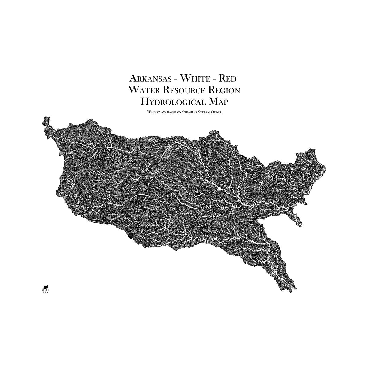
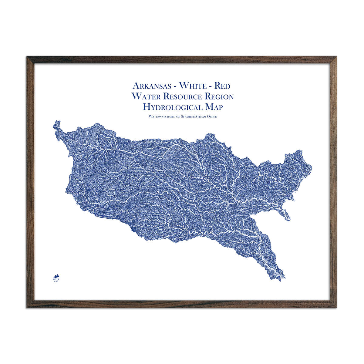
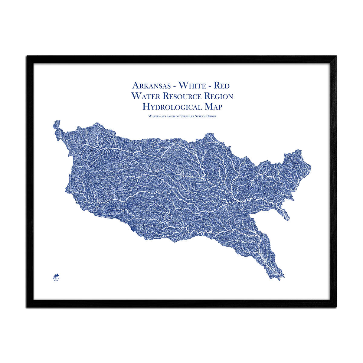
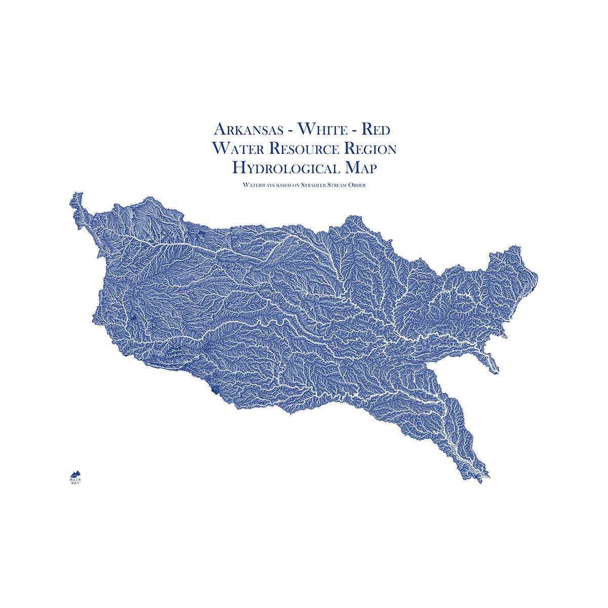
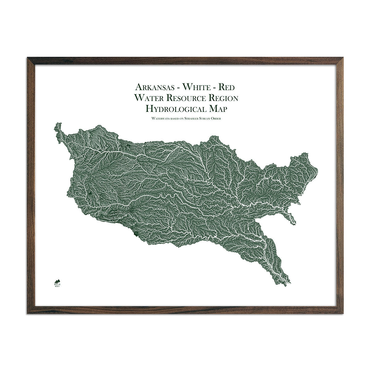
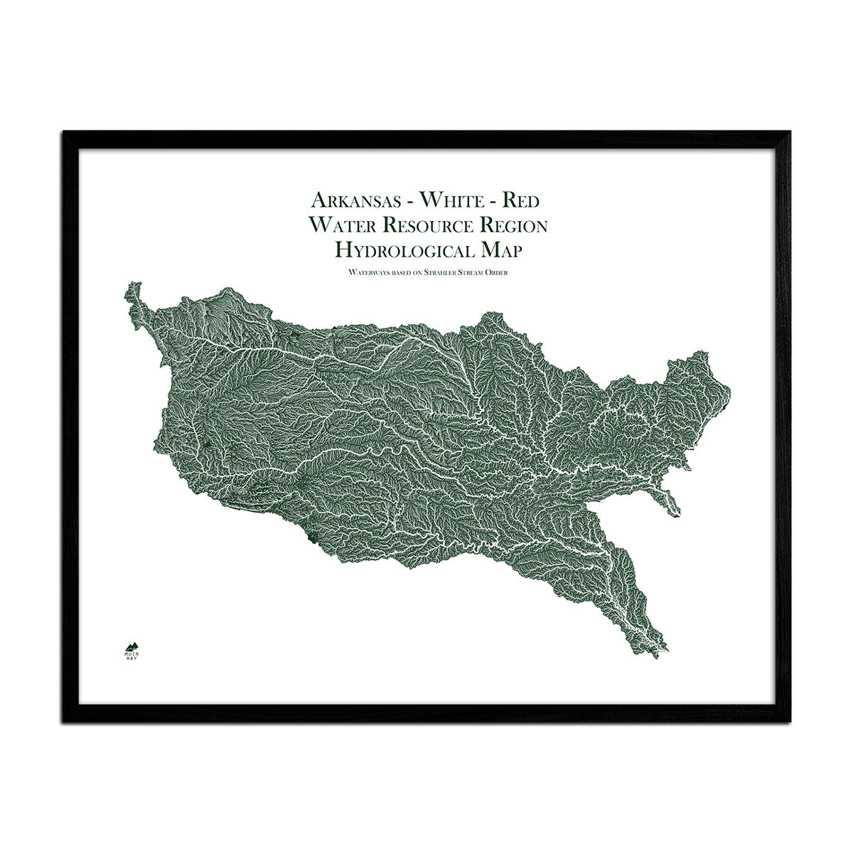
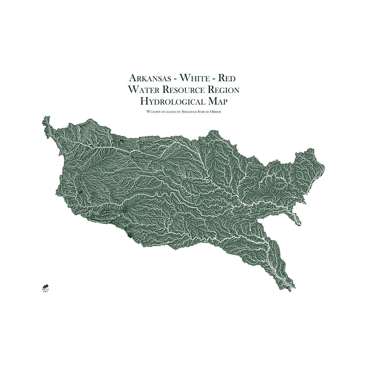
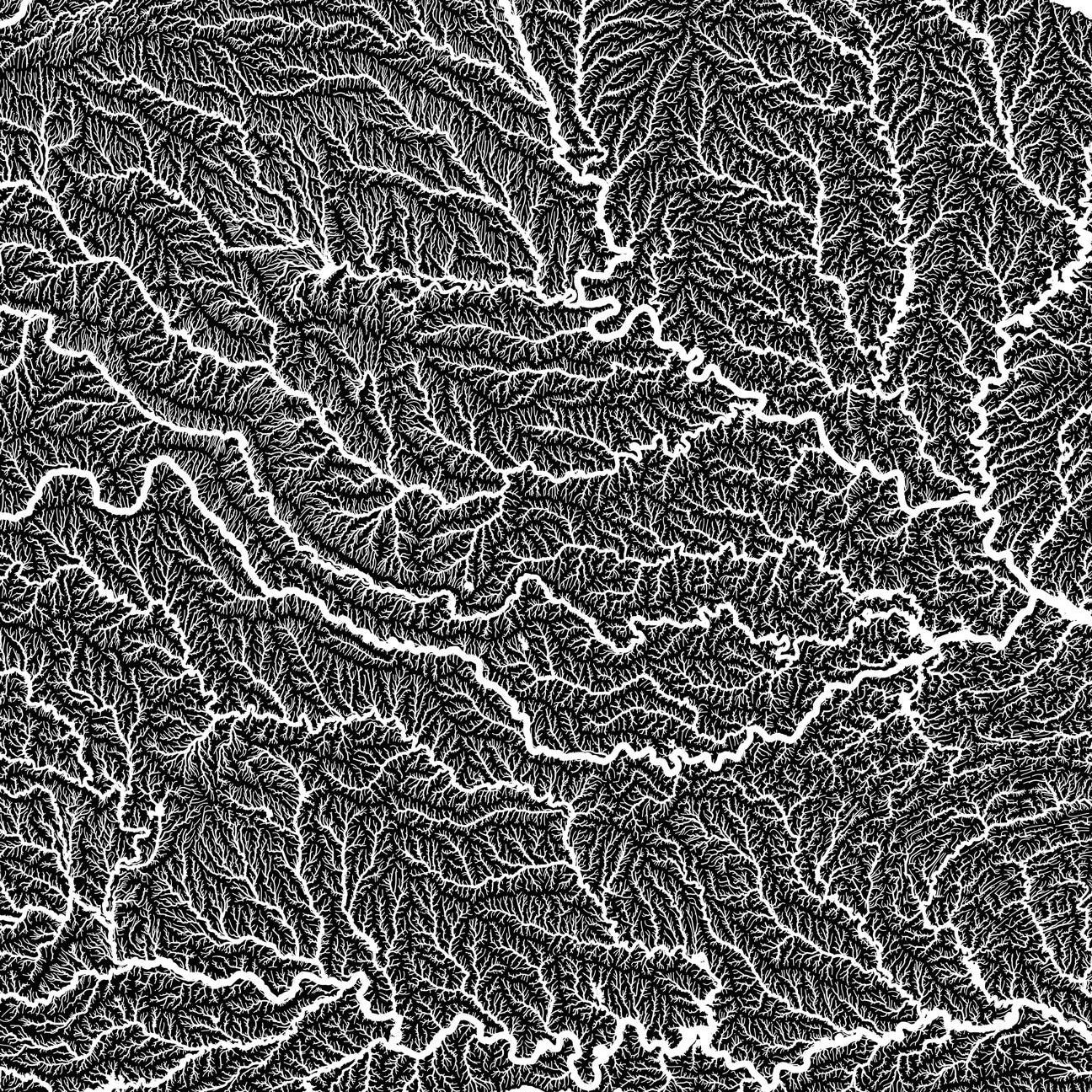
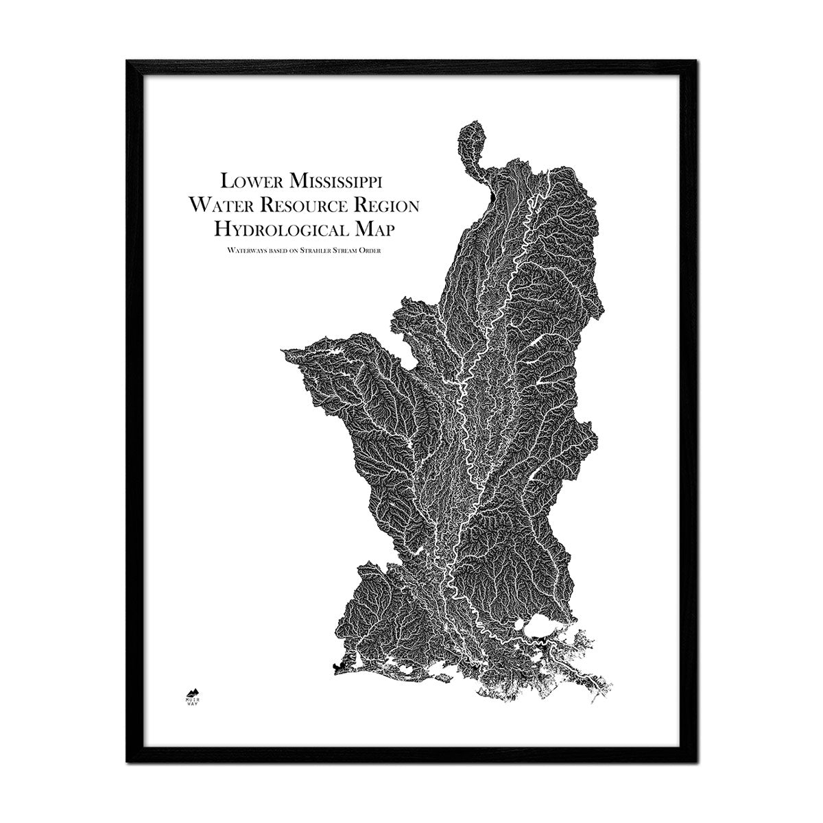
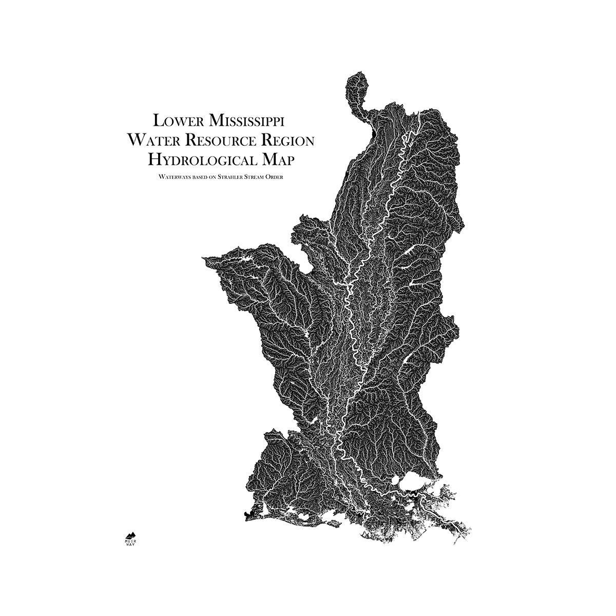
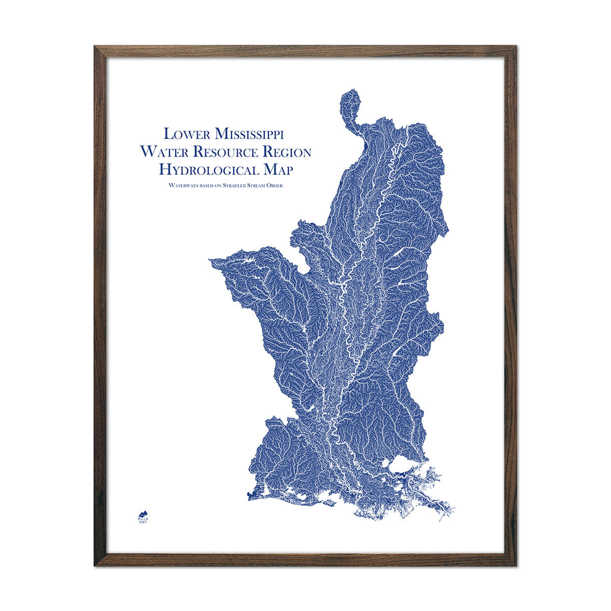
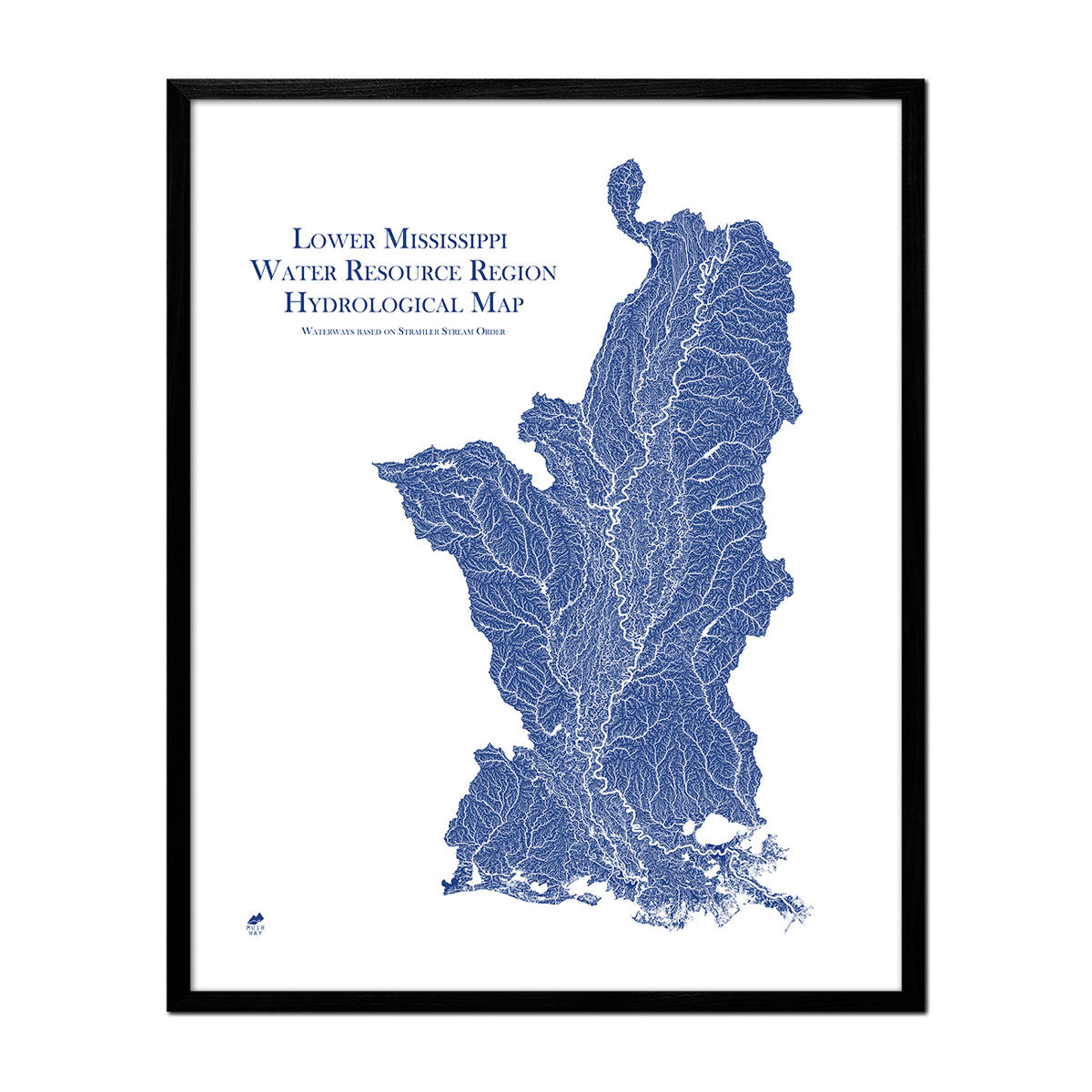
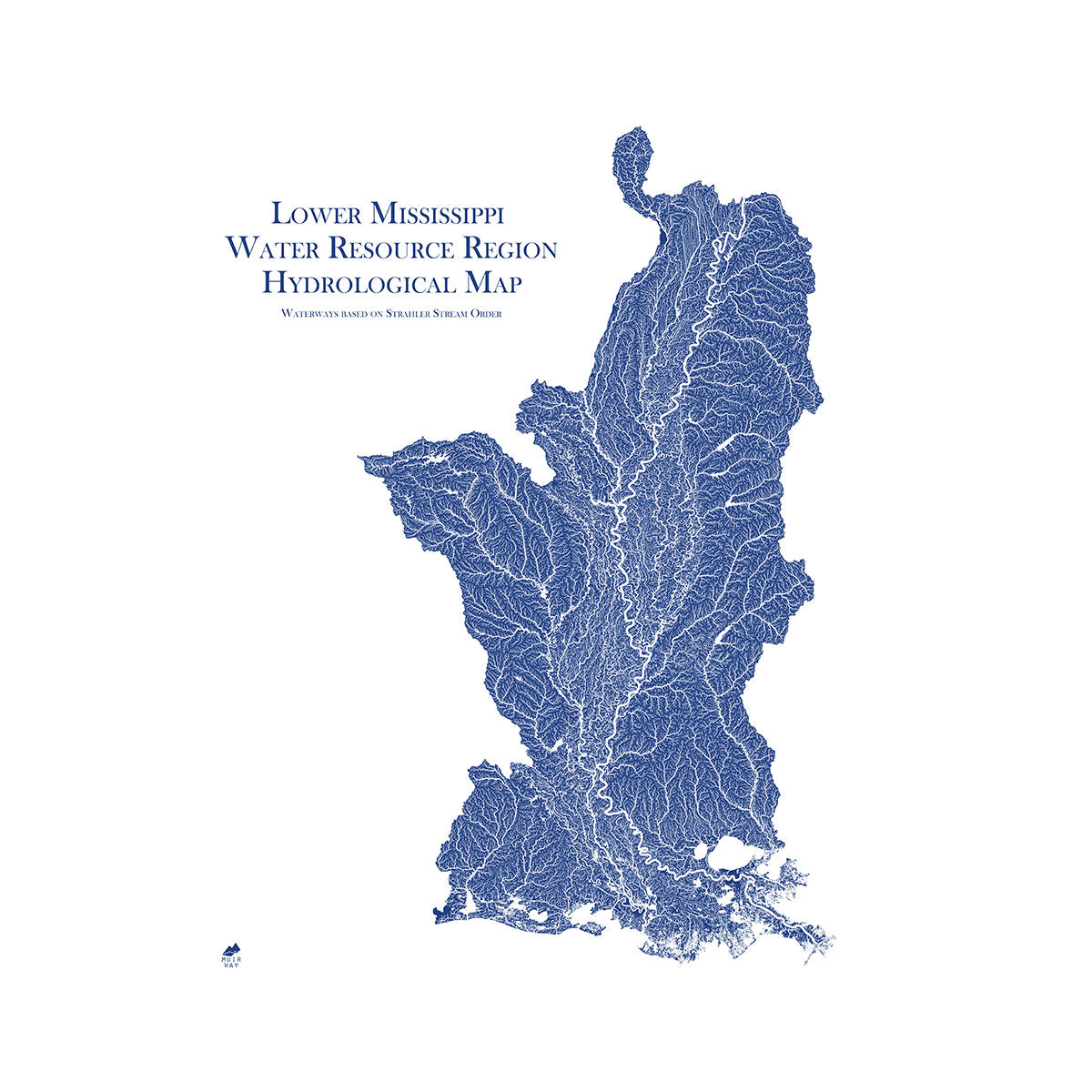
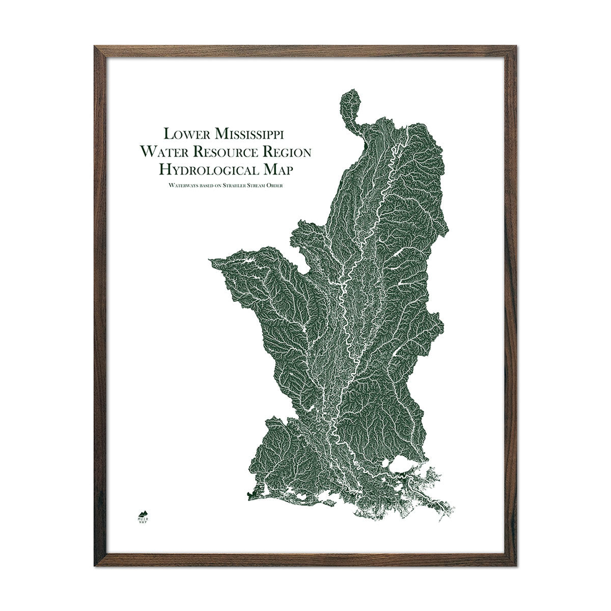
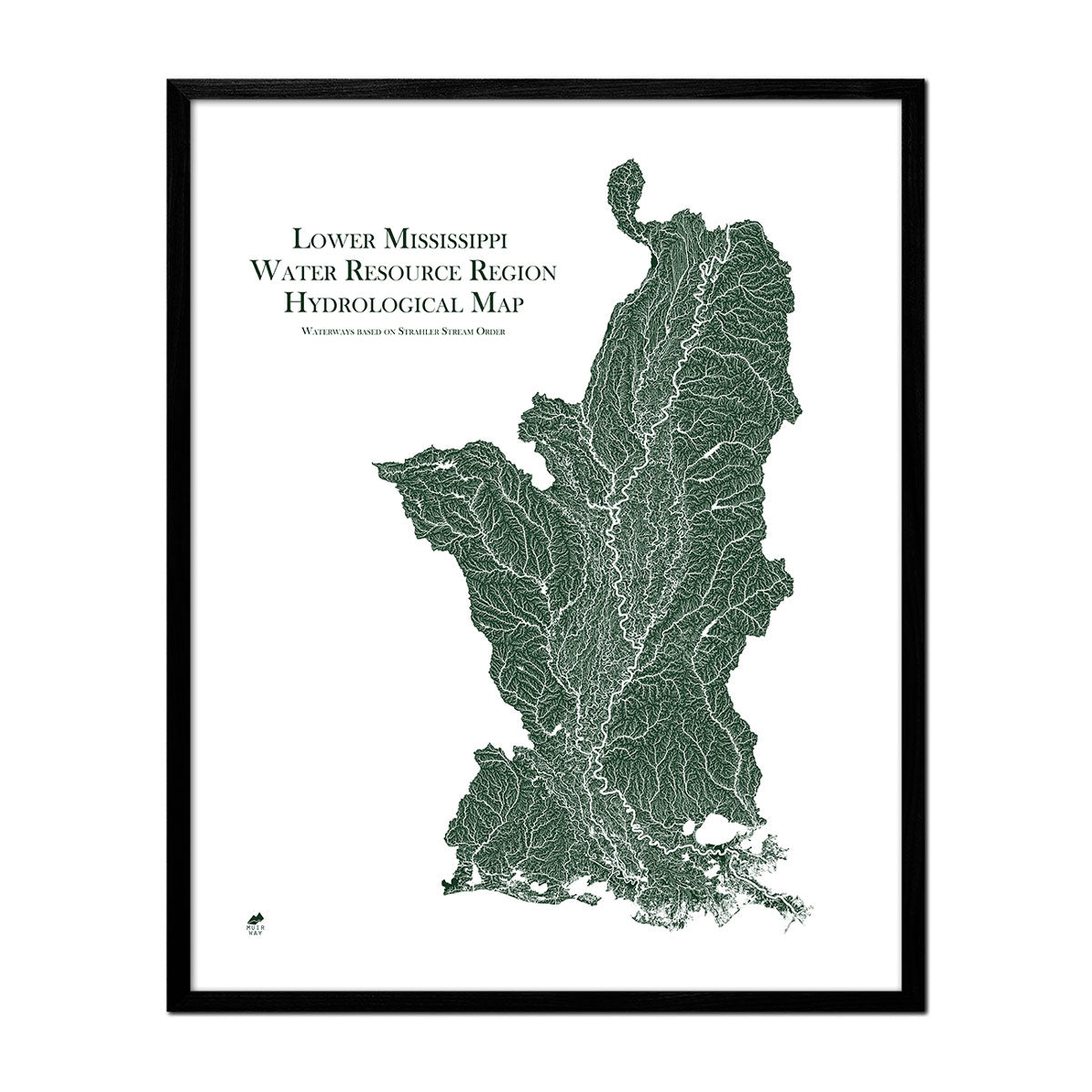
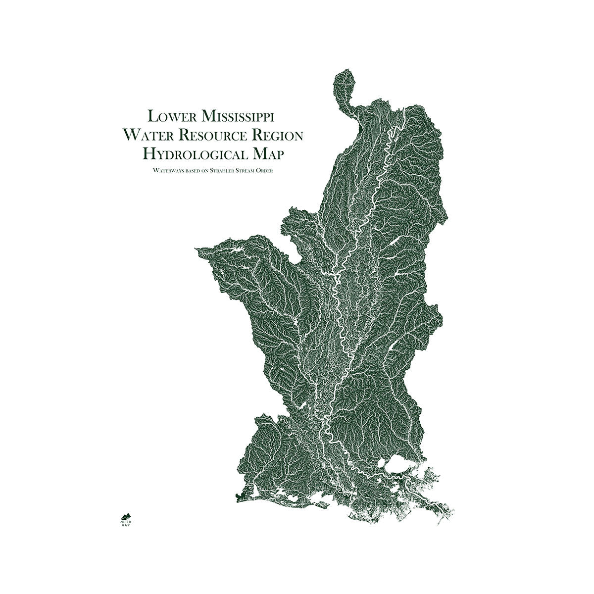
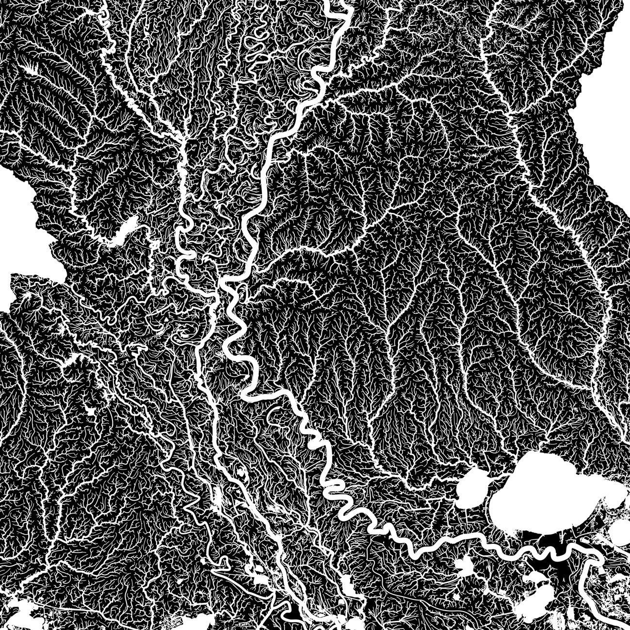
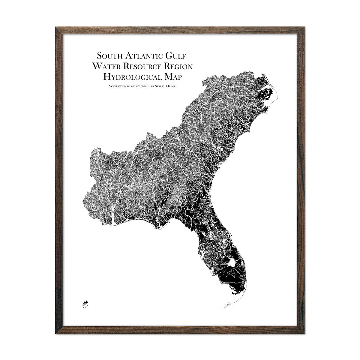
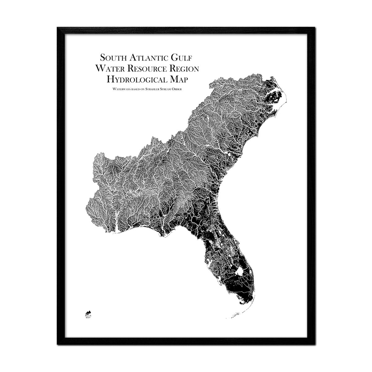
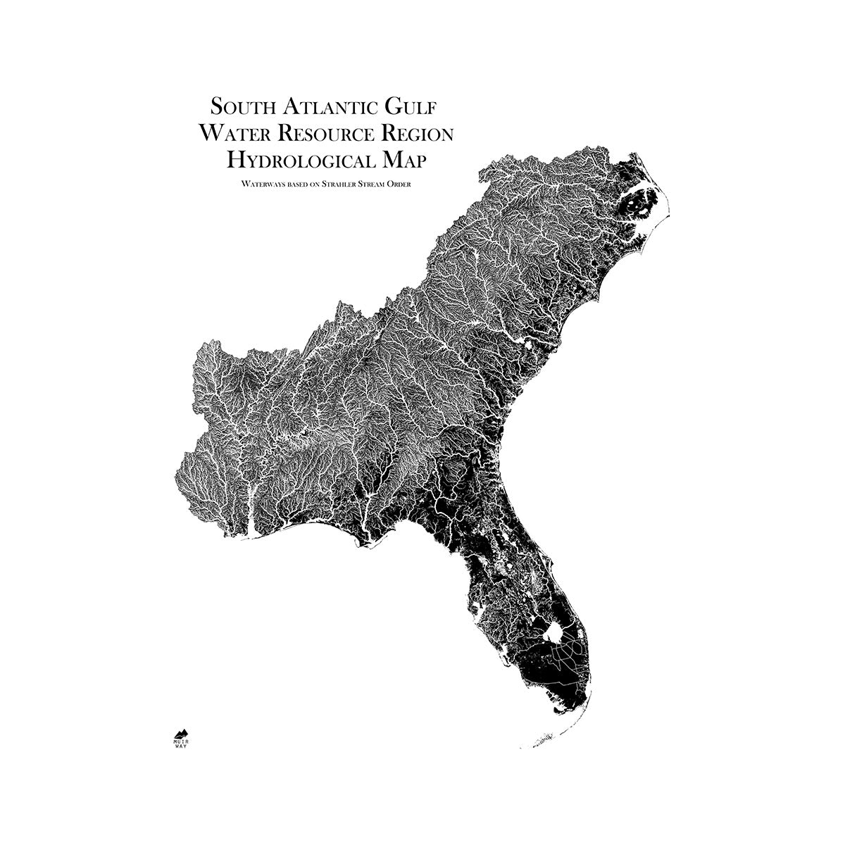
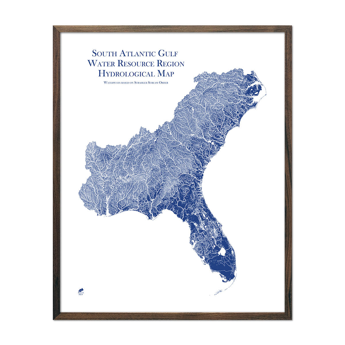
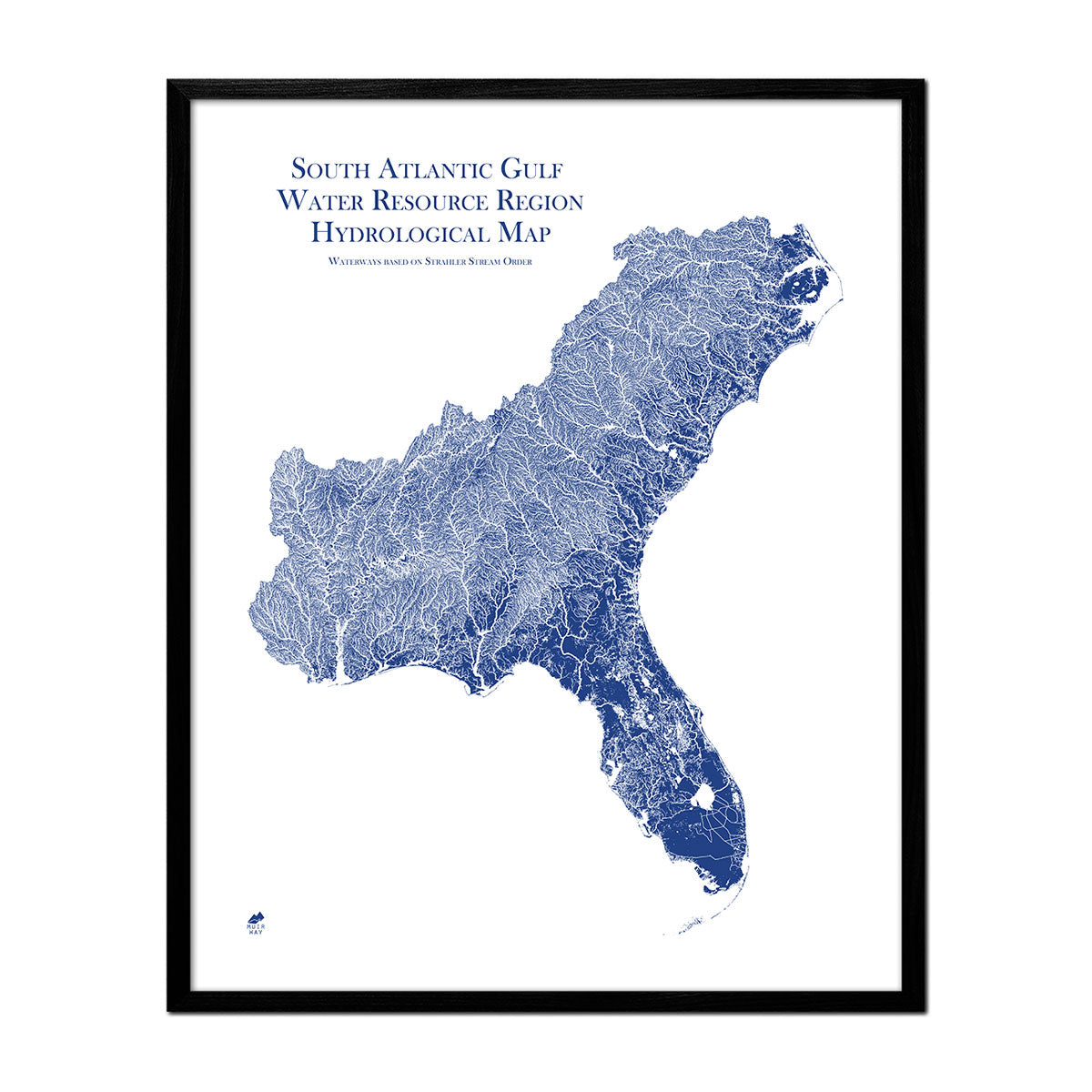
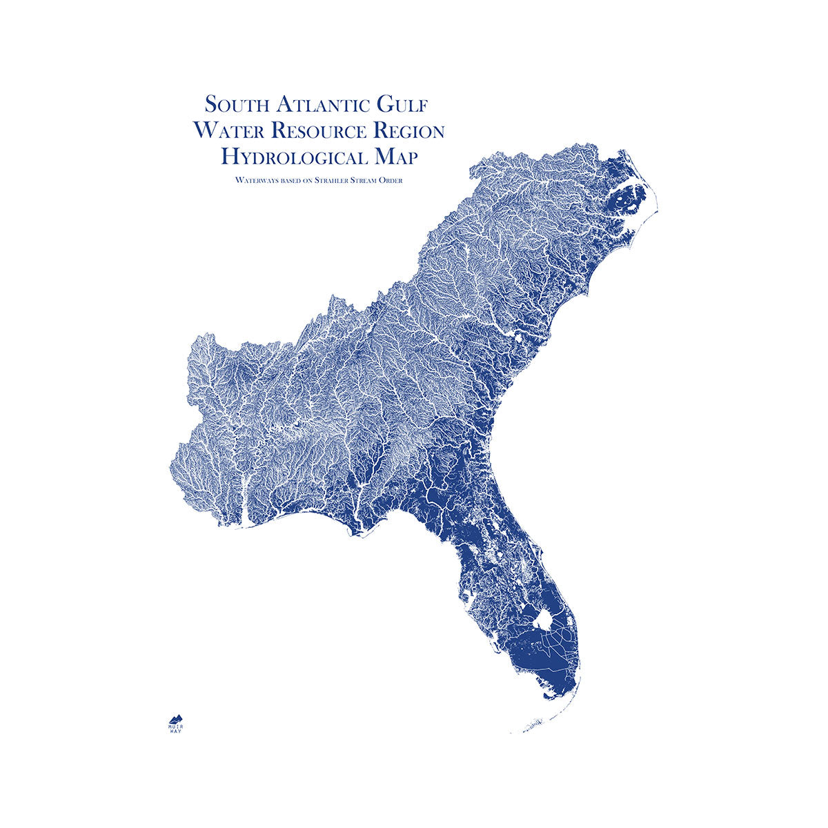
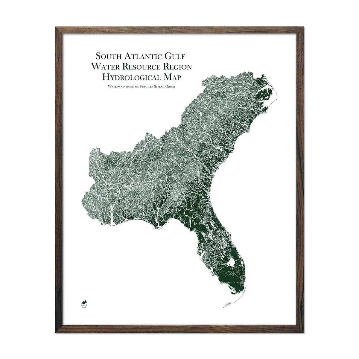
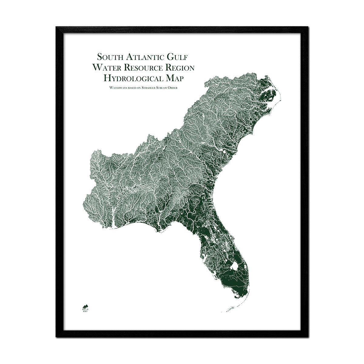
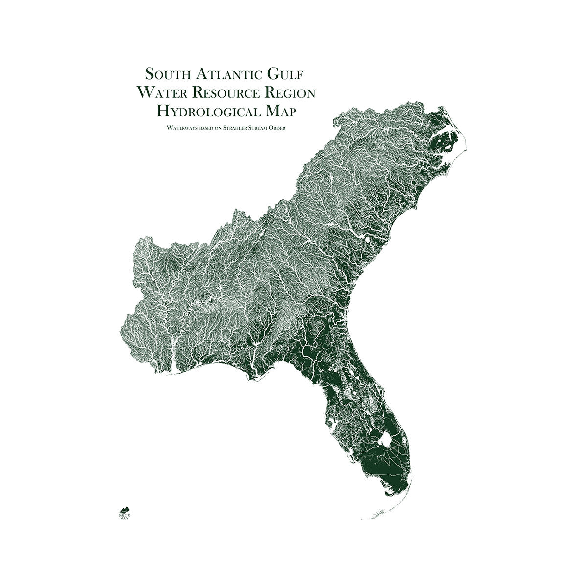
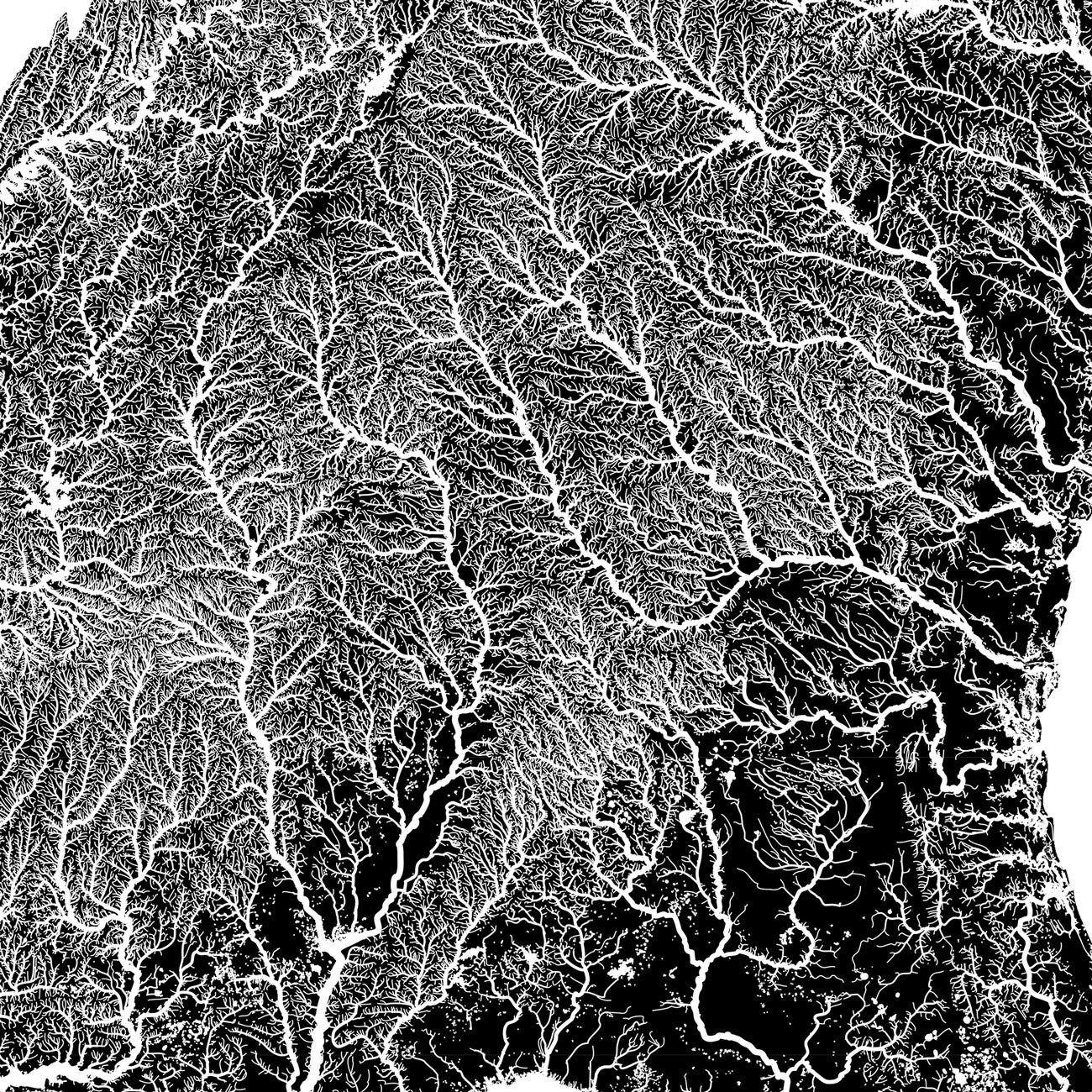
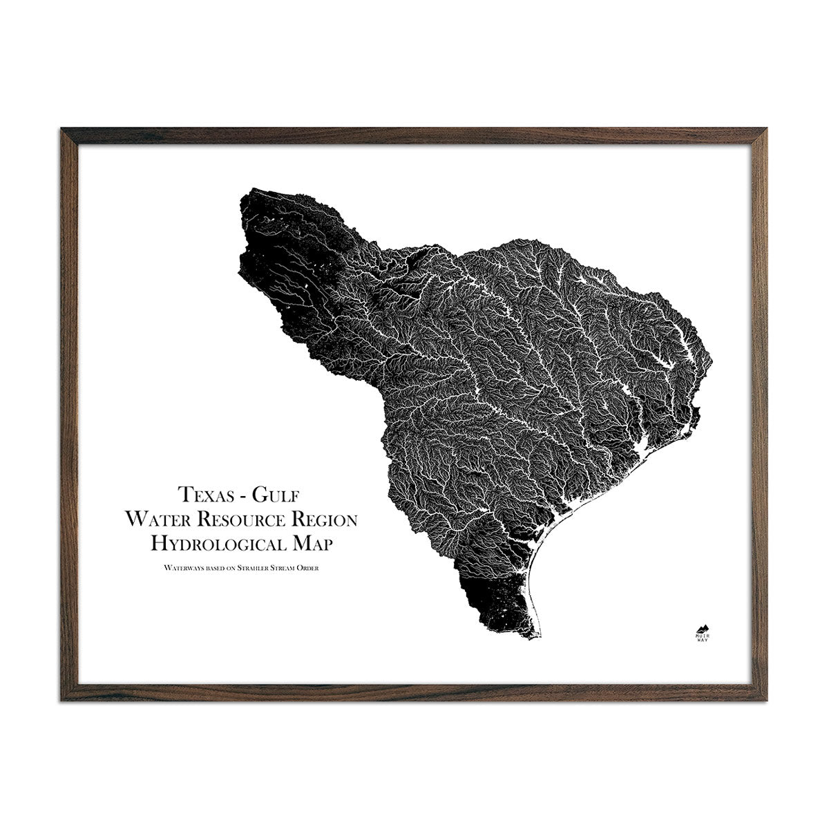
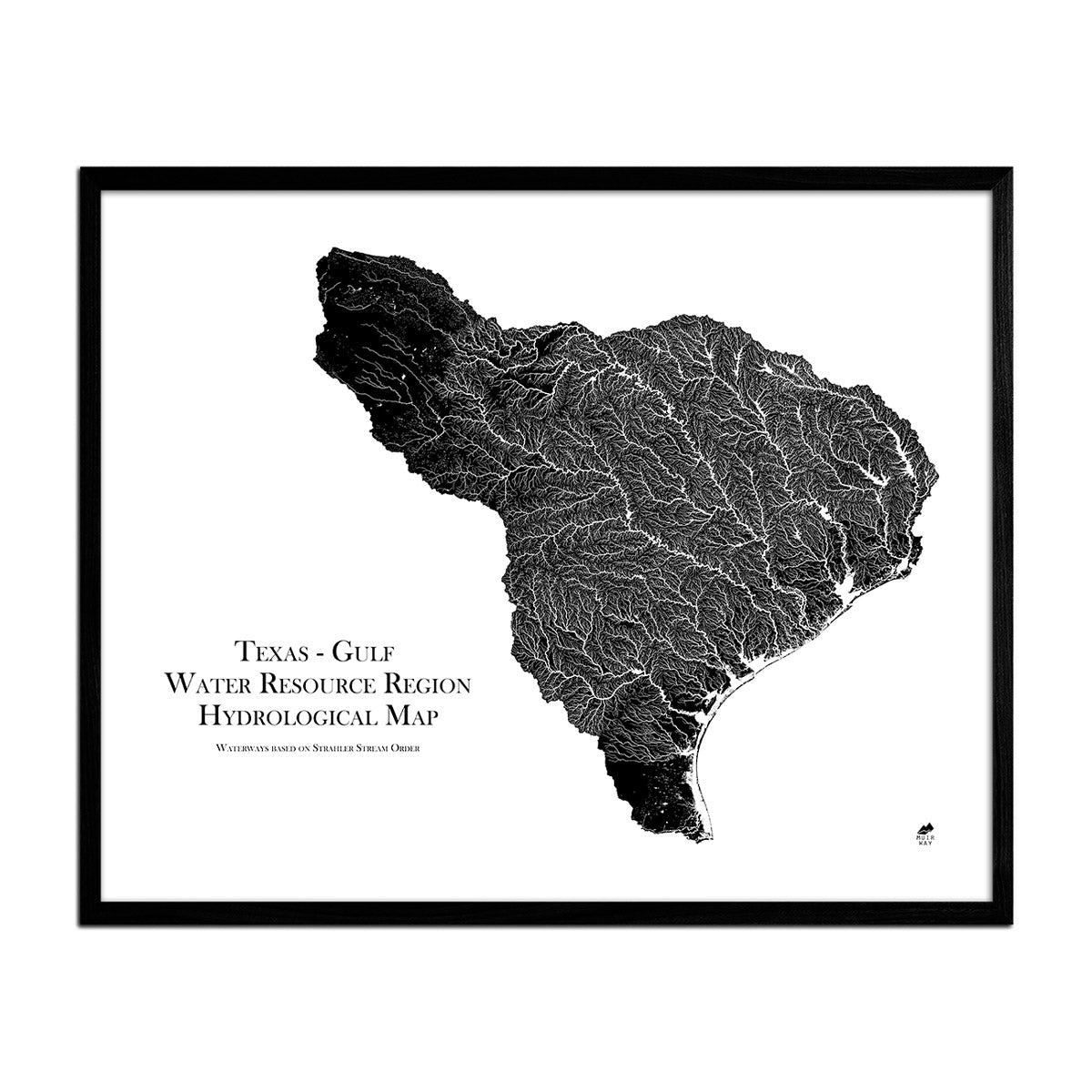
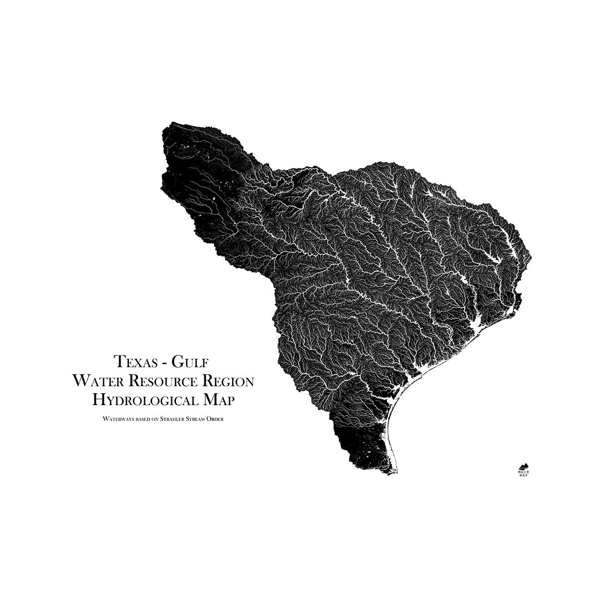
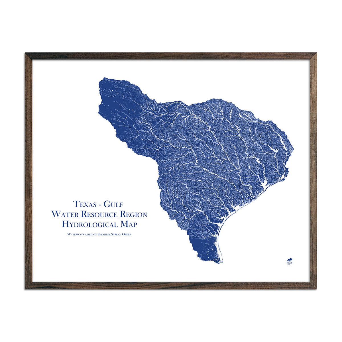
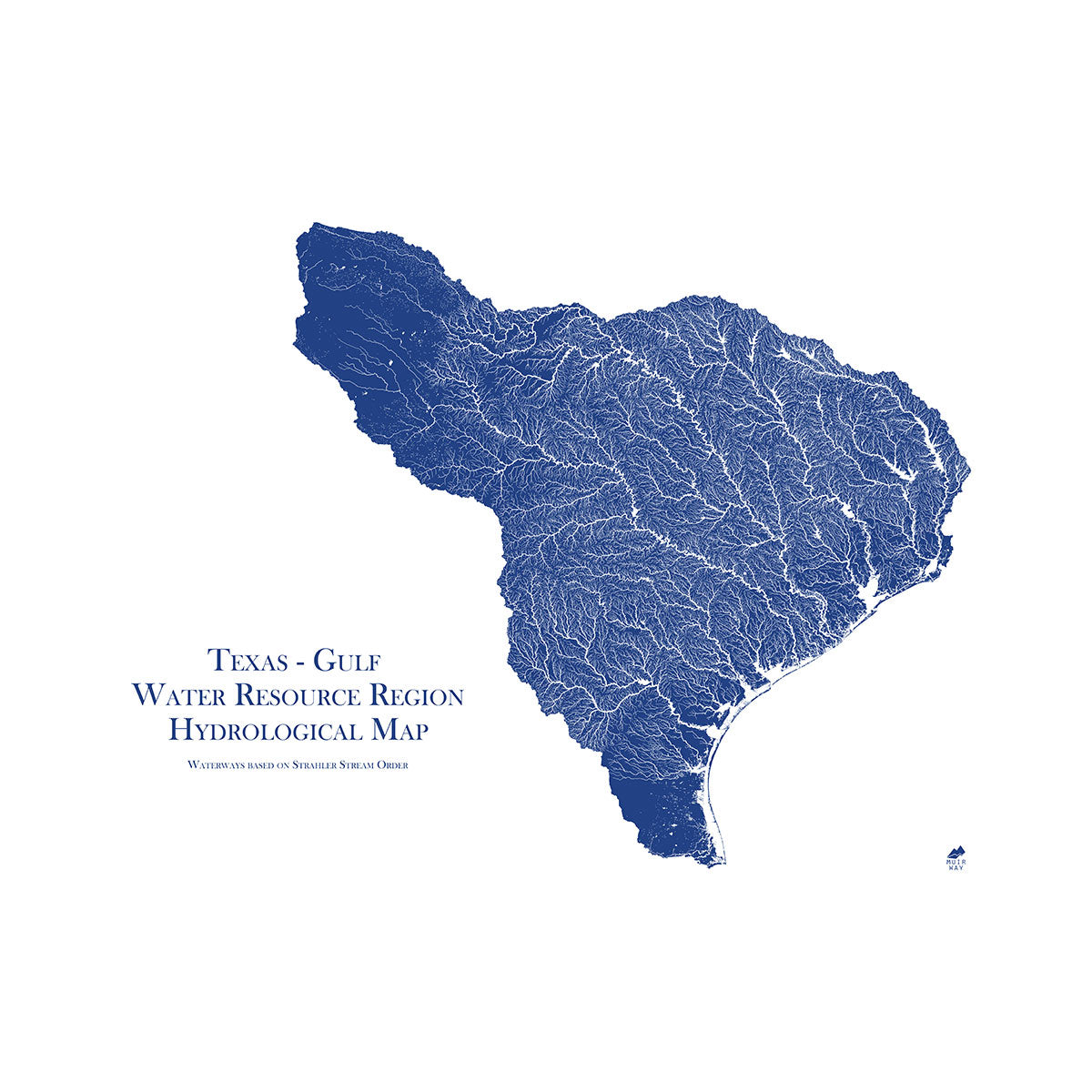
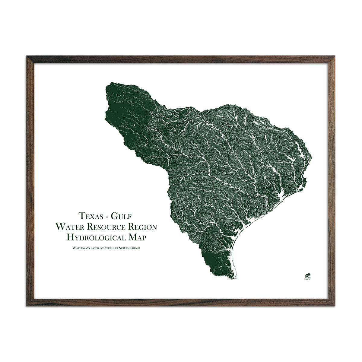
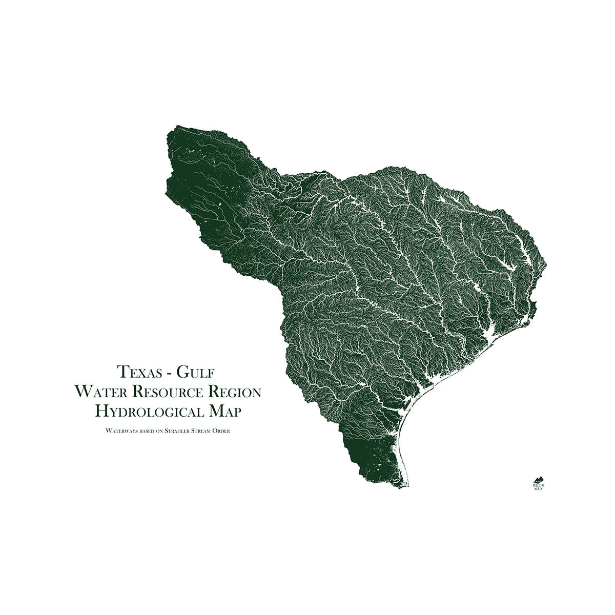
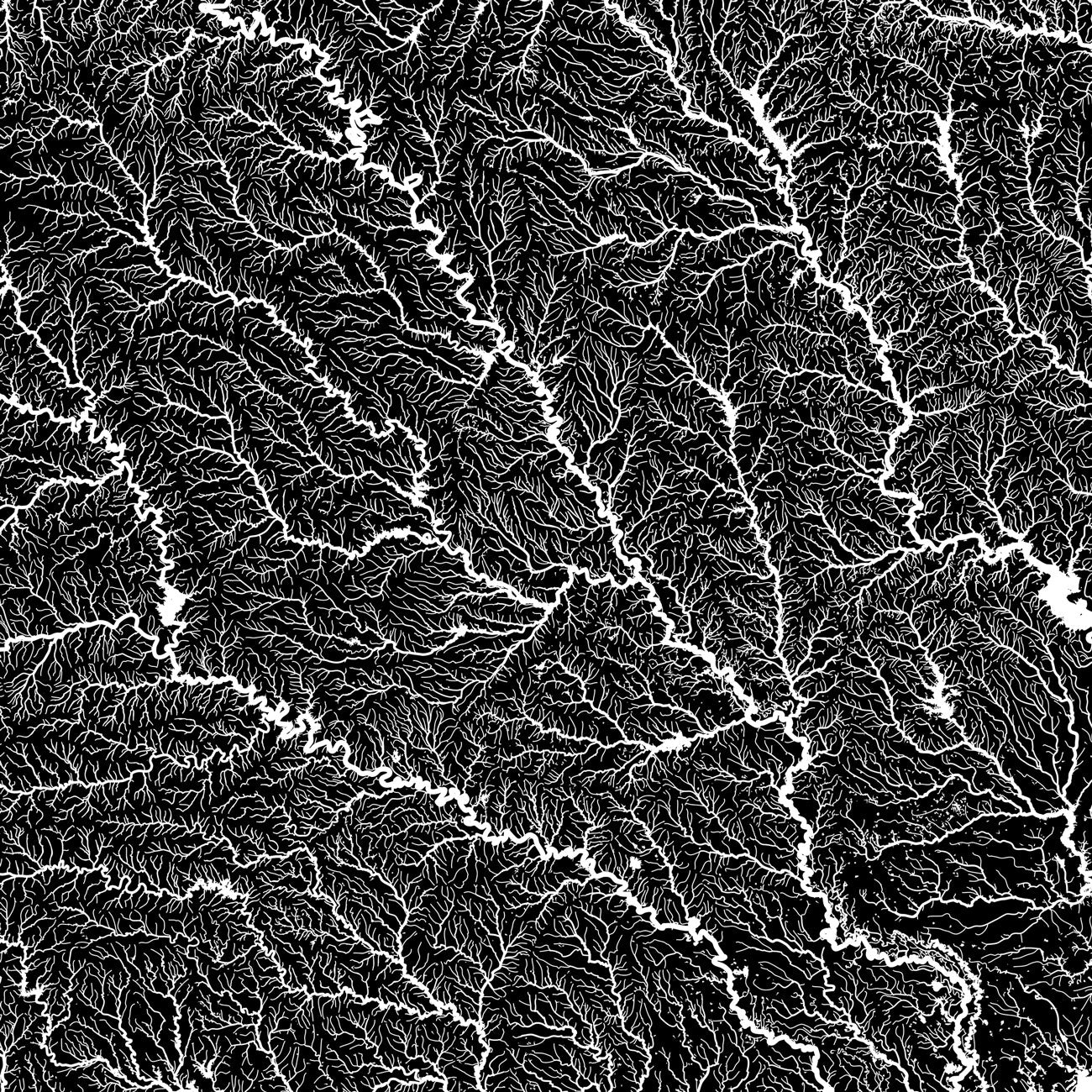
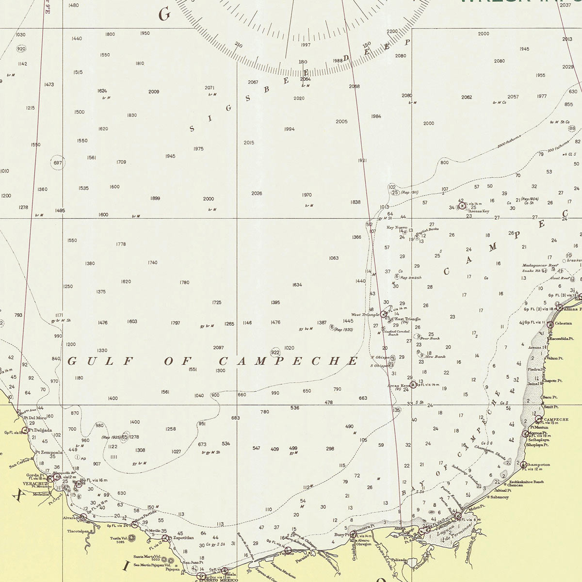
Louisiana hydrological maps - Our hydrological maps showcase the intricate network of waterways, from the widest river to the smallest tributaries. Trace rivers and lakes on our Louisiana hydrology map and you’ll see every single river and intermittent stream, as well as all bodies of water greater than 0.2 mi in diameter. Want to see the ‘bigger picture’? Try our Arkansas White-Red regional hydrological map, our Lower Mississippi regional hydrological map, or our South Atlantic-Gulf regional hydrological map. What makes our hydro maps stand out? We apply a method called the Strahler Stream Order to show the hierarchy of streams as they flow from their source. This shows rivers growing thicker as they acquire the flow of tributaries. Our hydrological maps are available in black, blue, or green.
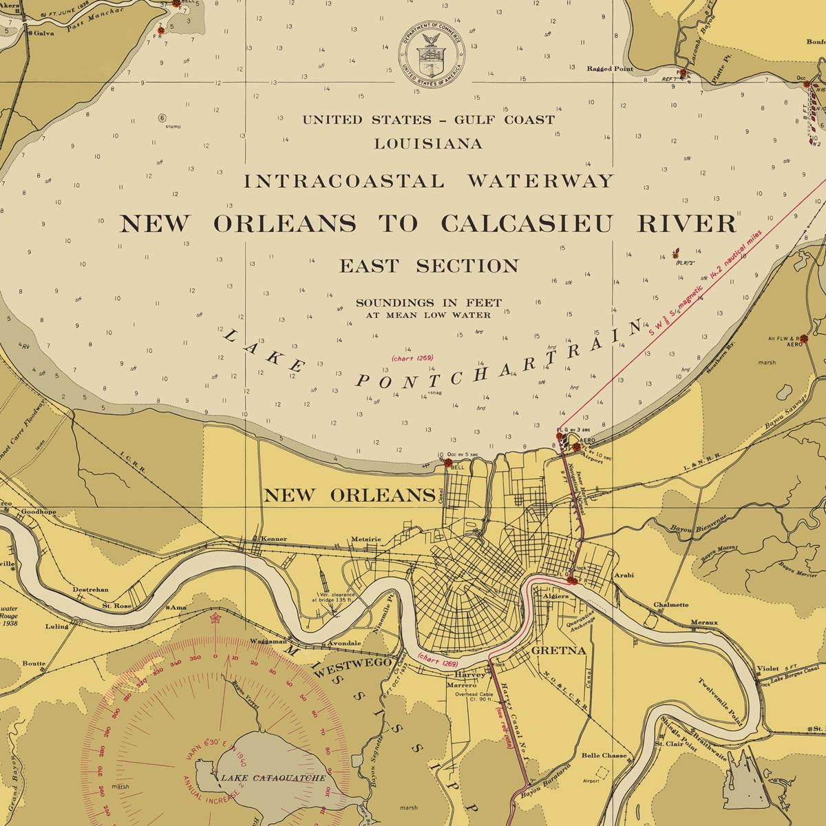
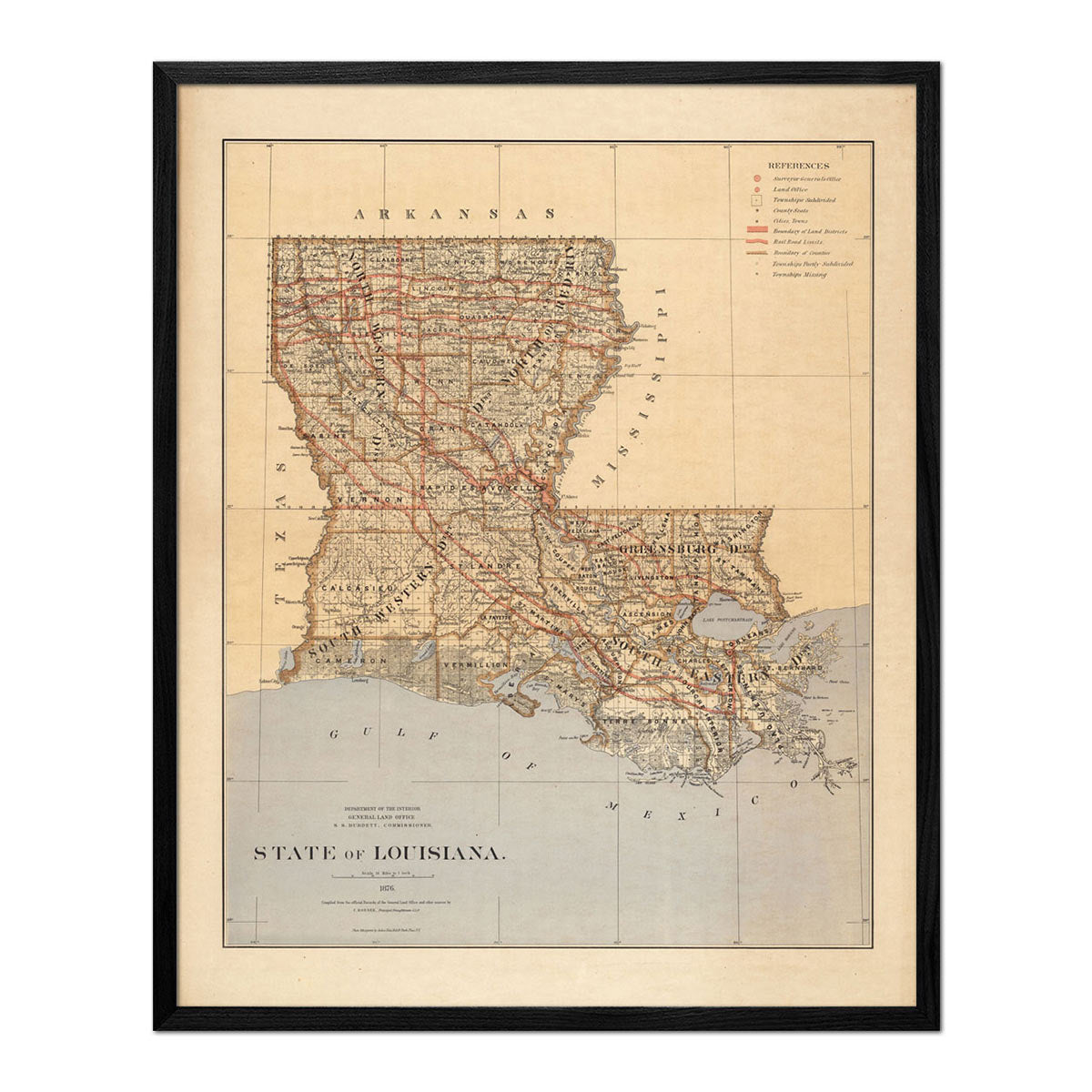
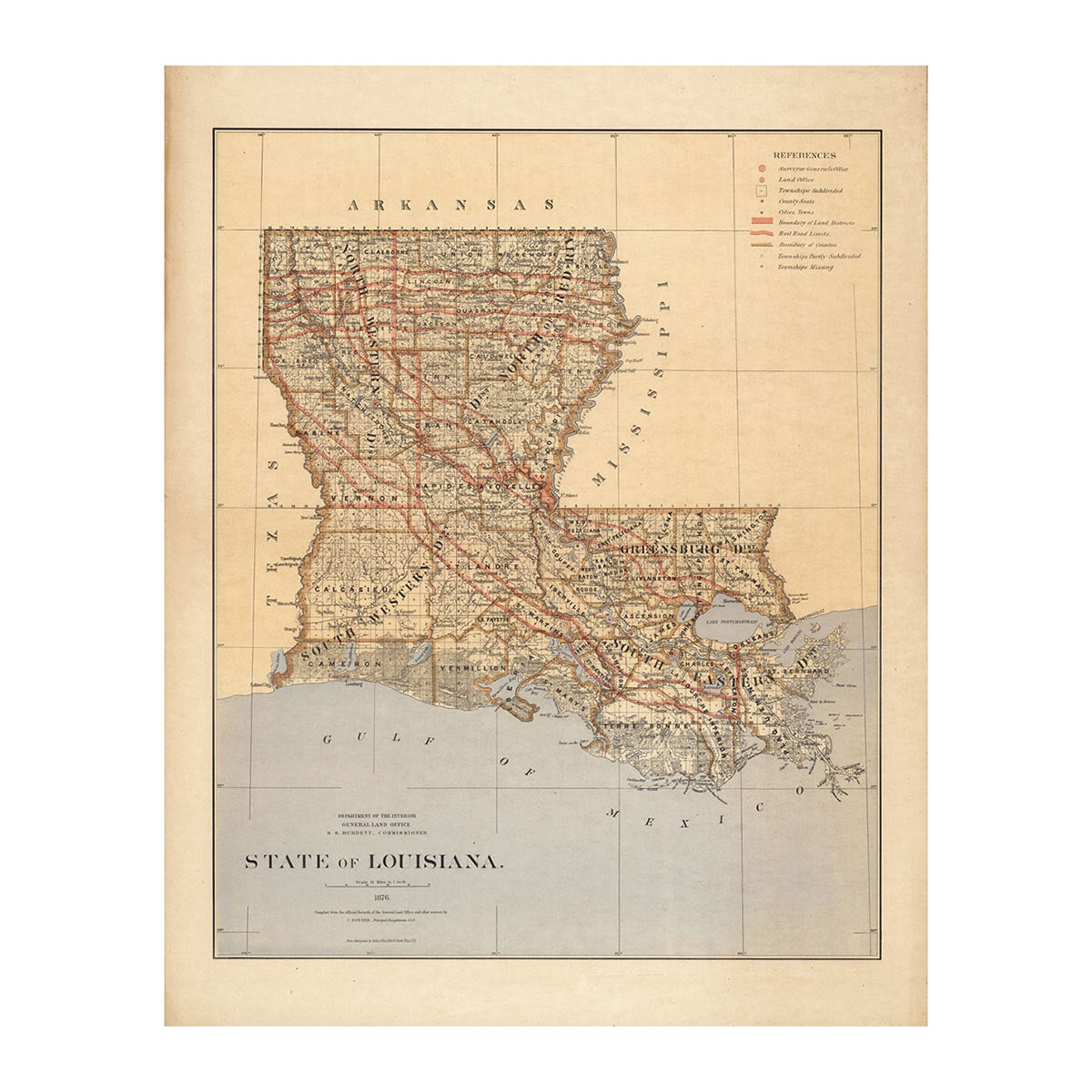
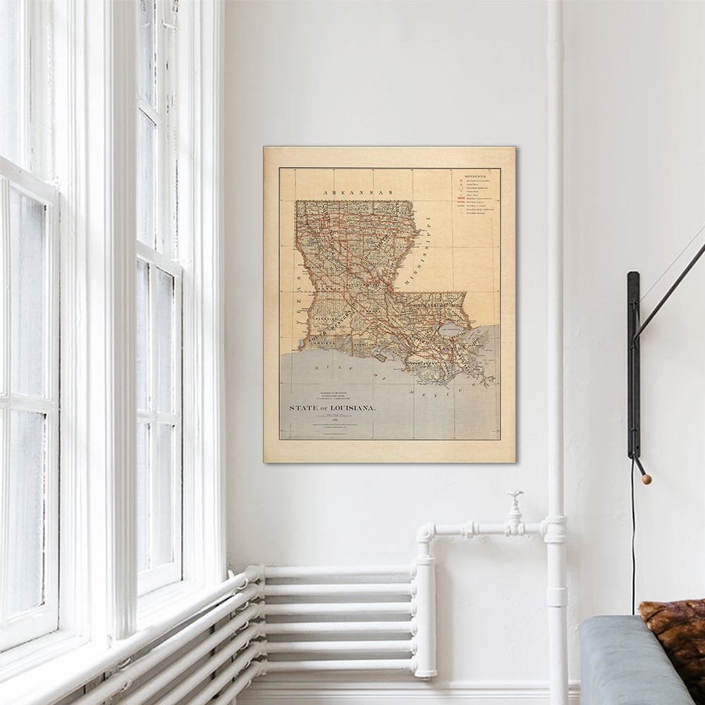
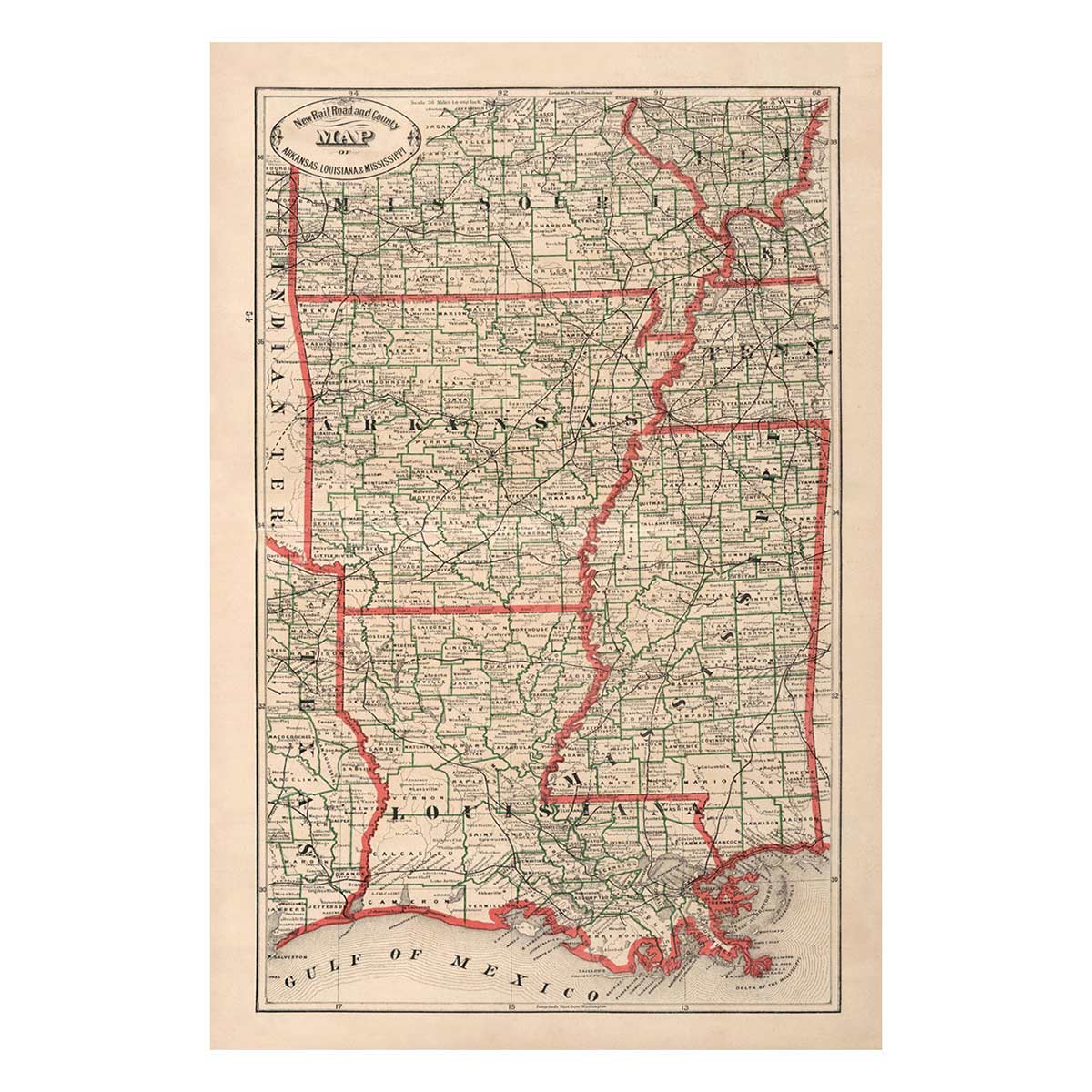
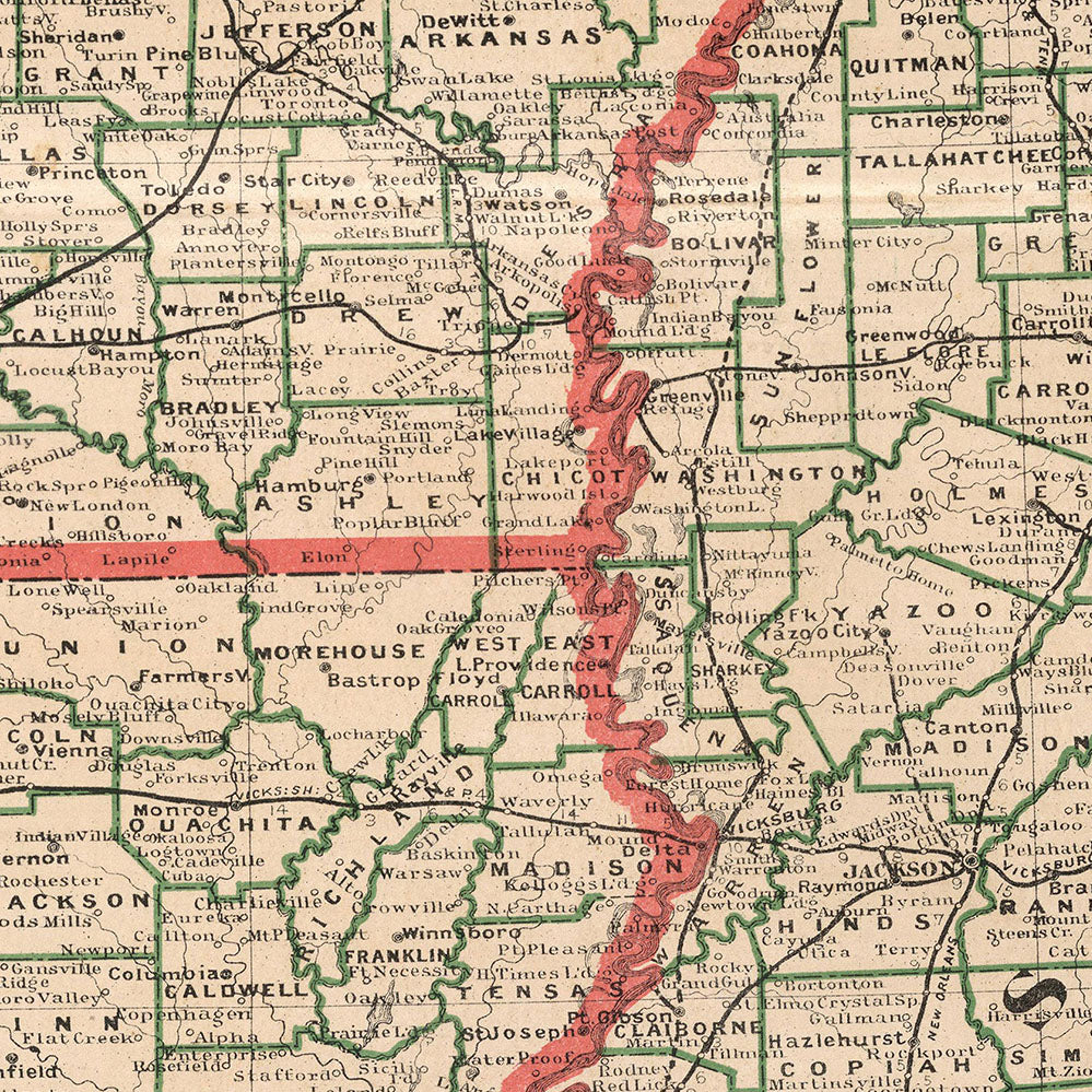
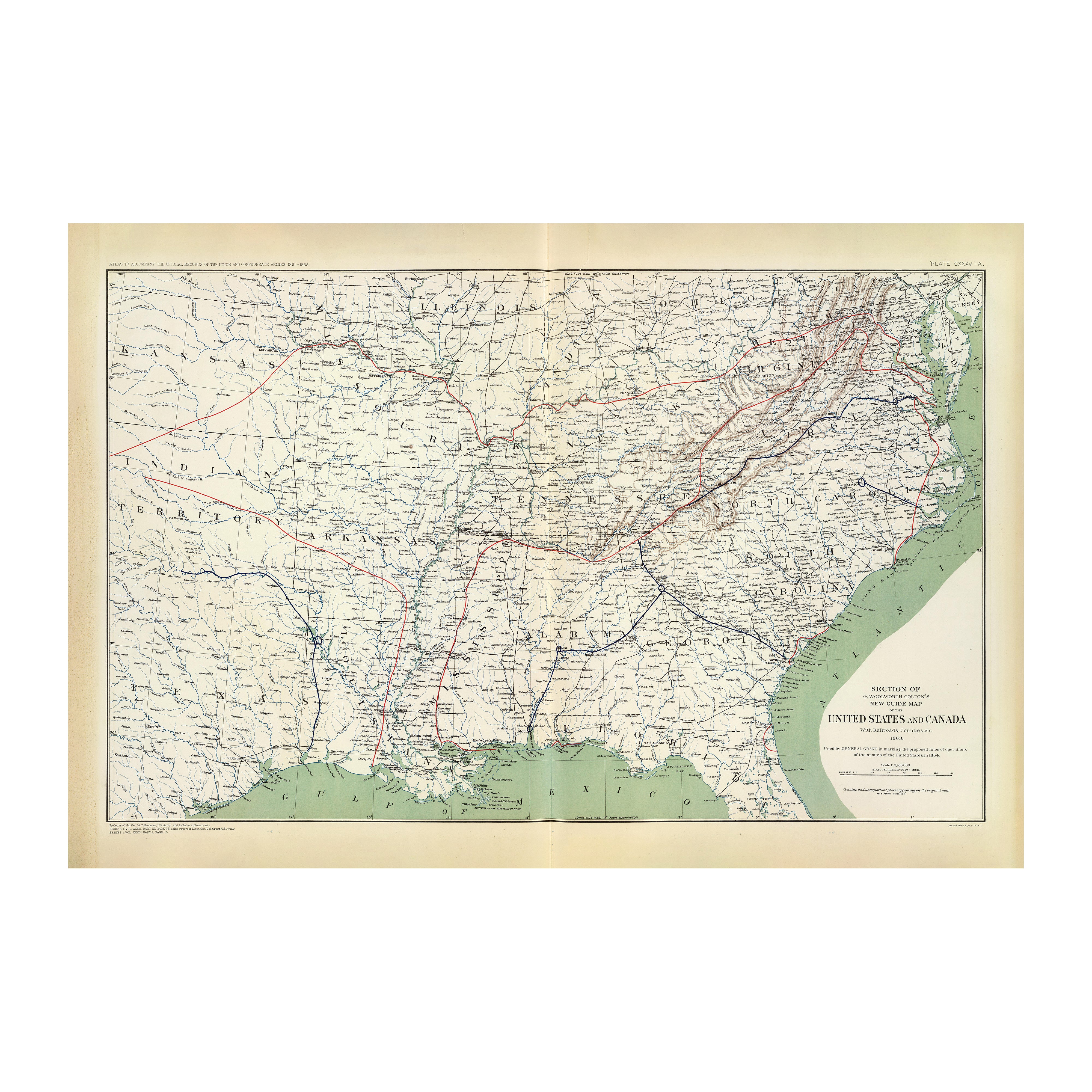
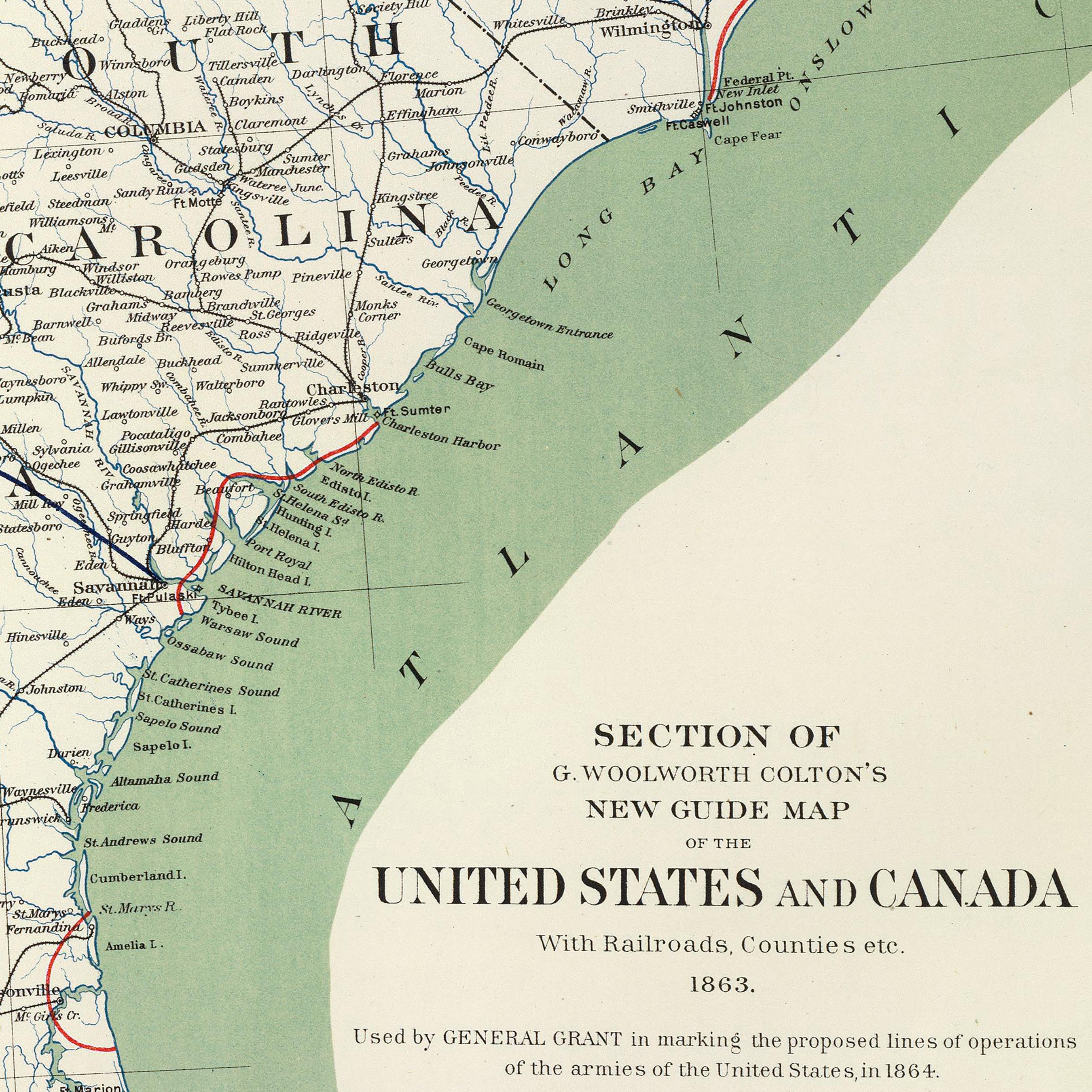
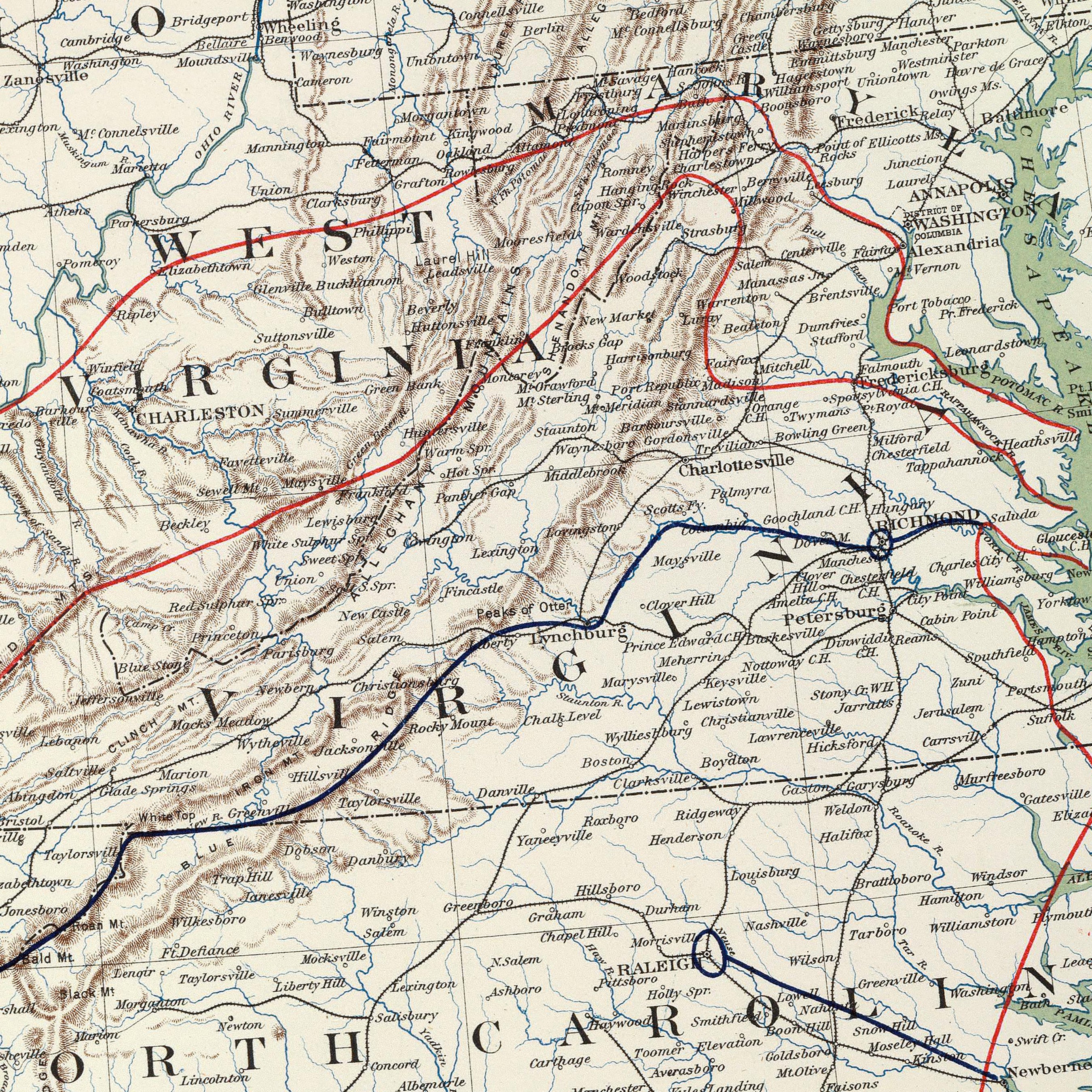
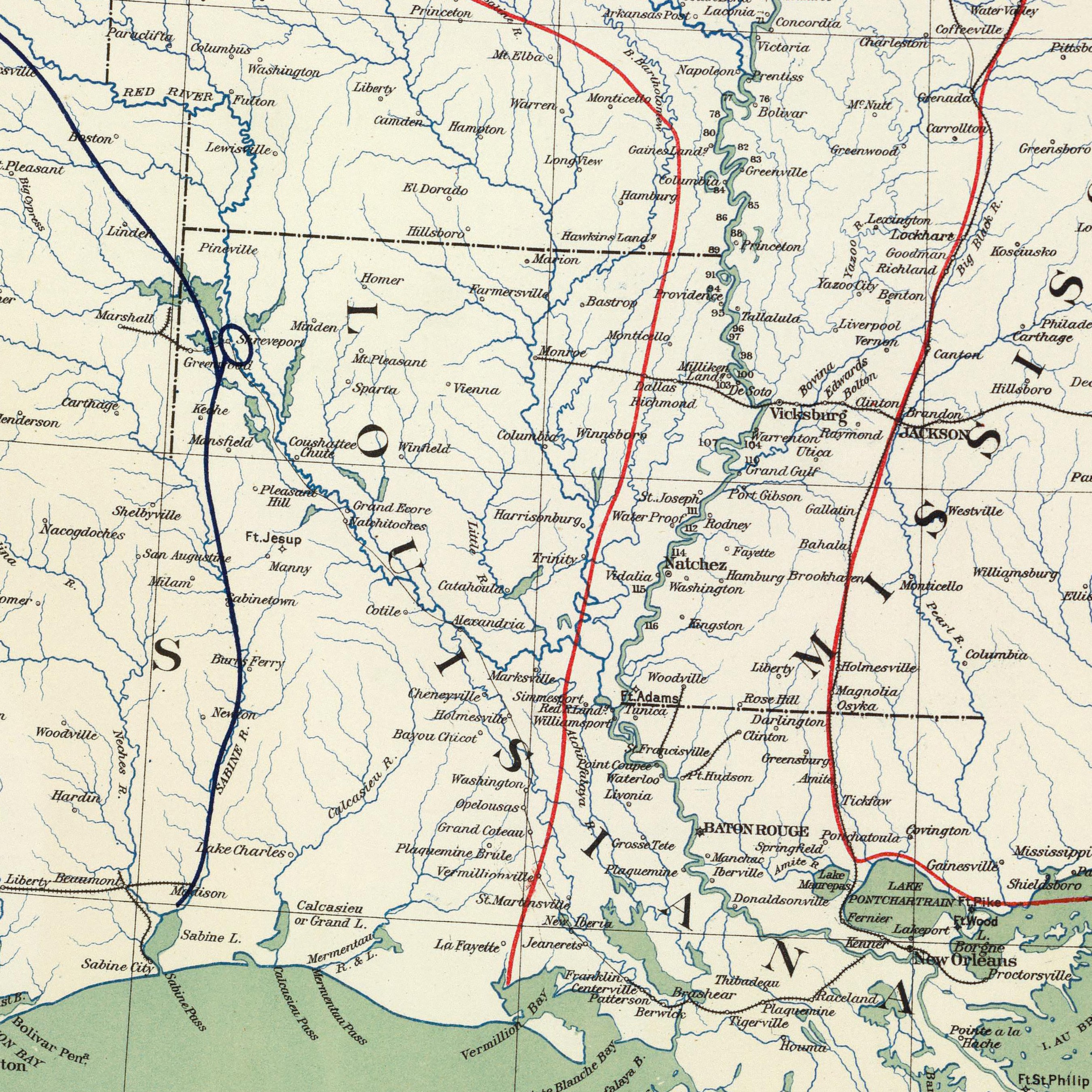
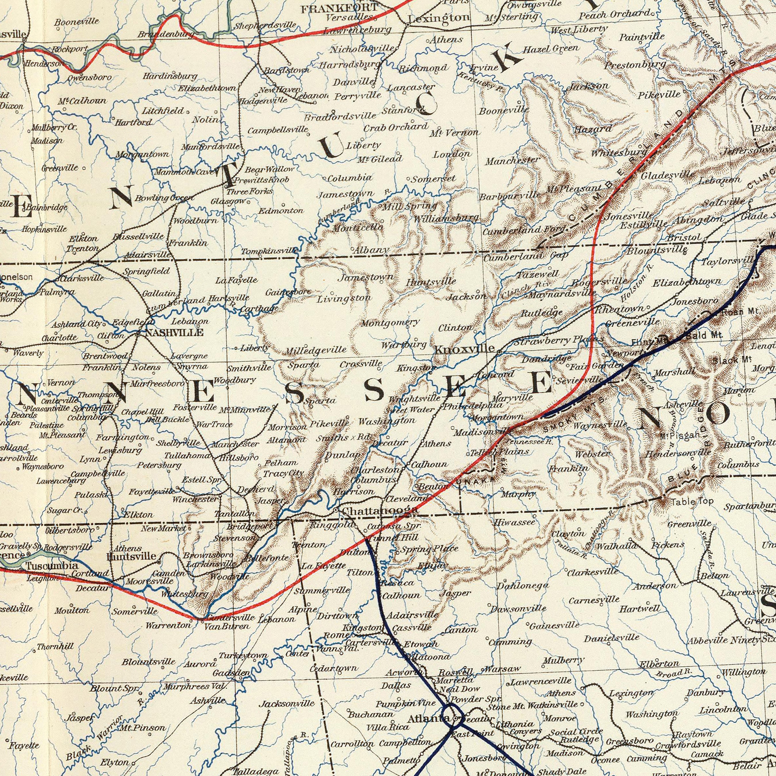
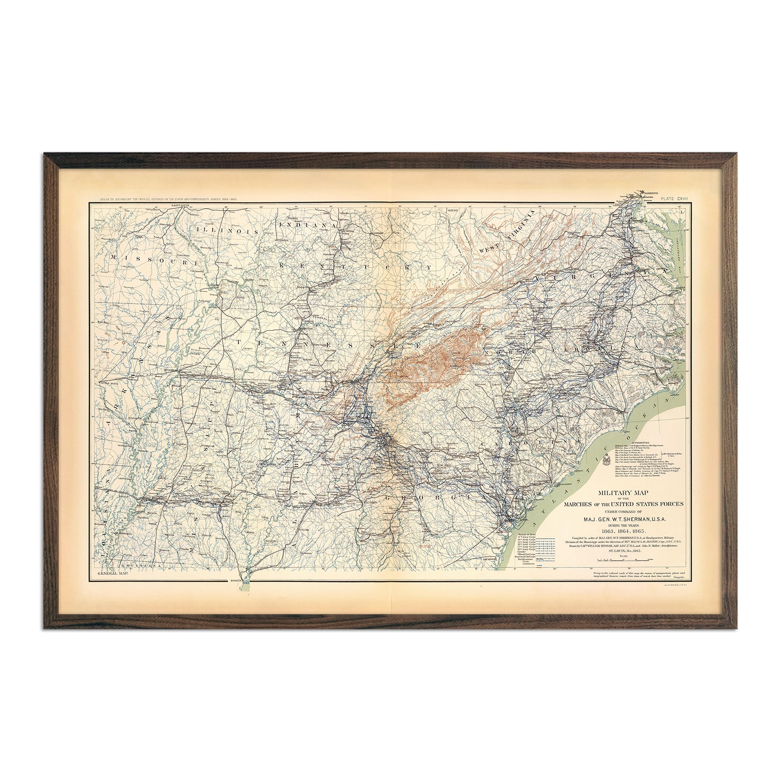
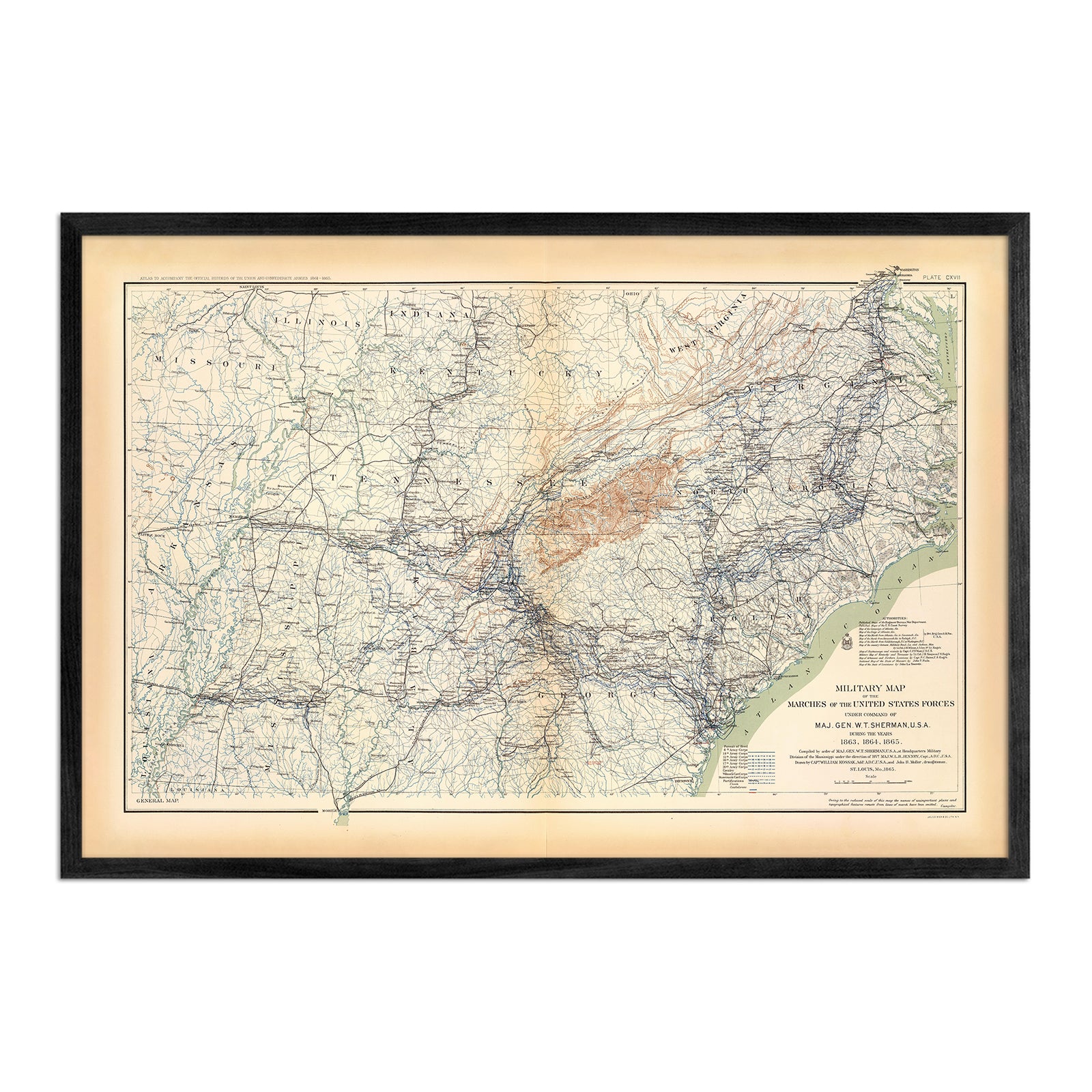
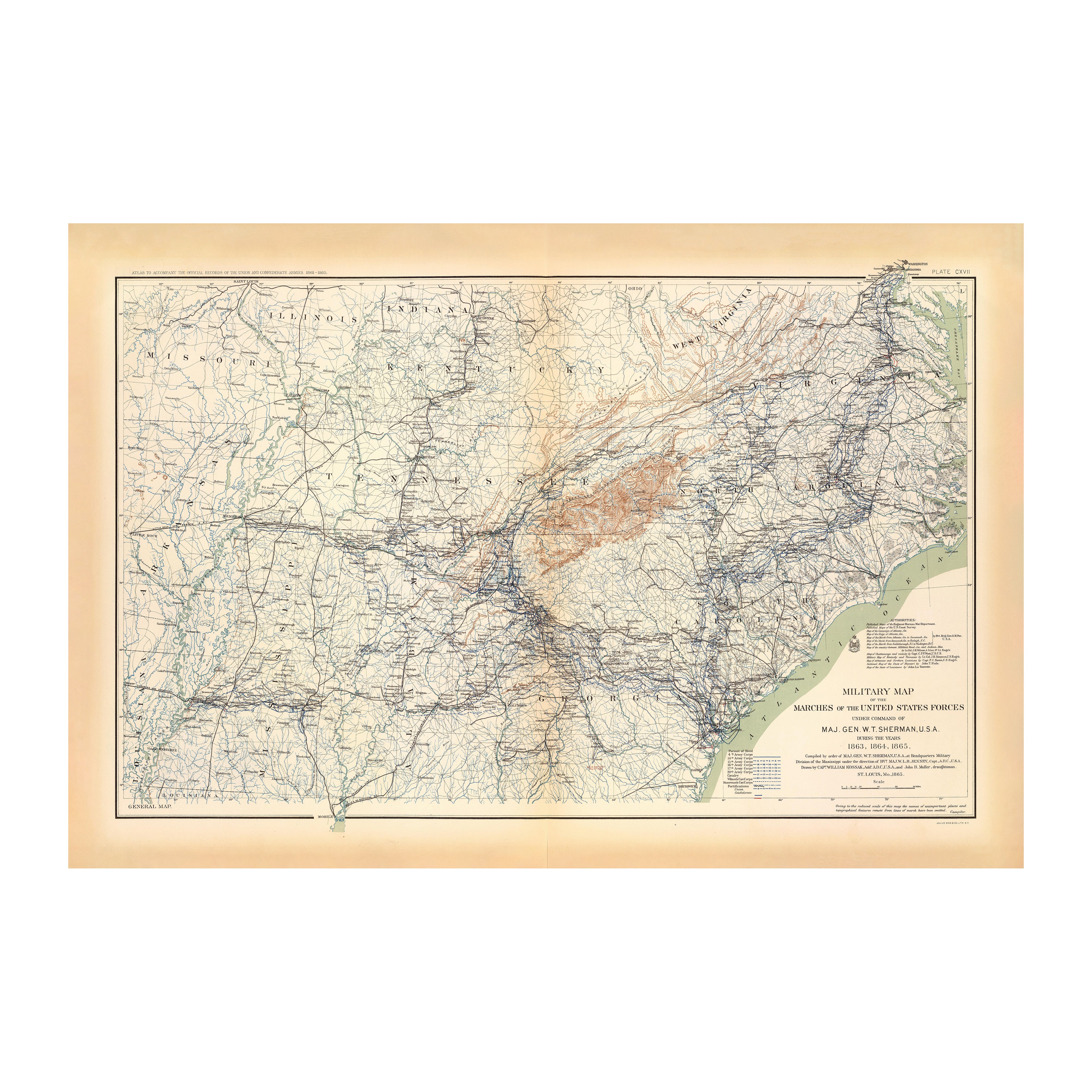
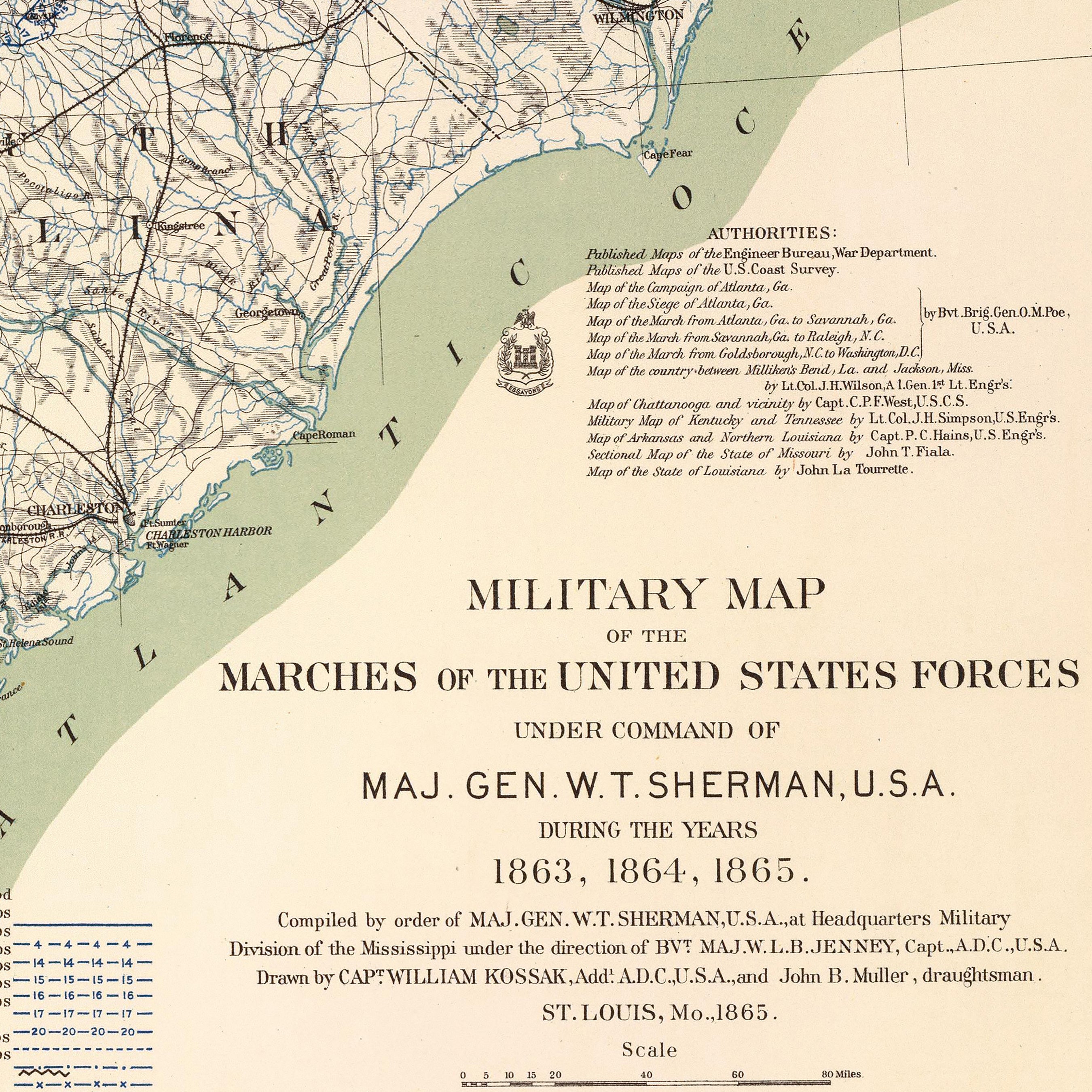
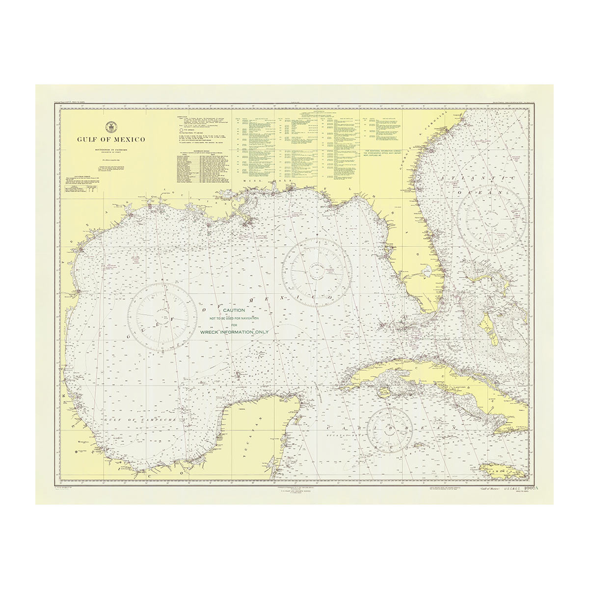
Enhanced vintage Louisiana maps - If you like the look and history of vintage maps, you’ll love our regional 1876 vintage map of Louisiana, or our 1883 Arkansas, Louisiana and Mississippi map. Unlike our relief maps, Muir Way historical maps don’t feature elevation effects, but they do feature a record of history beautifully restored to retain their vintage charm without the wear & tear. Our vintage Louisiana maps are custom printed just like our other maps using archival materials to preserve a snapshot of the Pelican State for years to come.
What are some prominent features on the map of Louisiana?
Louisiana is known for its melting pot of cultures, great food, jazz music, and, of course, Mardi Gras in New Orleans. But it’s also home to beautiful state parks, placid lakes and white sand beaches. Bordered by Arkansas in the north, Mississippi on the east, Texas on the west and the Gulf of Mexico on the south, Louisiana is an epicenter of Creole and Cajun foods and traditions, and is comprised mostly of low elevation plains and marshlands. In fact, Louisiana’s lowest elevation point in the state is 8 feet below sea level, making it the second lowest point in the United States before Death Valley in California. Louisiana is also the host of several notable state parks, such as Fontainebleau State Park and Bogue Chitto State Park, that draw outdoors enthusiasts and tourists alike.
What are the regions in Louisiana?
Louisiana can be divided into three main geographical regions:
- East Gulf Coastal Plain - This region of Louisiana lies east of the Mississippi River and north of Lake Pontchartrain. This mostly flat region consists of marshlands that slope gently to some rolling hills in the north.
- Mississippi Alluvial Plain - Marked by ridges and hollows, this region stretches far beyond Louisiana from Arkansas to the Gulf of Mexico. The most fertile area of Louisiana, this region includes the Mississippi Delta area which covers an entire quarter of the whole state.
- West Gulf Coastal Plain - This region of Louisiana encompasses the area west of the Mississippi Alluvial Plain and consists of marshlands, beaches, and prairies. As you get further away from the Gulf, the land rises in elevation, eventually reaching the highest point in Louisiana, Driskill Mountain, just 40 miles from the Arkansas border.
If you like our collection of Louisiana maps, you may also be interested in maps of other South Central states. Click below to browse:


